Archive for the ‘Uncategorized’ Category
Driving RAGBRAI XLIII: Day 3
 Comments (2)
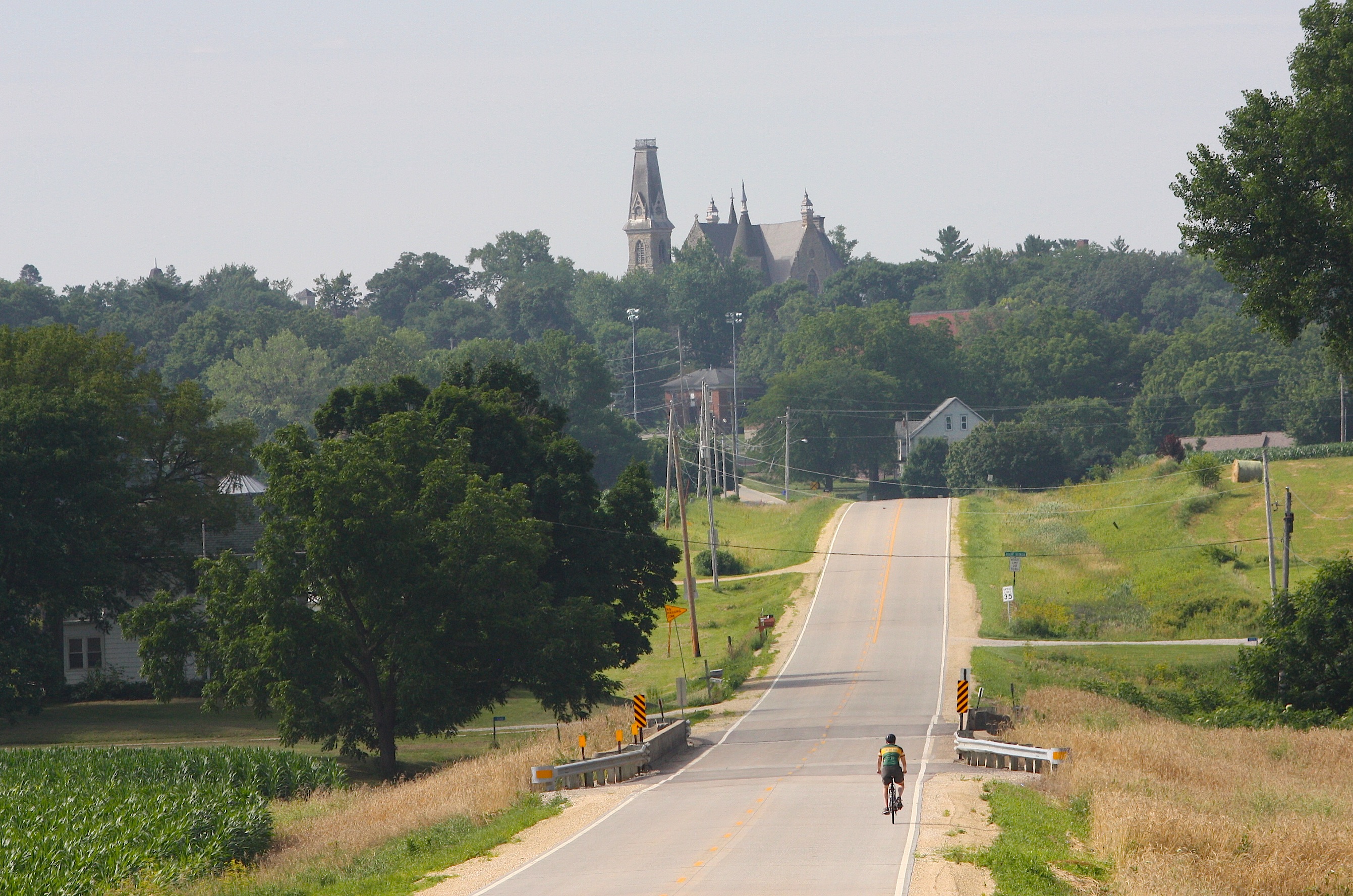
My goals for Day 3 of driving the RAGBRAI route are 1) to finish the drive, 2) to take better notes along the way, and 3) to find more to photograph than just welcome signs and old buildings. I want to find little kids with a lemonade stand or a farmer’s produce market.
My friend Jim, with whom I’m driving the Des Moines Register’s Annual Great Bicycle Ride Across Iowa, thinks I’m romanticizing rural Iowa. And maybe he’s right. What we’ve found so far on the first two days of the route is that many of the smallest pass-through towns are barely hanging on. They may have a business or two, but those businesses have not been open when we’ve been in town. If shops and restaurants don’t keep regular business hours, how can they survive? We’ve seen very few grocery stores and restaurants, few schools, and not even that many churches in some of these towns. My hope for them is that they can somehow survive, despite the decline in population, despite big ag taking over their family farms, despite businesses being shuttered. This sounds sort of depressing, but that’s my mindset as we start Day 3 of our drive. So here we go: Hiawatha to Davenport.
It’s a beautiful day: unseasonably cool, with fog in the low-lying areas, and the sun just starting to come out as I leave Ames at 6 a.m.
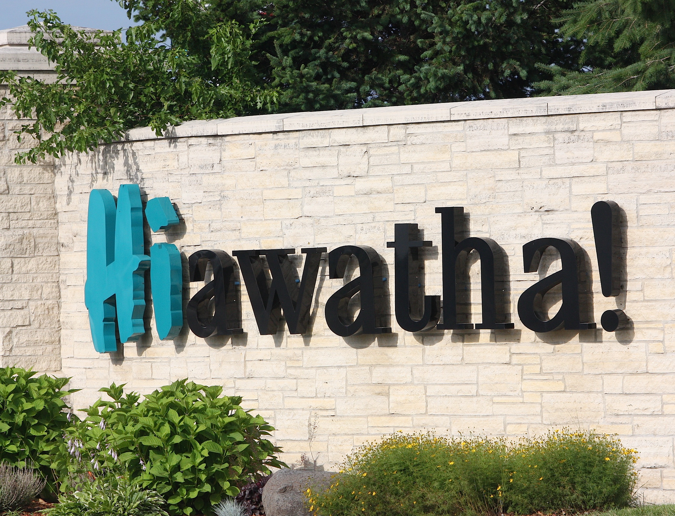
I meet Jim in Ankeny and we head for the start of the bikers’ Day 6 route: Hiawatha (overnight town theme: “Throwback Thursday.”) It’s nearly 8:30 when we get there. I visit Hiawatha at least once a year because I do business with Cedar Graphics, a local printer. So I know the welcome sign is a cute one: “HIawatha!” it says cheerfully. We take Boyson Road to Guthridge Park, a huge green space where cyclists will camp for the night. Hiawatha (population 7,024) is a relatively small suburb of Cedar Rapids. We don’t find much there besides homes, chain stores, and light industry.
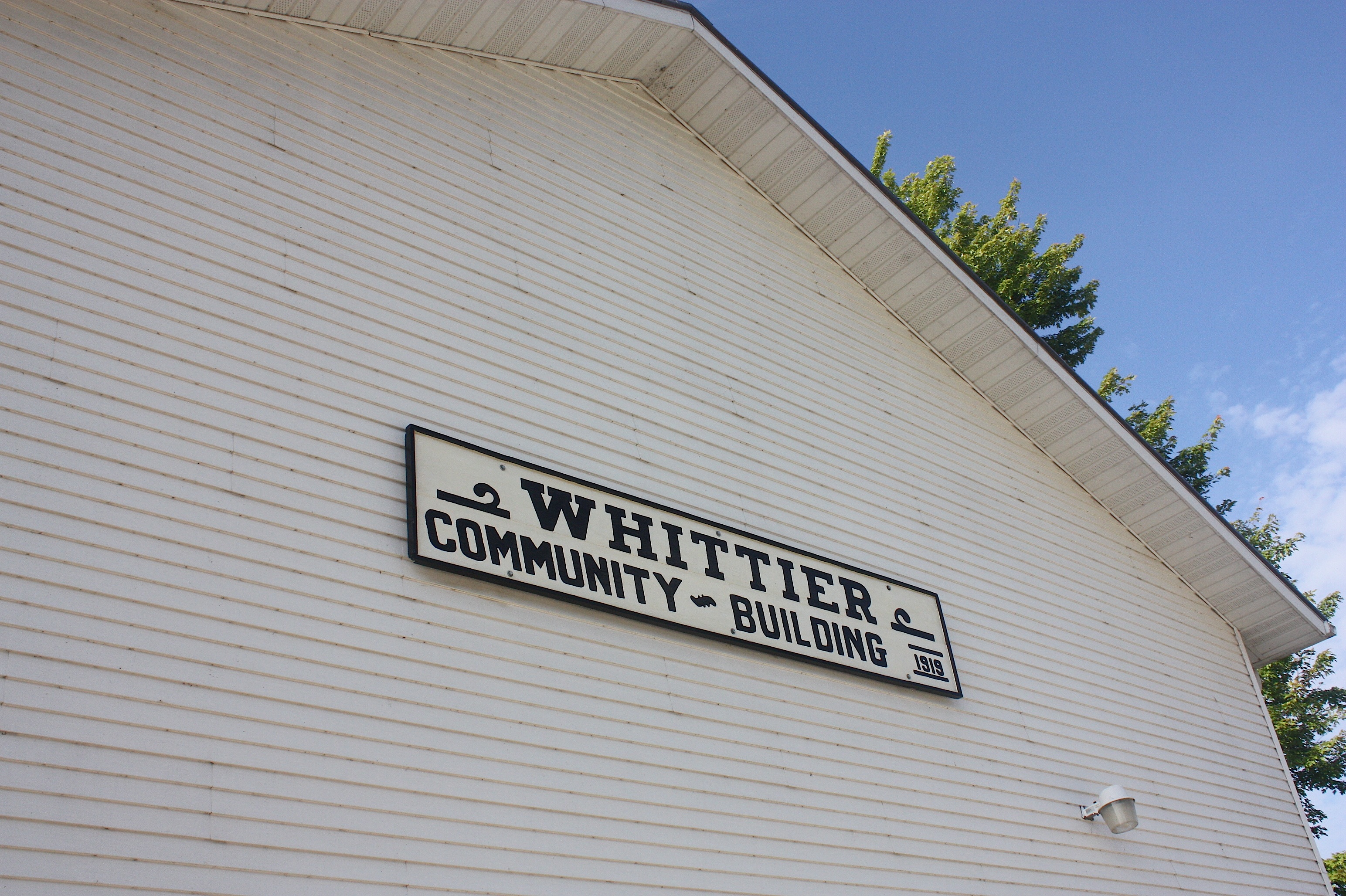

By 8:53 we’re on our way to unincorporated Whittier. The Whittier Market is OPEN, and we’re excited about that because we’re hungry. The sign outside suggests there will be home-baked breads and pastries, so we hurry inside. We find fruit-filled kolaches – a Czech specialty I’ve encountered before in Cedar Rapids – and we choose cherry and peach. The unfriendly woman behind the counter doesn’t seem inclined to let me take pictures inside the shop; in fact, she doesn’t seem inclined to do much of anything. We pay and leave.
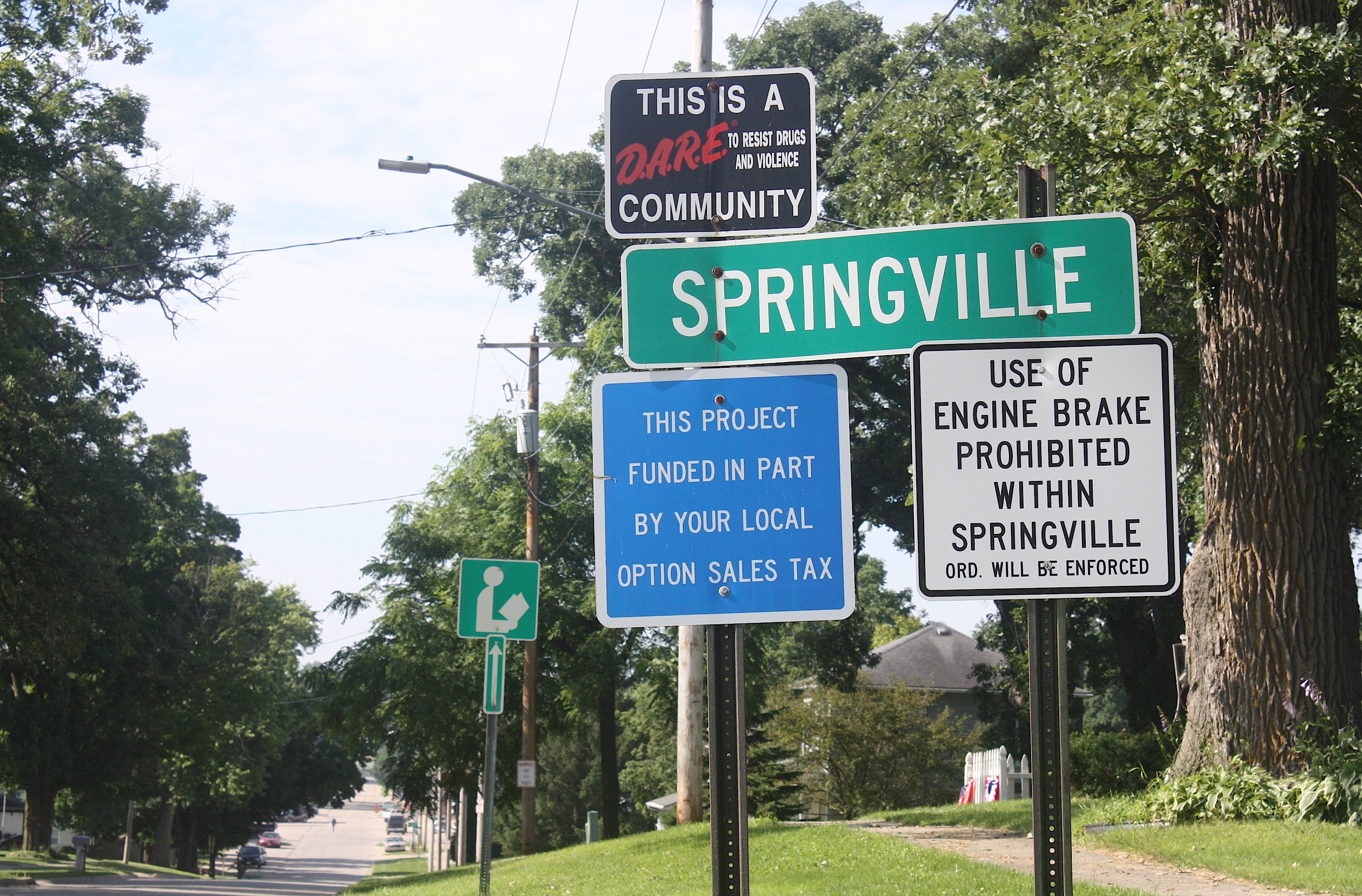
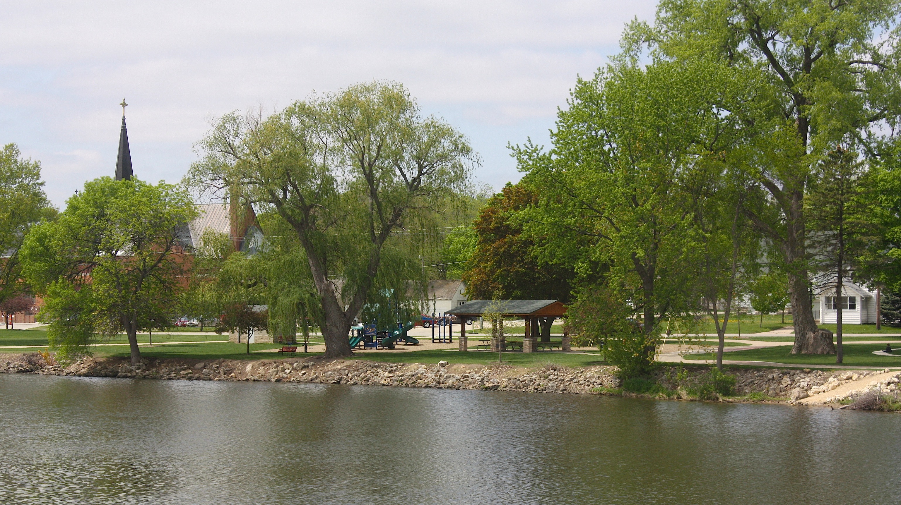
County Road X20 takes us to our next stop: Springville (population 1,074). We chuckle as we drive down the main street, with its American flags and welcome banners juxtaposed against the largest, most colorful NO PARKING sign I’ve ever seen, painted on the side of one of the town’s historic buildings. Well, OK then.
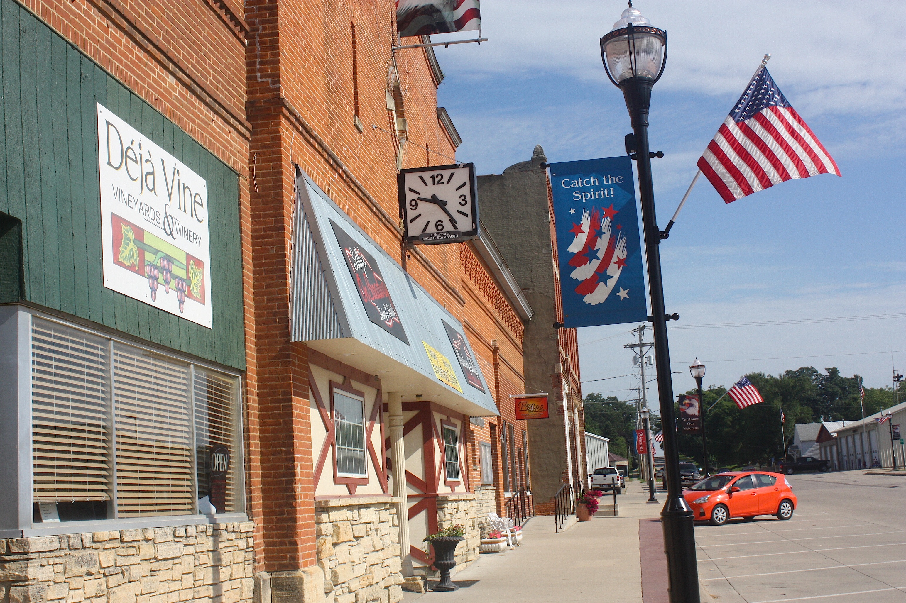
Springville actually has several businesses along the main street: an opera house, the Springville Inn, Deja Vine winery, Mustang Sally’s, and the Springville Station/Woody’s One-Stop. It’s just 9:30 a.m., so nothing is open.
We take the gently rolling farmland out of Springville. There’s a pretty approach to our next stop: Mt. Vernon, and while we’re enjoying the view, a bicyclist rides by.
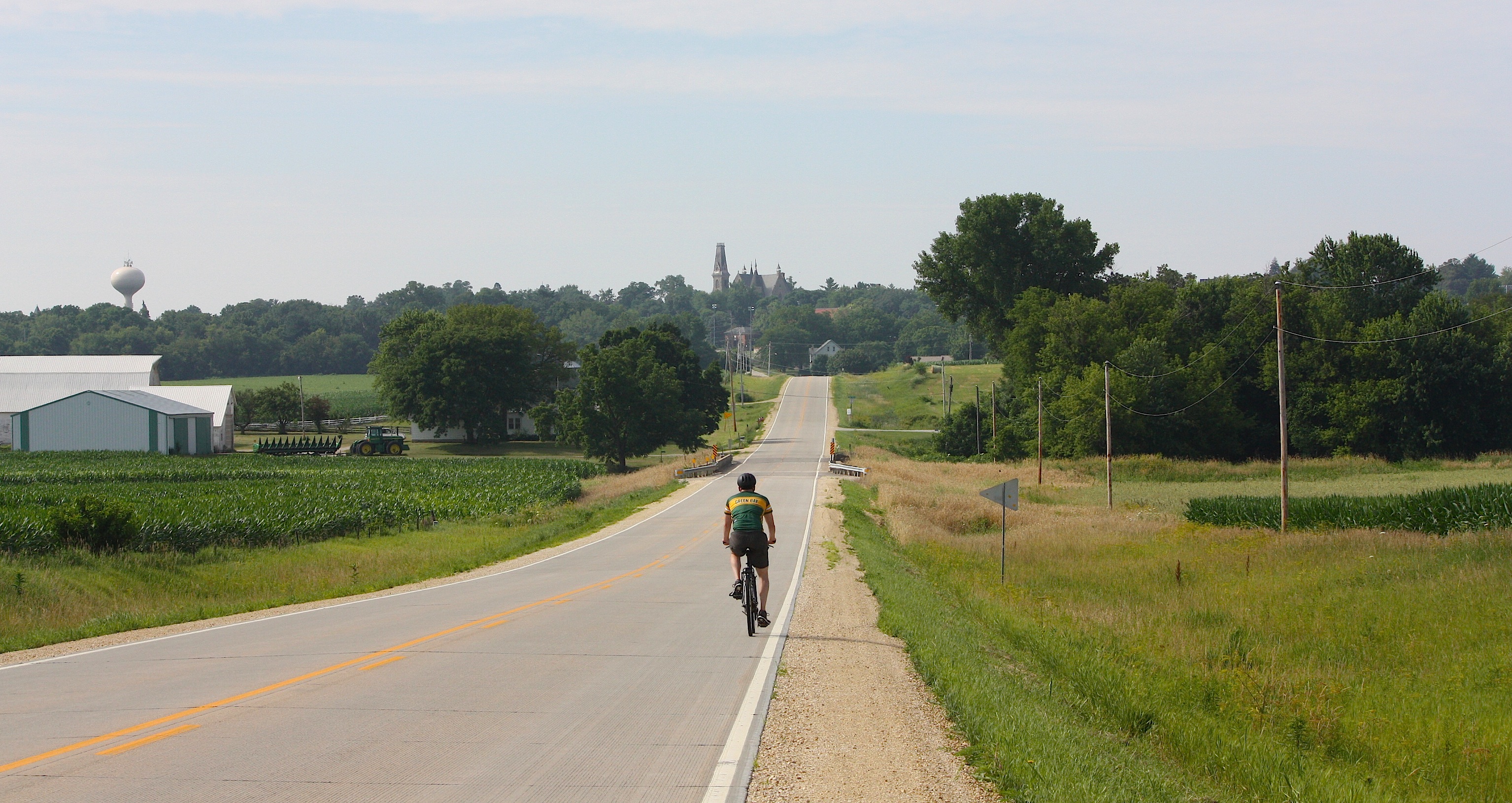
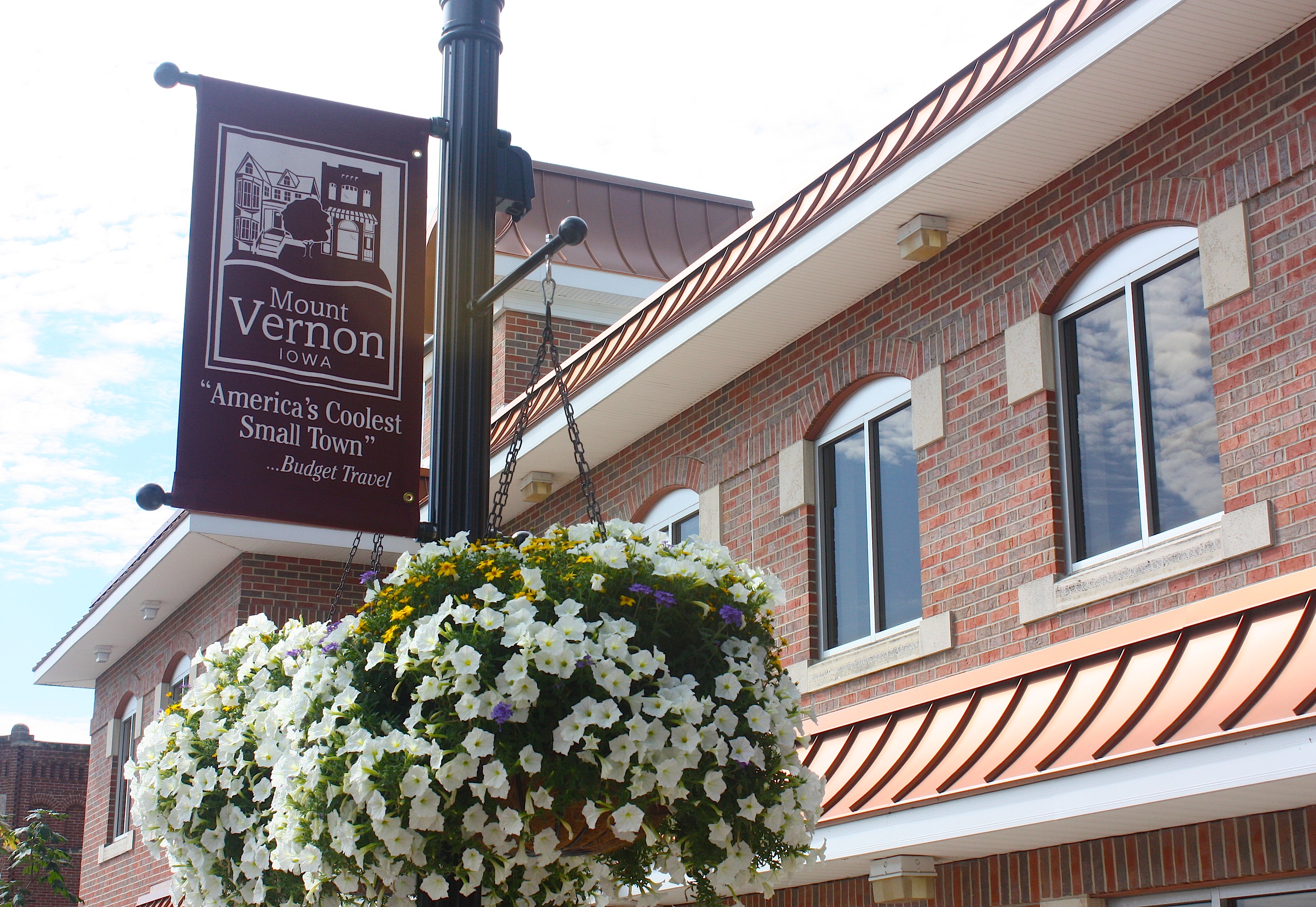
Mt. Vernon (population 4,506) boasts that it’s “America’s Coolest Small Town” as cited by Budget Travel. And I agree. Mt. Vernon is a small town in which I could comfortably and happily live. It’s close to Cedar Rapids, close to Iowa City, but it’s no suburb. Mt. Vernon is home to the charming and historic Cornell College, and it has some of the prettiest houses and liveliest little shops and restaurants that you could ever want to visit.


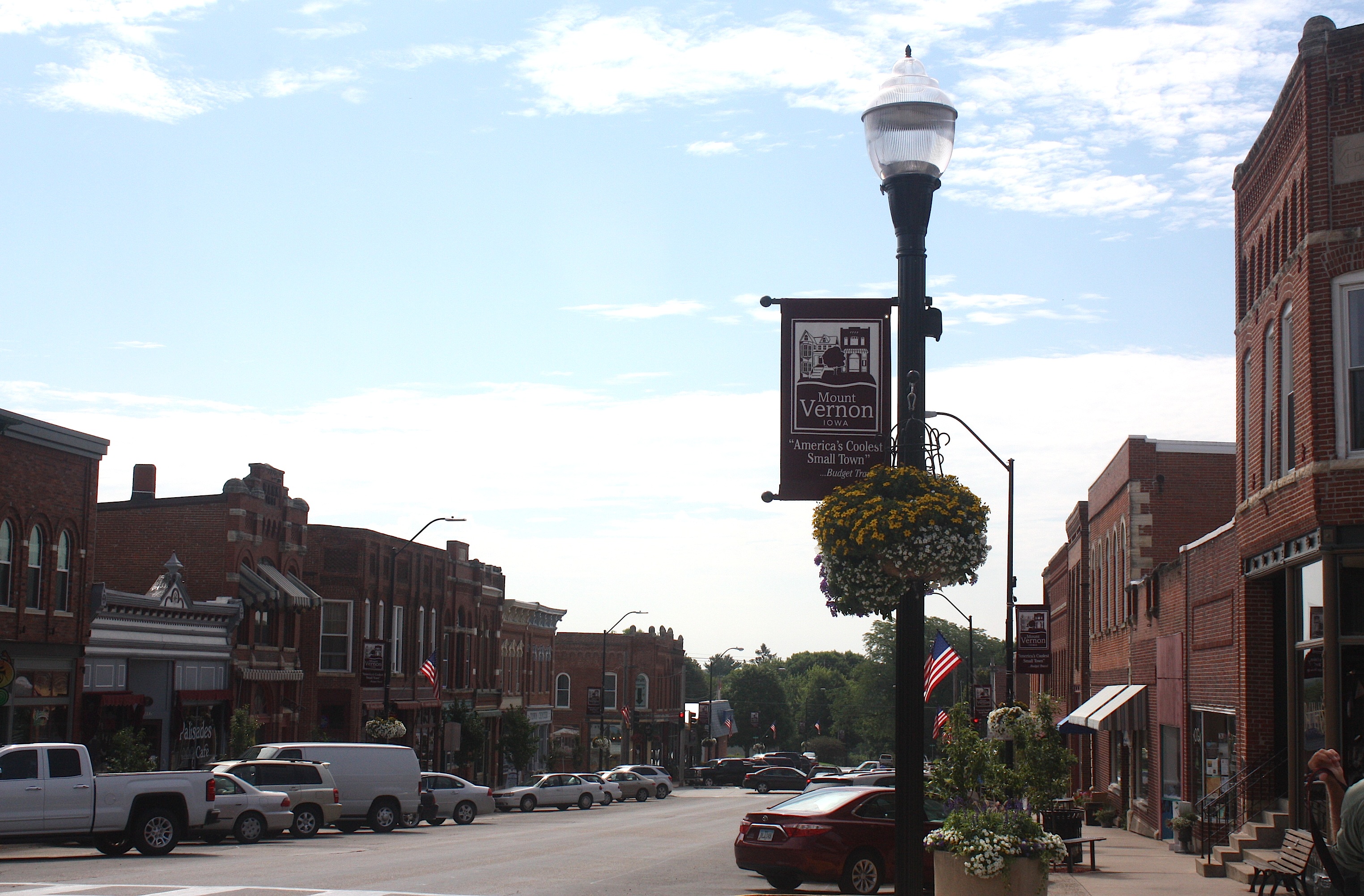

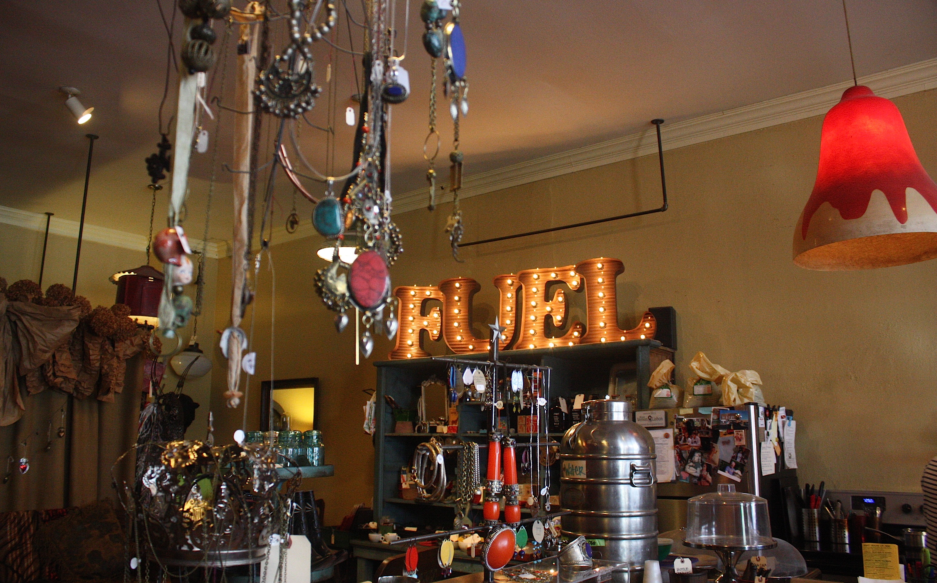
I’ve visited this town several times; in fact, I posted a blog about it in 2011. I loved the old Lincoln Café, and I was eager to try out its replacement, Palisades Café. But it wasn’t open for lunch yet. So we wandered through downtown, with its shops, antiques stores, services and restaurants. Still hungry after the kolaches, we stepped into Fuel, a shop that advertises “espresso and mom’s baked goods from scratch.” It was all that and more: an adorable coffee shop with antiques, vintage finds, and funky jewelry for sale. The two women behind the counter were friendly and welcoming; they offered to warm up Jim’s cheddar scone for him (he said it was delicious).
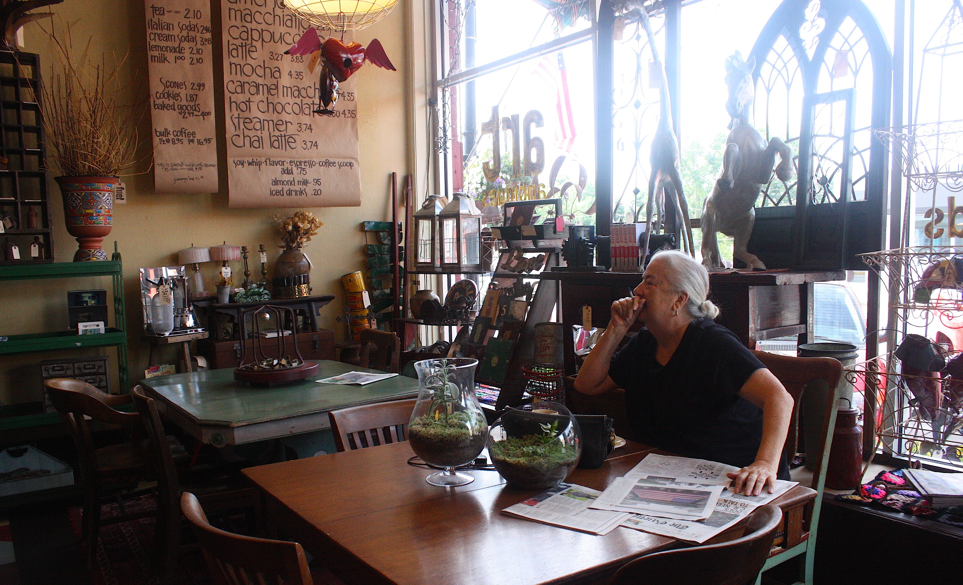
We talked to a local customer (above) who was reading the paper and enjoying her morning coffee and pastry. She said she had to go out of town the day the RAGBRAI bikes come through Mt. Vernon, so she had already planned her getaway.
“I’m packing the car the night before,” she said. “I’ll park it on the south side of town. The next morning I’ll walk to the car and be able to drive without going through the RAGBRAI route.” She seemed a little wistful that she would be missing all the fun.
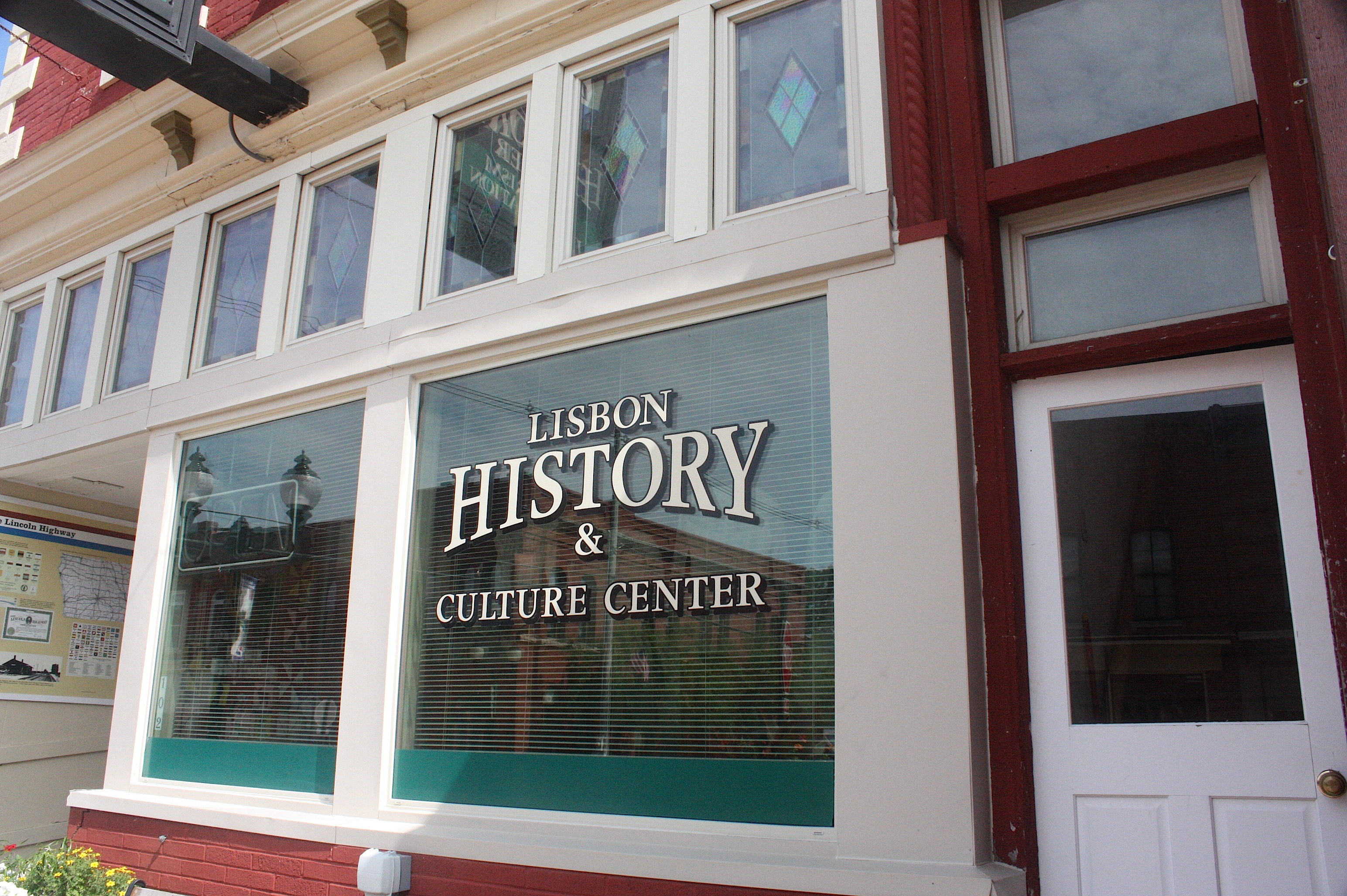
Mt. Vernon’s sister city, Lisbon (population 2,152) is just a minute’s drive. The two communities have joined forces to promote community events and festivals throughout the year – they’re the smartest duo in the state. Though Lisbon doesn’t have the commercial or college punch of Mt. Vernon, it’s a pretty town with lots of community pride. To wit: We drove past a home whose yard was pronounced the “Yard of the Month.”
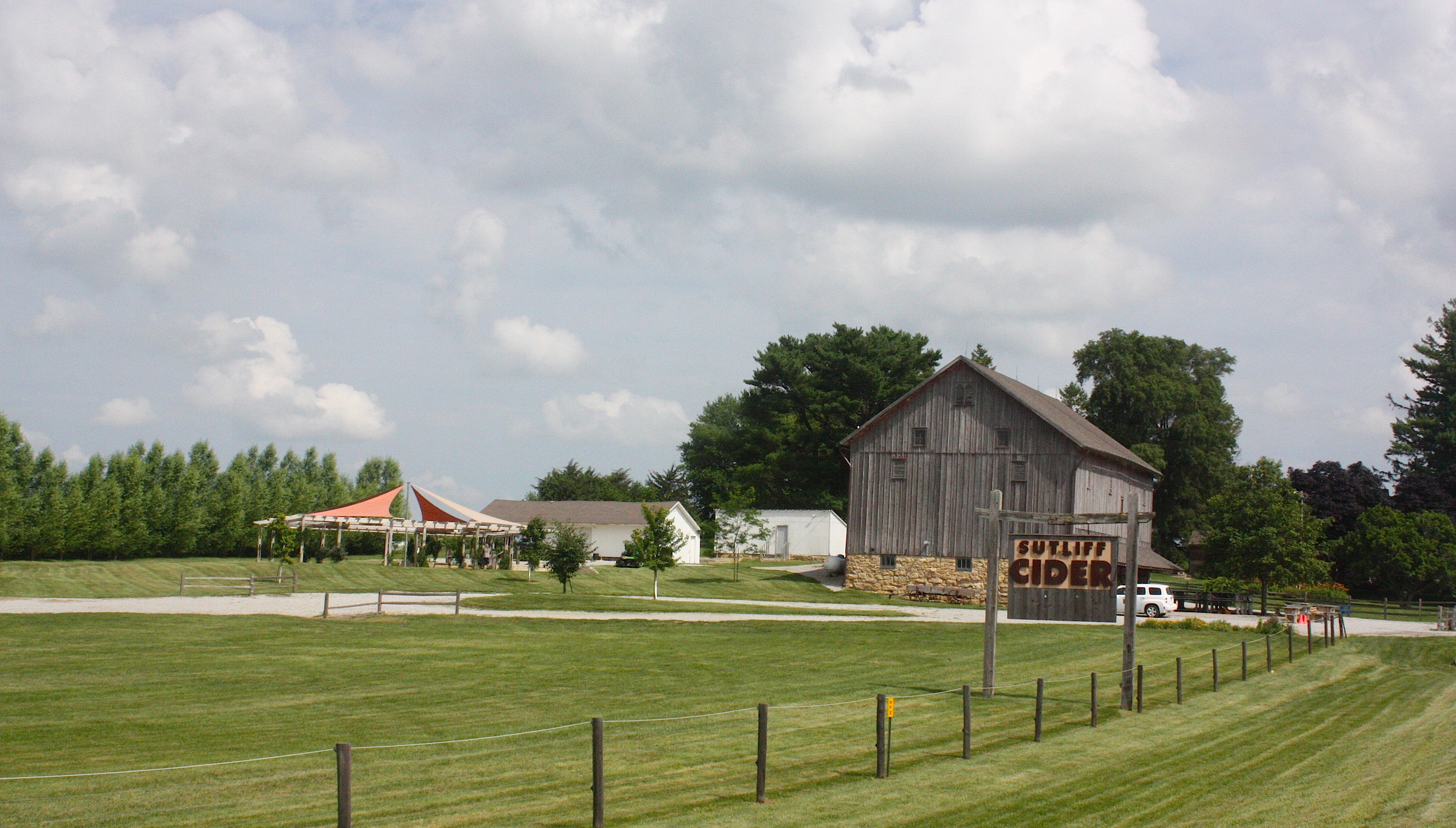
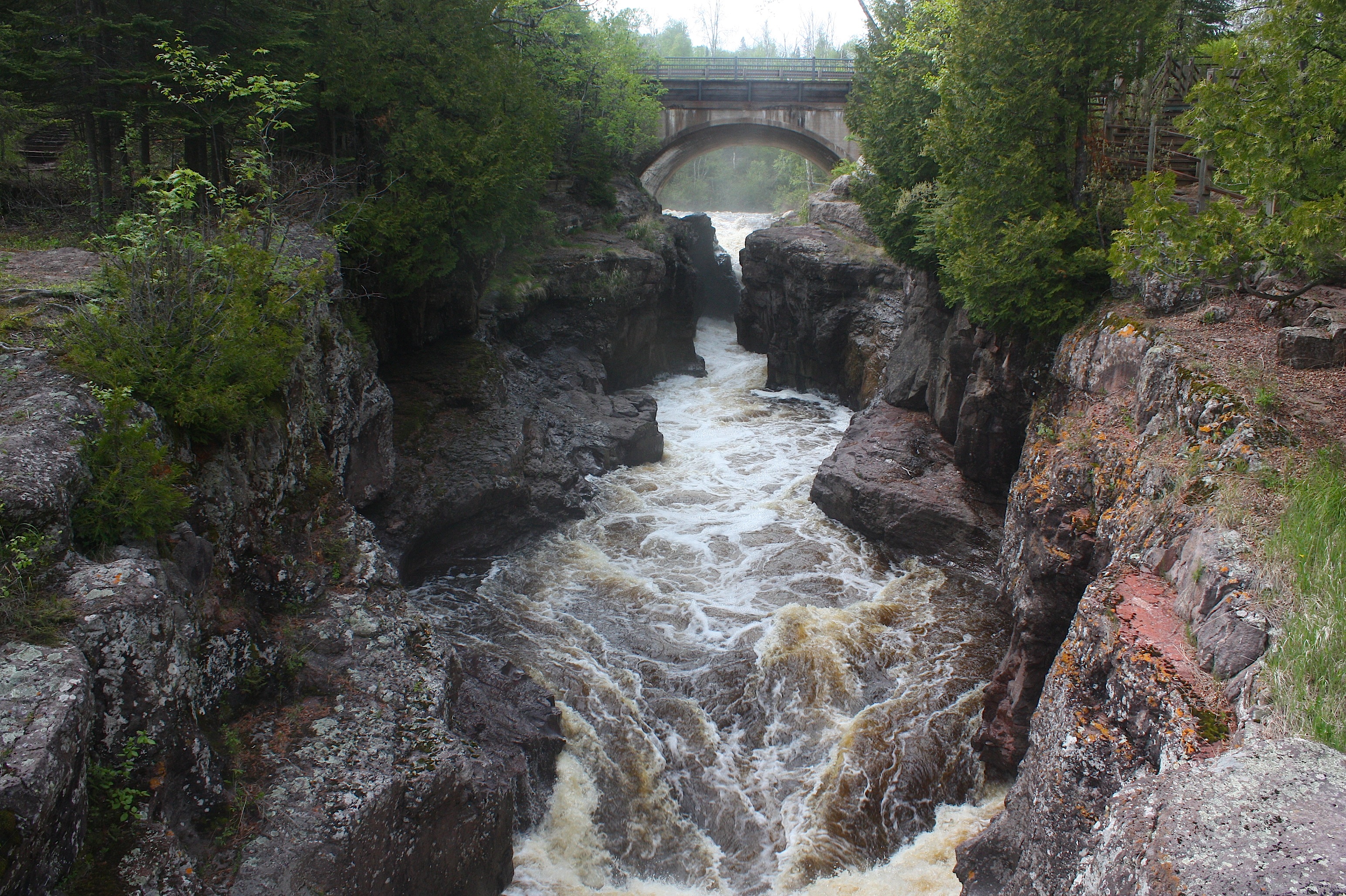
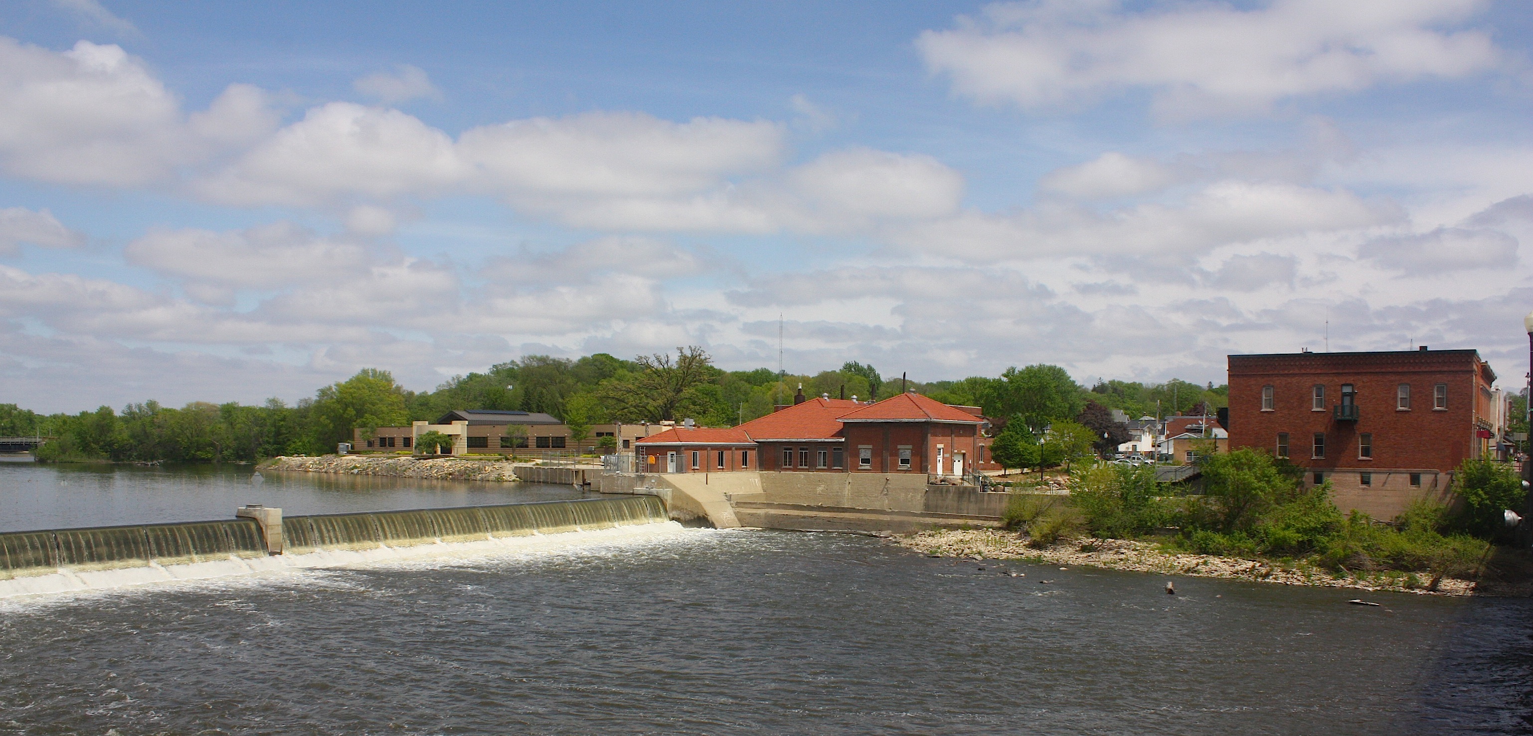
Continuing on X-20 we pass Sutliff Cider, a cider mill with hard cider produced year-round, and on to the Sutliff Bridge. The historic trestle bridge was built back in 1898 and spans the Cedar River. By 1979 the bridge was believed to be dangerous and was replaced by the Cilek Bridge for vehicular traffic. Upon the bridge’s retirement in 1983 it was one of only a few Parker trusses remaining in Iowa.


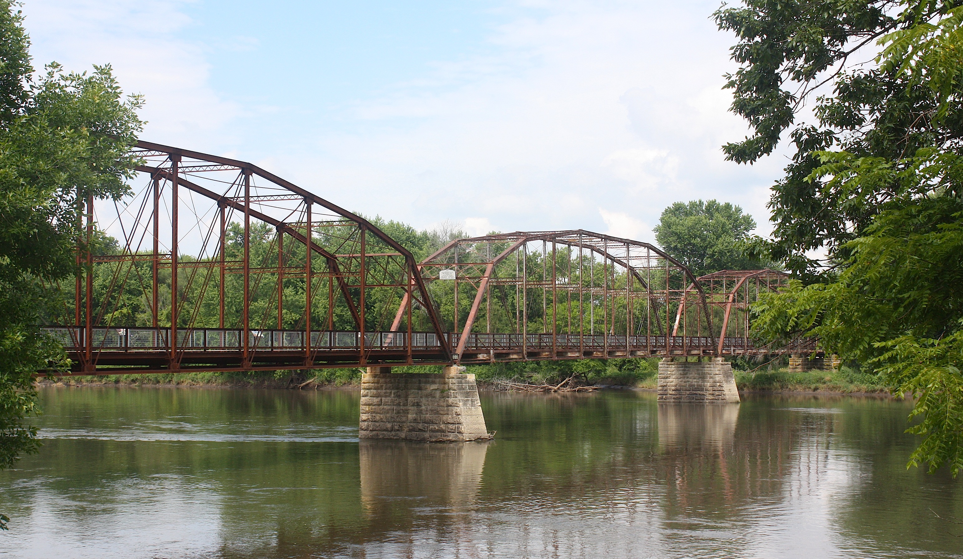
Unfortunately, the bridge was badly damaged by the flood of 2008. It’s since been repaired, thanks to the efforts of a lot of different organizations working together, and I think it’s a real beauty. You can walk or bike across the bridge and learn more about its history on historical markers that also include photographs of the flood.

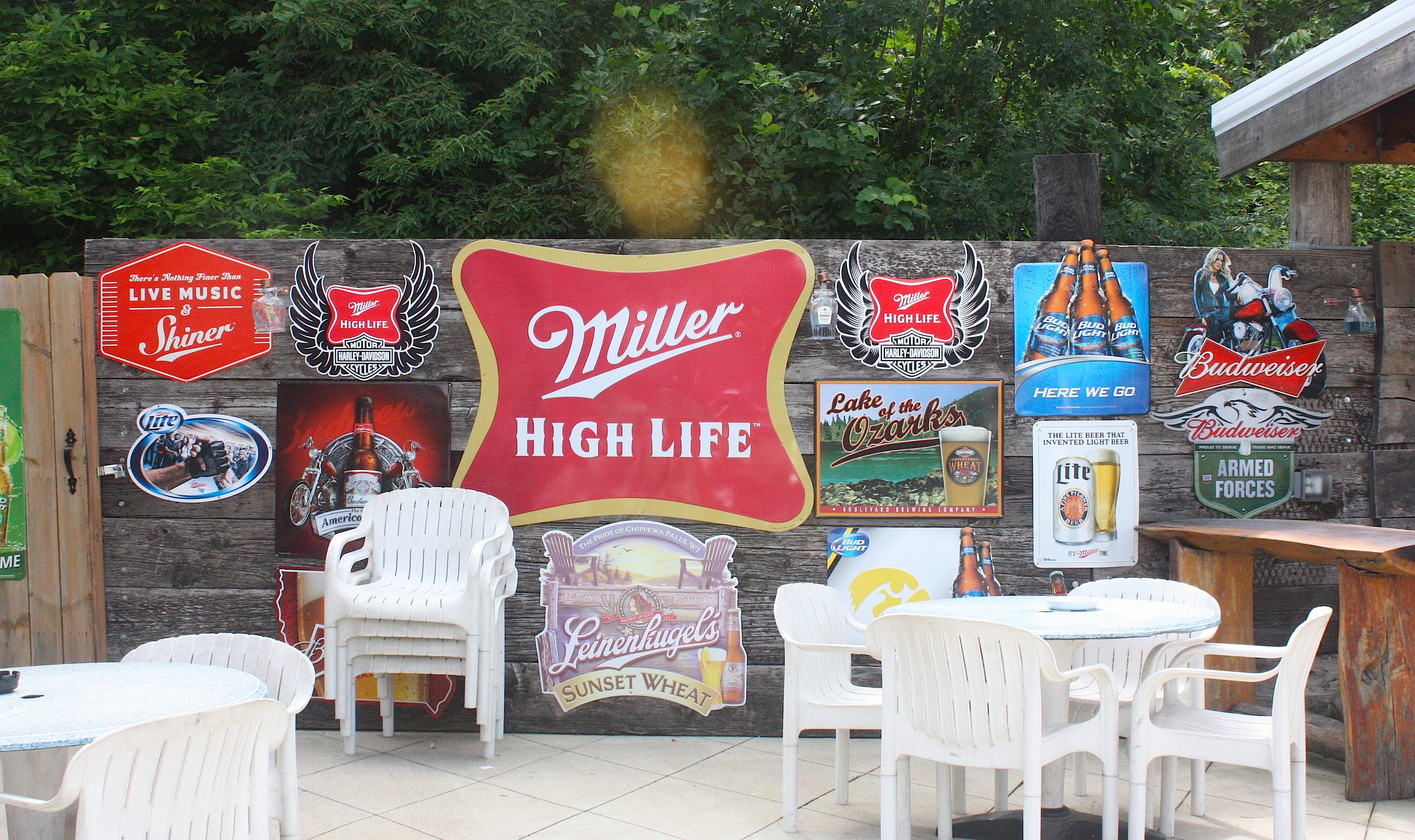
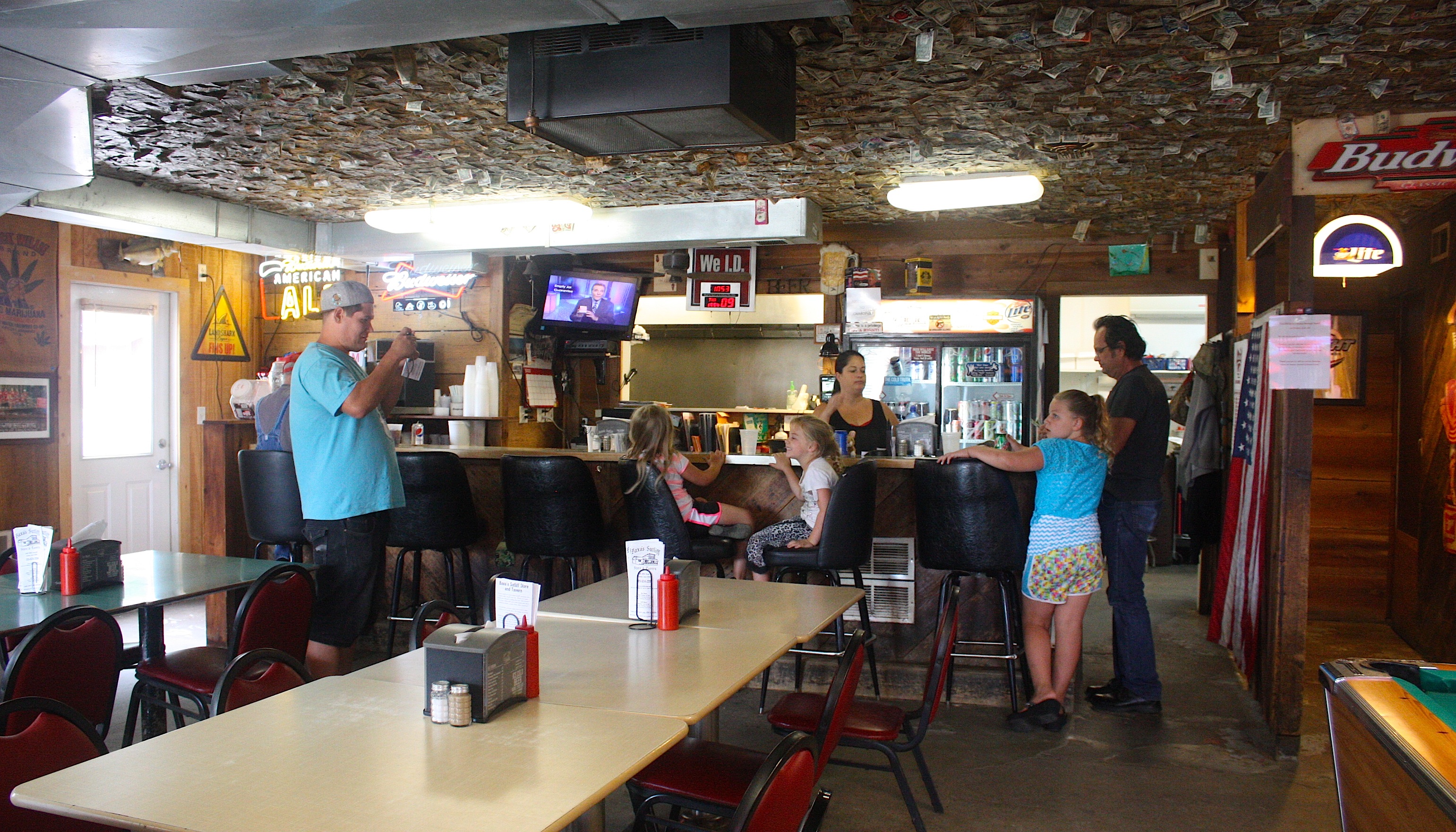
Adjacent to the bridge is another great reason to get out of your car (or off your bicycle): Baxa’s Sutliff Store and Tavern. This is a huge, awesome place with three spacious rooms for eating/drinking, plus a spacious patio for more of the same. There’s a long porch with theatre-style seats, loud country music playing, beer, food, and a view of the river. This would be an awesome evening destination during the summer or fall.


It was tempting to stay longer, but we had to move on. Our next stop was Solon, a cute little town with a bandshell, restaurants, and a brewery.
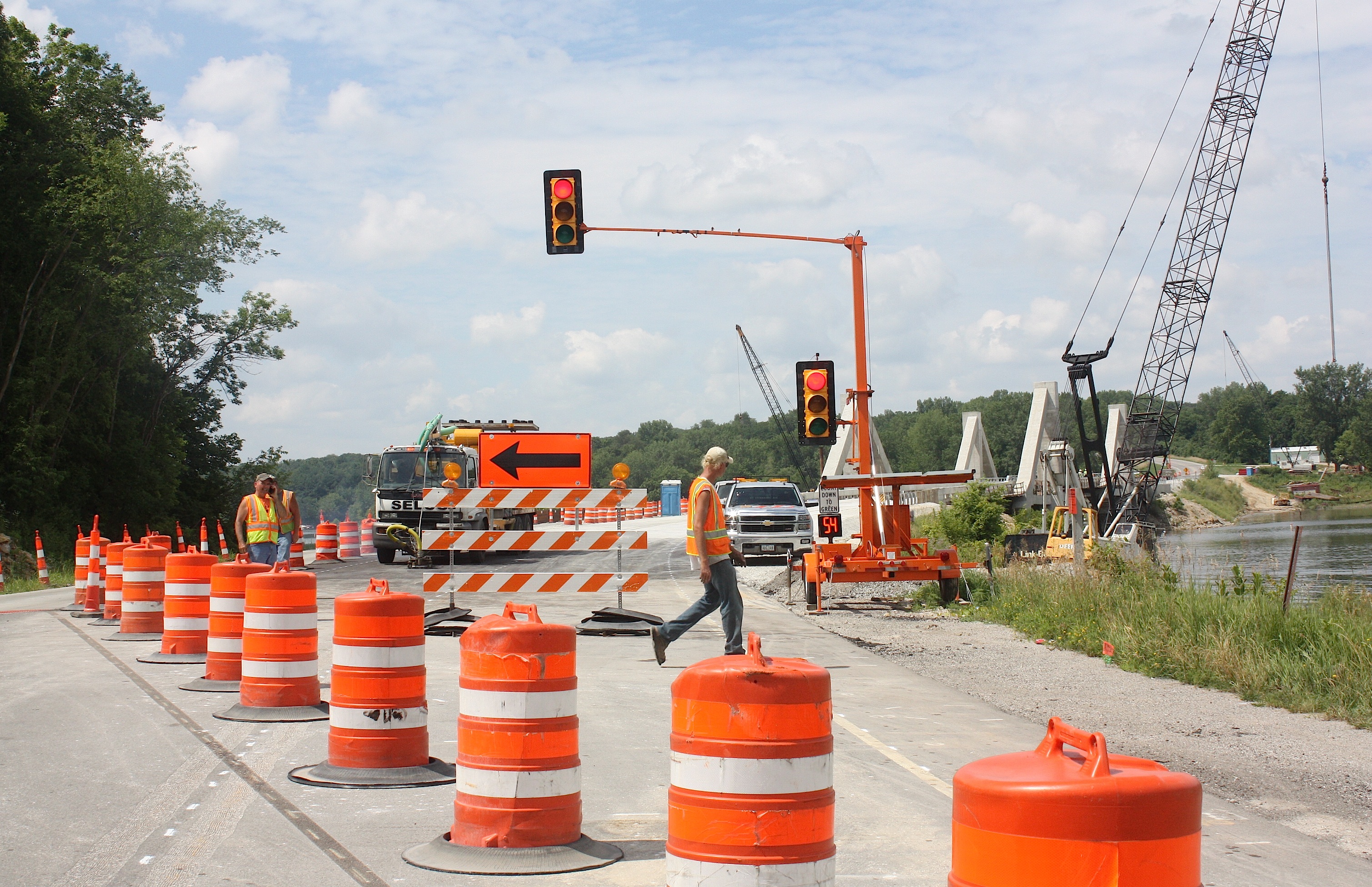
At this point in the day’s drive, we get lost. We may or may not be on the right road. We drive through Sugar Bottom, a popular bike route that’s well marked with green signs. We encounter construction. We cross the Coralville bridge, which is down to one lane. We pass by Lake McBride State Park, a very pretty place that would be a nice place to stop and hike or have a picnic. We end up in North Liberty, which definitely means we’re lost, because North Liberty is not on the RAGBRAI route.
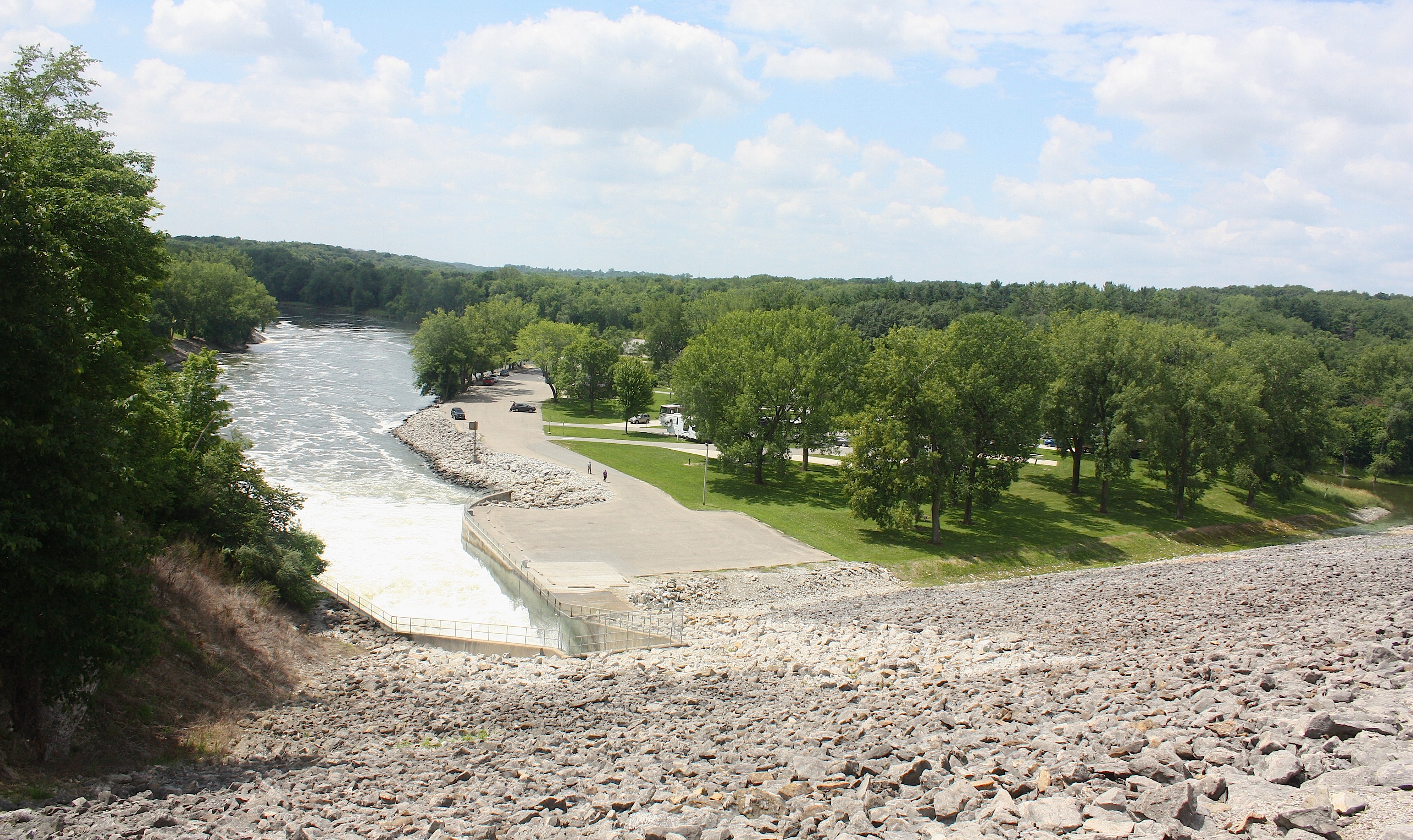
We backtrack. We drive by a fossil gorge, campgrounds, and other recreational areas. We drive over the Coralville Lake Dam (above). We end up in Iowa City, which is also wrong. The Register’s easy-to-follow route map is not exactly cutting it today, and we’ve left the detailed map back in Ankeny.

It takes a long time, and we’re never exactly sure where the bikes enter Coralville’s Iowa River Landing. And we have no idea where the cyclists are going to camp, because this place is nothing but concrete as far as the eye can see. But we’re here. So we explore.
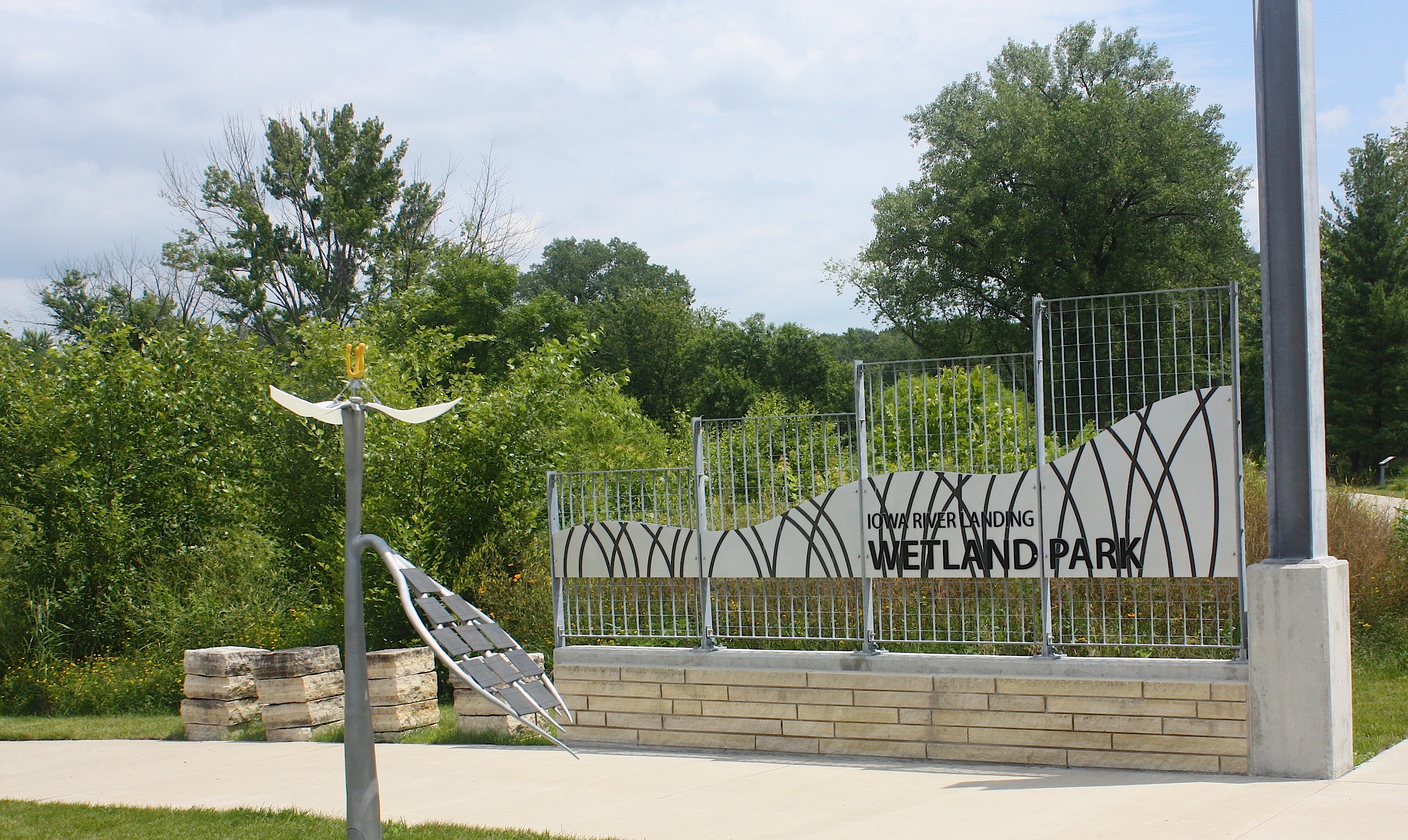
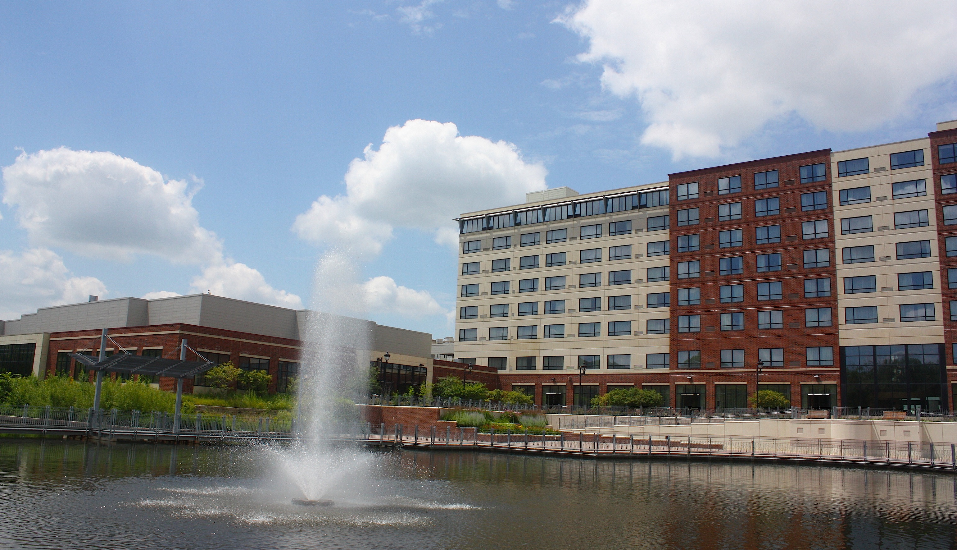
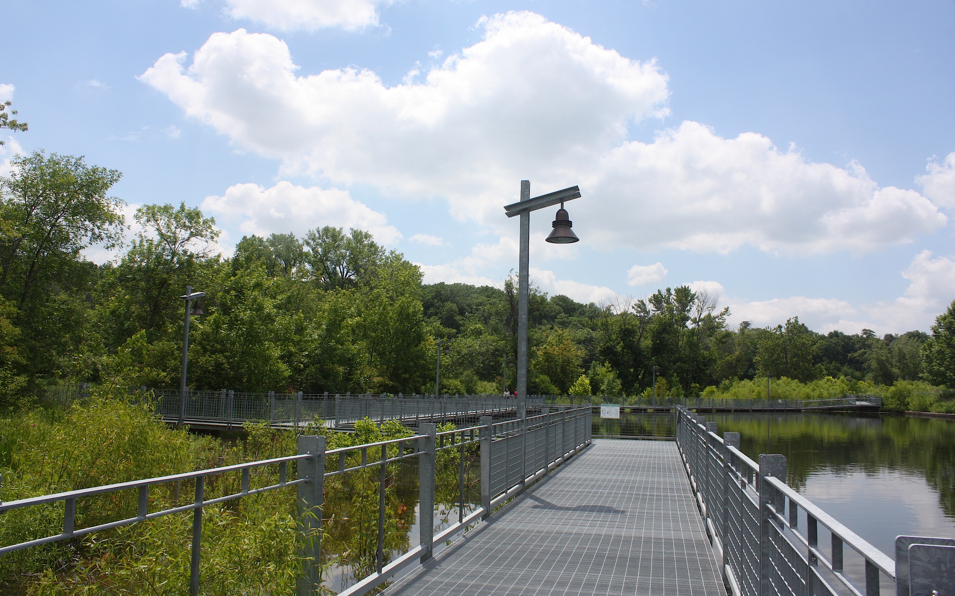

Iowa River Landing is mostly a giant Marriott Hotel and conference center. There are some shops, restaurants, and brewpubs. It looks newly developed and very suburban. We walk a wetlands trail, which is nice but sort of weird because of its location, and spot a few sculptures along the sculpture walk. We still can’t figure out where people are going to camp, and we’re not sure how they will travel from Coralville to Iowa City, which is basically one big sprawling city.
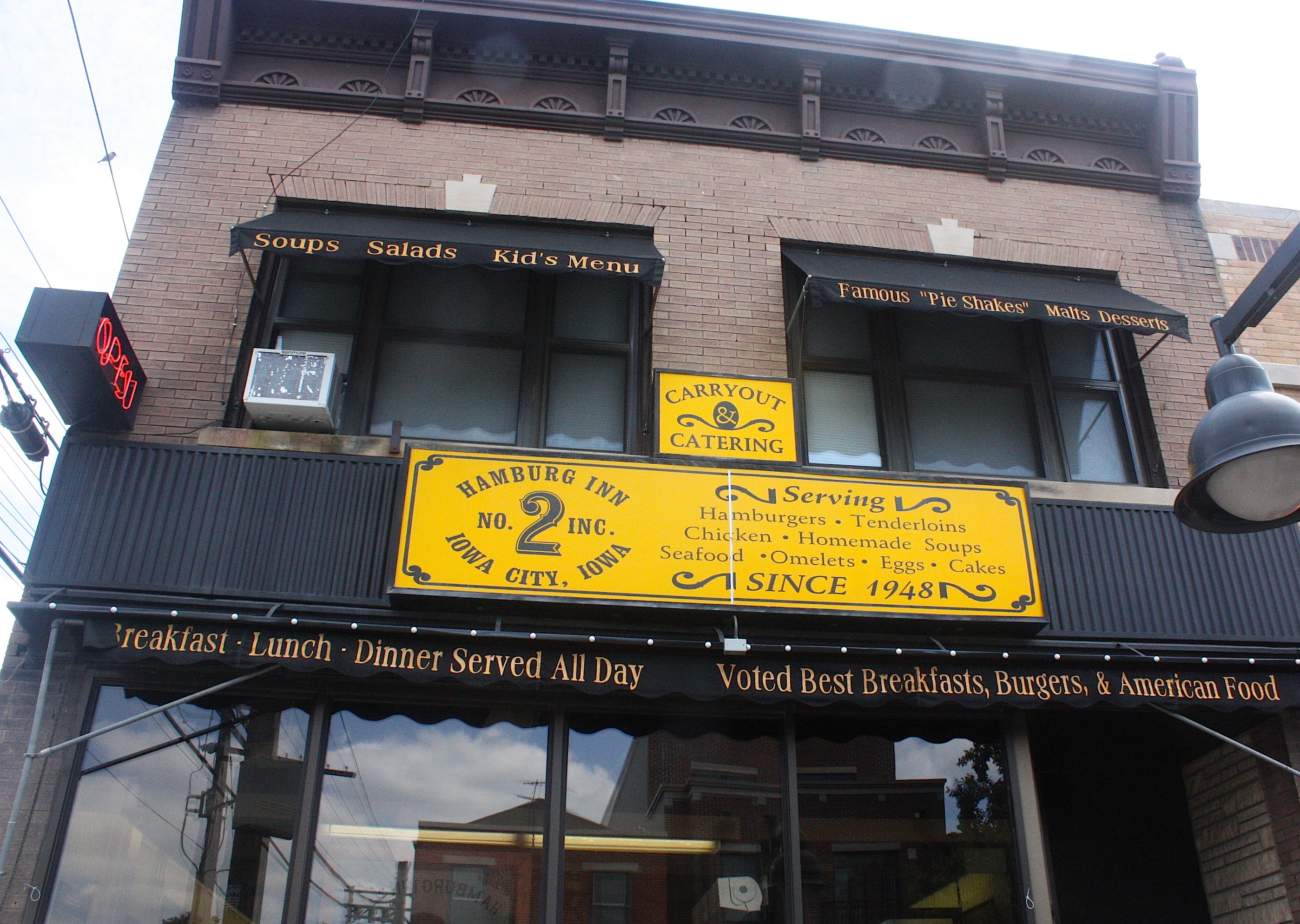
But now here we are in Iowa City, with its bustling downtown, University of Iowa campus, cyclists, pedestrians, and gangs of small children all dressed alike. There’s so much to do here, but so little time. But we’re hungry, so we stop at one of the Register’s suggested stops: the Hamburg Inn No. 2.
This a diners & dives kind of place that serves breakfast all day long and is famous for its pie shakes. I order a grilled cheese sandwich, fries, and coleslaw. Jim and I split a piece of lemon meringue pie for dessert.

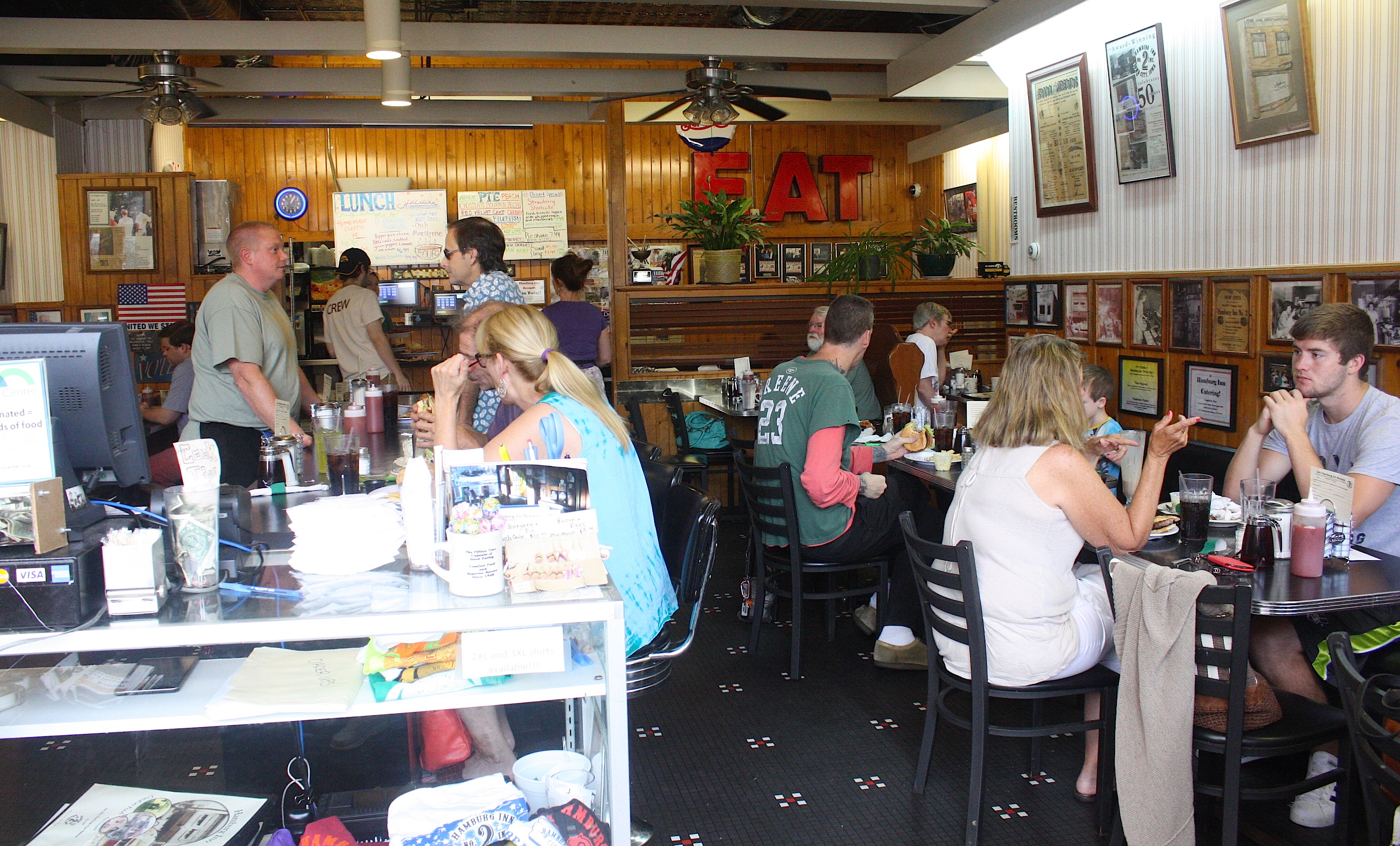
The food is okay, not great, but the atmosphere is fun and they’re playing Pink Floyd the whole time we’re here. We also spot Register RAGBRAI reporter Kyle Munson at the next booth, conducting an interview. It’s after 1:30, and we have a whole day of the route left to drive. So we bid farewell to Iowa City and attempt to find County Road W66, which is the way the bikes are leaving town. But we never find it and decide to cheat by taking State Hwy. 6 to West Liberty. Where is our detailed map when we need it???
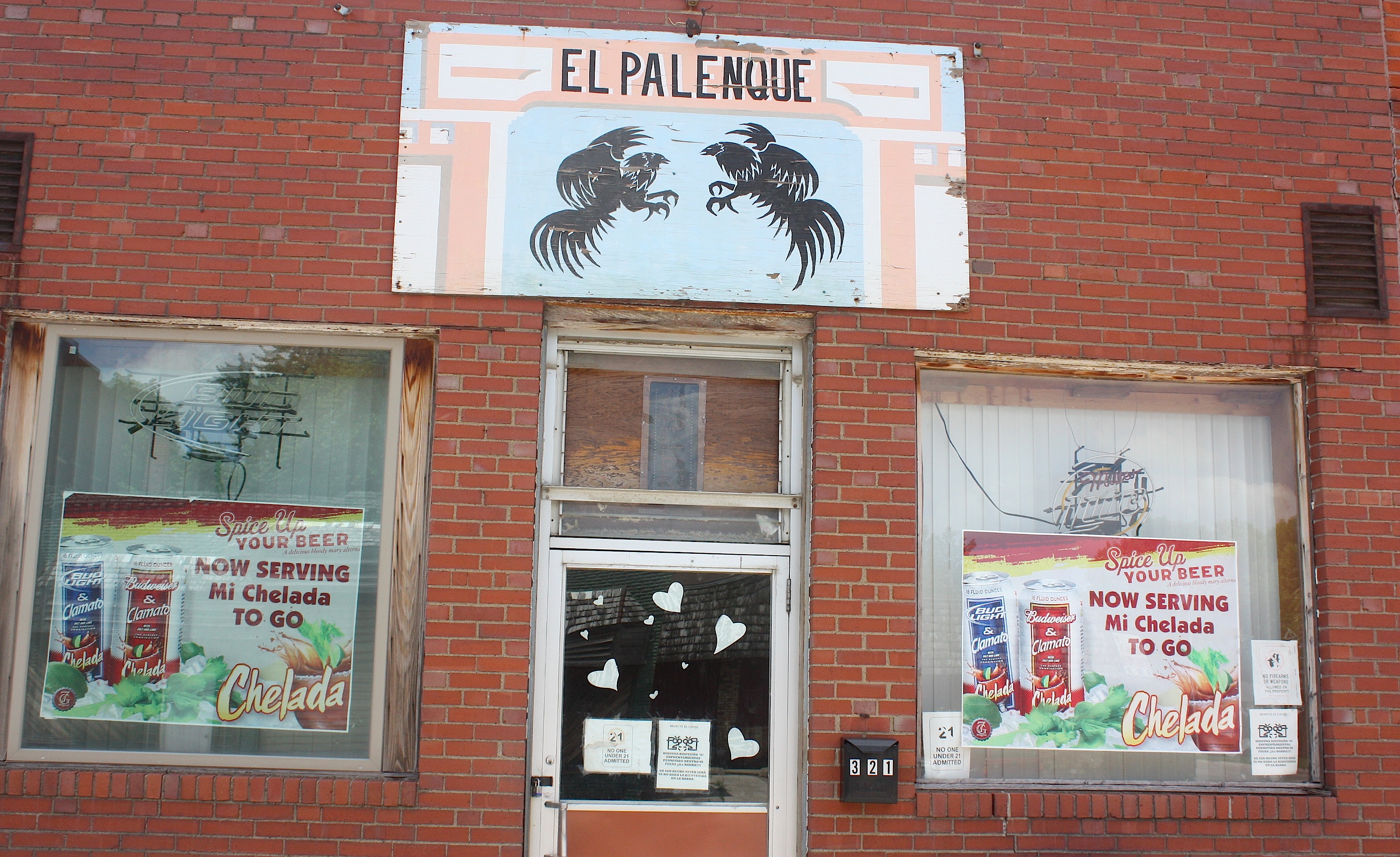


We arrive in West Liberty (population 3,736), a multicultural community with a decent-sized downtown. We stop in a Hispanic bakery because it smells so good, even though we’re still stuffed from lunch. West Liberty Foods, a turkey processing plant, seems to be the town’s largest employer.
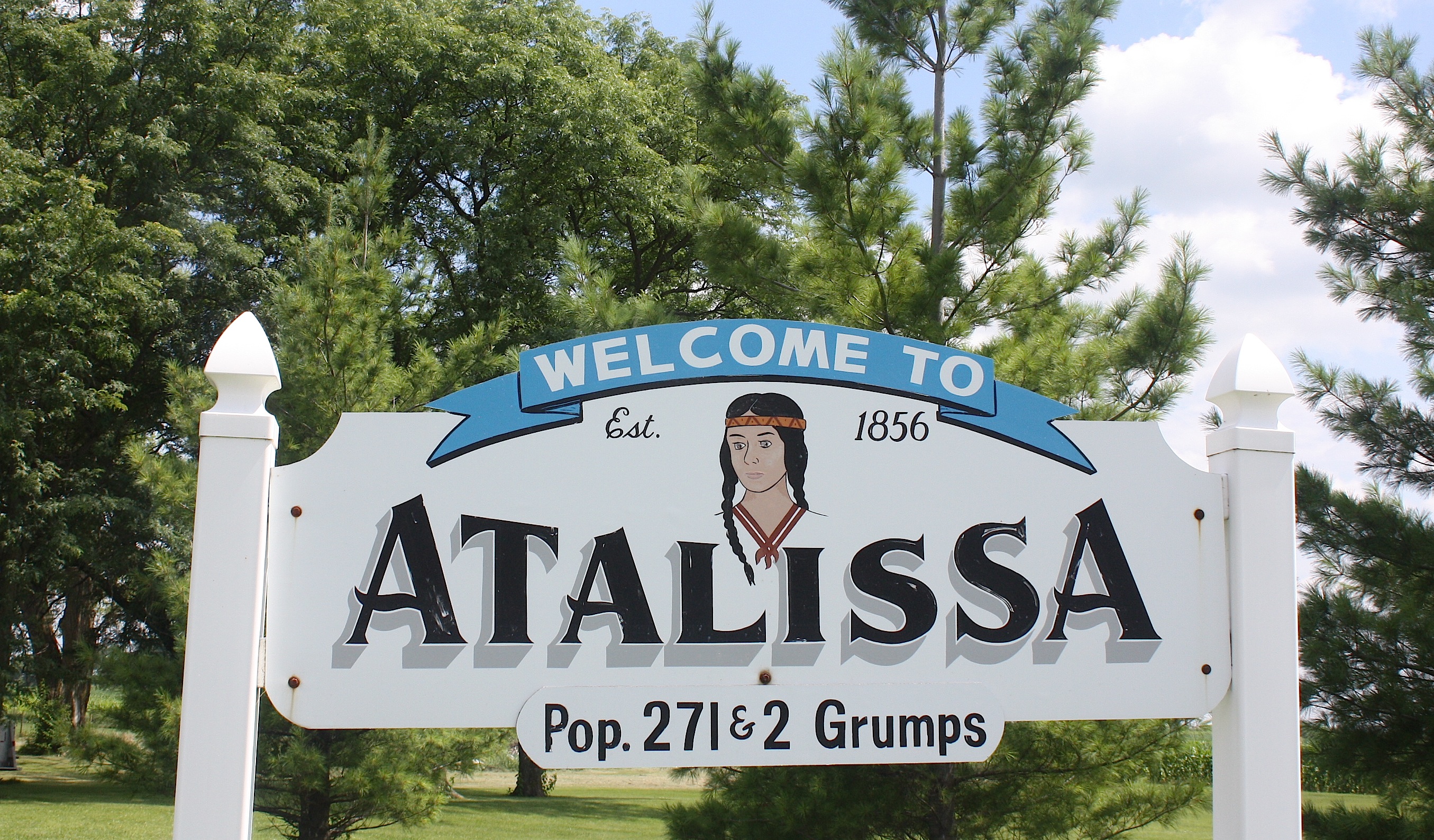
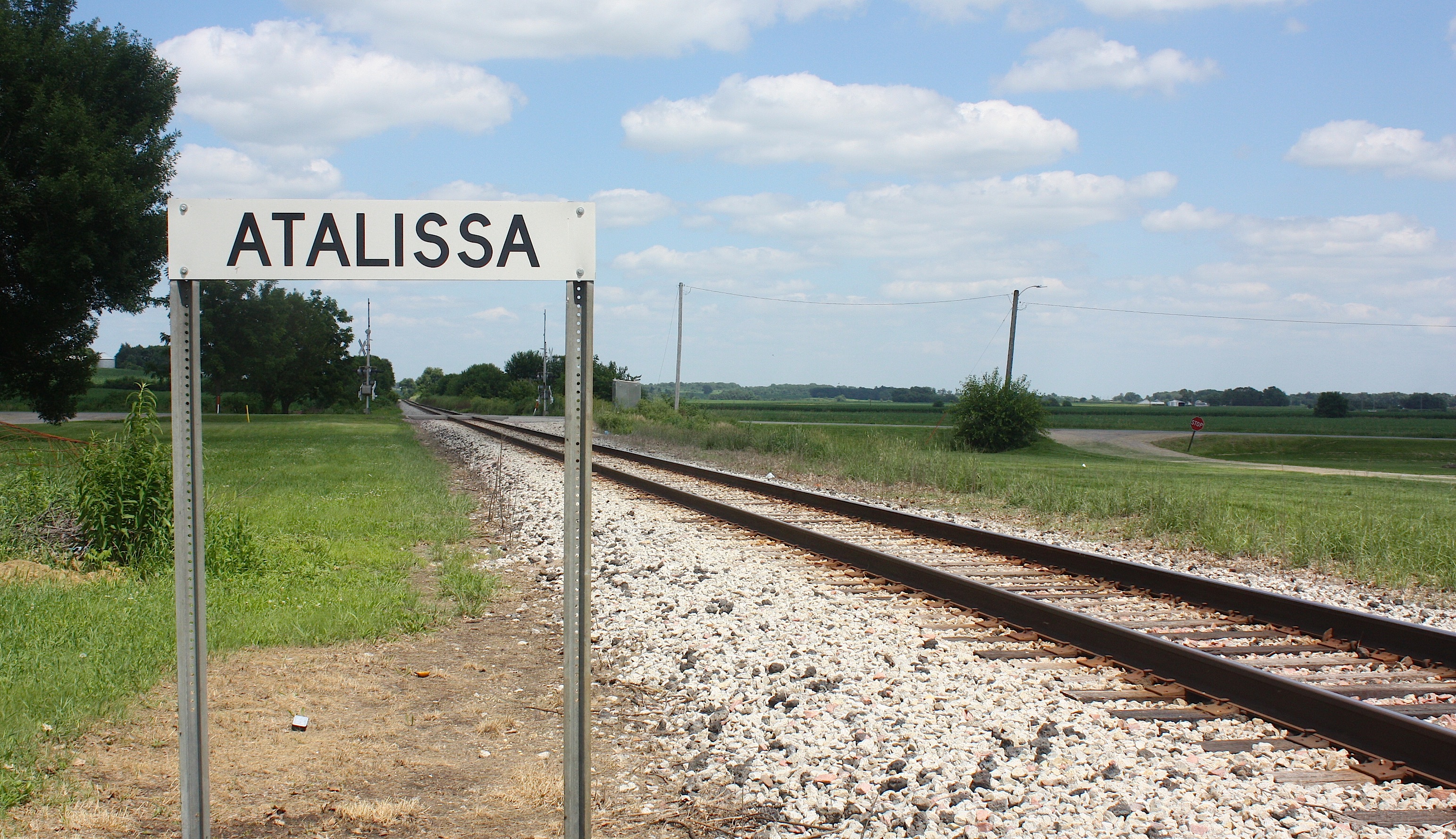
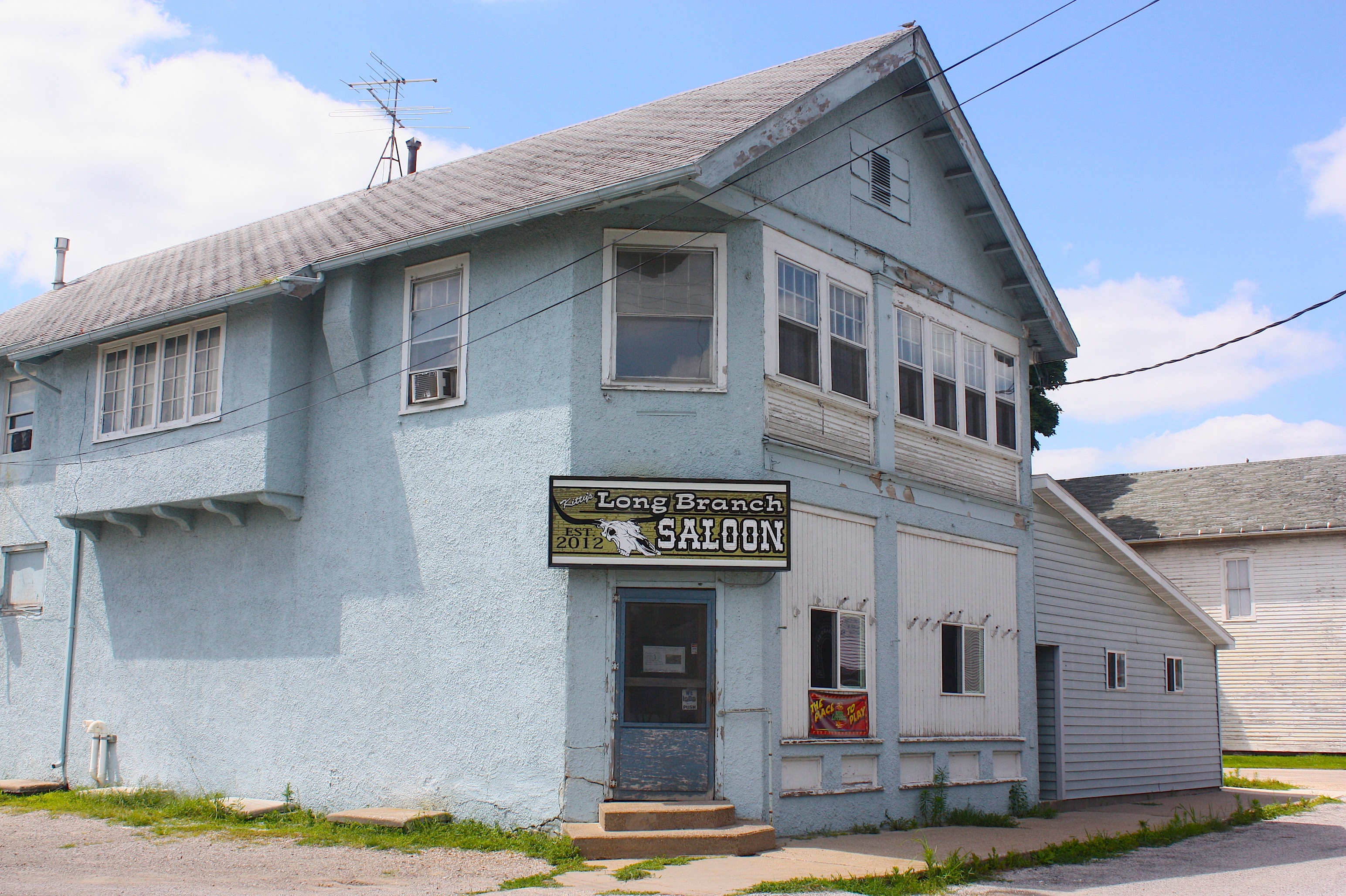
Just down the road is Atalissa (population 311). Going in, the only thing I know about Atalissa is all the negative press it got because of its own turkey processing plant here. Strangely, we never did see the plant. But we found the town had a number of enticing visuals, including the railroad tracks and the Longbranch Saloon.

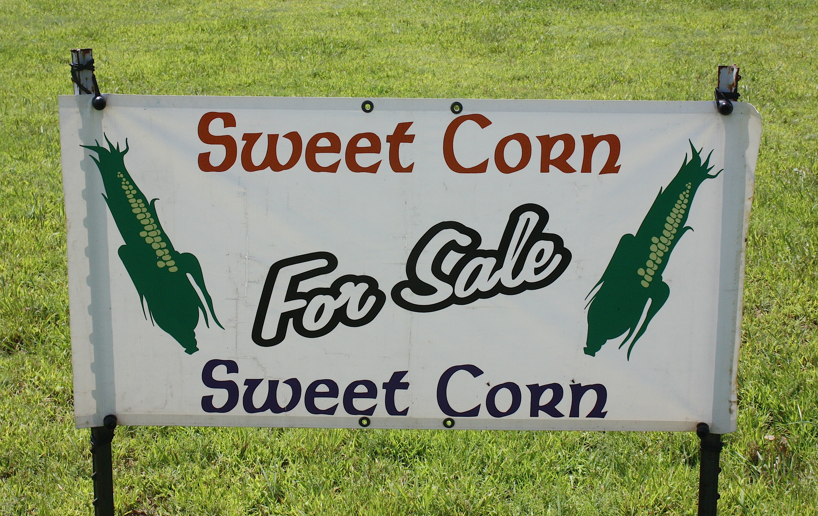
Another fun, visual stop was at Birkhofer Produce stand, an adorable corner of the world in unincorporated Moscow. There we found interesting signs, mailboxes, an old-fashioned laundry line, gardens, barns, and produce, below.


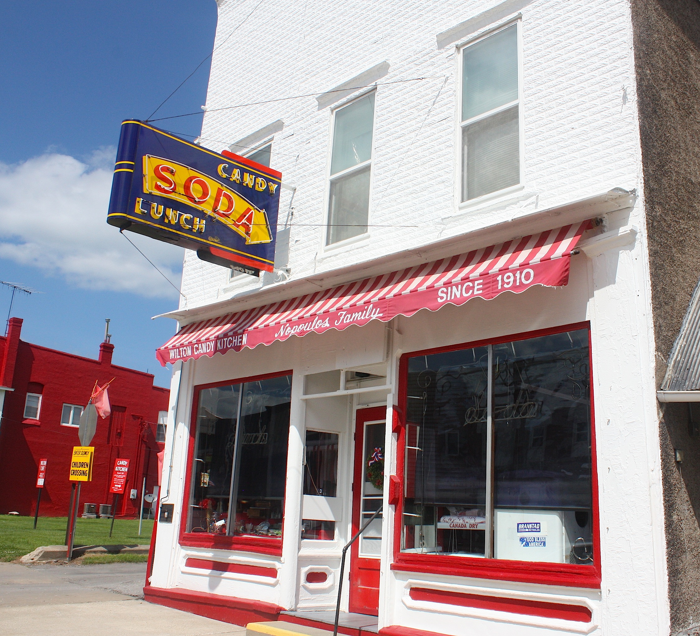
We leave Moscow and head for Wilton, a town I’ve wanted to visit for a long time because of the famous Wilton Candy Kitchen ice cream parlor. And wouldn’t you know it? It was closed. At 3 o’clock on a Thursday afternoon. Really??? I’m finding this trend truly annoying right now. I mean, I understand if we roll in to a town at 7:30 in the morning or after 5 p.m. or on a Sunday. Things will be closed. But come on! This is really baffling and disappointing.

Wilton (population 2,802) is a cute town nonetheless, and there are the ubiquitous flags and flower baskets lining the streets. Which makes me wonder: Does RAGBRAI provide these to the pass-through towns? Because these things are everywhere.

Next on the route is Durant (population 1,832), home to Durant Iron & Metal. There doesn’t appear to be much here…until we start to head out of town and spot Sunshine Antiques & Uniques, an adorable shop in a 1930s Texaco gas station, with painted patio furniture, tables, and other goodies outside. Inside, it’s very girlie and sweet.
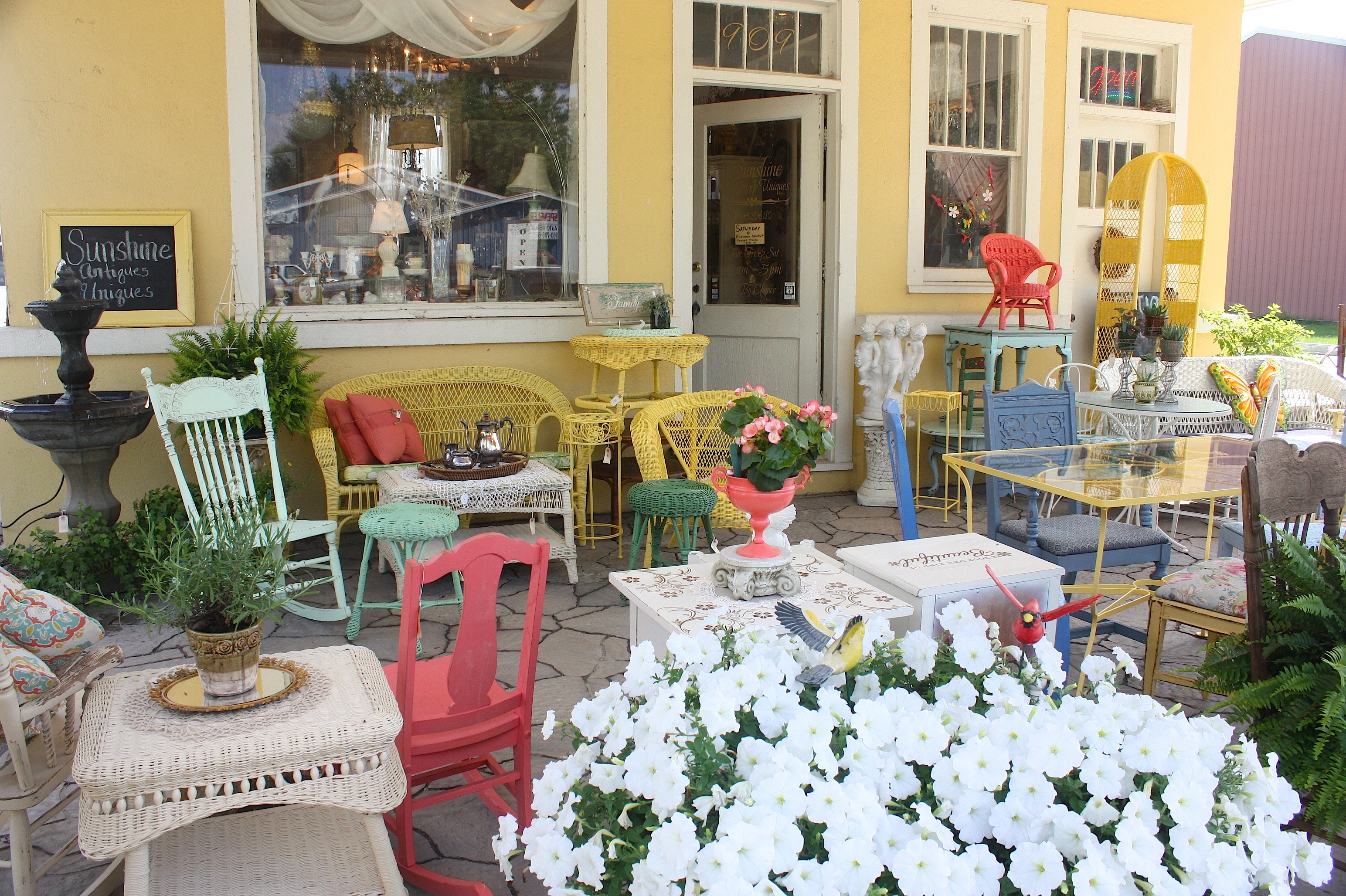
The owner said that men aren’t too crazy about the shop, but their wives love it. She said she buys most of the antiques and vintage goods at auctions and estate sales, and she paints/refurbishes the furniture herself. This is an awesome place.
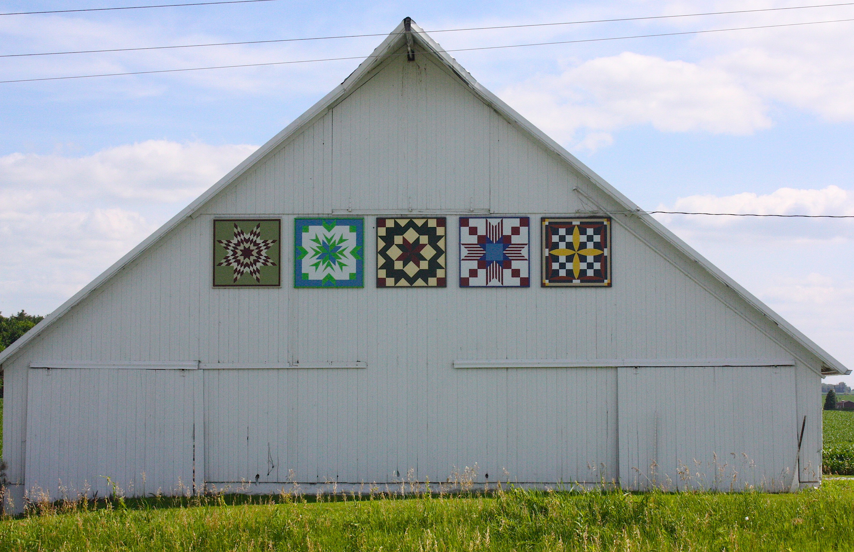
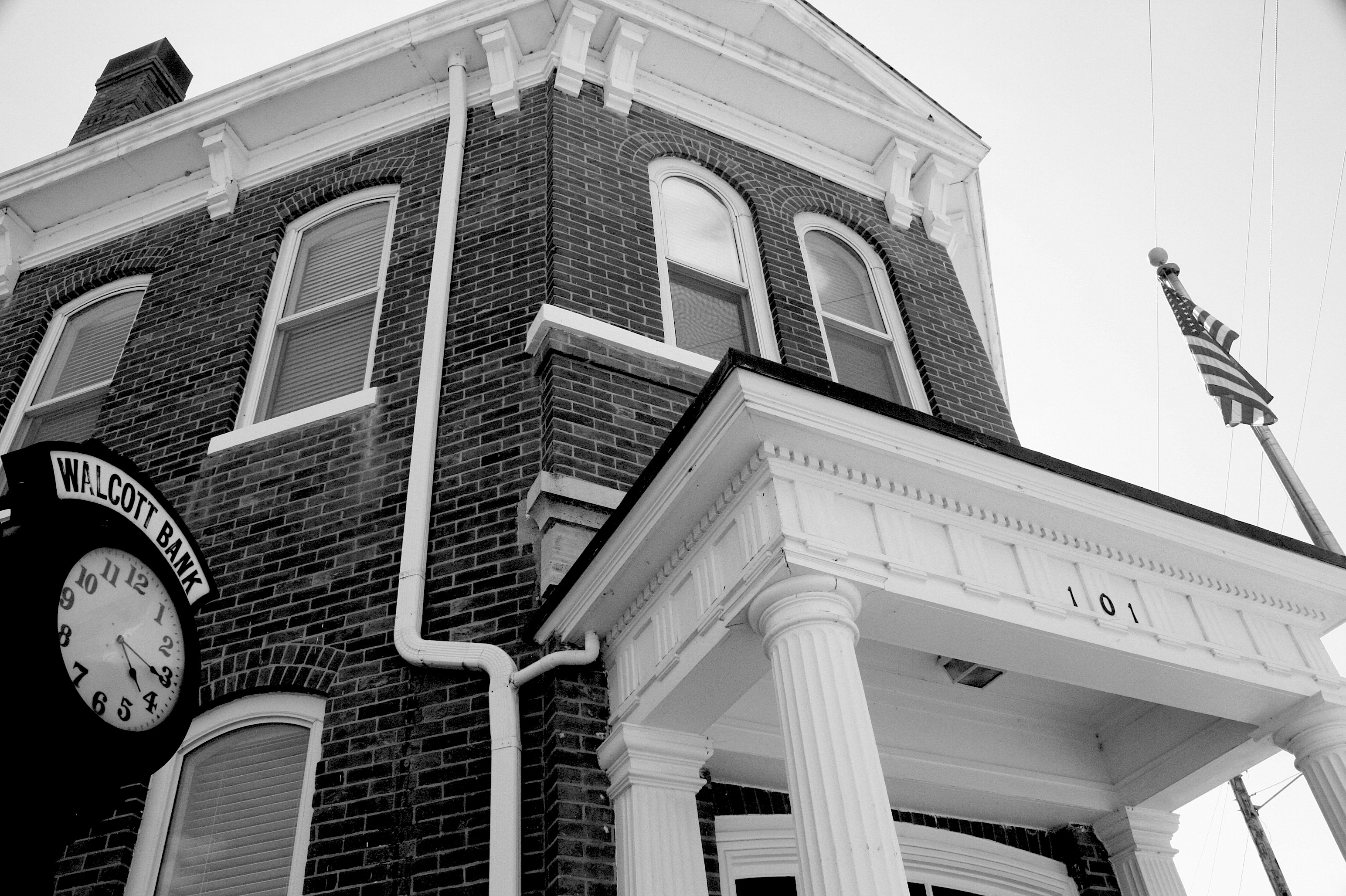
Our last stop before the end of the road in Davenport is Walcott (population 1,629). I’d characterize this tidy little town as a bedroom community for the Quad Cities, but with some character of its own. We met a gardener working to beautify a small plot in one of the city’s parks. There are some picturesque barn quilts on the way into town, and the downtown area has a historic VFW and a lovely bank, plus a large grain elevator.

Oh, and this: a castle! Apparently the castle was built as a home and was featured in the Acri Creature Feature, a regional television show that used to be on every Saturday night. (We learned this from the gardener.) The castle has seen better days; it appears to now house several rundown apartments.

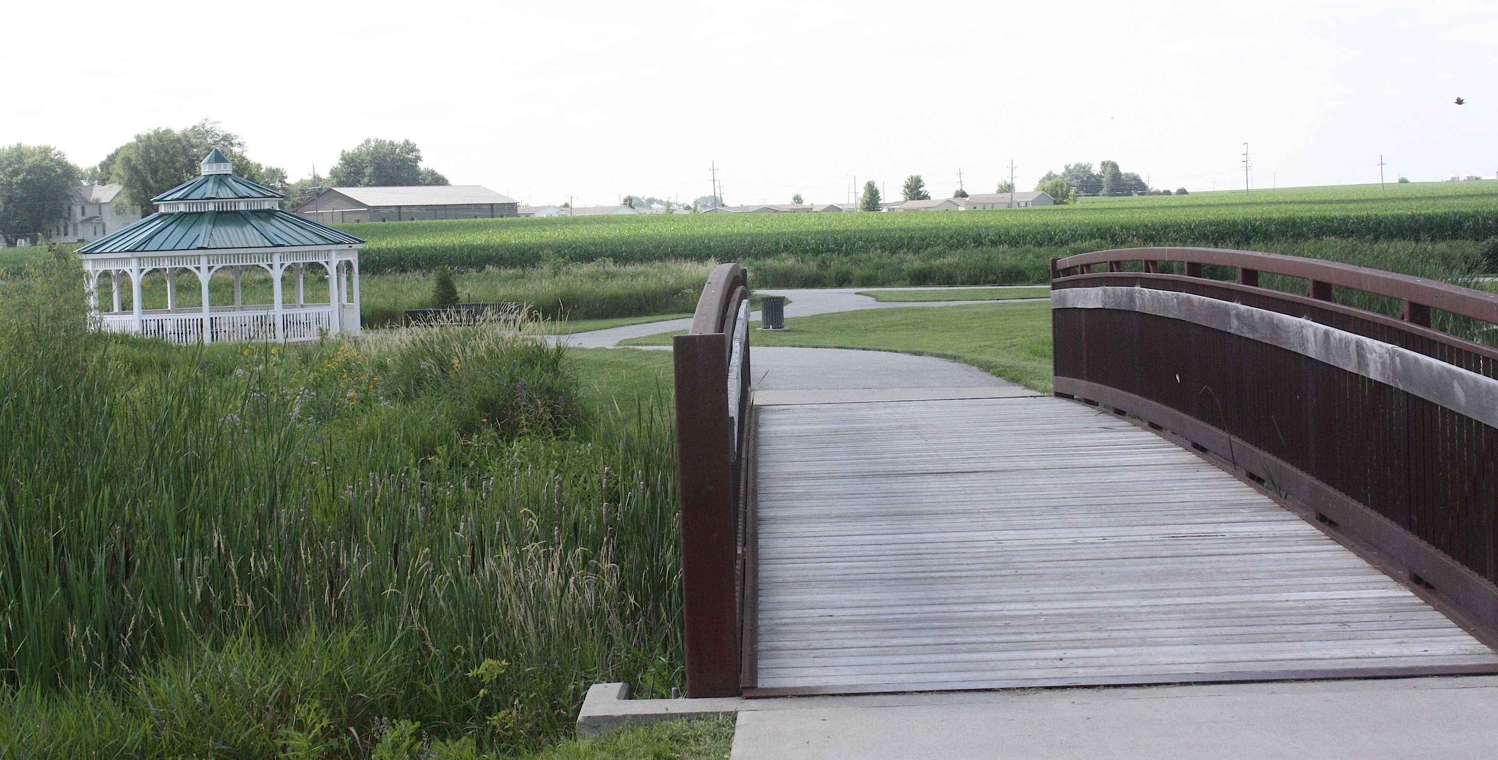
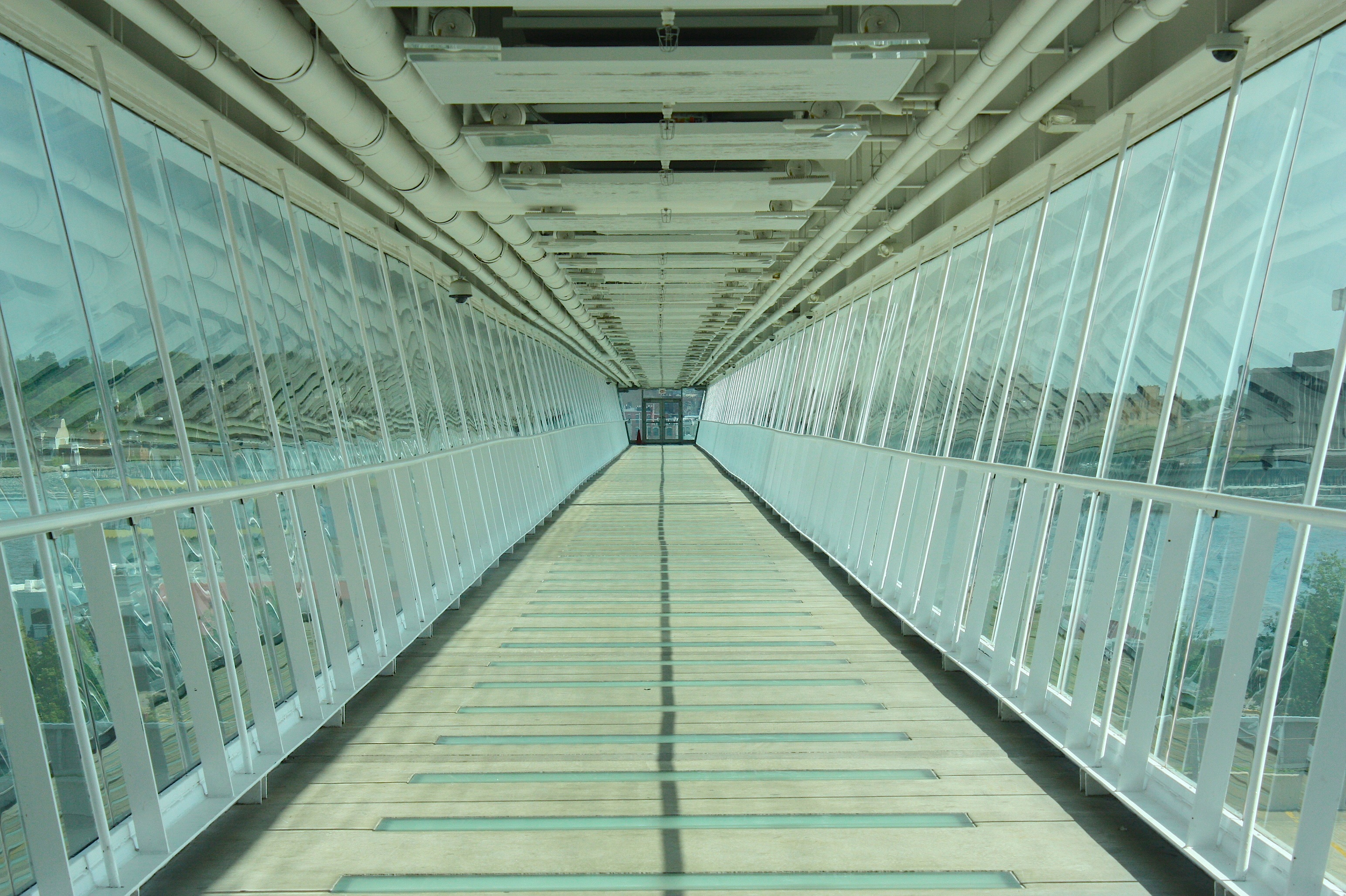
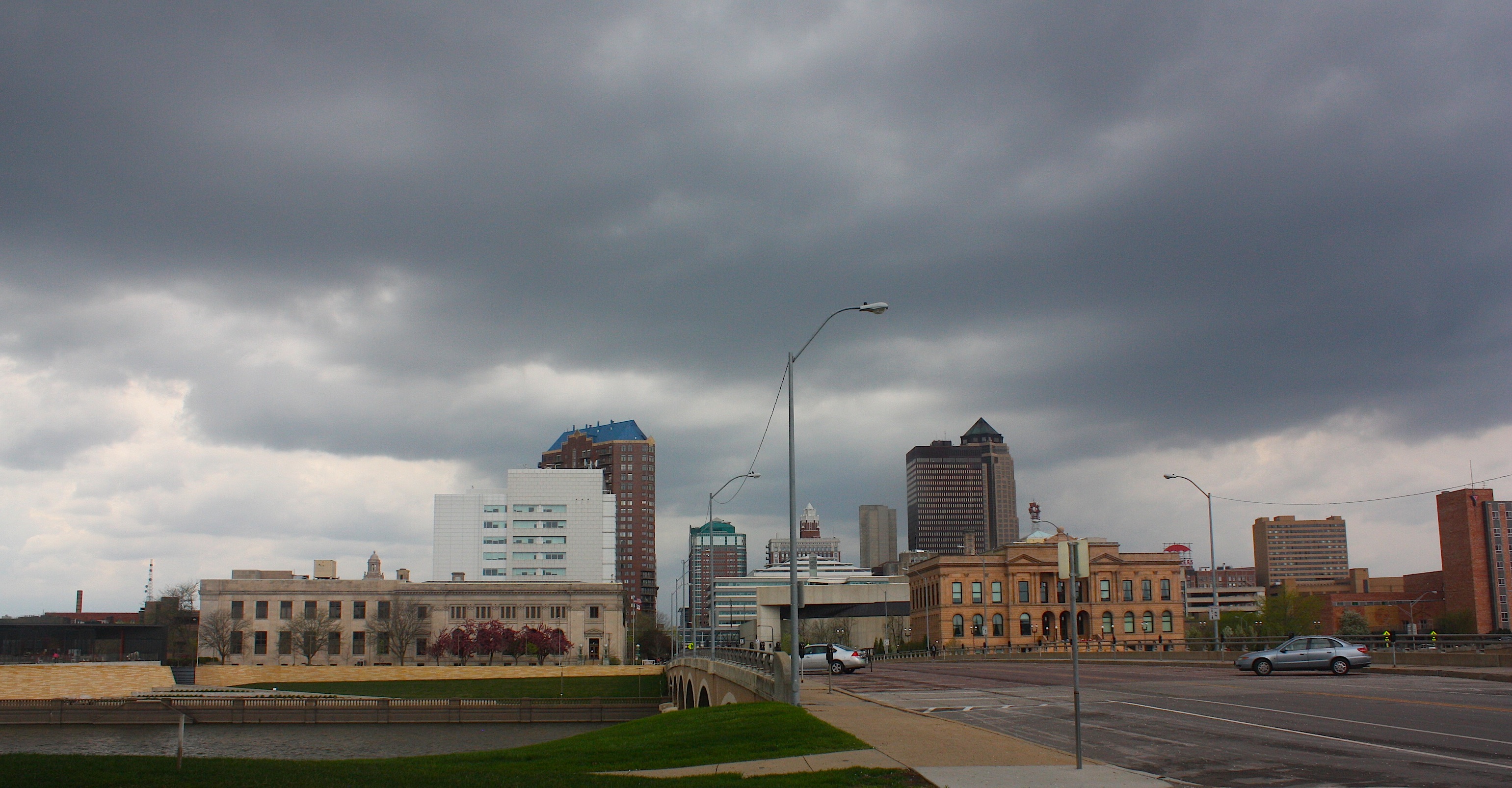
At 4:45, we roll into Davenport. Our route takes us by some spectacular old architecture, including the lovely St. Ambrose College campus. Our destination is the riverfront, with its sky bridge, casino, green space, and bike path along the river. We go up the sky bridge for a different view before driving north along the river, with a view of lovely historic homes on the bluff.


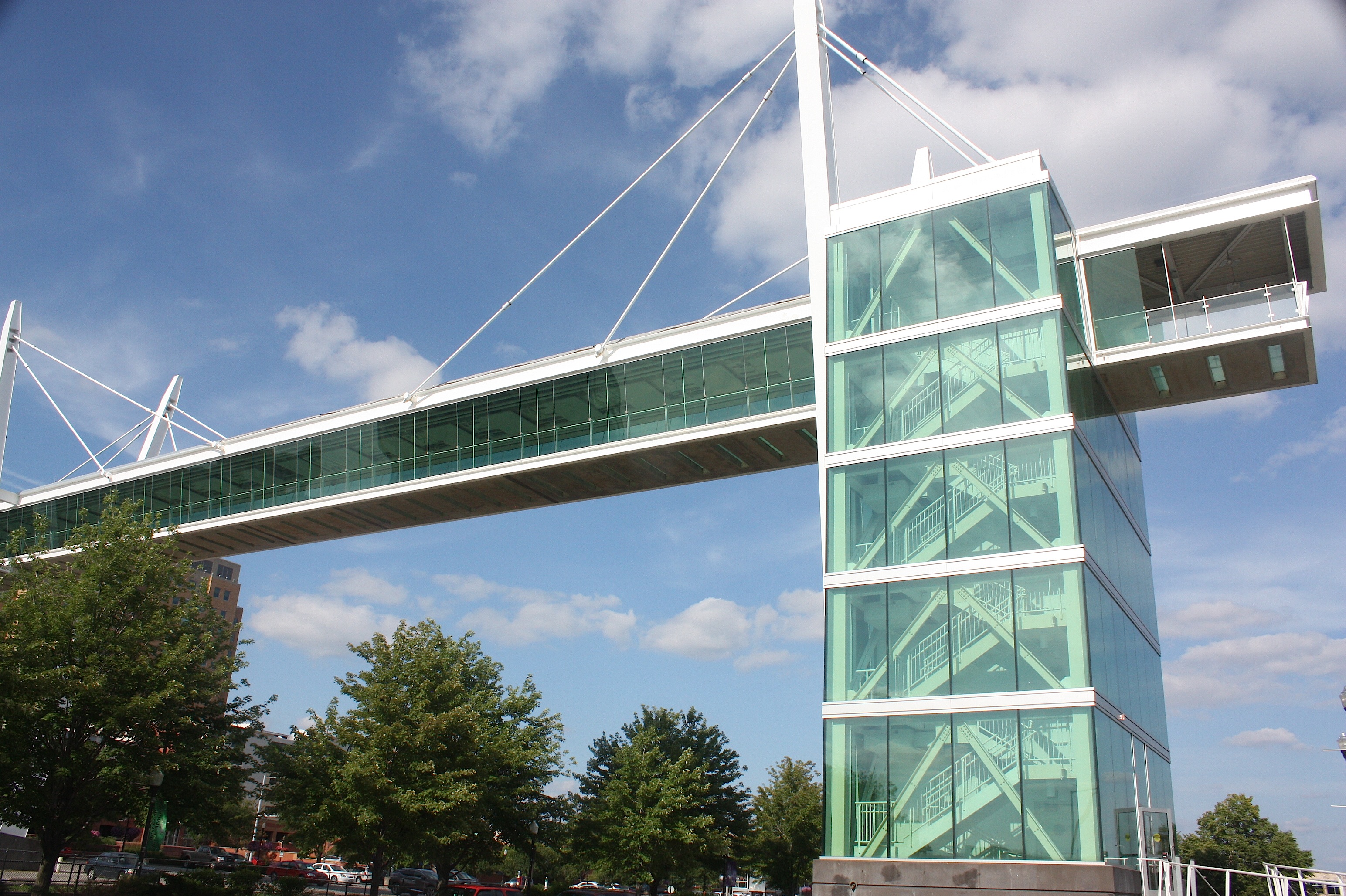
There’s much to see and do in Davenport, but we have a three-hour drive ahead of us, so we end our RAGBRAI route here at the waters of the Mississippi.
My hat’s off to the RAGBRAI route planners, and I’m a wee bit jealous of the riders who next week will see all that we’ve seen, but from the seat of a bicycle and with the added fun of food, friends, drink, and much frivolity.
Enjoy!
Driving RAGBRAI XLIII: Day 2
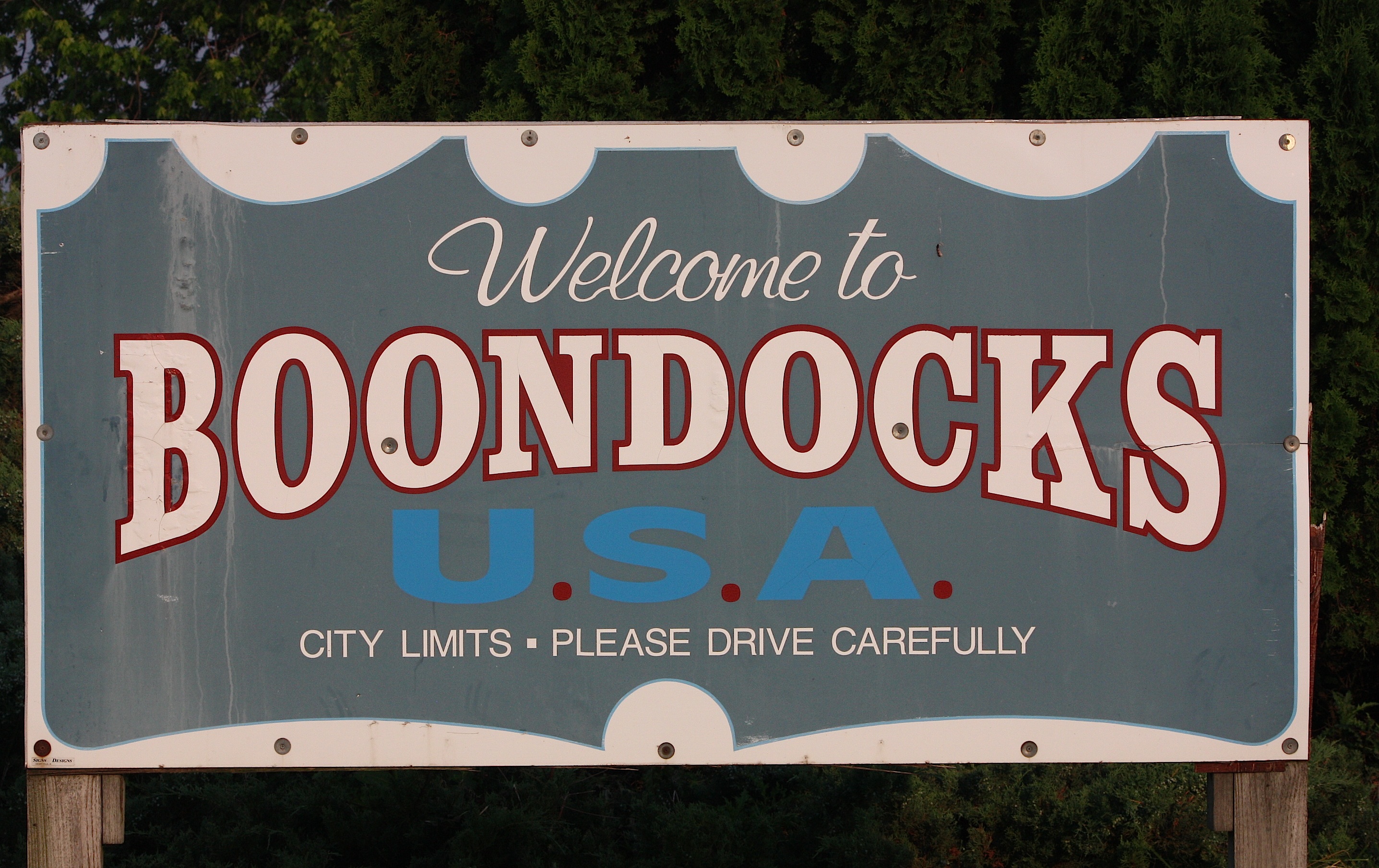
Here we go on Day 2 of the Des Moines Register’s Annual Great Bicycle Ride Across Iowa! We left off in Webster City, so the first stop this morning is Boondocks – not so much a town as a truck stop/motel next to Interstate 35.
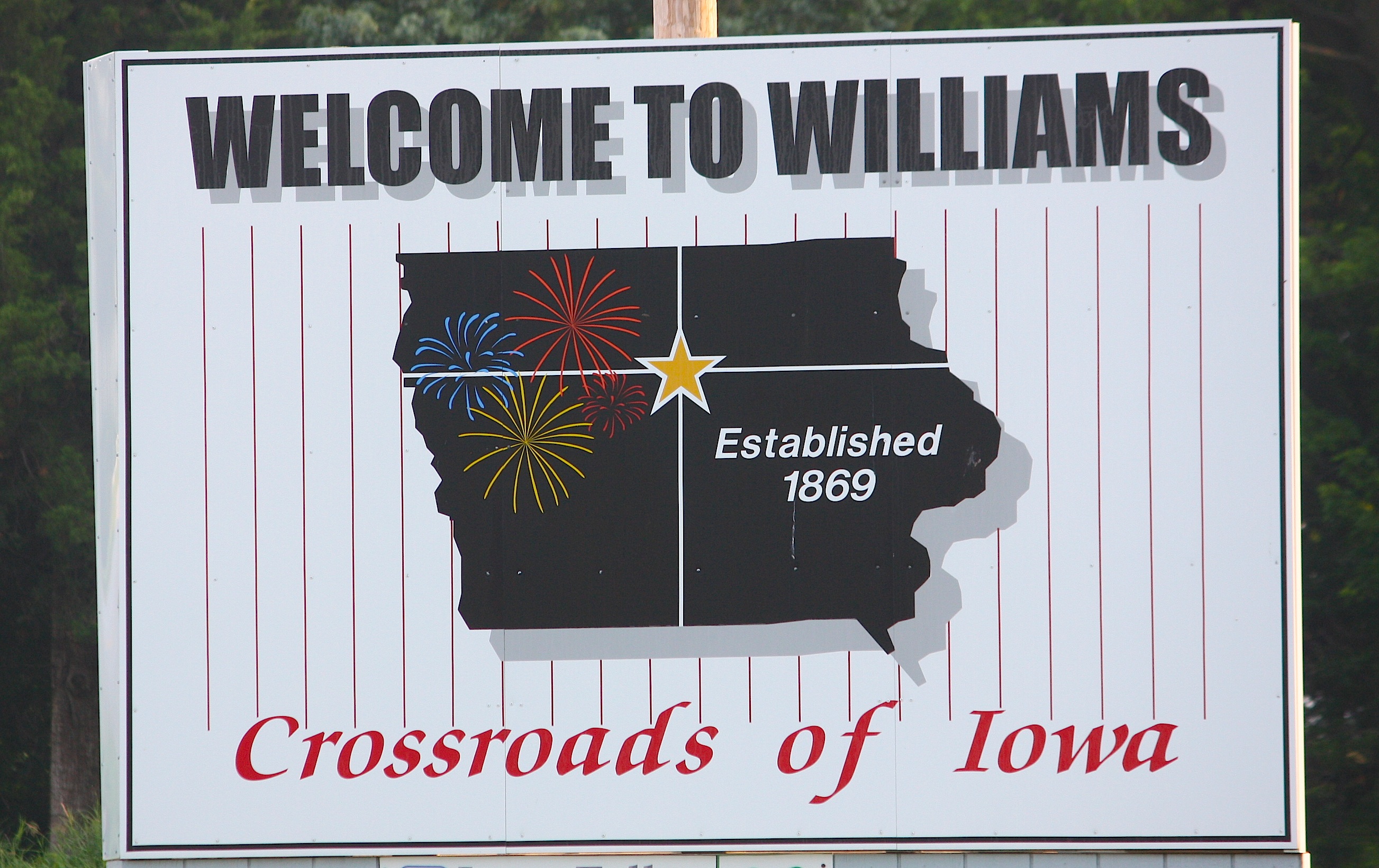
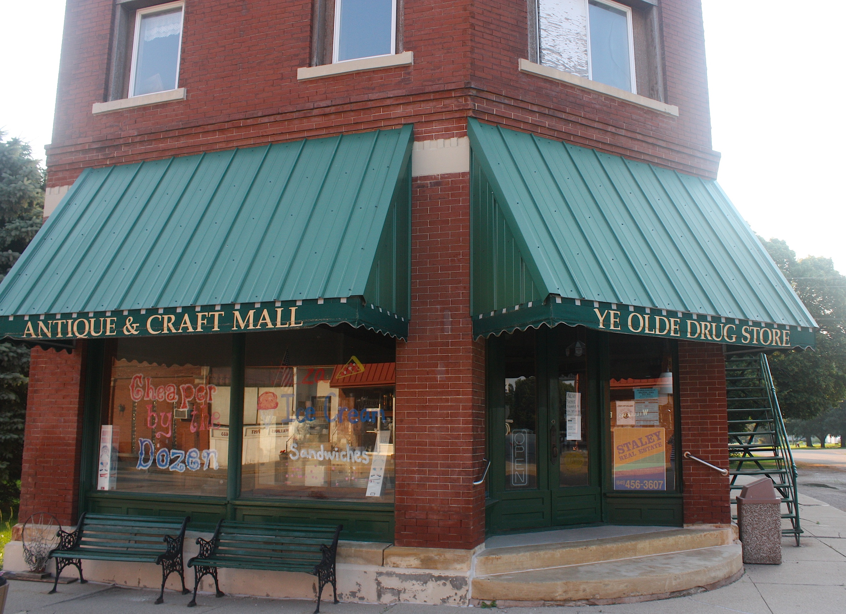
Our route today (which actually starts midway through Day 3 of the cyclists’ week) starts out hovering near Highway 20. Our second stop was in tiny Williams (population 344), home to the Hemken Collection of vintage cars and to Ye Olde Drug Store / Antique & Craft Mall. Nothing was open, and the town was pretty darn quiet.
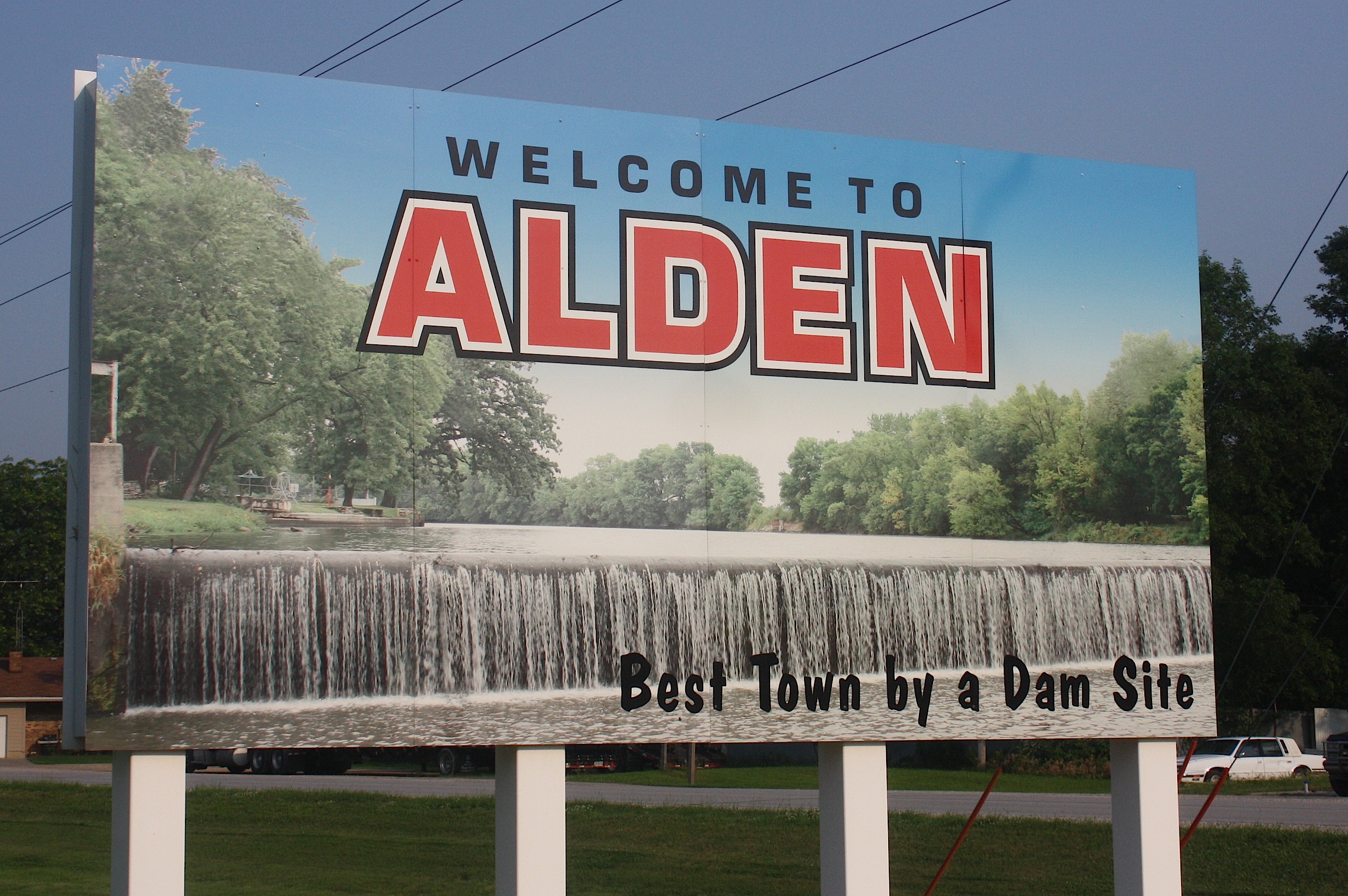
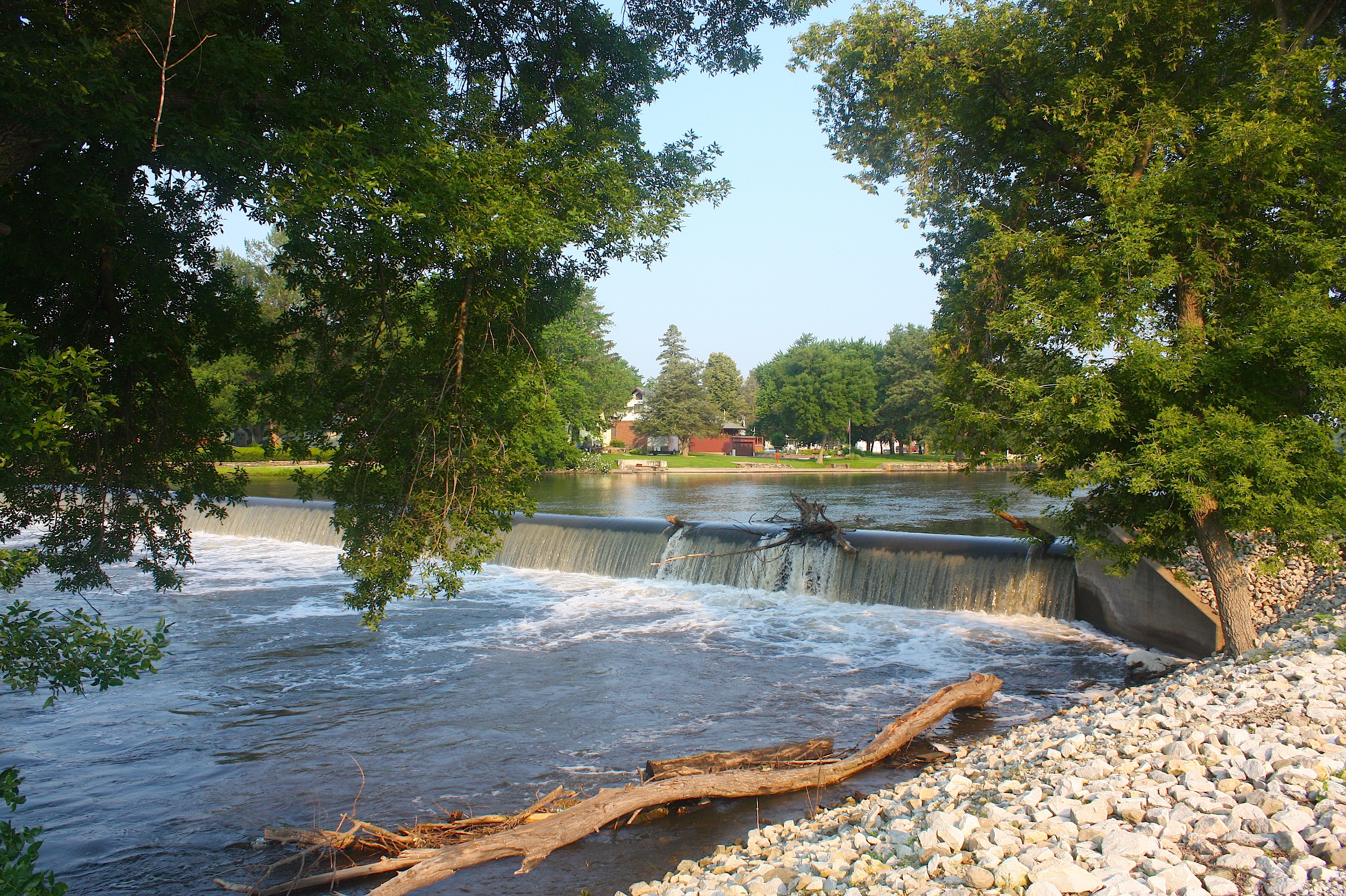
Next up: Alden (population 787). We had trouble getting to Alden, because D20 was closed and the gravel road we tried to skirt around it was closed. So we had to retrace our steps back to Williams and take an alternate route to get there. But it was worth it, primarily for the dam on the Iowa River.

Alden city leaders really seem to be into the swing of RAGBRAI already, even though the ride doesn’t start for nearly three weeks. We saw signs promoting “Iowa’s Best Dam Party” along with a friendly beaver mascot. The city’s year-round motto is “Best Town by a Dam Site,” so the folks here seem to have a lot of fun with this theme.
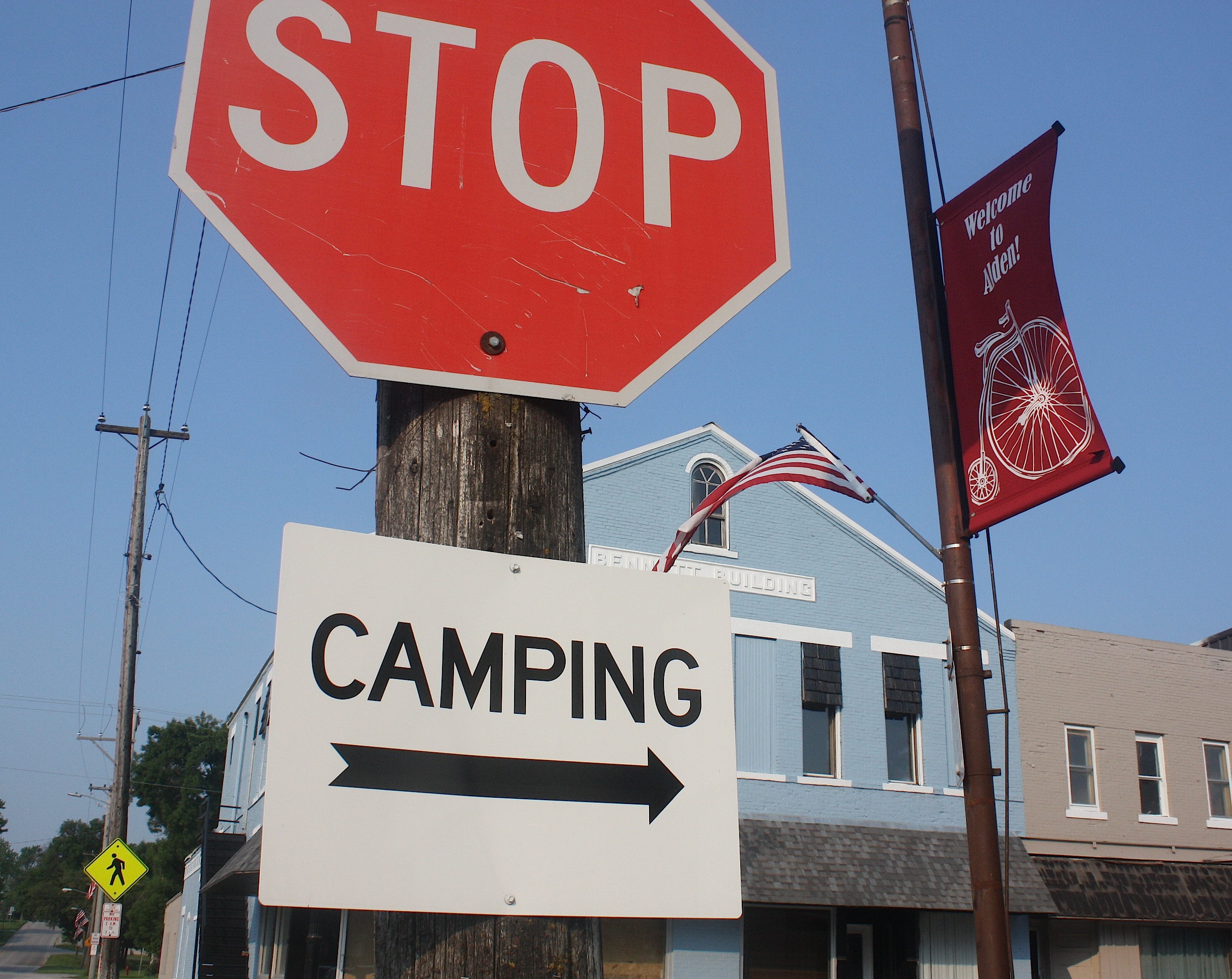
Alden has several shops in the downtown area, a pretty park, bars, and, of course, the river. It should be a fun stop for riders. Before we left town, we stopped at Casey’s for a donut.
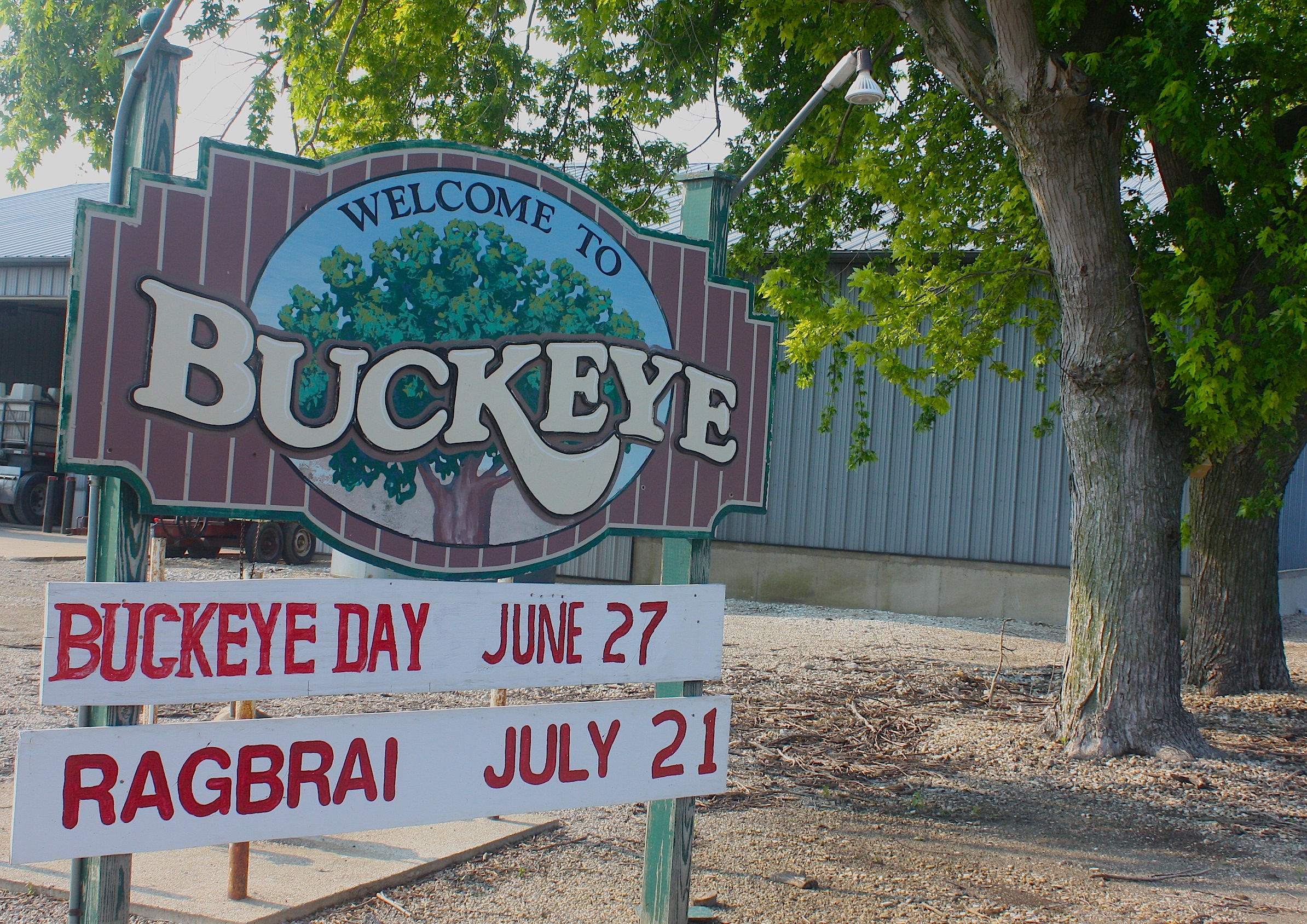

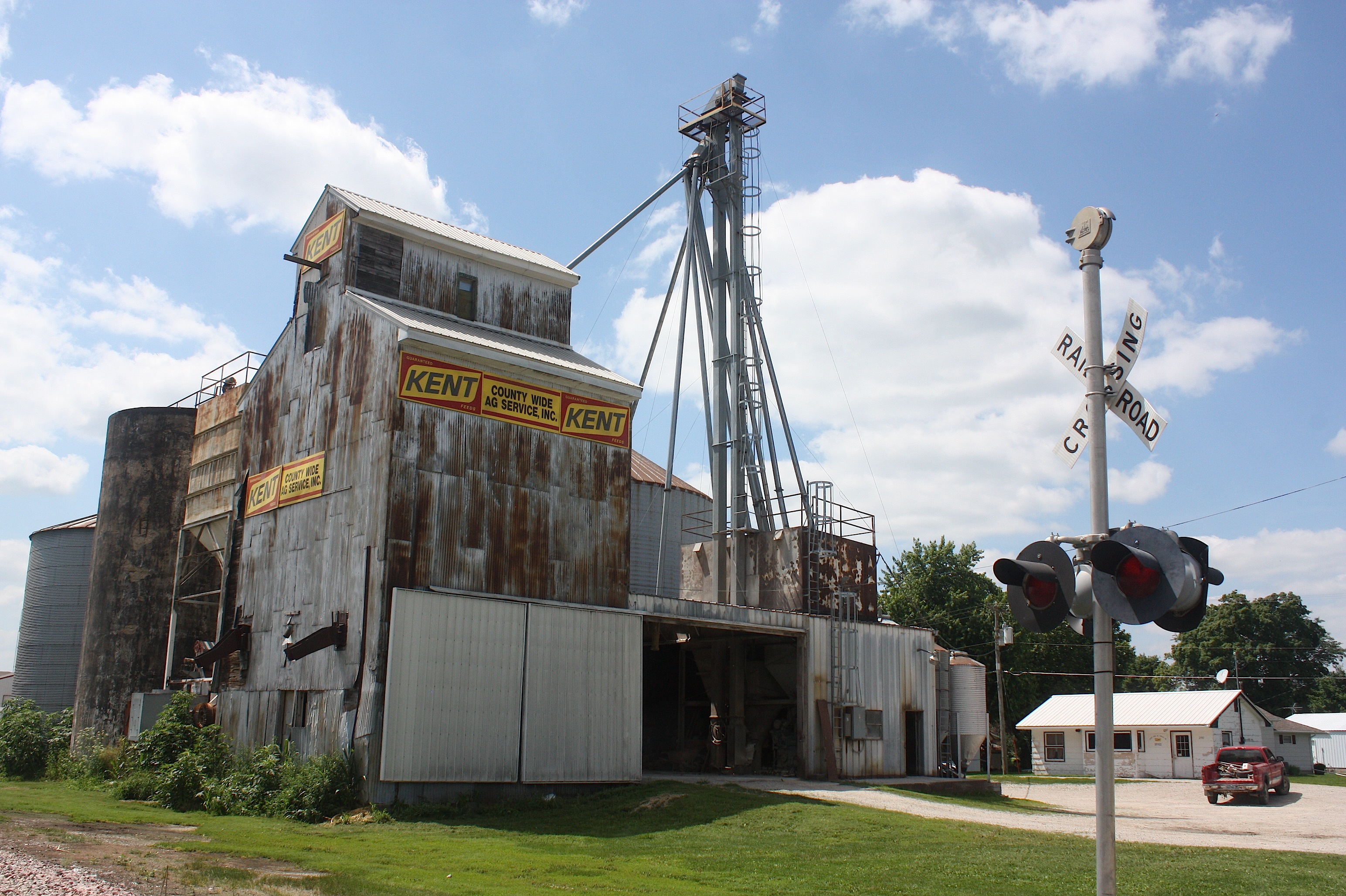
Tiny Buckeye (population 108) didn’t hold much interest except for a grain elevator (does every small town in Iowa have one of these? It sure seems like it) and massive railroad tracks.
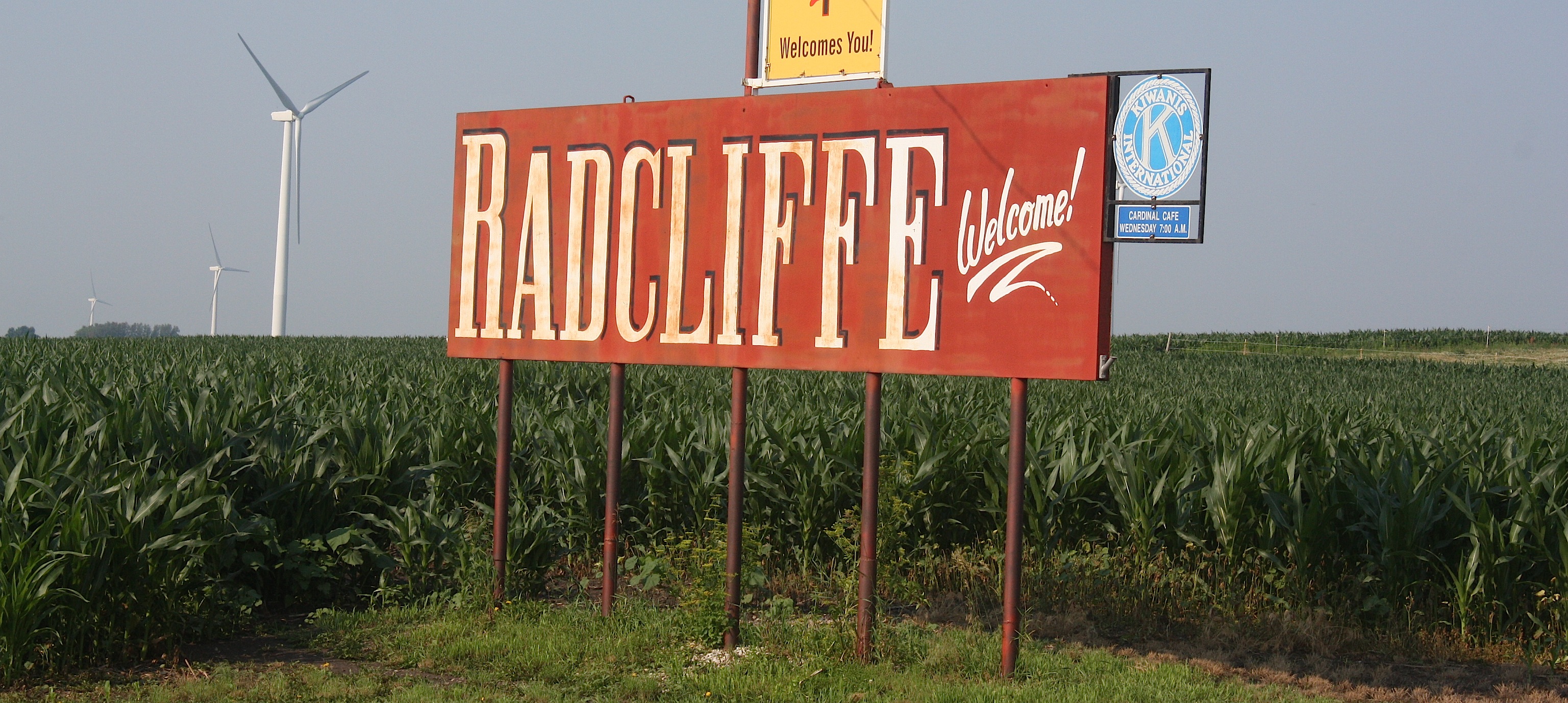
Moving on, we take the Karras Loop to Radcliffe, and I’m so glad we did. Because it’s in Radcliffe (population 545) where we meet Larry Pearson, a metal artist who’s hard at work welding a bicycle sculpture for Eldora, the next overnight town.
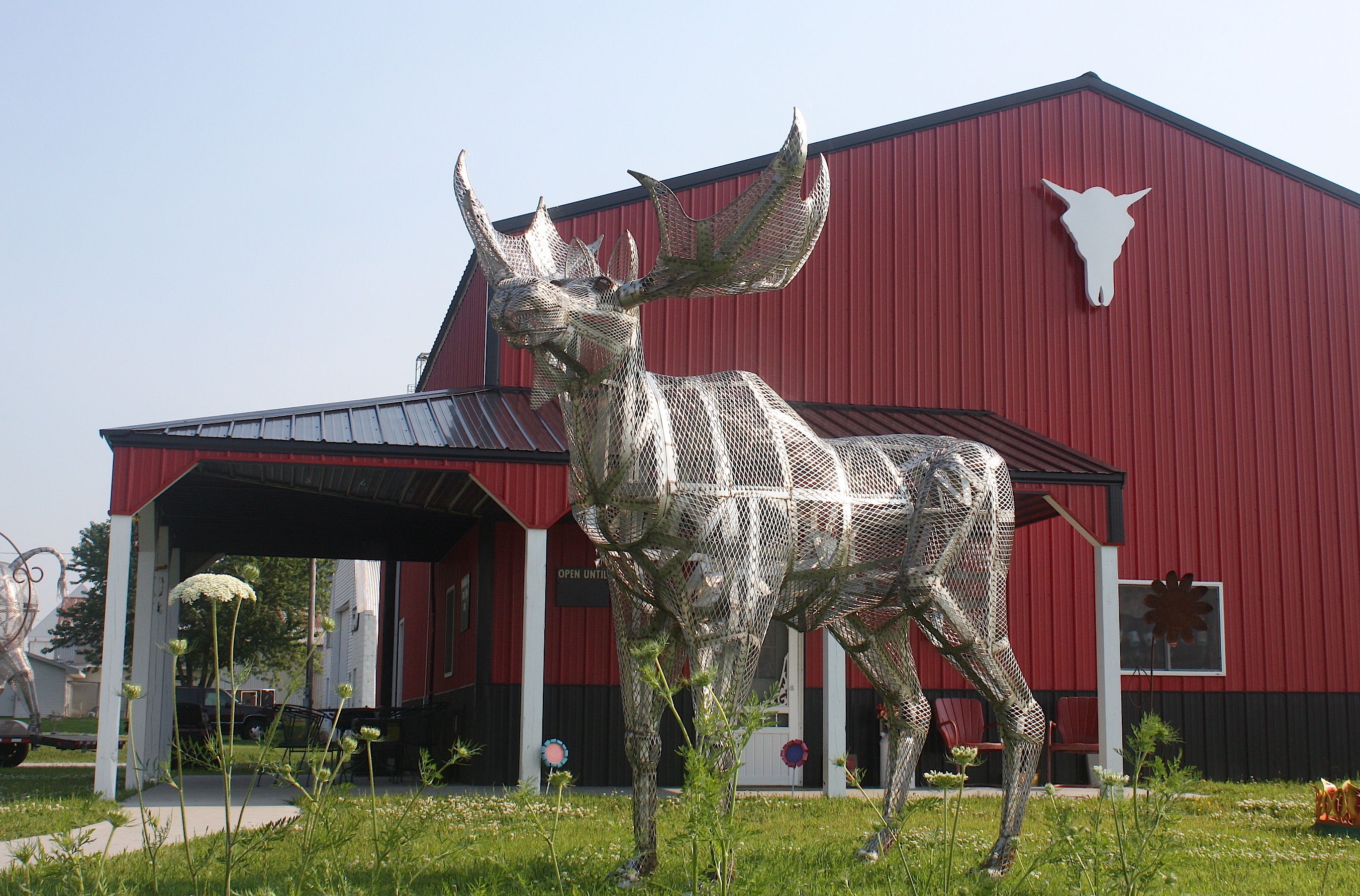
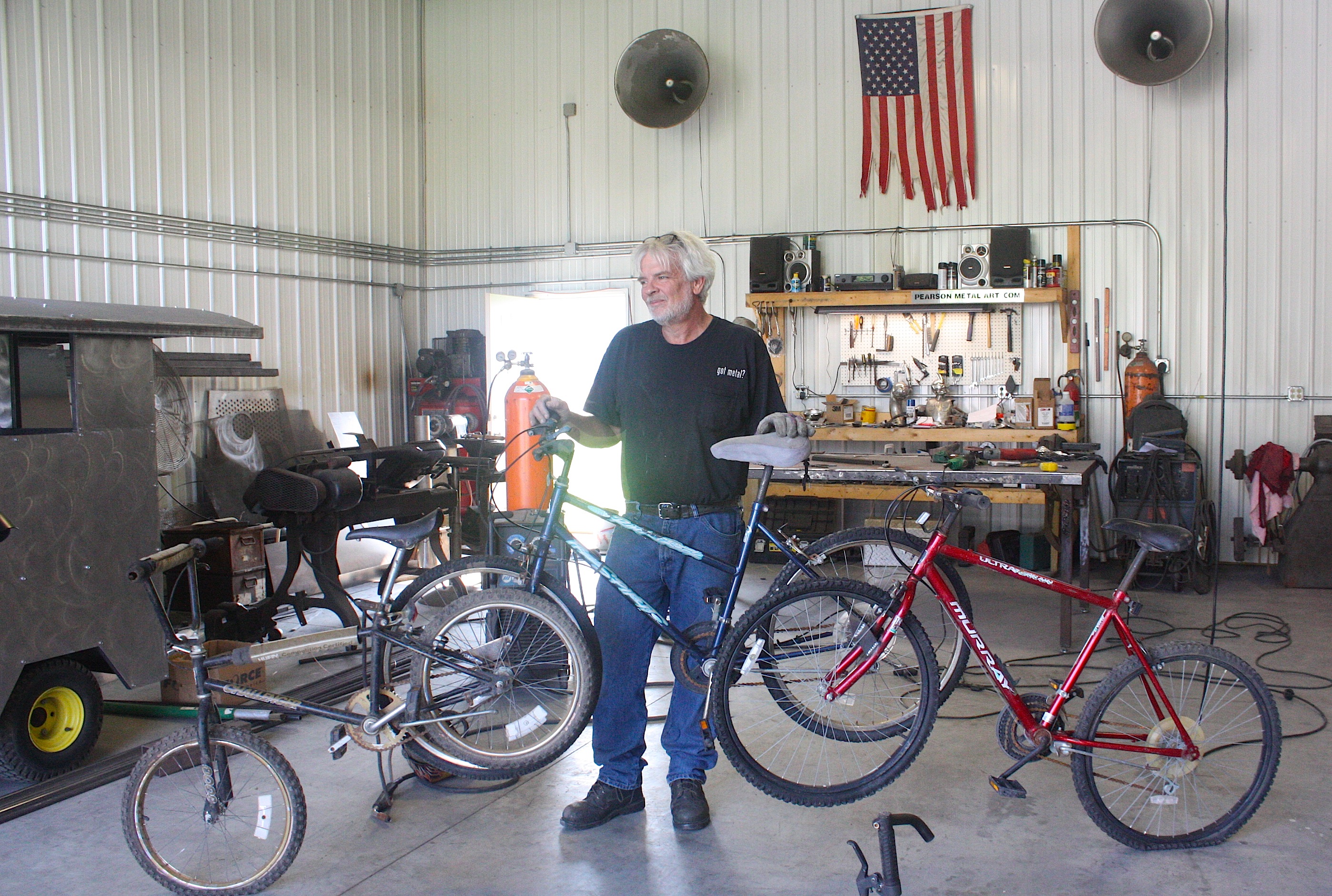
Larry was a very interesting guy; he took us into his shop and showed us several projects he was working on. We also visited his showroom. He’s got a couple of really cool pieces – a buffalo and a moose – that will be great photo ops on RAGBRAI.
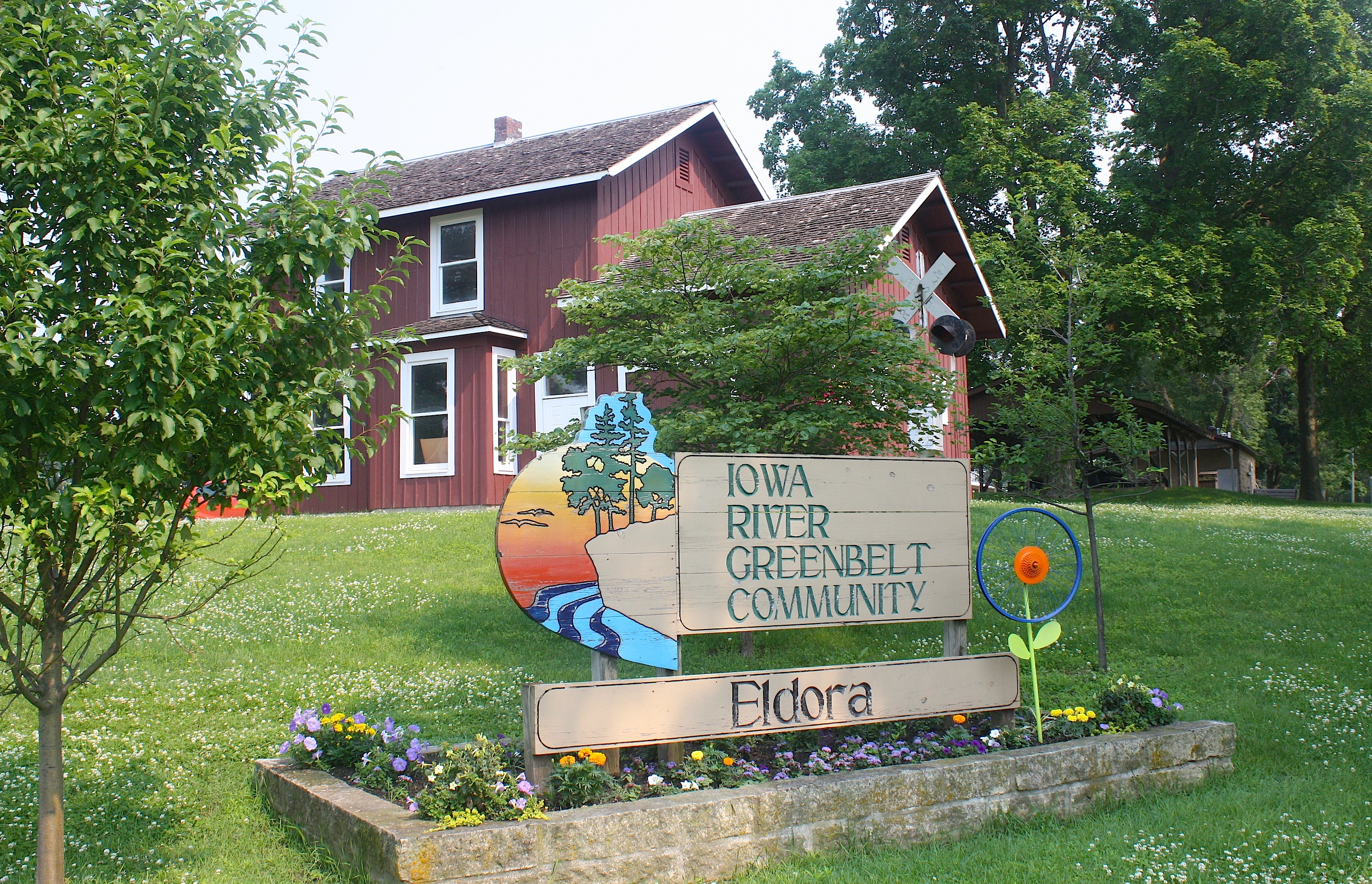
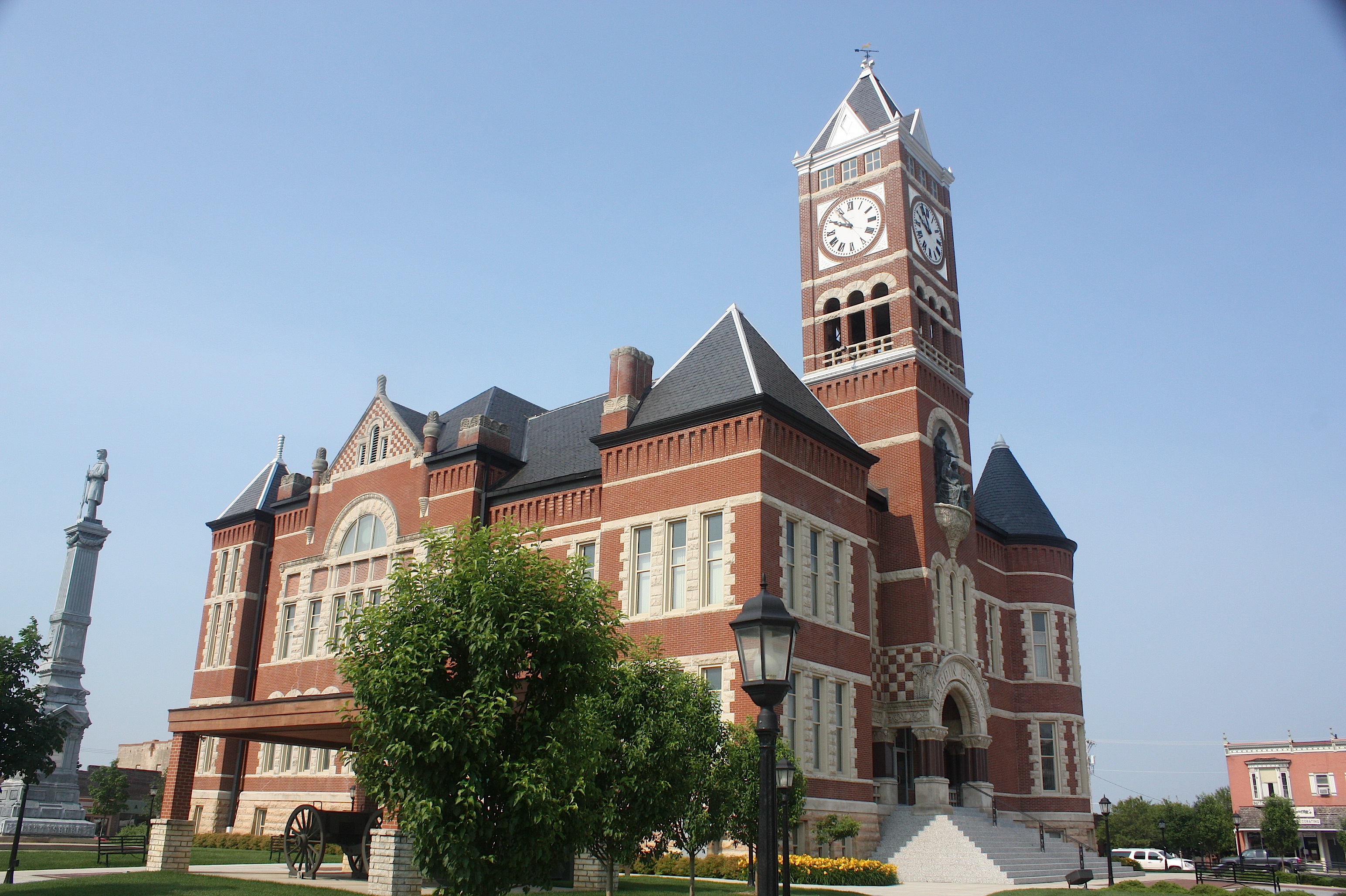
Rounding out Day 3 of the riders’ route is Eldora (population 2,732), the county seat of Hardin County. Eldora has at least three things going for it: First, its courthouse (below) is one of the most beautiful in the state, and it’s located in the middle of a nice town square.
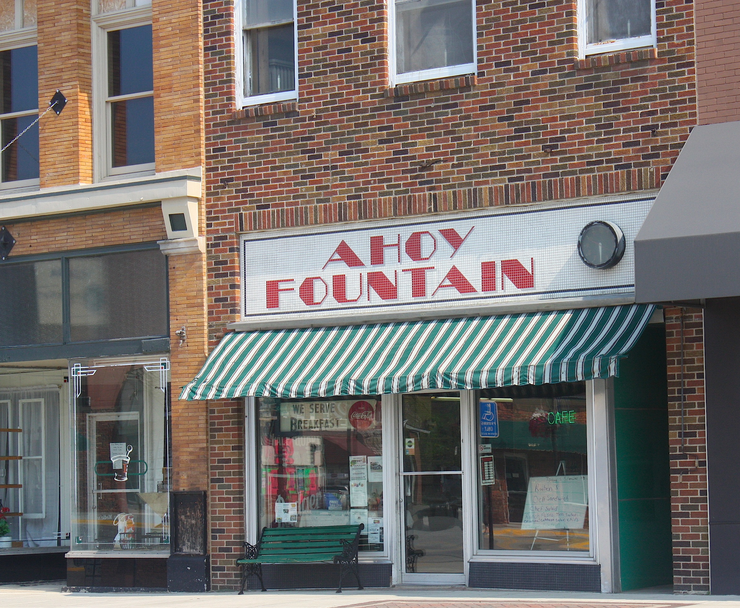
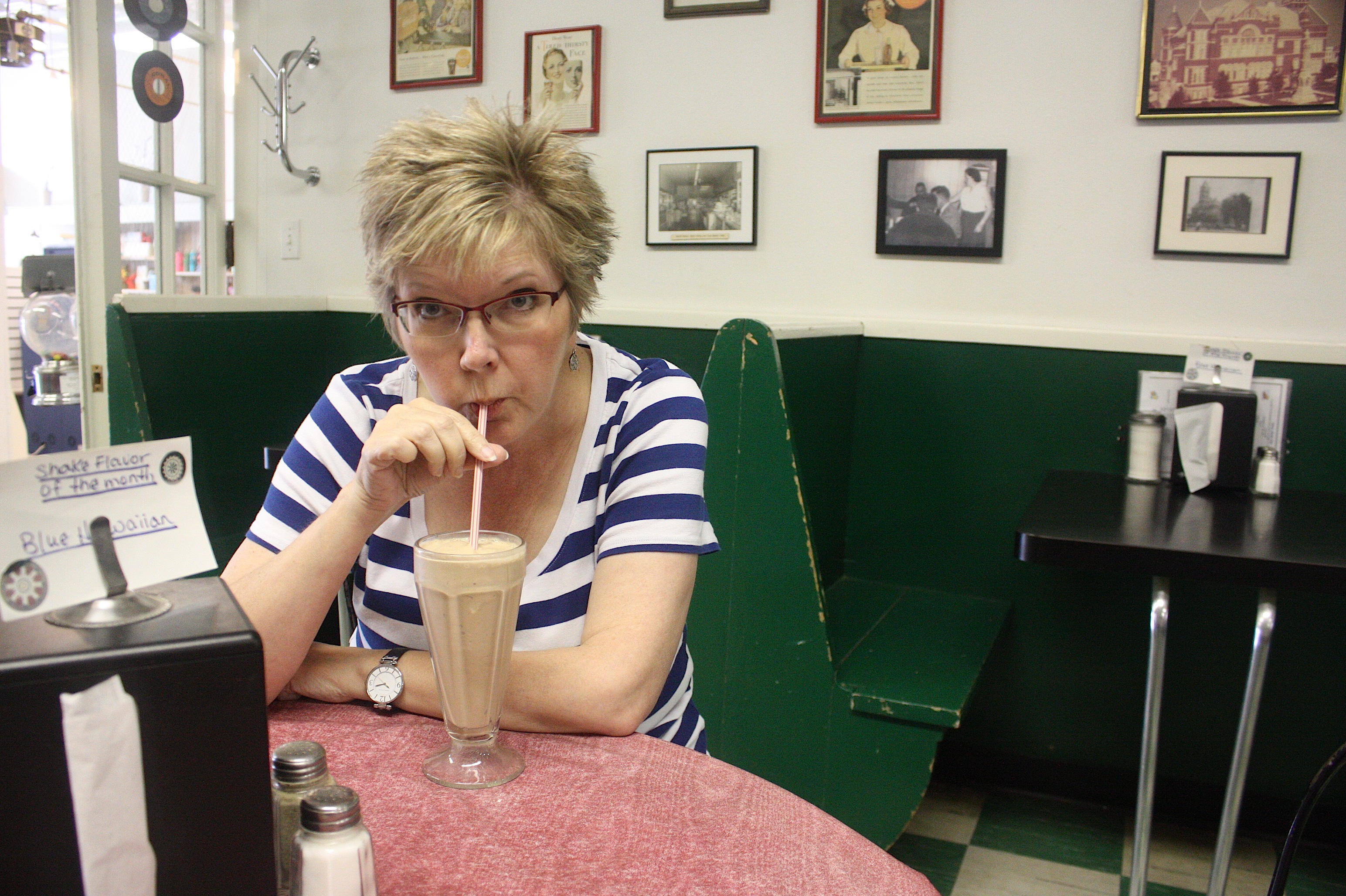
Second, one of the businesses on that square is the Ahoy old-fashioned soda fountain, above. It’s a dandy place to stop for a chocolate malt. (Yummy!) And third, Pine Lake State Park is nearby. The 654-acre Pine Lake park (below) has a very scenic lake – when we were there, lots of folks were canoeing and boating – plus hiking, picnic spots, camping, and more. It’s tough to just drive through without getting out and taking a hike, but we had to keep moving.
Oh, by the way, Eldora’s overnight stop theme is “A Wheely Big Deal!” and riders will be entertained by The Johnny Holm Band, along with a number of opening acts.
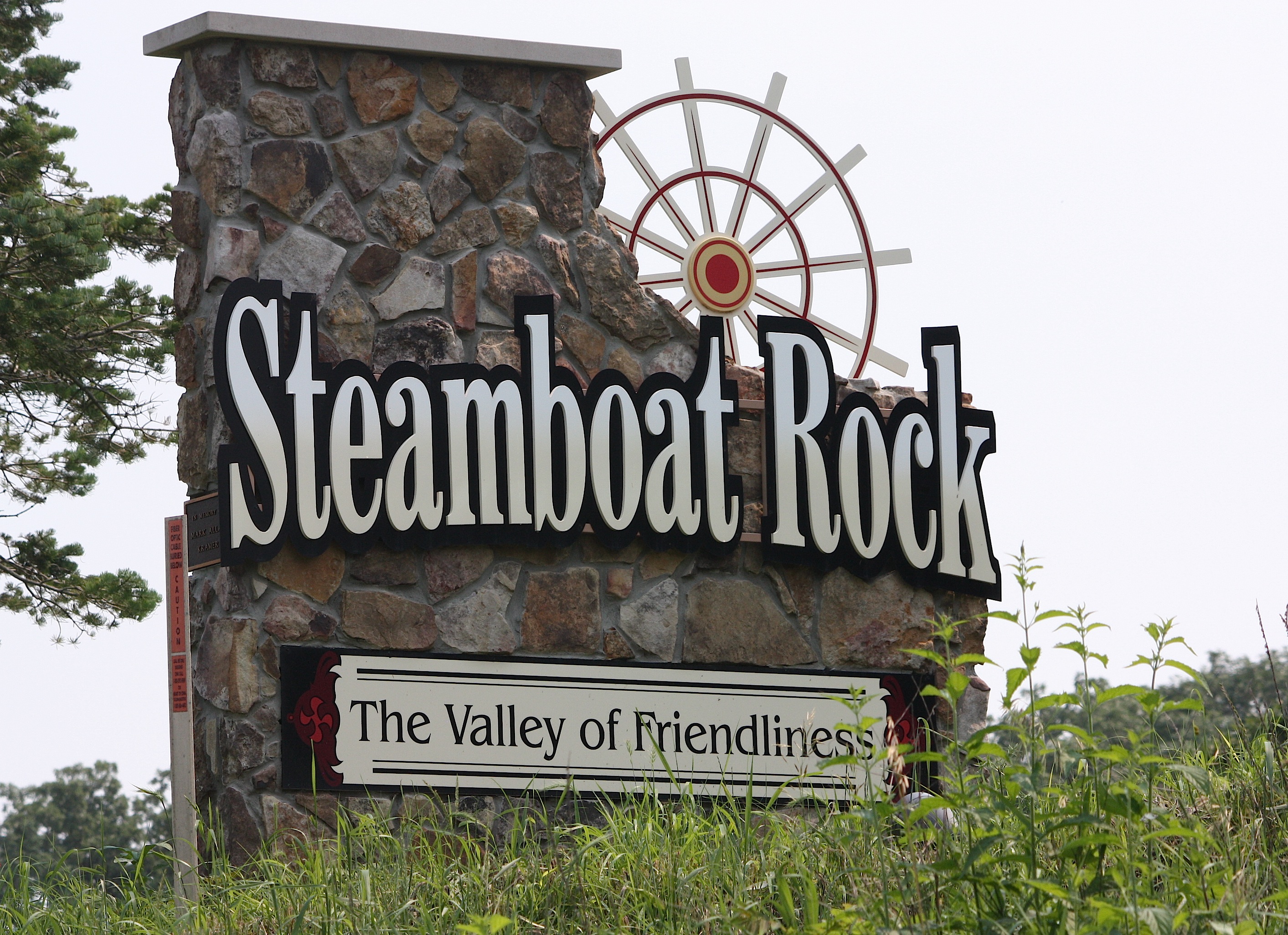
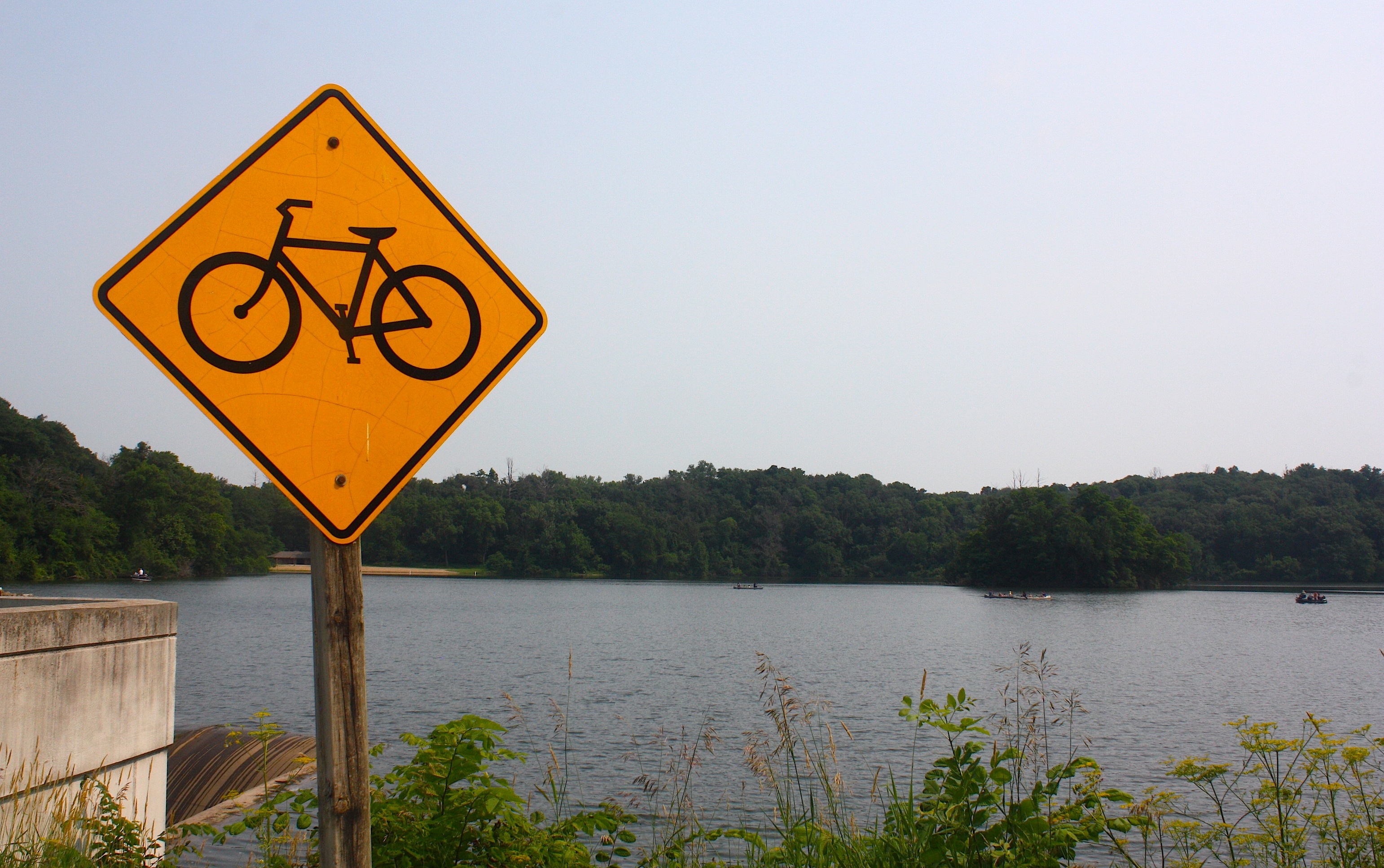
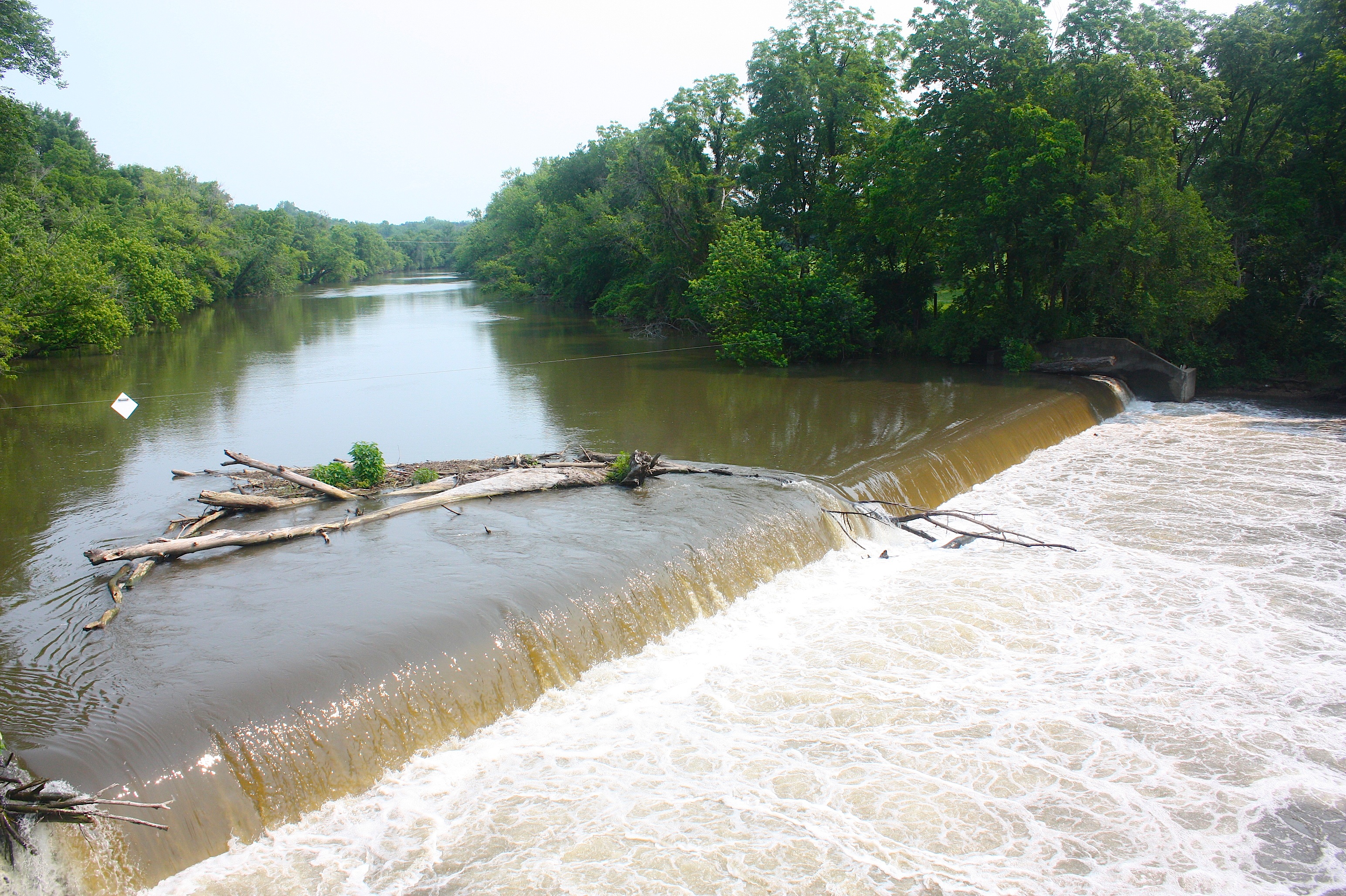
Cyclists will start their Day 4 ride by passing through Pine Lake State Park and they’ll very quickly reach their first town of the day. Steamboat Rock (population 310) is one of several towns on the route where the welcome sign is pretty much the best thing about the town. Steamboat Rock does have a dam (below), and we met an interesting biker dude there.
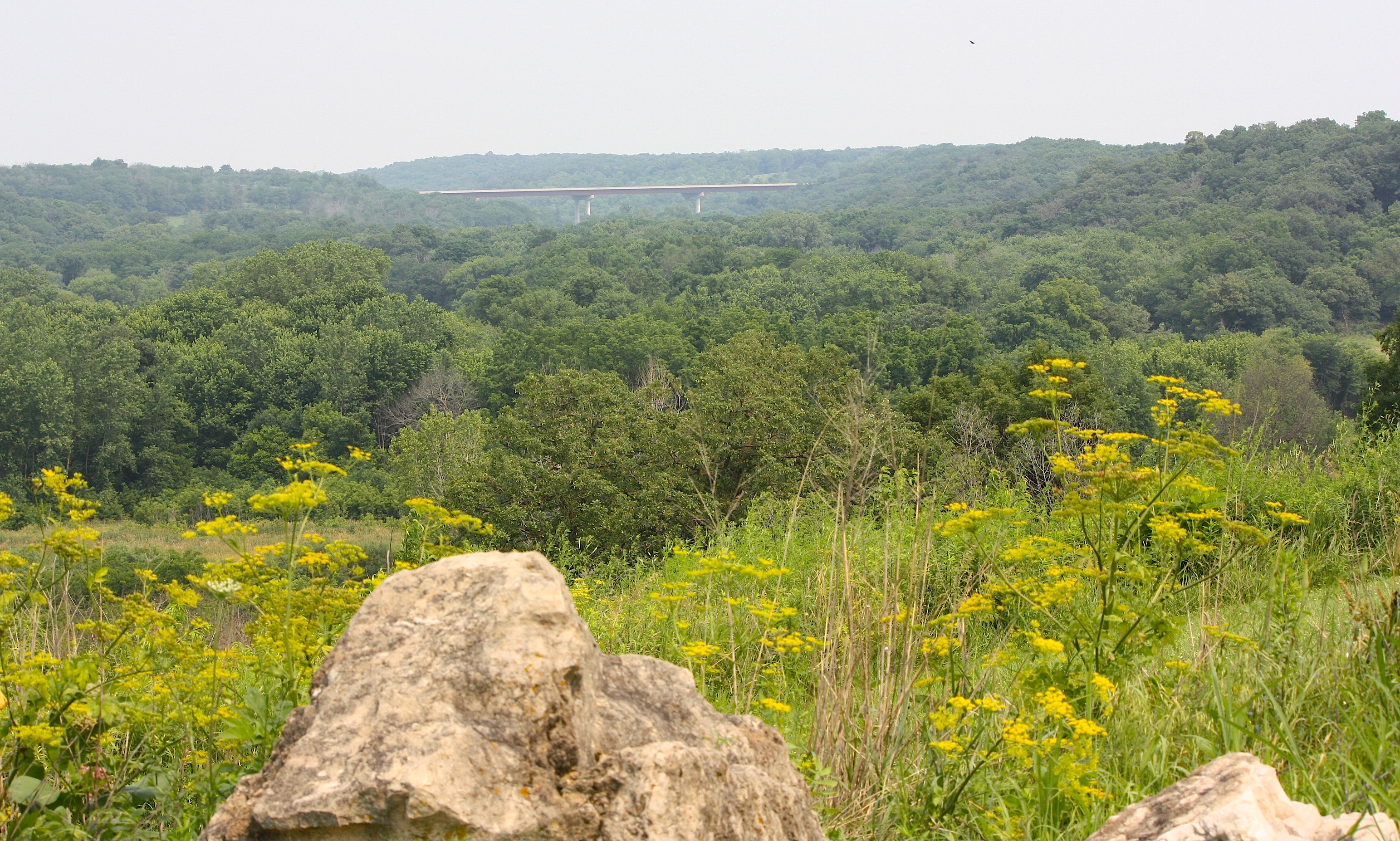
Just past Steamboat Rock is the very pretty Sac & Fox Overlook (above) with a view of the celebrated Hwy. 20 bridge that took decades to complete due to the challenging environmental impact of the area.
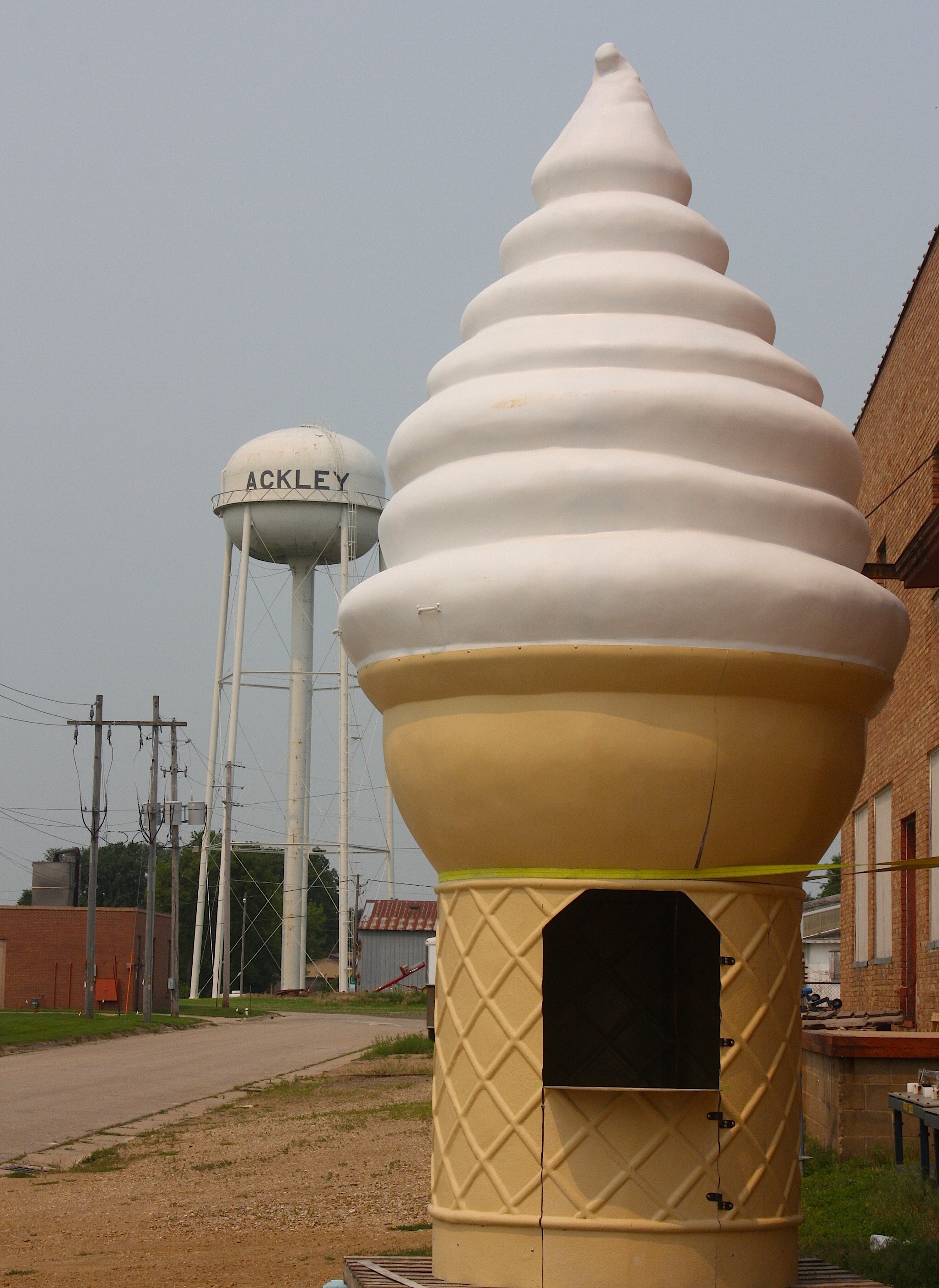
Next, there’s unincorporated Cleves, followed by the slightly disappointing town of Ackley (population 1,589) where we found this giant ice-cream cone (above). Absolutely no idea what this was for.

And then it was on to Austinville (also unincorporated), where we found a historic bank building (above) and more railroad tracks.
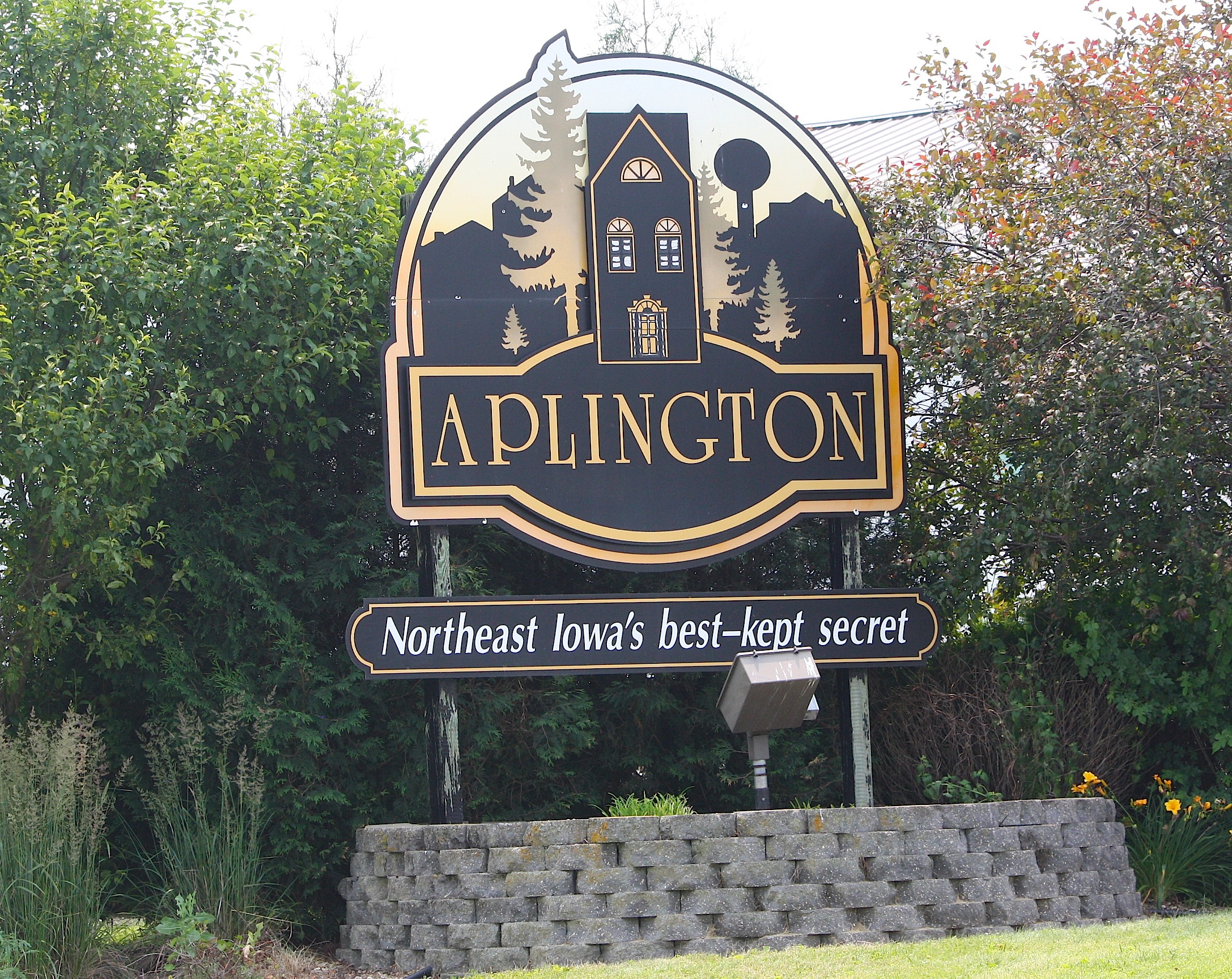
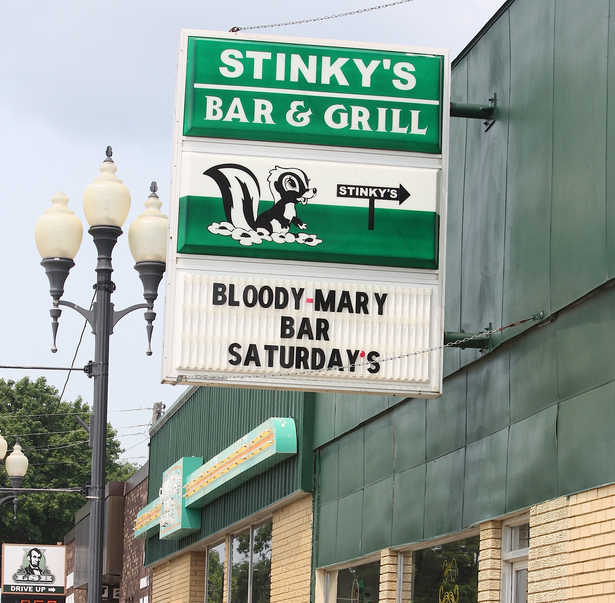
Aplington (motto: “Northeast Iowa’s Best-kept Secret”) boasted a few businesses, none of them open. The 1,128-person town is home to Stinky’s Bar & Grill, the Busy Day Mini-Mall (“A Little Piece of Iowa”), and the Peppercorn Pantry.
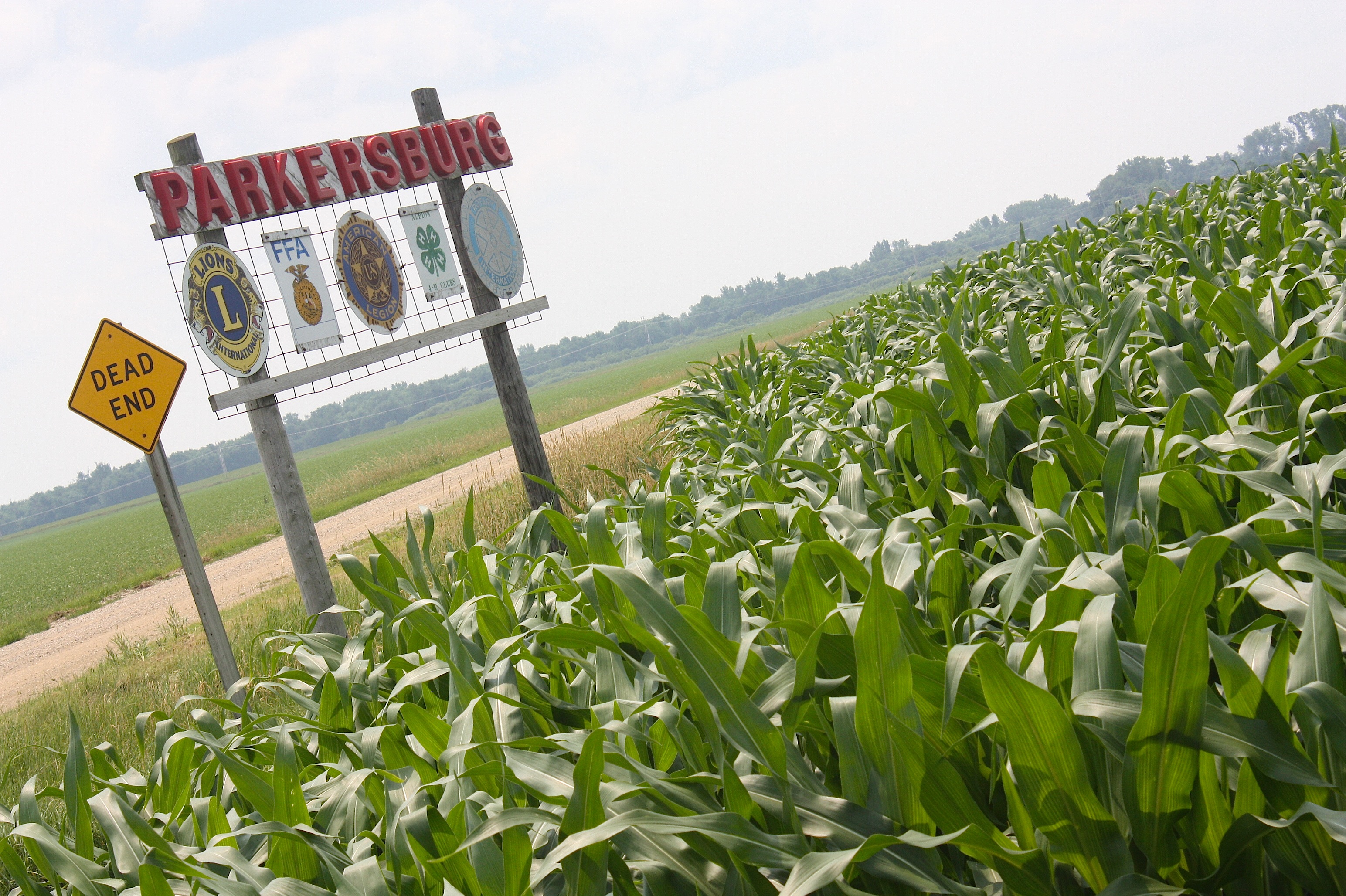
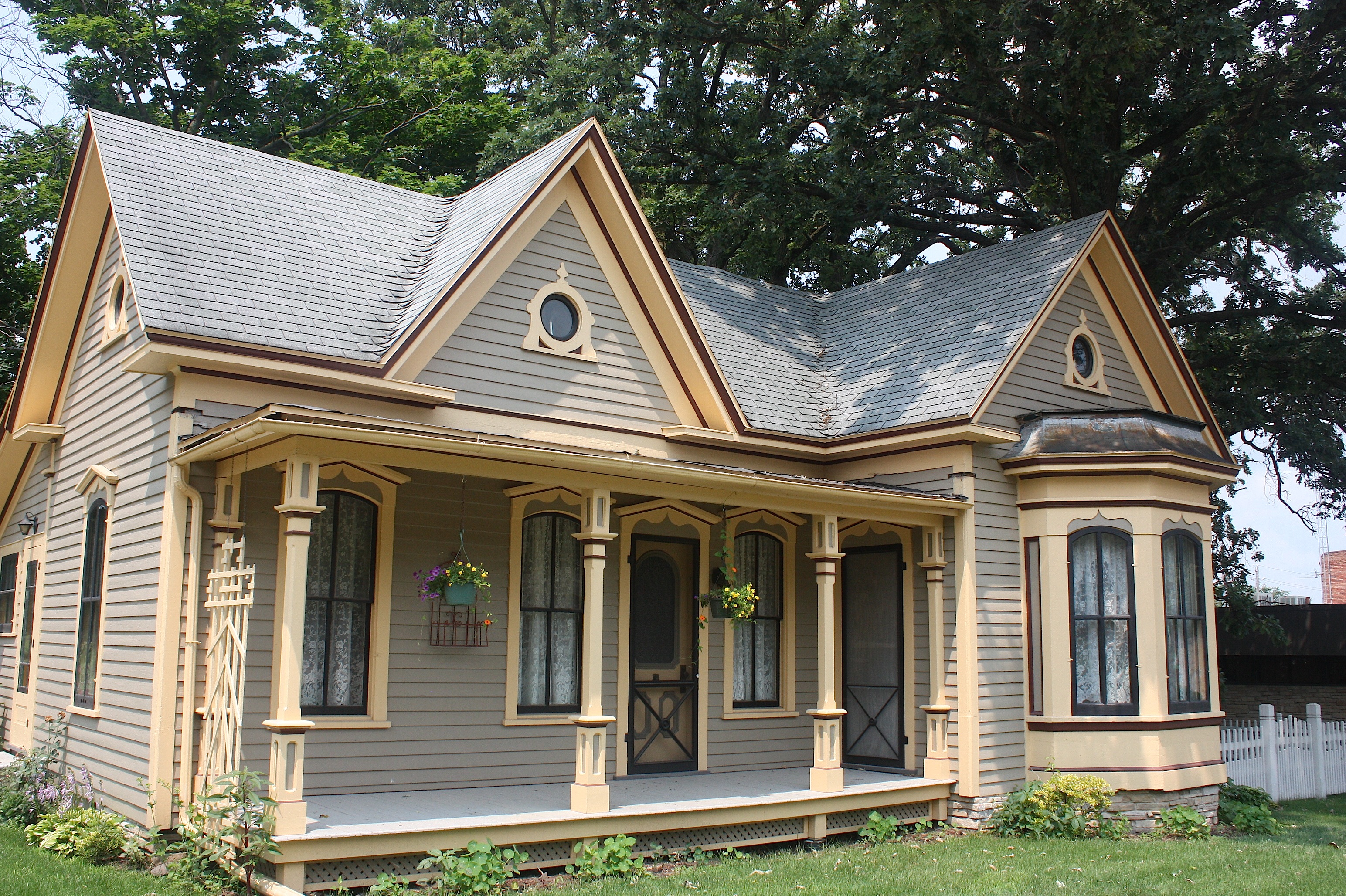
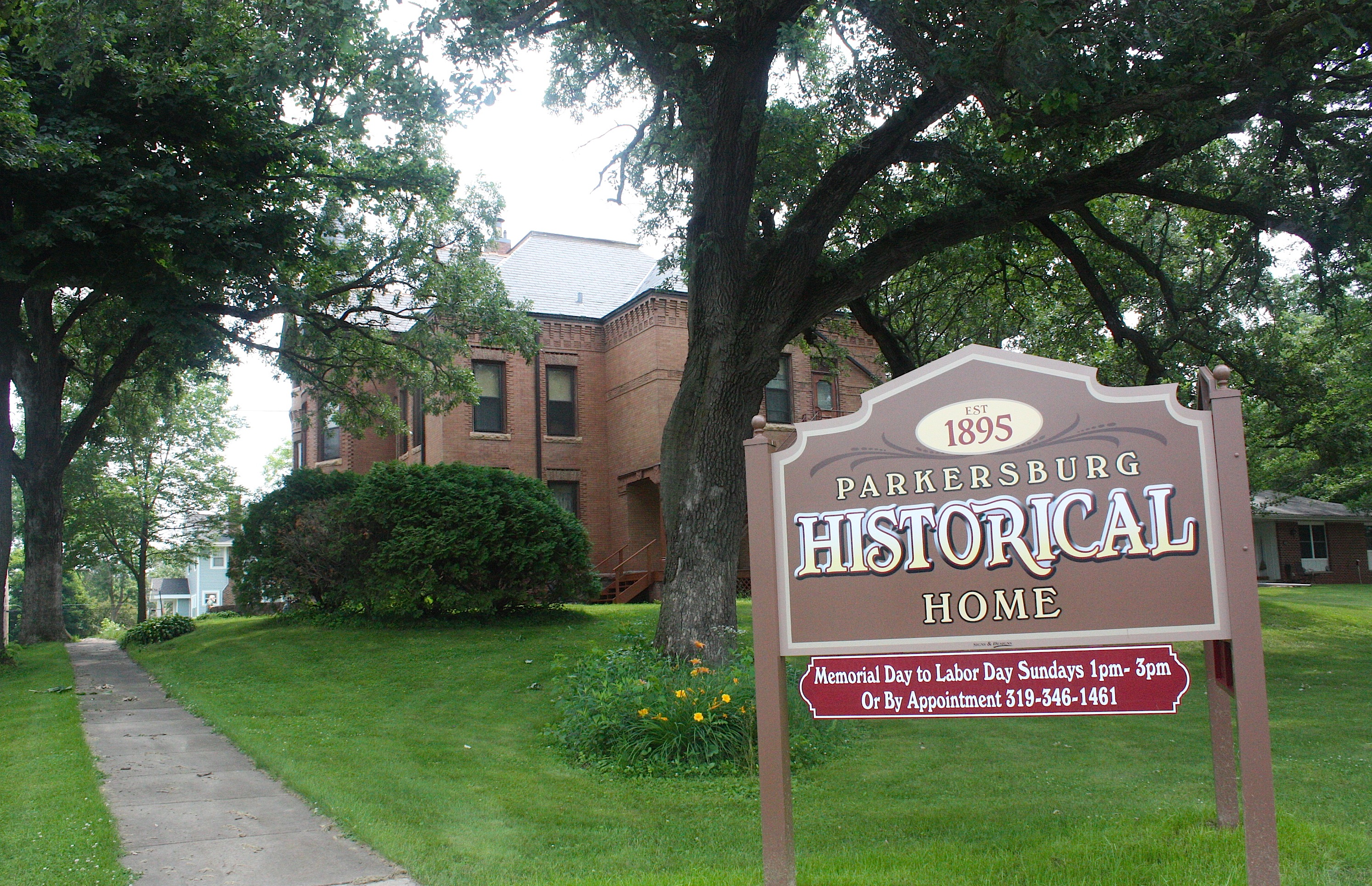
Parkersburg (population 1,870) is a robust little town, with a lively Main Street, some nice historic architecture, and lovely homes, all pictured above. There’s even the Parkersburg Historical Home (established 1895) that’s open for tours.
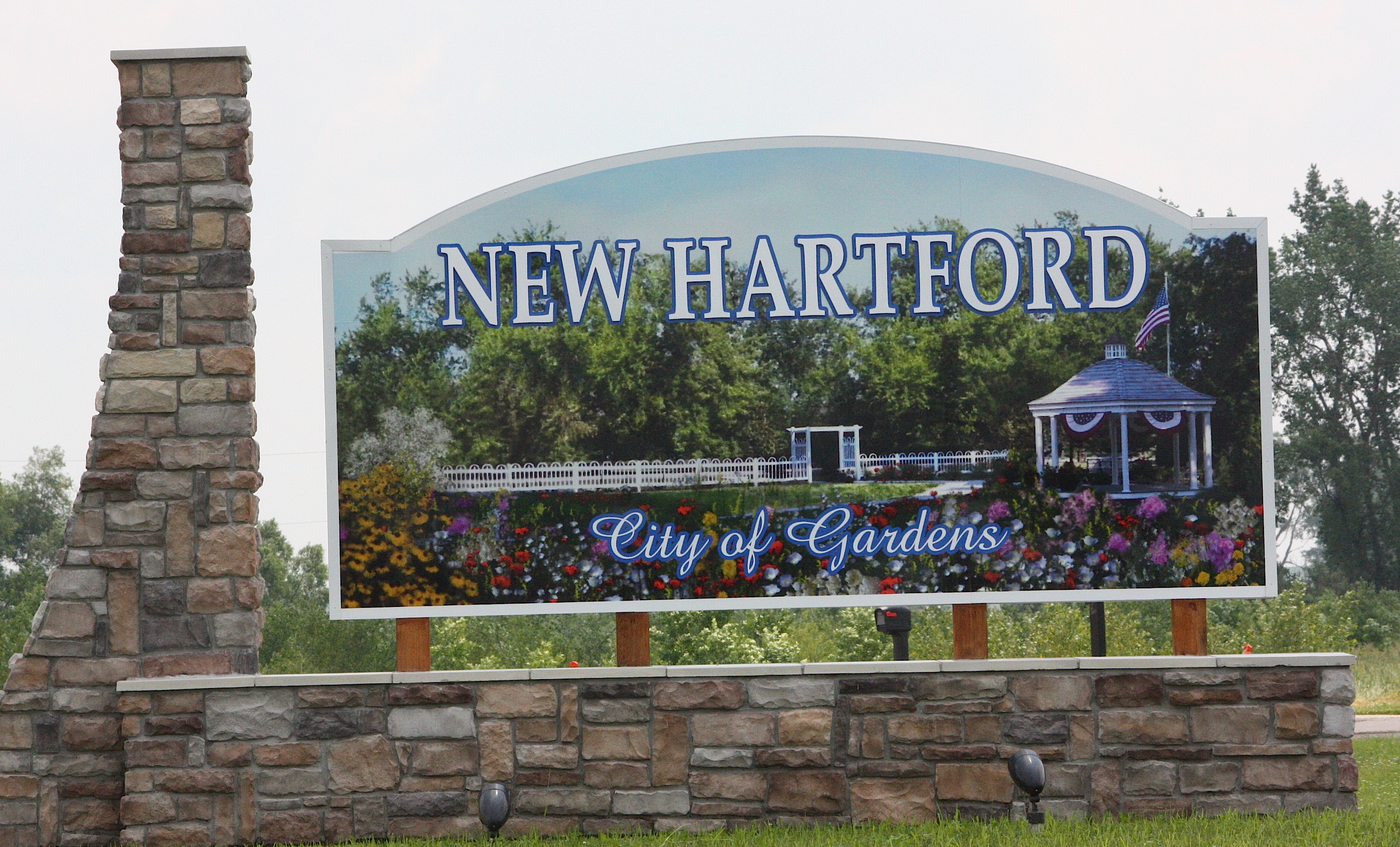
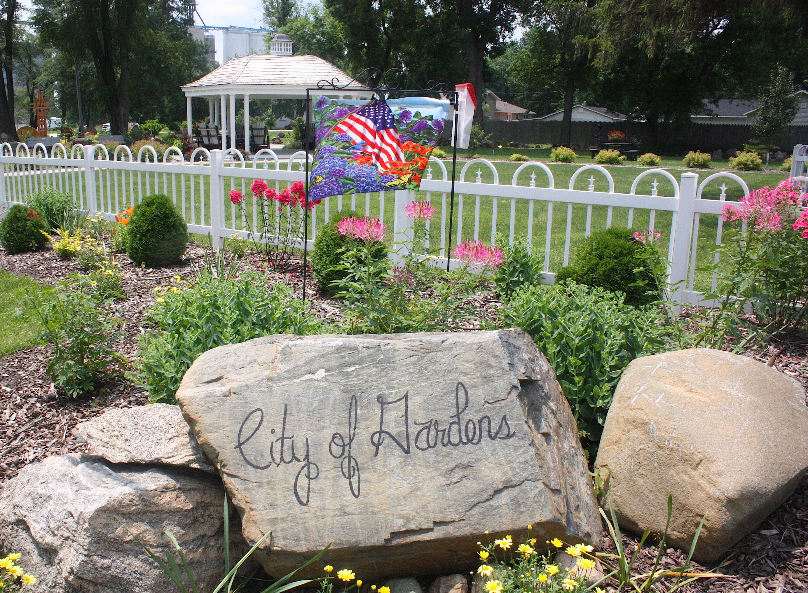
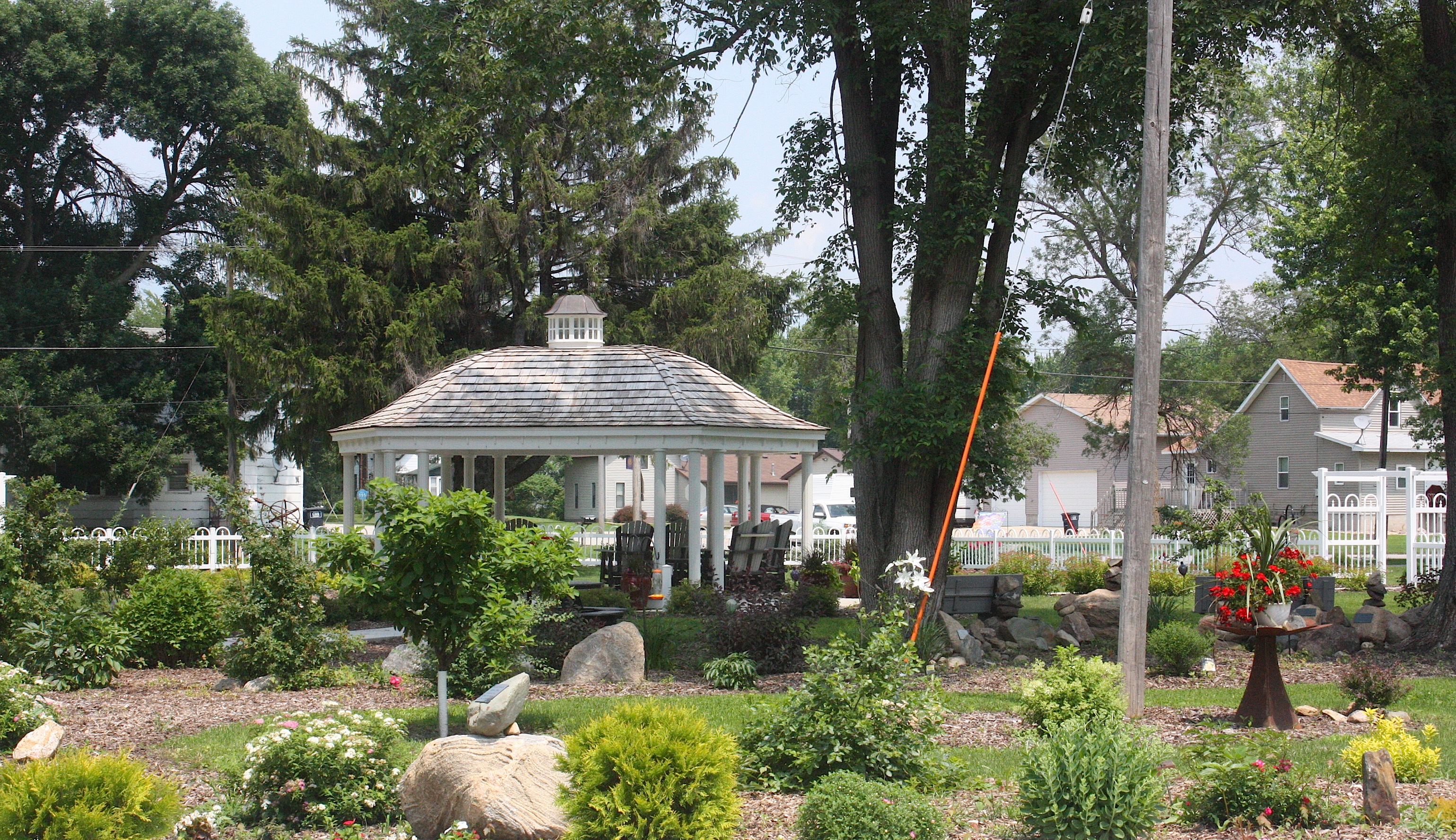
I was looking forward to our next stop, New Hartford (population 516) based on the description in the Register’s RAGBRAI preview. It seems that floodwaters devastated the city in 2008, forcing a number of houses to be torn down. The empty lots have been filled with parks and gardens. What a great idea! We found a map of New Hartford in one of the parks, and we found that there’s a Town Square Gazebo, Meditation Garden, Four Seasons Perennial Garden, 1800s Heritage Garden, and more. I also loved the topiary flowers lining the main street.
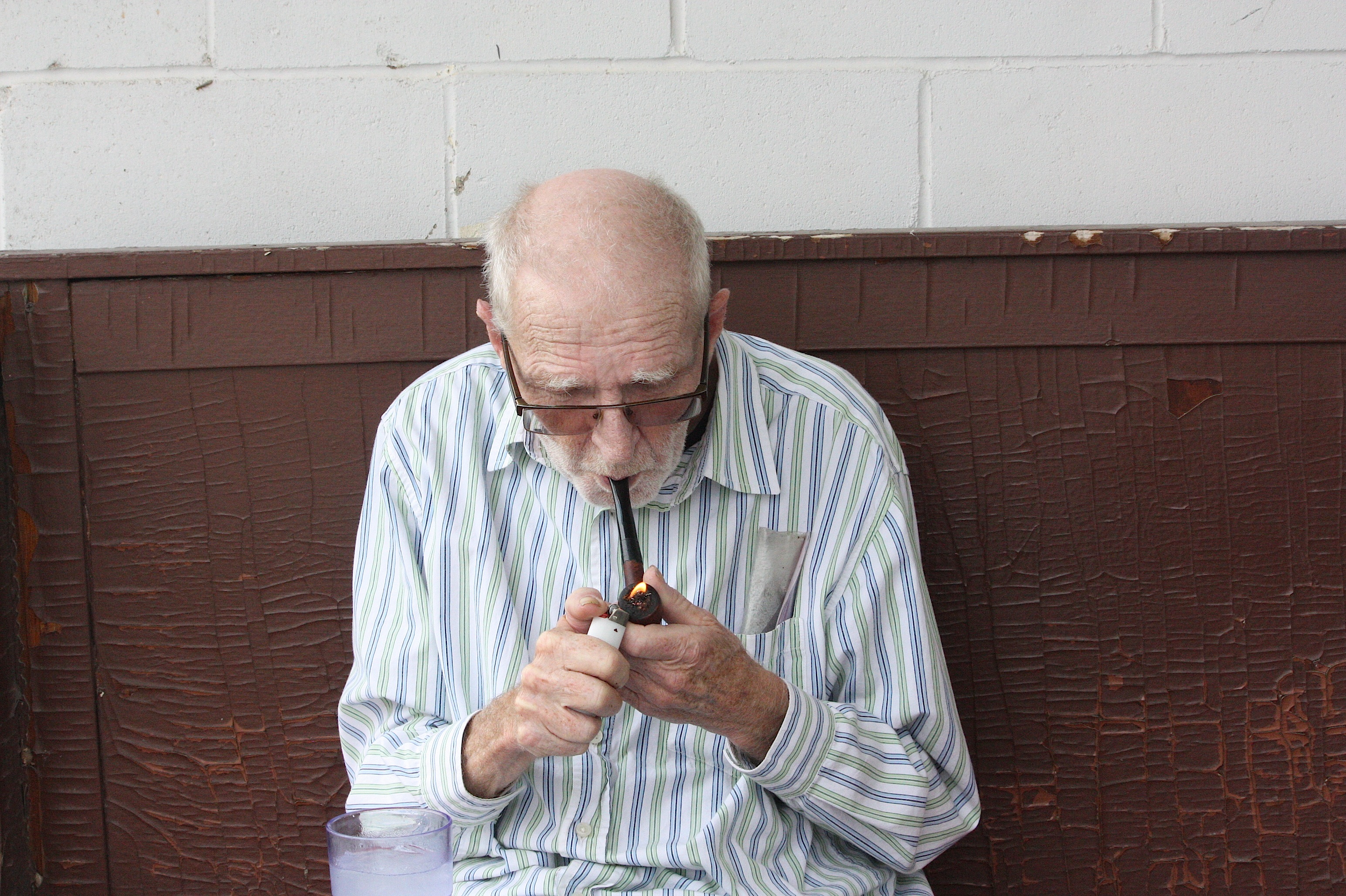
While we were in New Hartford we met an interesting older guy, Lee, smoking a pipe and telling stories about the floods and the history of the town. He was very entertaining.
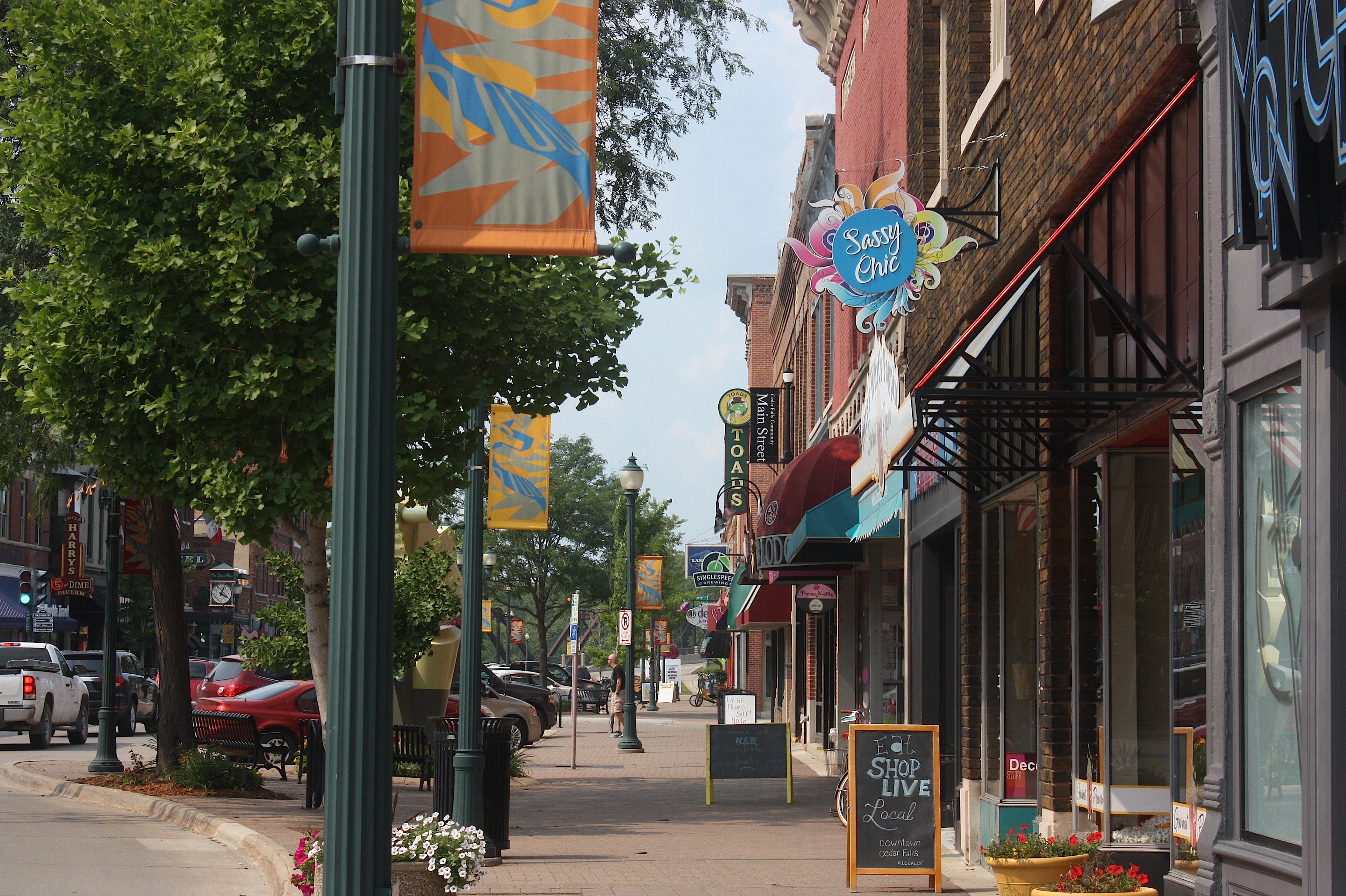
But we have to move on. Our next stop is the Day 4 overnight town of Cedar Falls (theme: “It’s All Down Hill From Here”).

This is where the day got really fun, because we met with Mary Taylor (with me, above), one of the co-chairs (along with Steve Carignan) of Cedar Falls’ RAGBRAI committee. Mary is a friend of mine, and she was willing to take time out of her very busy schedule to meet with us at Cup O’ Joe coffee shop in downtown Cedar Falls.
It was really interesting to get Mary’s perspective on all the work that goes into an putting on an overnight stop on RAGBRAI. Mary and Steve oversee 18 committees, with about 35 total leaders. Official planning for the July 22 overnight stop began in early February, but behind-the-scenes work began as early as last fall. The leaders plan the route within the city, book entertainers (Hairball, with a variety of opening acts) and 30 commercial food vendors, locate campgrounds, and a ton of other logistics.

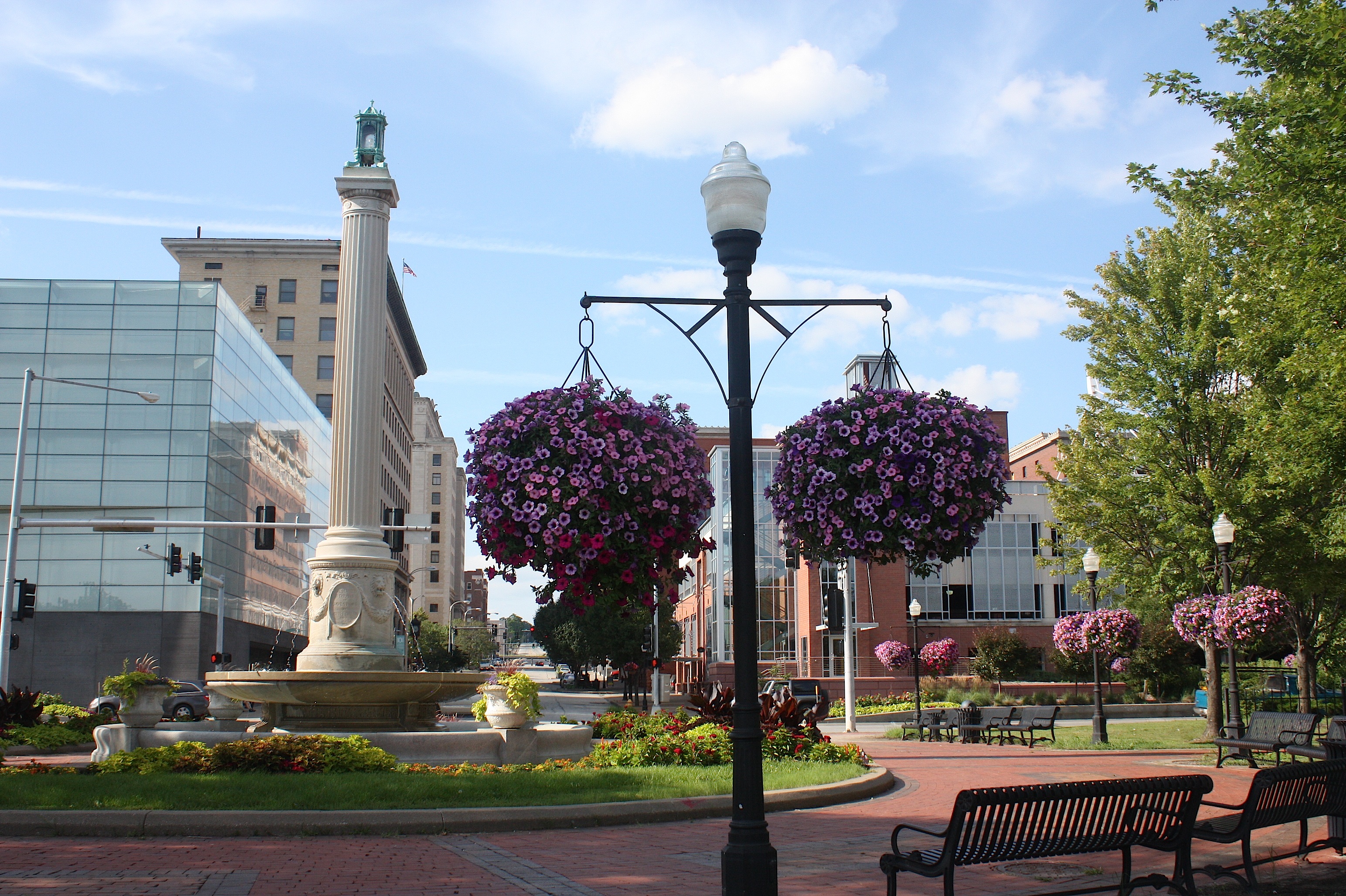
Cedar Falls is unique in that it encompasses both the city and the University of Northern Iowa, where most of the events will take place. Mary suggests visitors to Cedar Falls should explore the downtown area (we did, and it’s fabulous…I hate to admit this, but I think it’s better than Ames), the Ice House Museum, restored Post Office on 3rd & Washington, and, of course, the UNI campus.
Mary expects 20,000 visitors on July 22 and has an estimated 1,000 volunteers at the ready. She’s excited to share Cedar Falls’ bicycle culture with a lot of new friends!

We sort of hated to leave Cedar Falls – there was so much to see and do there, that I vowed on the spot to come back and explore the city further. But we had to go “down hill,” as the route finally strays from the Hwy. 20 corridor and heads southeast toward Cedar Rapids.
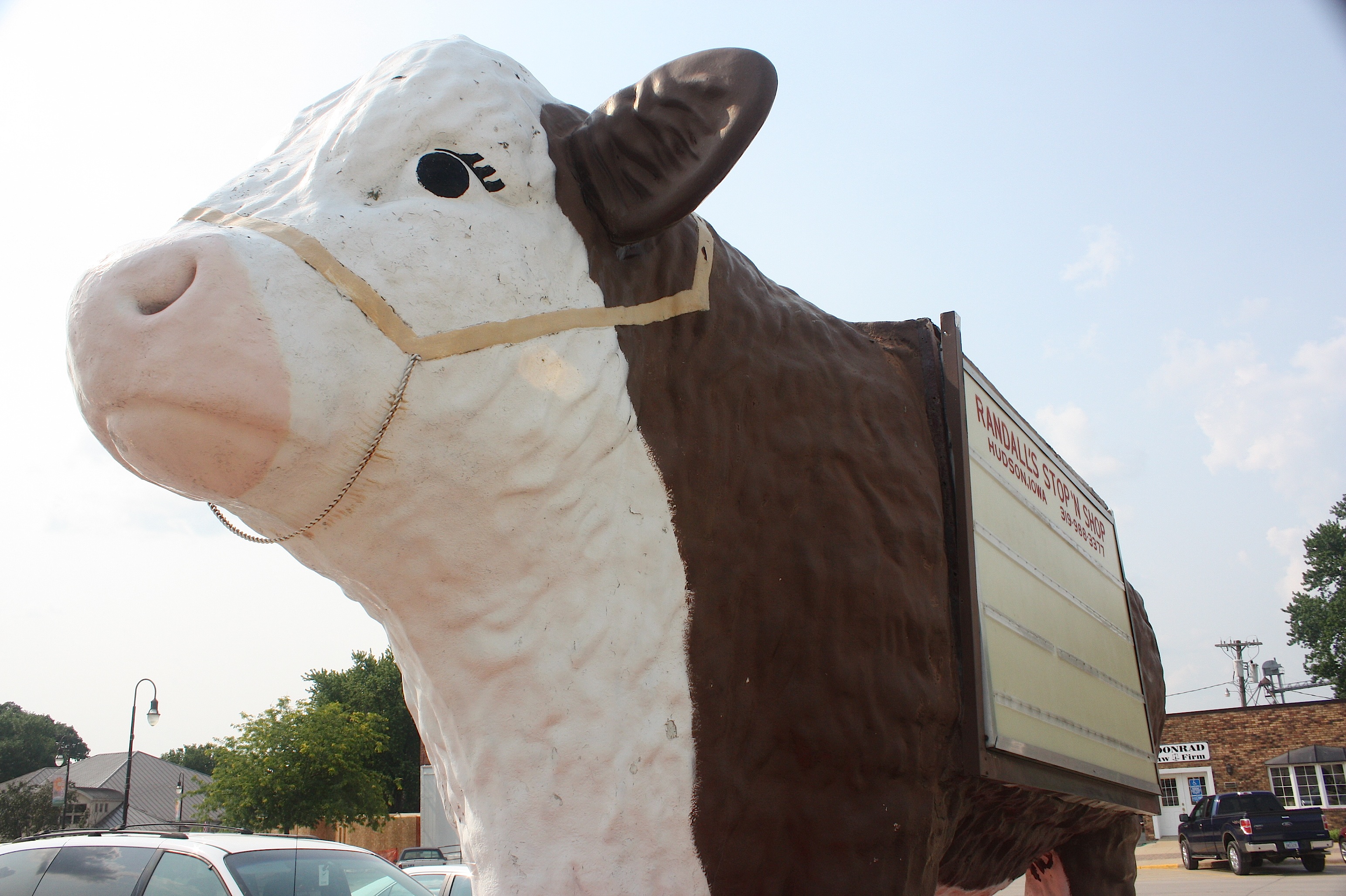
Our first stop on Day 5 of the route is Hudson (population 2,282). I was happy to see that there’s an actual grocery store here, and in front stands a large cow sculpture, making that the highlight of the town.
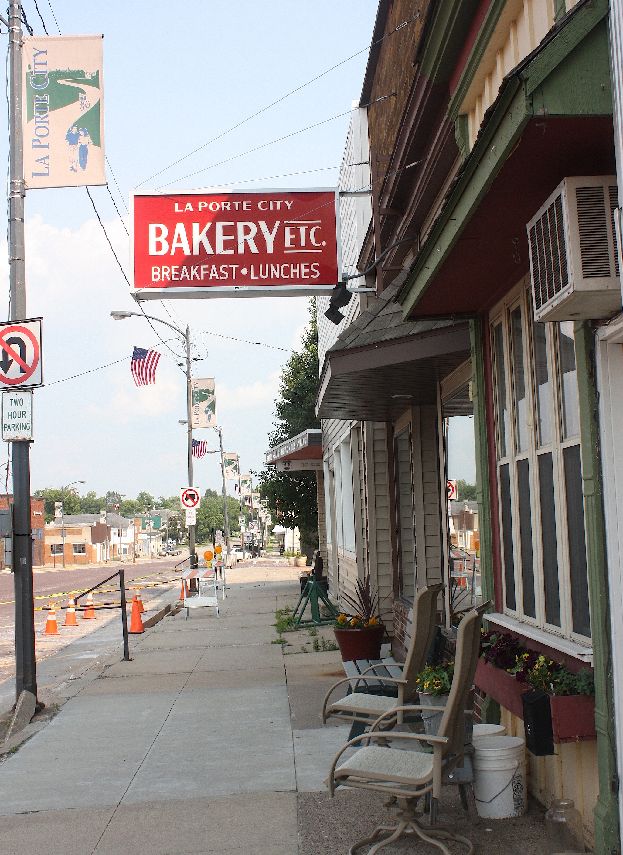
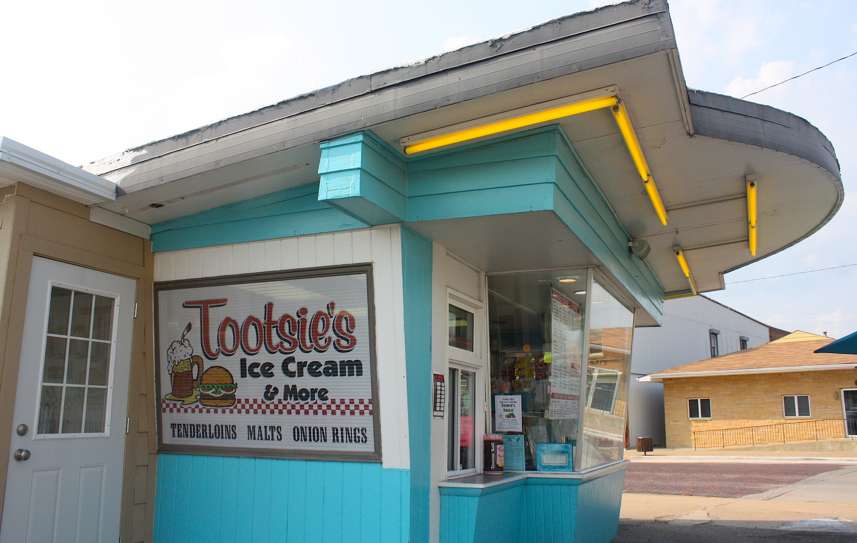
I eagerly anticipated the next stop – La Porte City – because I’ve been to this town before, specifically to buy donuts. La Porte City Bakery is known far and wide for its glazed donuts and cinnamon twists. My mouth was actually watering as we headed into town. But, of course, the bakery was closed because we were too late in the day. We did find Tootsie’s Ice Cream stand open, but we’d already had those chocolate malts earlier in the day…so we didn’t order anything.

The next town, Mt. Auburn, embraces its population number – 150 – by highlighting it right on its welcome sign. The downtown area is as small as you expect it will be, but what you don’t expect is for someone to come out of one of the buildings and regale you with tales of a rock ‘n’ roll career.

But that is what happened in Mt. Auburn. Ron James came out of the Rhythm of Life Music Hall and talked about the small town’s citizens pulling together to clean up the streets in preparation for RAGBRAI. He himself was putting a fresh coat of paint on the music hall. In fact, he had the paintbrush in hand as he spoke. We asked about the kinds of music he attracts to his establishment and he launched into a tale of his own career, playing with the likes of Glen Campbell, Wynona Judd, Rare Earth, Bob Seger, Grand Funk, and Gary Puckett and the Union Gap. Wow! He admits that nobody would recognize his name (“I’m a nobody,” he says) even though he is proficient on 32 musical instruments. Someday I’d like to visit Mt. Auburn when Ron has a concert going on.

Vinton, Iowa (population 5,257) was perhaps the most surprising stop along today’s route. Vinton calls itself the City of Lights, and we were thinking, yeah, right.


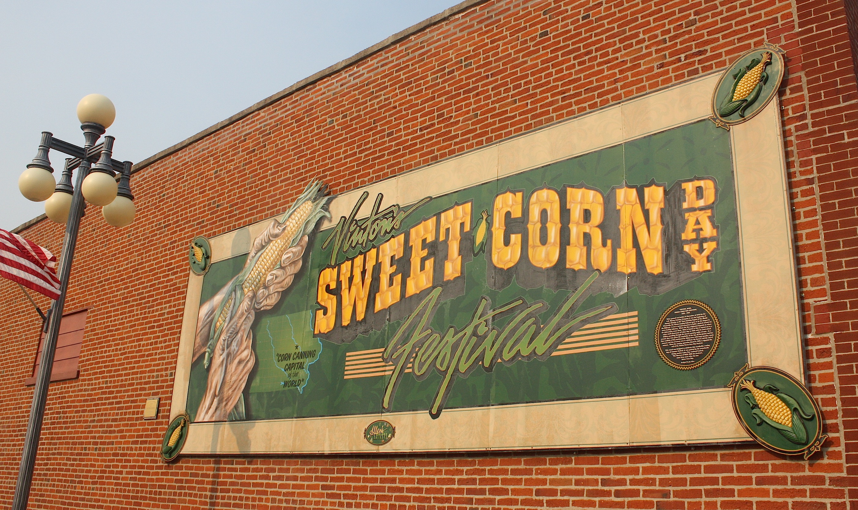
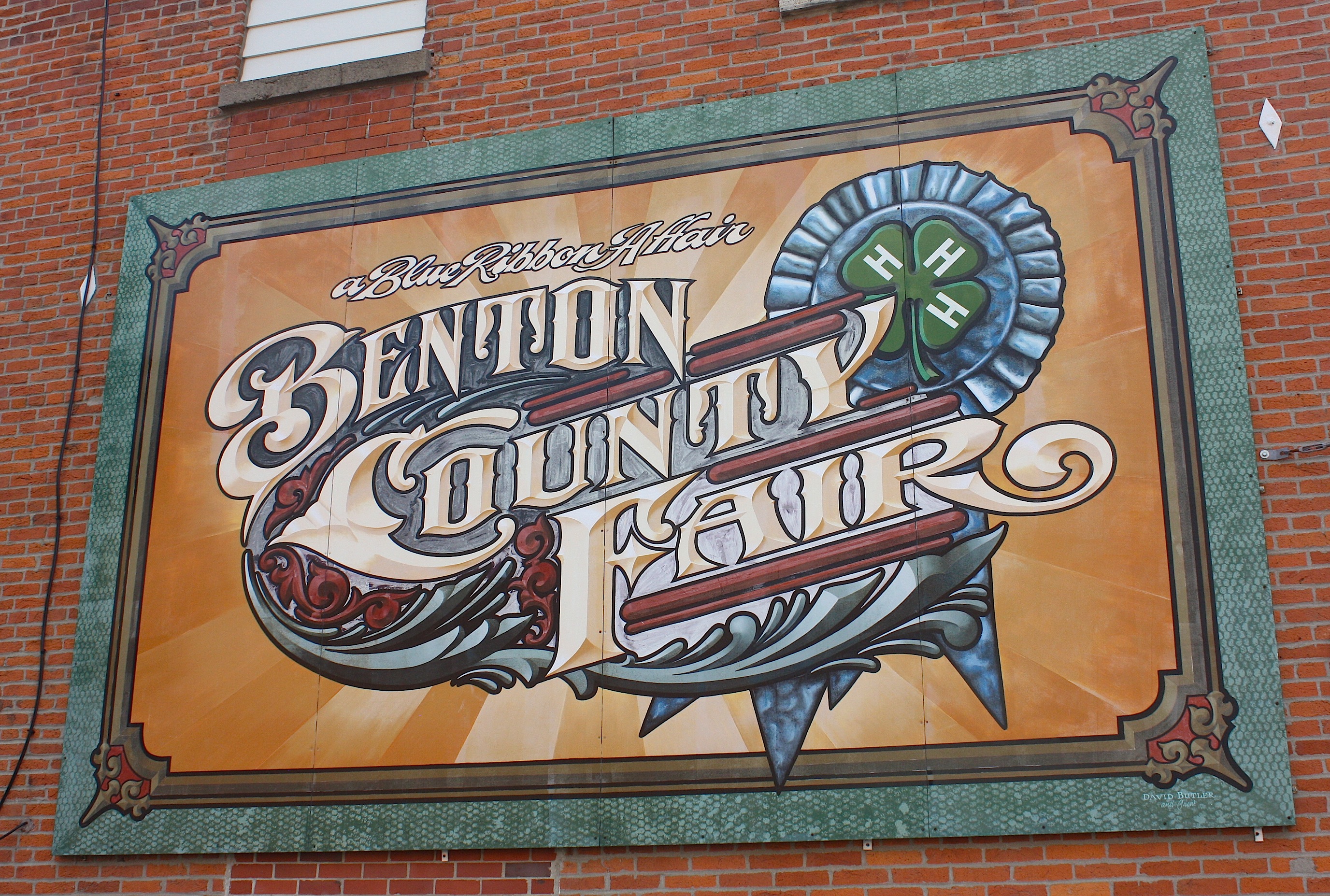
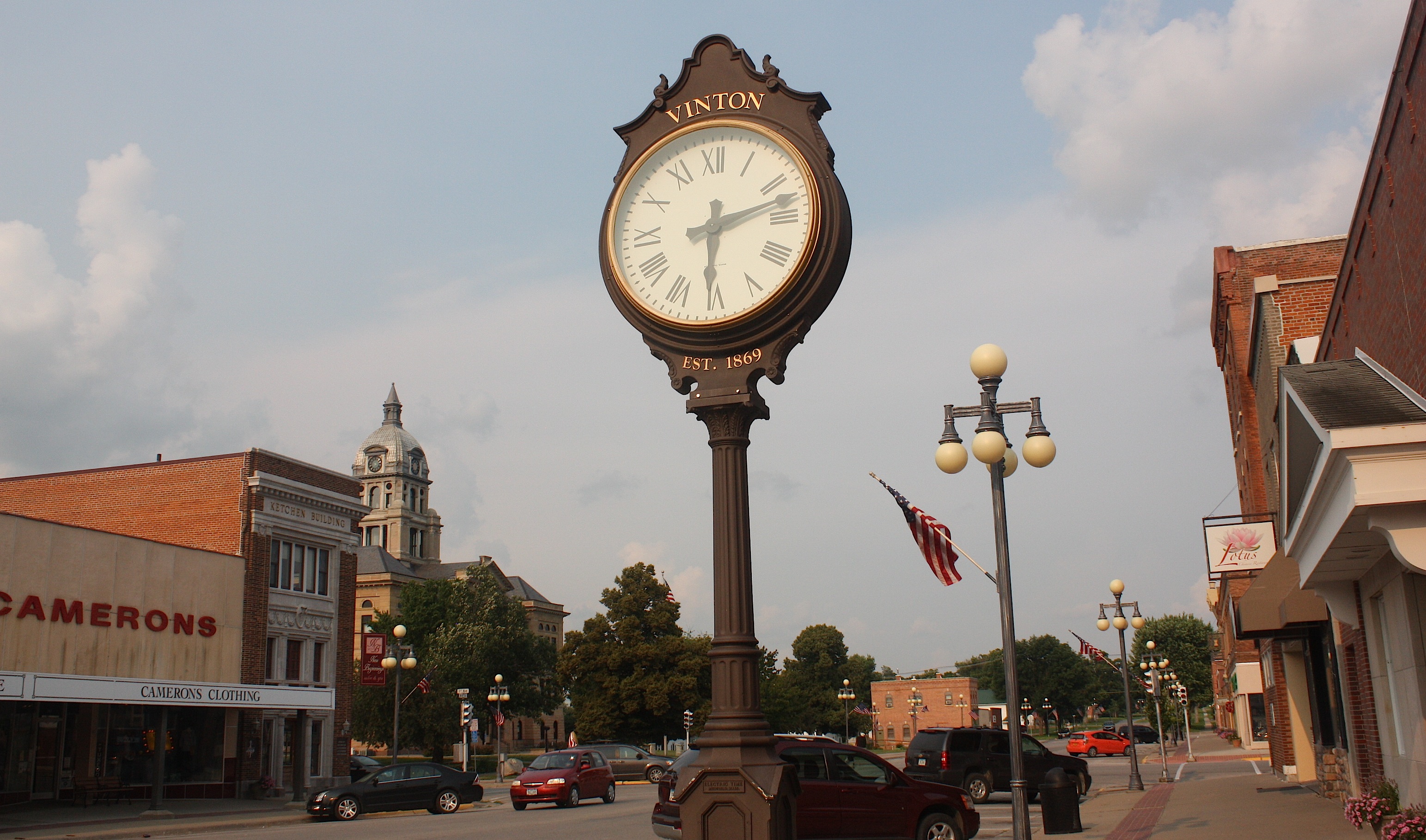
But it’s a great little town! The “City of Lights” claim comes from the dozens of old-fashioned streetlights that line the main street. And the Benton County courthouse is a beauty. Shops and restaurants line the streets, the architecture is noteworthy, and the town has half a dozen well-painted murals. Not to mention a parade of corn statues.


Two more towns to go before calling it a day. Shellsburg (population 983) has a few interesting attractions. Coop’s Roadhouse Bar & Grill looks like a fun place to eat and drink. There’s a candy company called Divine Decadents. And, of course, Shellsburg is the future home of the Benton County Freedom Rock.
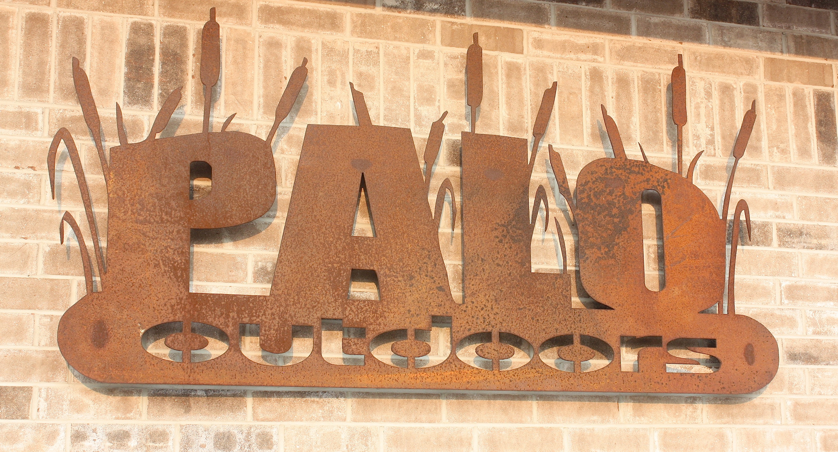
We ended our second day of driving the RAGBRAI route in Palo, a Cedar Rapids bedroom community and home to Iowa’s only nuclear power plant. Riders will continue to Hiawatha for their Day 5 overnight stay, and that’s where we’ll start our next day’s drive.
Driving RAGBRAI XLIII: Day 1
Next to the State Fair, RAGBRAI – the Des Moines Register’s Annual Great Bicycle Ride Across Iowa – is about the most “Iowa” thing you can do during the summer. It’s the best idea ever: an enormous convoy of cyclists from all over the country converges on Iowa for one week to see the beauty and friendliness of the state while peddling along back roads and county highways. Oh, and eating pie and drinking beer and listening to bands that haven’t been popular for 30 years. So awesome!
But the thing is – and this is important – even if I did own a bicycle, which I do not, the idea of sitting on a bike seat, peddling up and down all those hills, baking in the July heat, standing in line for porta potties, and sweating with 10,000 of my closest friends in a campground? Um, no thanks.
But the roads…and the countryside…and the small towns: Those call my name.

Twice I’ve “intercepted” the crush of RAGBRAI bicycles as they rolled across Iowa: once for three days when I covered the ride from an Iowa State University viewpoint for VISIONS magazine; once when the route was so close to Ames that I couldn’t stand not visiting just a few of the pass-through towns and glomming on to some pie for myself. And two years ago I set out to drive the route the week before the actual ride, only to fail miserably after just one “ride” day – less than 100 miles – because my schedule just didn’t cooperate.
So this year I vowed I’d do the whole thing. From Sioux City to Davenport, through hills and farm fields and tiny towns and bigger cities. I’m driving the route with a friend who, like me, thinks he’s been everywhere in Iowa but, as it turns out, has not. Some of the pass-through towns on this route don’t even show up on a map. Part of the joy of driving this route is discovering these hidden gems.
This year’s RAGBRAI ride will be held July 19-25. If all goes well, the car drive will take three days. Here’s Day 1: Sioux City to Webster City.
We started in Sioux City after already being in northwest Iowa for a full day, doing research and photography for a story for an upcoming issue of VISIONS. We’d been pretty much eaten alive all day by mosquitoes and ticks, so we were smelling of insect spray and sweat when we arrived in Sioux City Friday night. Desperate for food and drink, we headed to the bar-and-restaurant dense Historic 4th Street area (above). We opted for Buffalo Alice’s pizza – a pretty good choice, with a gazillion beer choices and build-your-own pizzas. Nearby, the streets of downtown Sioux City were hopping, with live music being performed outside while we ate.


The next morning, we explored the city: the Hard Rock Hotel & Casino (not my cup o’tea), Palmer’s Olde Tyme Candy Shoppe (“Making Life Sweeter Since 1878!”), the Sioux City Art Center, Lewis & Clark Interpretive Center, Sgt. Floyd river boat, and the Anderson Dance Pavilion on the Missouri River. Pretty much everything was closed at that early hour, unfortunately, so we just poked around outside.
Sioux City (population 82,684) is the Woodbury County seat. During their initial overnight stay before the ride gets started, RAGBRAI-ers will be treated to the sounds of Huey Lewis & the News as the city “Parties Like it’s 1973” in the Tyson Events Center parking lot.
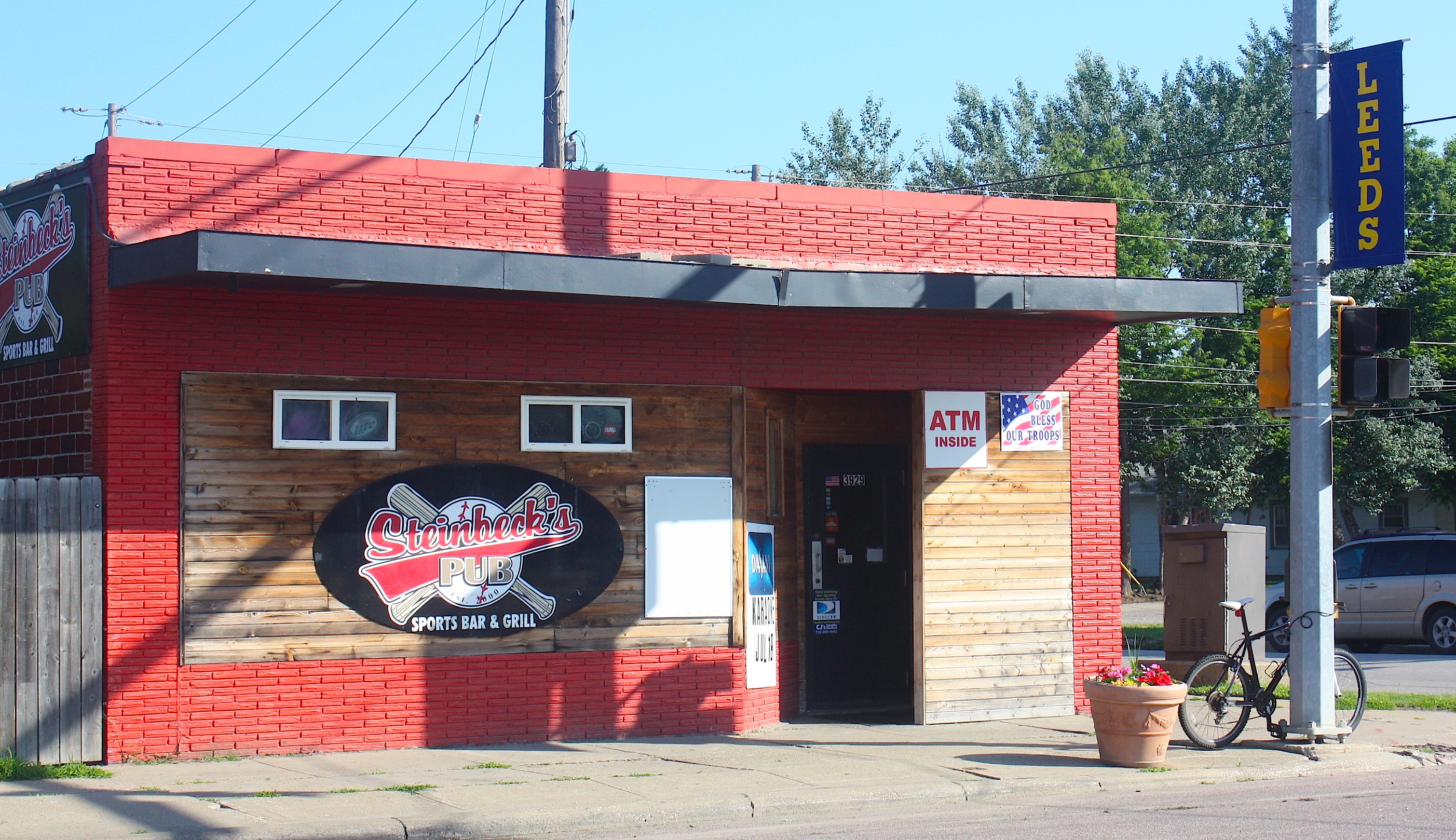
Just outside of Sioux City – really, a part of Sioux City – is Leeds, the first stop on Day 1 of the bike route. This community/neighborhood in northeast Sioux City was founded in April 1889 and annexed like five minutes later by Sioux City. Steinbeck’s Pub looks like a fun place to stop for an early-morning brew, if riders are so inclined. And many will be.

Heading out of the city and on to the open road, riders who think Iowa is flat will have an interesting time maneuvering the hills in western Iowa. In fact, today’s ride includes 4,110 feet of climb according to the Register. But what makes for a difficult bike ride makes for a gorgeous drive, and the section between Leeds and Kingsley is the prettiest on today’s route.

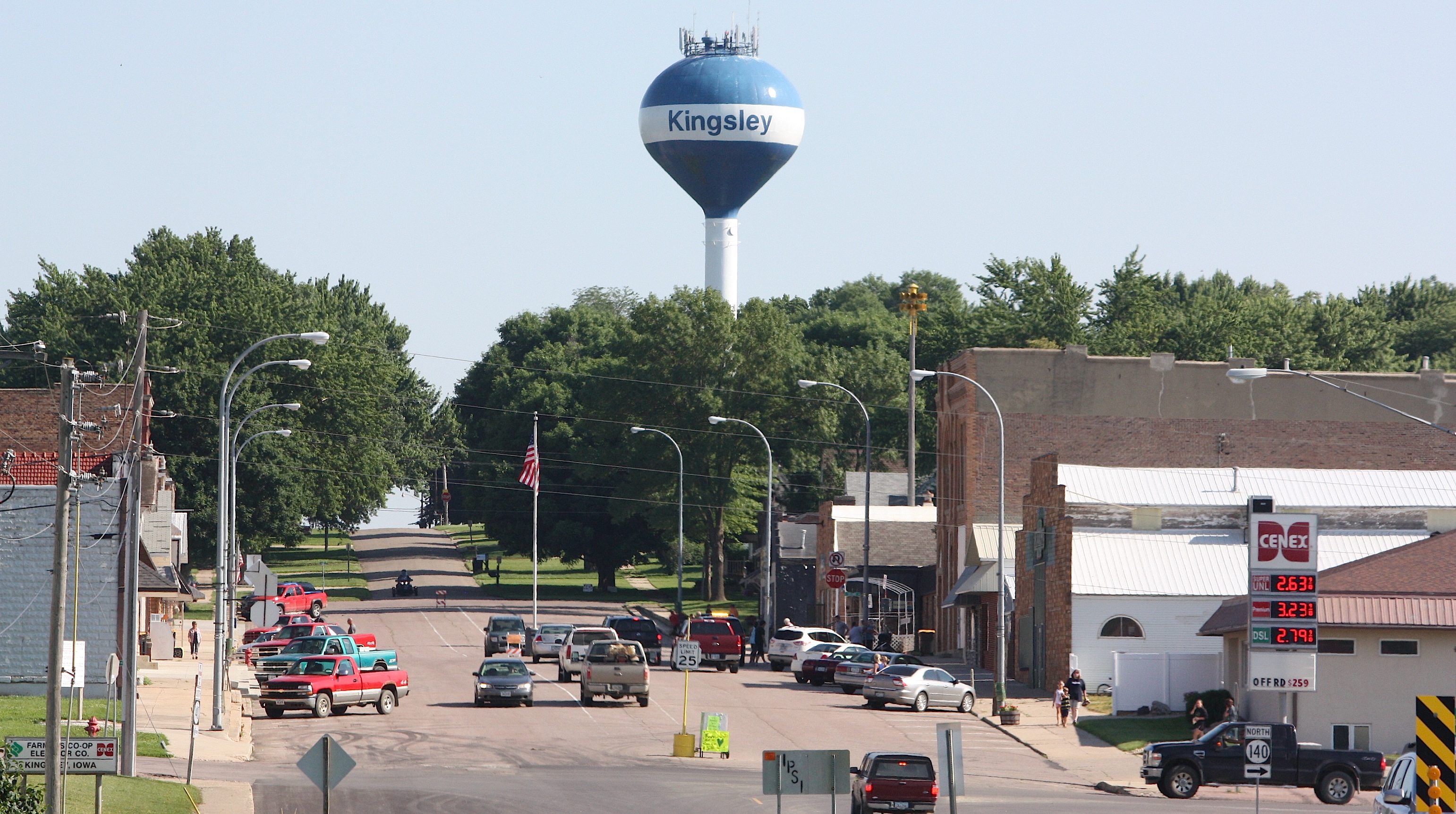
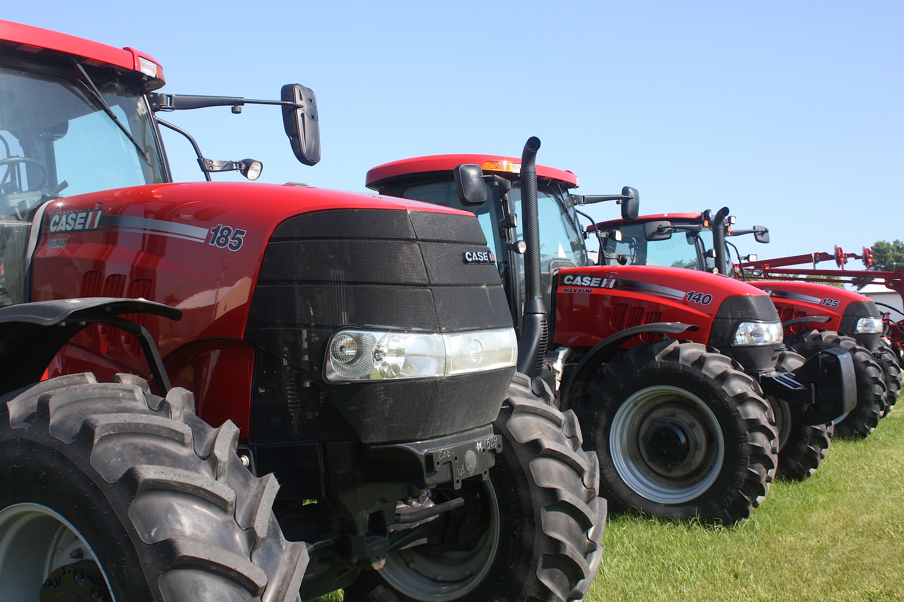
Rolling into Kingsley (population 1,411; motto “Some Bigger, None Better”) we found farm implement dealers on each end of town, which makes sense, because the town’s RAGBRAI theme is all about antique tractors.

Folks in Kingsley were getting ready for some kind of afternoon parade, with a fun run and some other stuff happening on this glorious summer Saturday. The town’s mix of older and newer homes with neat, sprawling lawns makes this Sioux City bedroom community pretty desirable for a town this size. In fact, the population grew 12% between the 2000 and 2012 census, and 166 new homes were built during that time. Kingsley has a golf course, swimming pool, city park, walking/biking trail, ball fields, tennis courts, a teen center, and five churches.
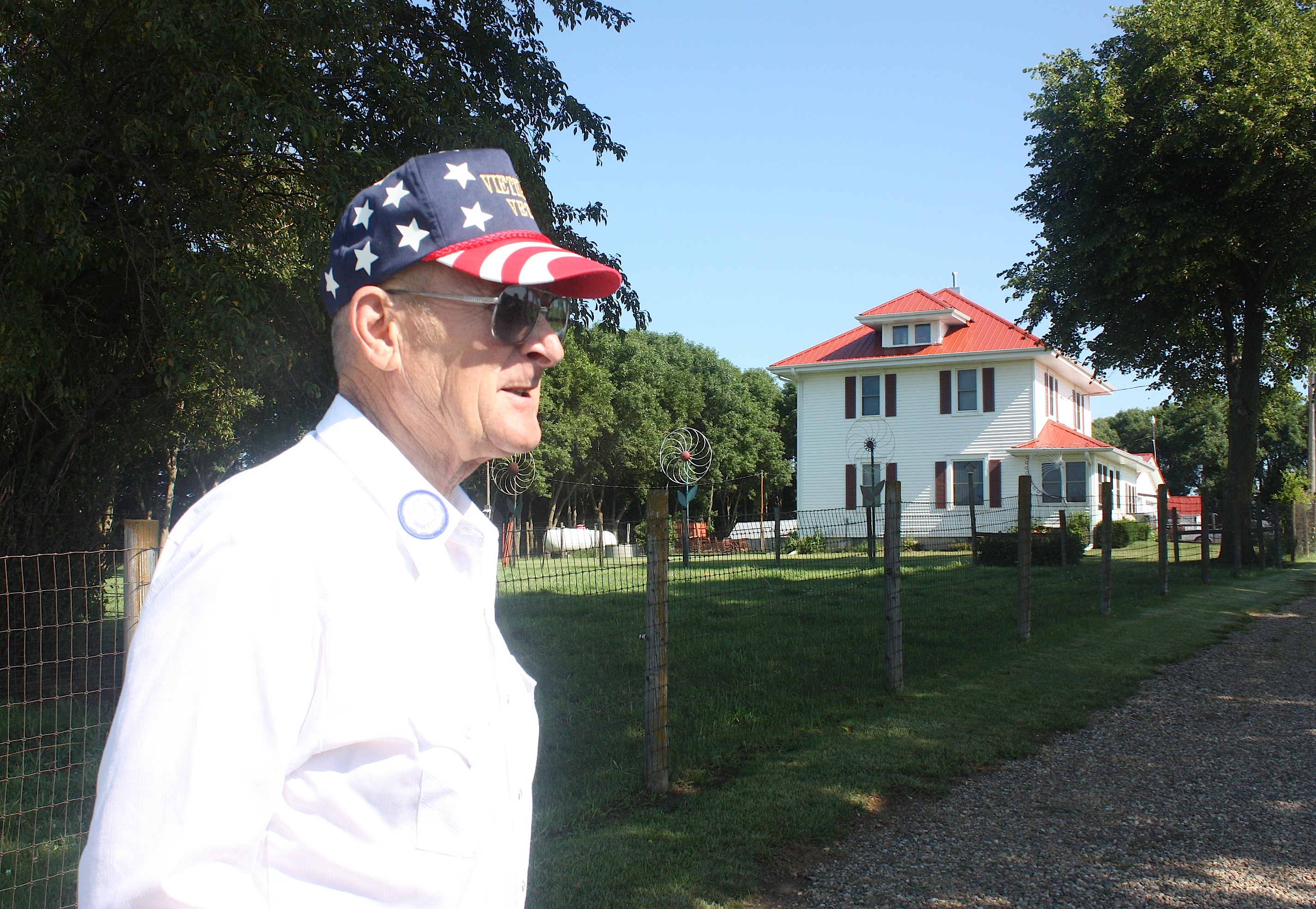
Just outside Kingsley on route C66 we ran into Don Riemenschneider, a farmer and military veteran who lives on the farmland bought by his father in 1945. He gave us a walking tour of his front yard, with a carefully curated collection of farm implements and other memorabilia. Riemenschneider was rightfully proud of his home and farm buildings — with their bright white sides and fire-engine red roofs, they stand out from others along the highway.
Just as we started to leave, a lone cyclist rode by. “Not exactly RAGBRAI,” I said to him. “But almost!” he called back.

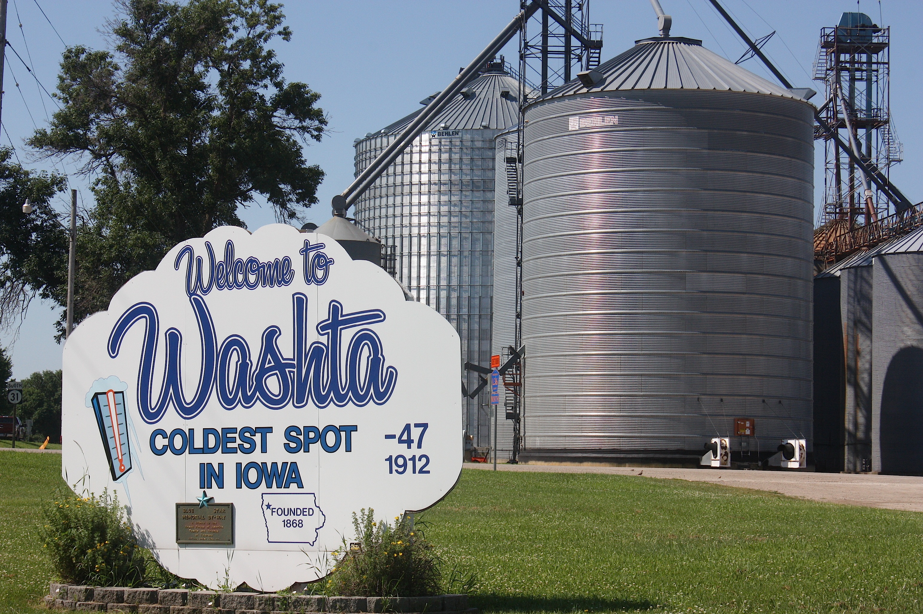
The next stop, Washta (population 248), holds the distinction of being “The Coldest Spot in Iowa,” having recorded a temperature of 47 degrees below zero without wind chill on Jan. 12, 1912. Today, there’s not much going on in Washta, although we talked to a woman at the post office and bought a big bag of Twizzlers at the convenience store on the edge of town.
This started a long discussion in the car about where older folks – or anyone without transportation, for that matter – buy food in some of these small, tucked-away Iowa towns. Many of the communities we visited today had no apparent source of food, despite being surrounded by abundant farmland. Some had Casey’s or other convenience stores, but those offer mainly packaged foods. None of the smallest towns had a visible grocery store.
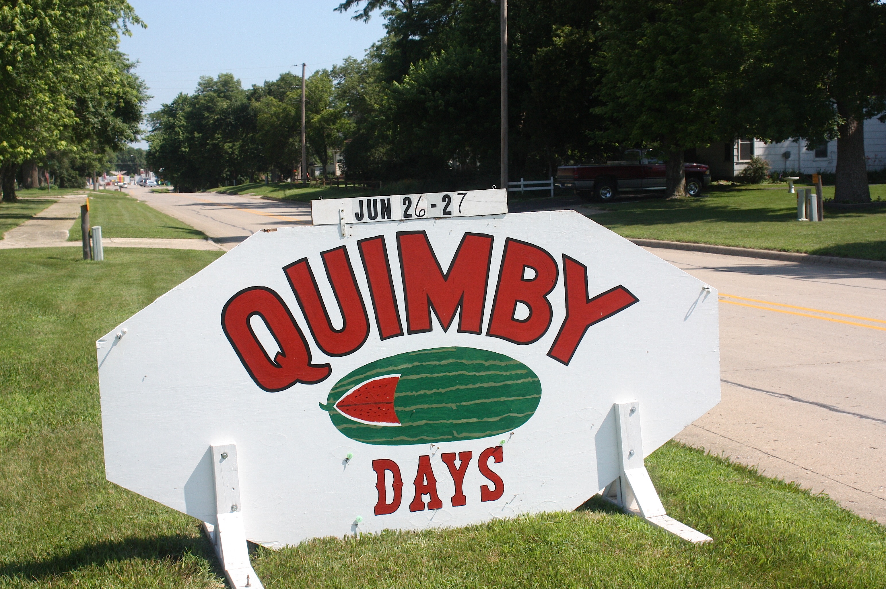
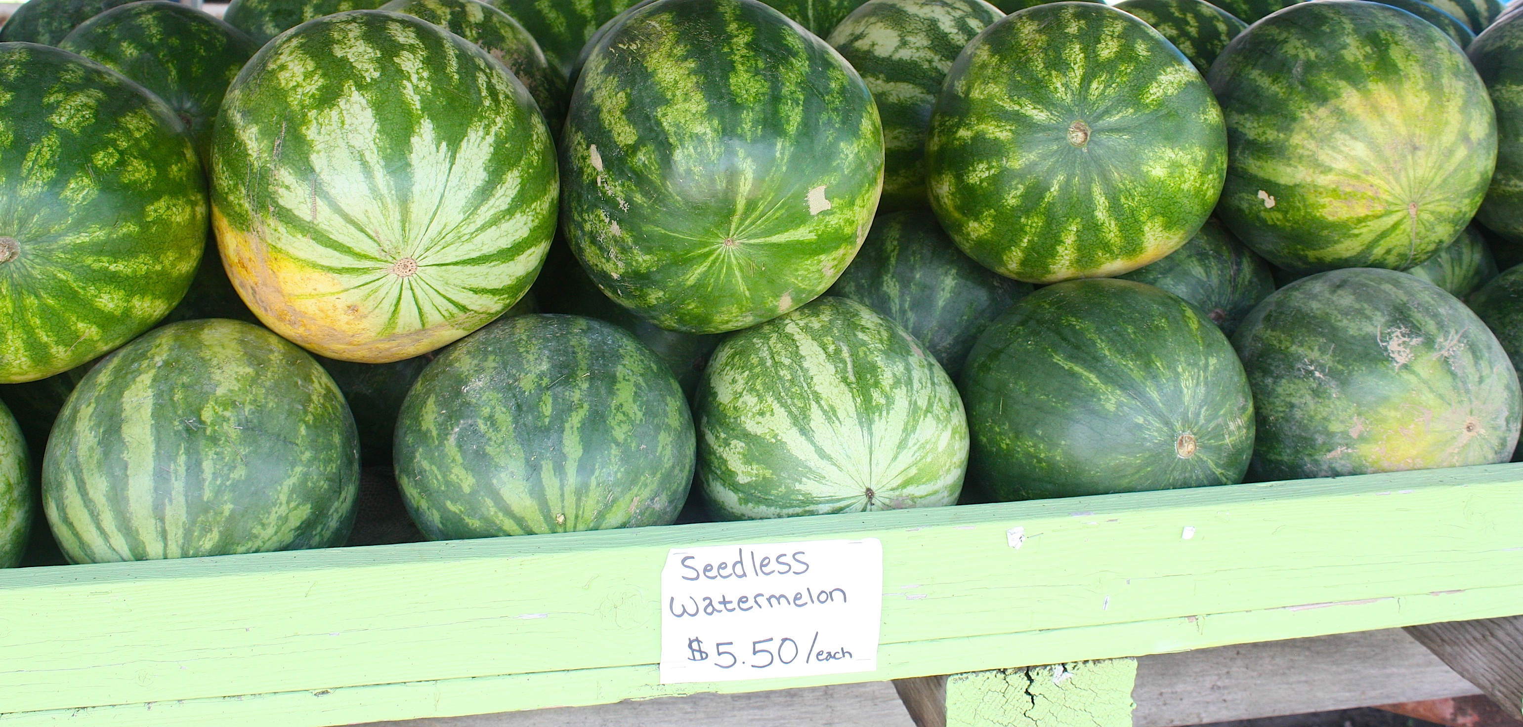
As we drove, we followed the Register’s March 8 guide to RAGBRAI towns because it includes a detailed map of the route and also because it includes highlights of each town. Nearing Quimby (population 319) we suddenly realized that the town’s Watermelon Days celebration was going on RIGHT NOW. We were stoked. I dug money out of my purse, hoping to buy a big, cold, drippy slice.

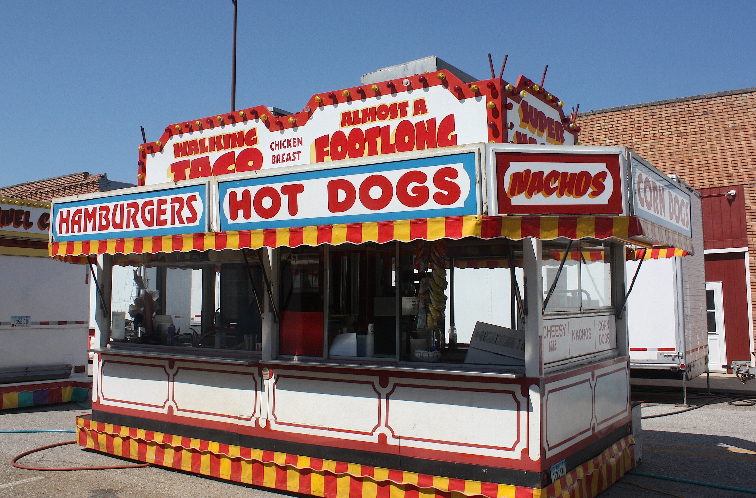
But it was not to be. Yes, Quimby Watermelon Days were indeed this weekend. But apparently things don’t get started too early around here. We were there mid-morning, and there was plenty of evidence of a festival – chainsaw artist at work, food stands and carnival rides at the ready – but nothing happening YET. And no watermelon to be seen. I’m guessing everything springs to life after dark.


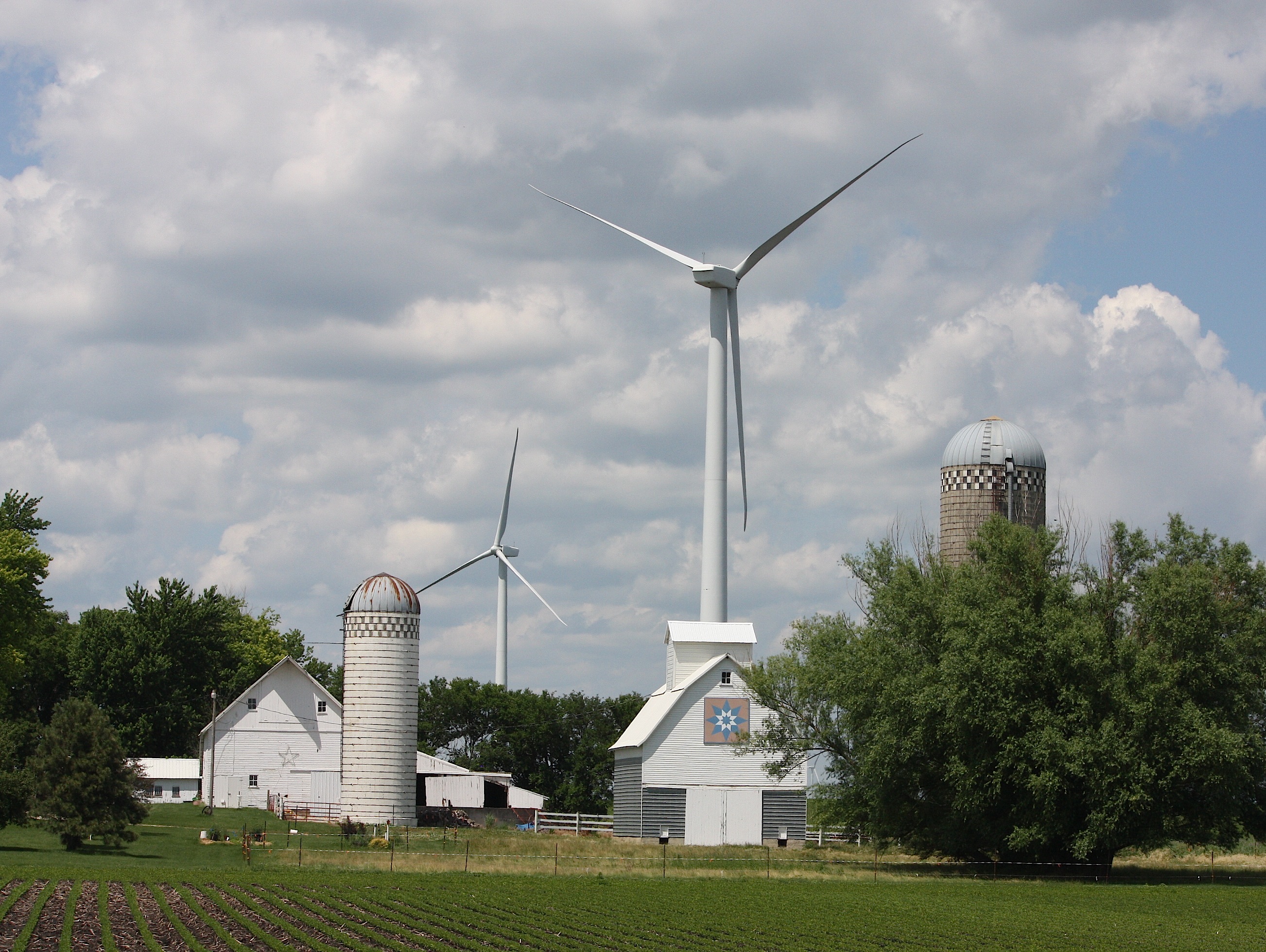
Driving along C63 en route to Hanover, we spotted a friendly bicycle sculpture just in time for RAGBRAI. And then we saw a peaceful cemetery framed by wind turbines. This is the stuff you don’t see on the interstate.
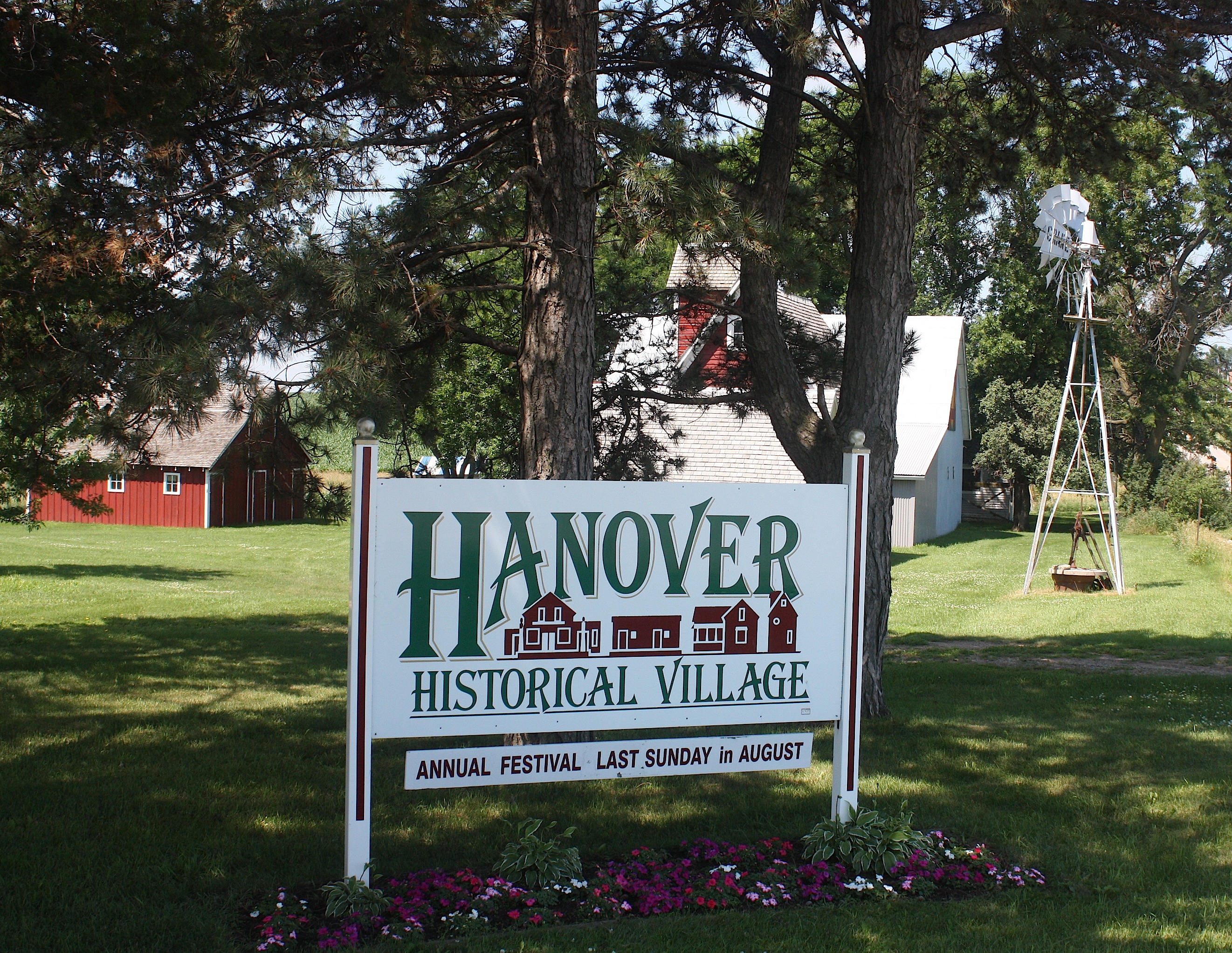
And then we came upon the Hanover Historical Village, the cutest little place you ever saw in the middle of Nowhere.
There’s a restored country general store with original furnishings, an old-time barbershop, two-story machine shed, historic home, windmill, working mill house, and a display barn. There’s even an annual Hanover Festival; this year, it’s on Sunday, Aug. 30, 2015. Here’s what the website says: “Come and help us celebrate our festival with toe-tapping polka and old-time music to listen or dance to. All buildings will be open, and numerous displays, demonstrations, games, and petting zoo will be enjoyed by all. Food is also available. Gates open at noon with music from noon-7 pm. Admission will be charged to all over 14 years of age. Free parking — bring your lawn chair.”

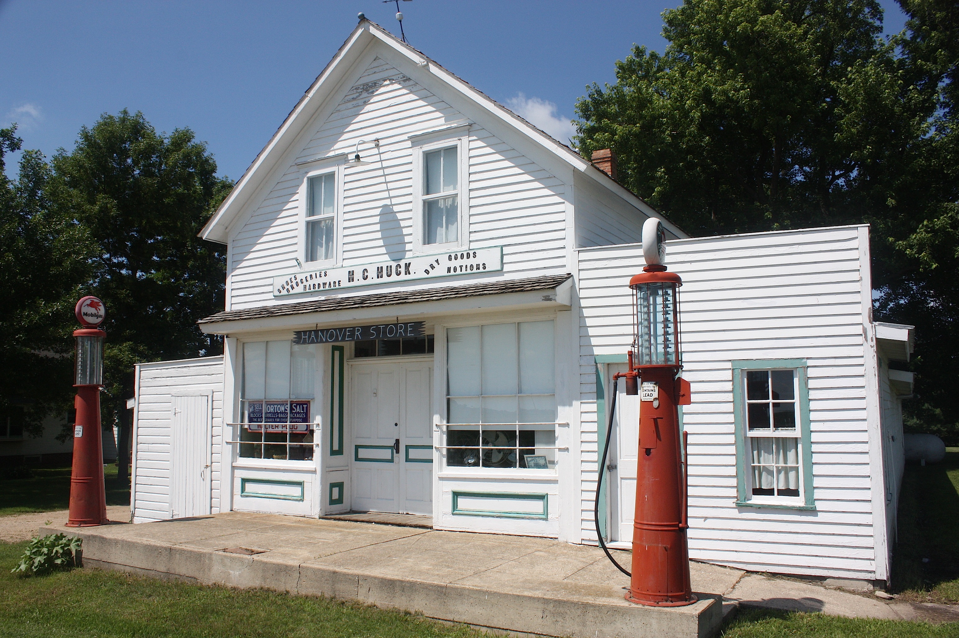
Hanover Historical Village is located 8 miles southwest of Alta, Iowa, at the corner of M27 and C65. Tours are available any time by appointment. It’s truly a hidden gem.
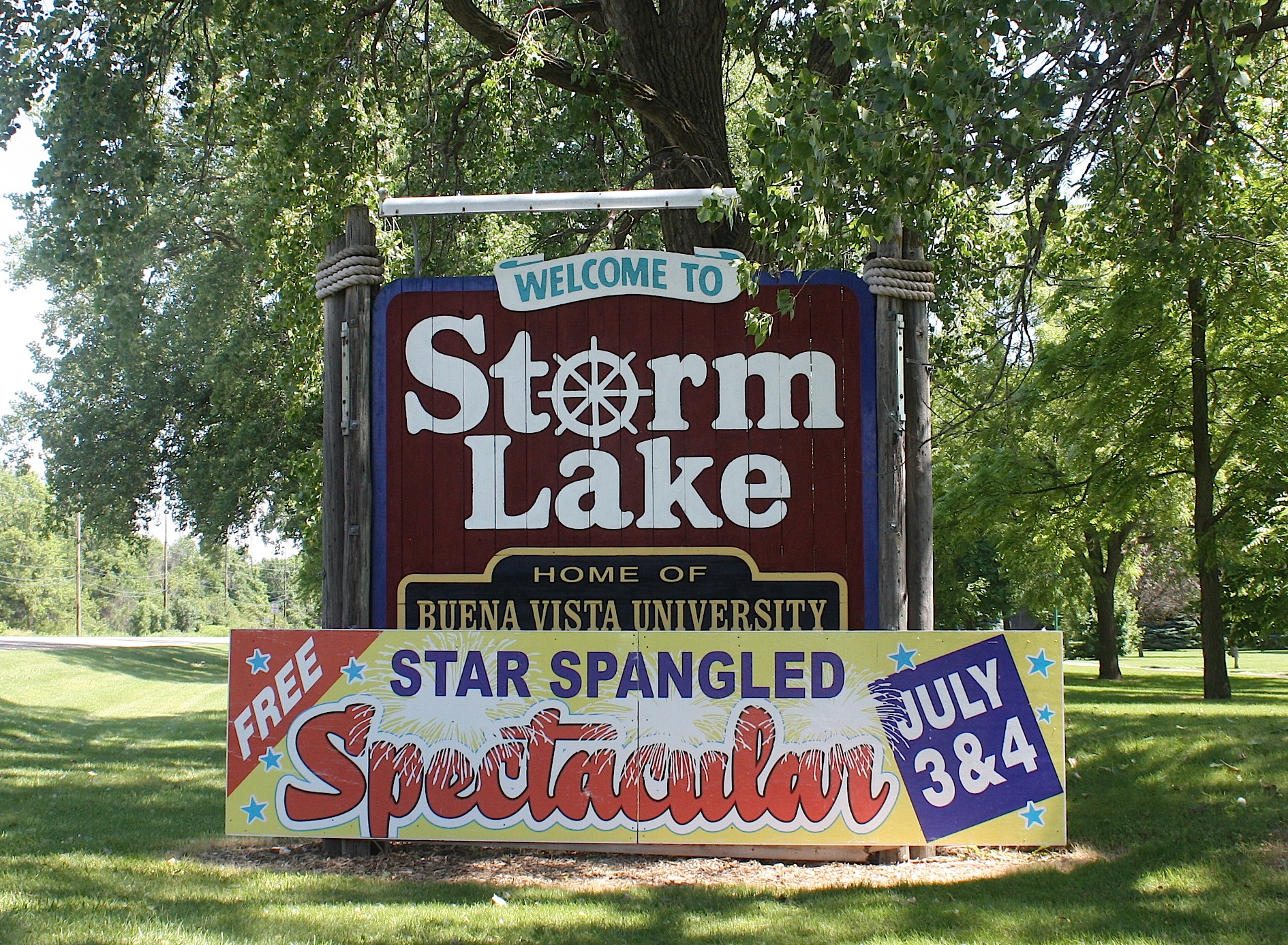
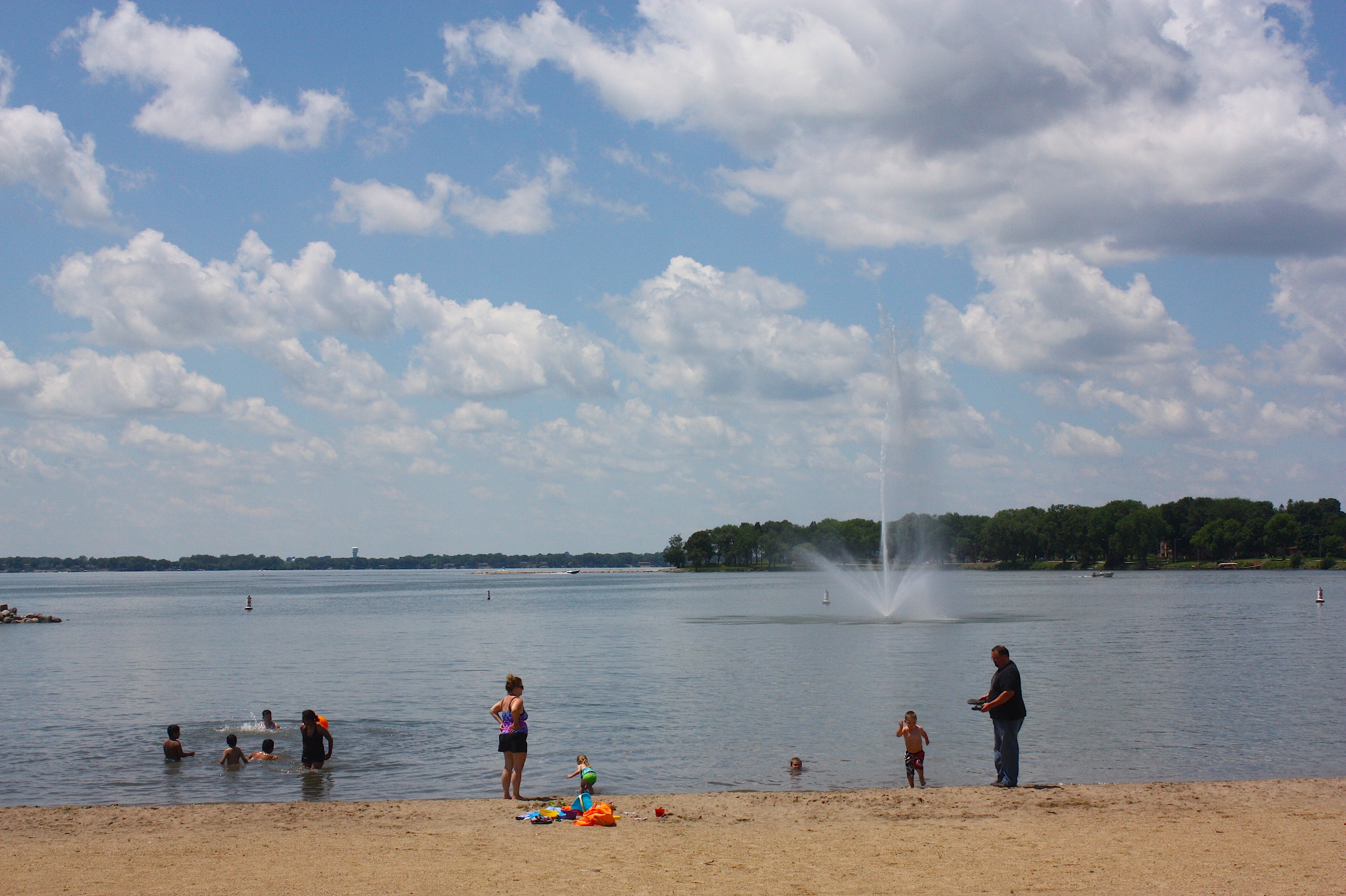
Finally, we’re at the overnight town of Storm Lake (population 10,600). After 74 miles and all those hills I can only imagine how wonderful this lake – and these shady parks and ginormous water park – are going to look to RAGBRAI riders on July 19. Because it looked pretty damn good to me, and I’d mostly been in the passenger seat of a car the whole way.
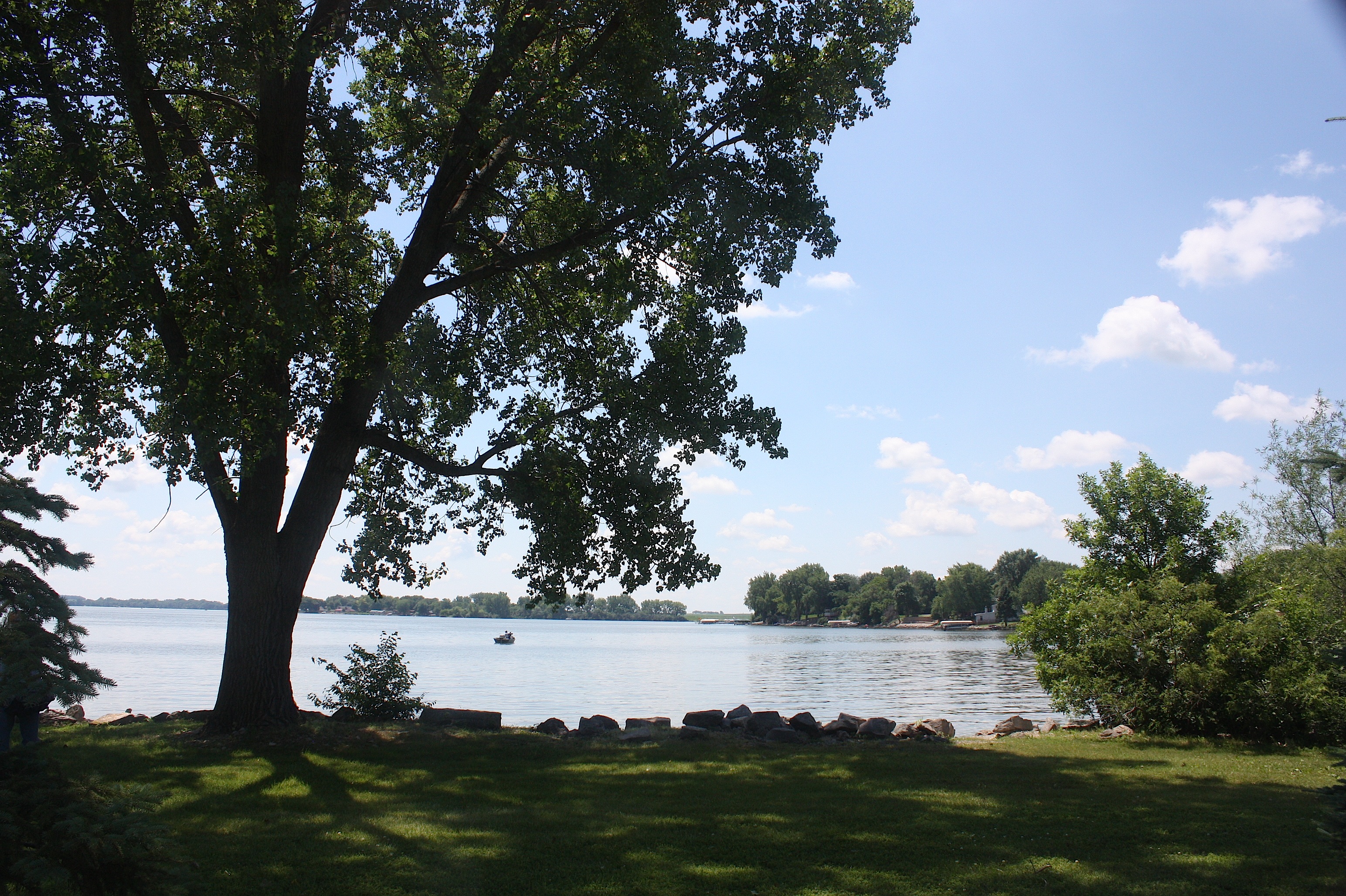

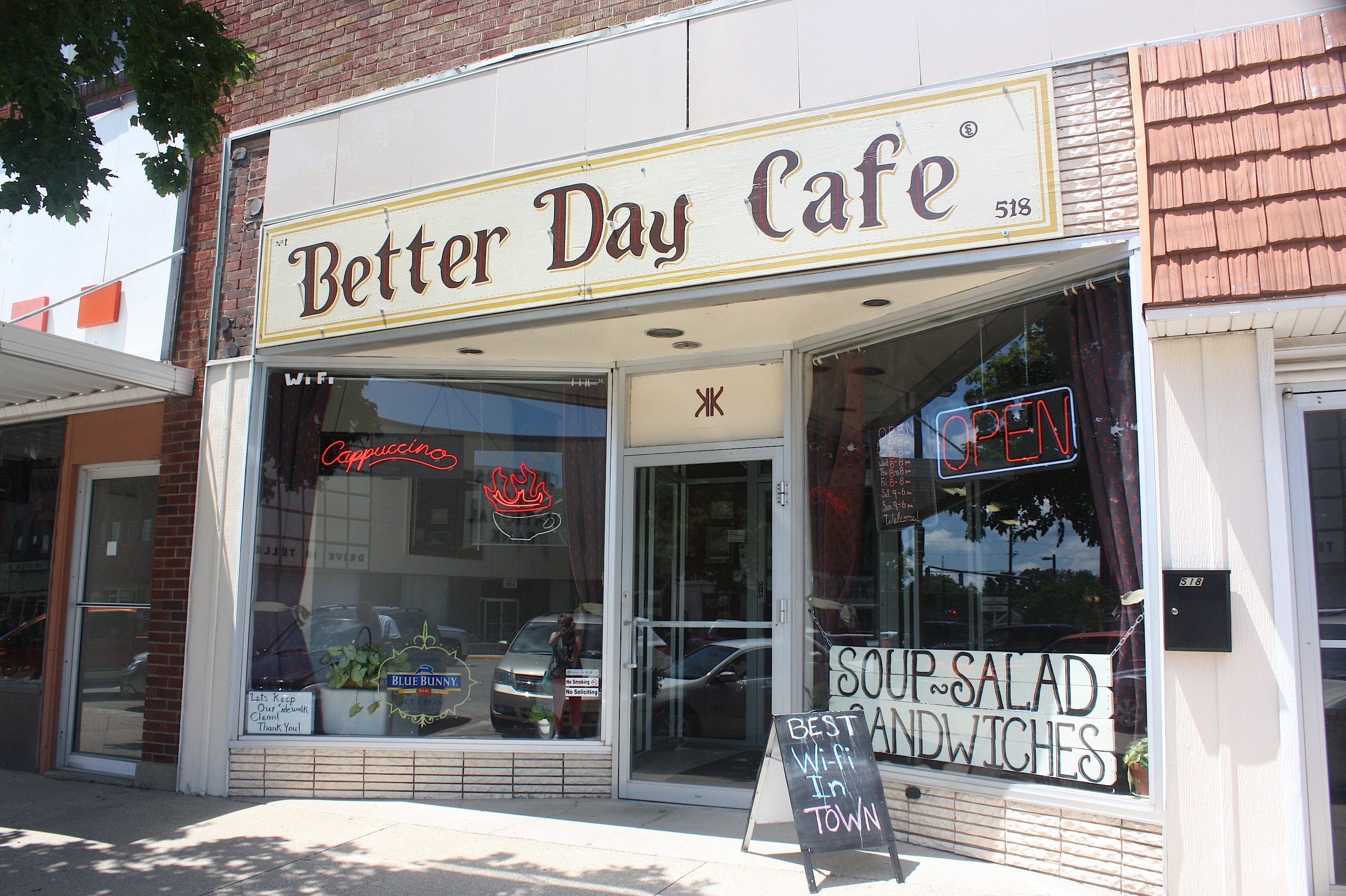
We arrived in Storm Lake around noon and took in the loveliness that is this 3,200-acre glacially created lake. We walked through Frank Starr Park, drove around town, grabbed some sandwiches at the Better Day Café, and ate them in another of the city’s lakeside parks.
Storm Lake feels like a resort town – but it’s also very much a working town. Tyson Foods operates a large hog slaughterhouse and meat packing plant here, and Sara Lee has a turkey processing plant. About 36% of the city’s population is Hispanic/Latino – making Storm Lake one of Iowa’s most diverse communities. Storm Lake is the county seat of Buena Vista County and home to Buena Vista University. And did I mention the wood carvings? Apparently any tree that dies in this town is transformed into art. There are artistic wooden statues all over town created by chainsaw artist Jeff Klatt.

Storm Lake is also an historic town. Santa’s Castle, a former Carnegie Library, houses a collection of Christmas memorabilia, and Harker House, one of Storm Lake’s oldest homes (above), offers tours by volunteer guides all summer long.
We met one of the guides, Justin Yarosevich, and he did such a good job pitching ideas at us that we could have stayed and toured Storm Lake the rest of the day. But we needed to hit the road. So we made one last stop – at the kid-centric King’s Pointe Waterpark Resort – and headed out of town.

RAGBRAI overnighters, by the way, will be entertained by Styx, Journey, and REO. The highly appropriate overnight town theme is “Give our Shores a Spin.”
Moving on down the road:
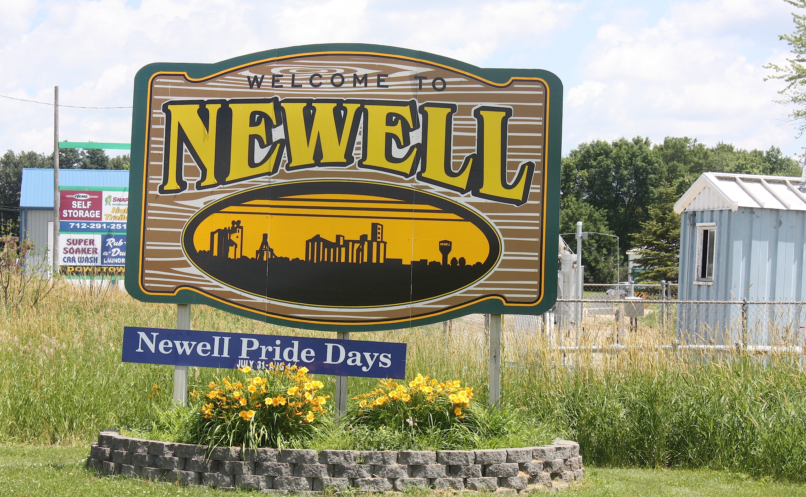
There’s not much to see in Newell (population 876); in fact, the whole town is only a total of 1.27 square miles. But just south of town is the Allee Mansion, a stunning Victorian home and farm (operated by Iowa State University) on the National Register of Historic Places. Apparently George M. Allee was a Pioneer corn breeder and philanthropist, and he willed the farm in 1958 to the state of Iowa for agricultural research.

Despite its size, I’ll give this tiny community credit: They have an up-to-date website listing “What’s New in Newell” including this RAGBRAI info:
“RAGBRAI XLIII will be in Newell on Monday, July 20th as a breakfast town. We are excited for this!! There will be several vendors on main street that morning. Food vendors will be serving Pancakes, Omelettes, Biscuits and Gravy, Breakfast Burrito at clubhouse, protein balls, homemade pies, and lots of fresh fruit! There will be DJ’s, and beer gardens. Other entertainment will be a football toss, basketball 1 on 1 throw, and golf challenge. Free water, free WiFi, free cell phone charging, & 2 ATM’s.” (This is a direct quote, with their capitalization and punctuation, just so you know.) It sounds like a fun morning to me.

Next up is Fonda, another whopper of a town, with 631 recorded inhabitants as of the 2010 census. The community seems to be small but mighty. Fonda was founded in 1870 and is located in the southwest corner of Pocahontas County.
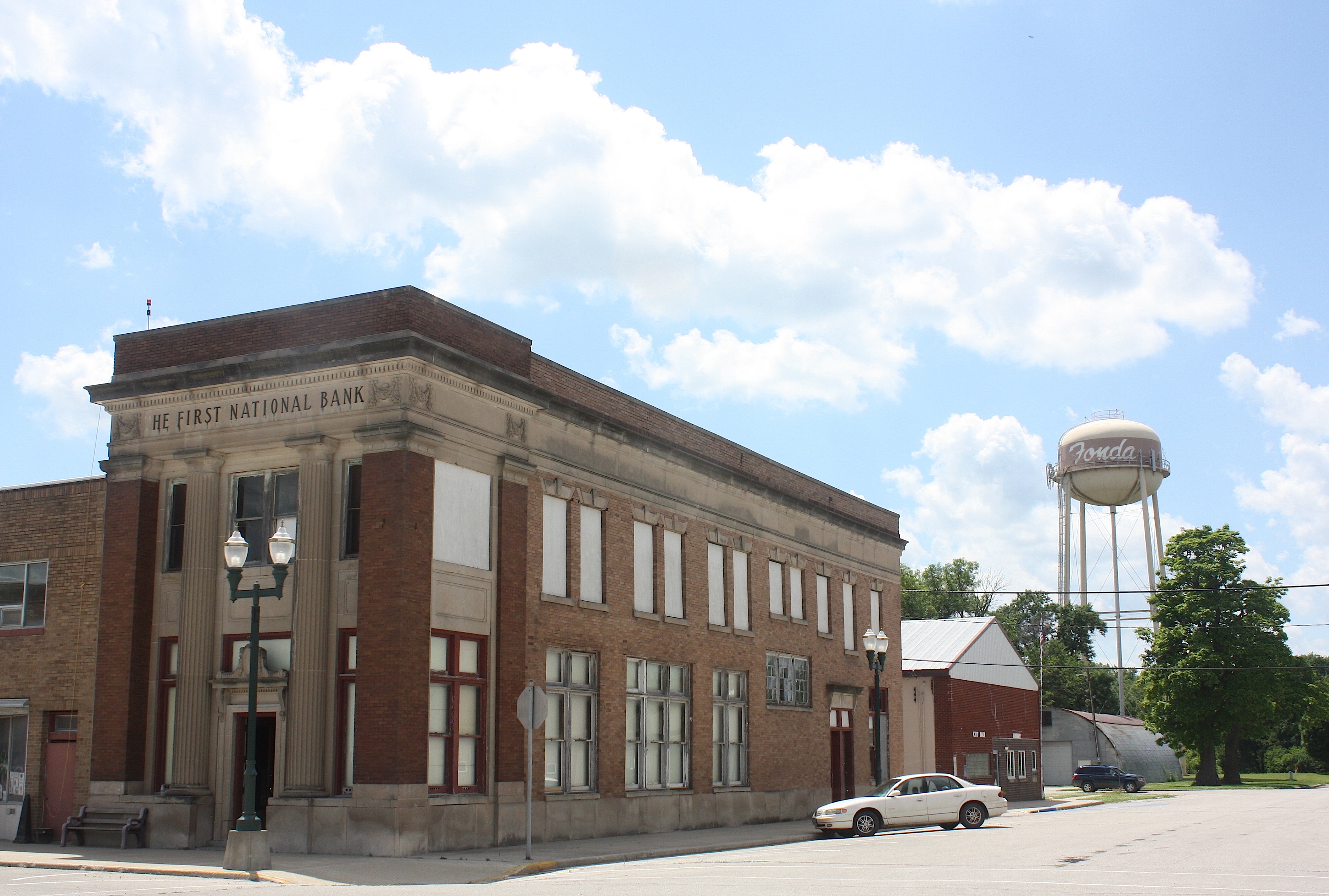

Fonda is home to the Fonda Museum operated privately by Jan and Gib Alpers, but unfortunately it’s open by appointment only so I didn’t get to go inside. It looks really fun; there’s a general store, ’50s room, music, barbershop, popcorn, print shop, and automotive memorabilia. You can watch a video here.
Like nearby Newell, Fonda’s Website also has RAGBRAI info.
The drive between Fonda and Pomeroy is flat – we’ve left the hills behind – but no less lovely. Cyclists will be surrounded on both sides of the road by pretty farmland and enormous wind turbines as far as the eye can see.


Pomeroy: Now here’s a town (population 662) worth going out of your way for. Byron’s bar, the town’s claim to fame, has been around “forever” according to a bartender we met who had worked there for 19 years. This place is a destination, a Grateful Dead/hippie bar with live music most weekends. I’m sure it will be hopping like crazy when RAGBRAI rolls through.

The town itself was nearly wiped off the map in 1893 by a devastating tornado. Not much remains of the downtown. But come and visit anyway, because Byron’s is a gas.

Our next pass-through town is Manson, Iowa, population 1,690. Manson (town motto: “Making an Impact!”) is famous for its ancient history. The town was built upon the site of the Manson Impact Structure, the largest known meteorite crater in the United States. The crater, measuring more than 23 miles in diameter, was created when a meteorite crashed into earth some 74 million years ago. The crater now sits approximately 200 feet below the city of Manson. Although the crater is not visible today, the impact of the meteor significantly changed the geography of the area. As a result, the city of Manson was known for years as the “soft water capital of the world.”
Besides the BEST welcome sign I’ve ever seen, there’s not much of a reason to visit Manson. It’s a pretty sleepy little town.

It’s almost the end of Day 2 for the riders when we arrive in Clare (population 146). Like most of the farming communities we’ve visited today, Clare has a grain elevator – but there’s not much else: one bar, a post office, and a couple of businesses that appear to have been closed for years.

Cyclists will be greeted in Fort Dodge (population 25,206) with the “Spazmatics Ultimate ’80s Show” and the overnight town theme “We’re Going Places!”
Historically – and I’m quoting this from the city’s website because frankly I’m too lazy to rewrite it – “Fort Dodge traces its beginnings to 1850 when soldiers from the United States Army erected a fort at the junction of the Des Moines River and Lizard Creek. It was originally named Fort Clarke but was renamed Fort Dodge because there was another fort with the same name in Texas. It was named after Henry Dodge, a governor of Wisconsin Territory (which included Iowa at the time). The fort was abandoned in 1853 and the next year William Williams, a civilian storekeeper in Fort Dodge, purchased the land and buildings of the old fort. The town of Fort Dodge was founded in 1869.”

So, blahblahblah, there’s a fort — Fort Museum & Frontier Village – a replica Civil War militia fort, with military, pioneer, and Native American artifacts and a historic town.
There’s a lot more to do in Fort Dodge, because it’s 20 times bigger than most of the towns we’ve driven through today, but I was tired and didn’t really care. I walked around the downtown area a bit and strolled through Karl King Park. Fort Dodge is the Webster County seat.
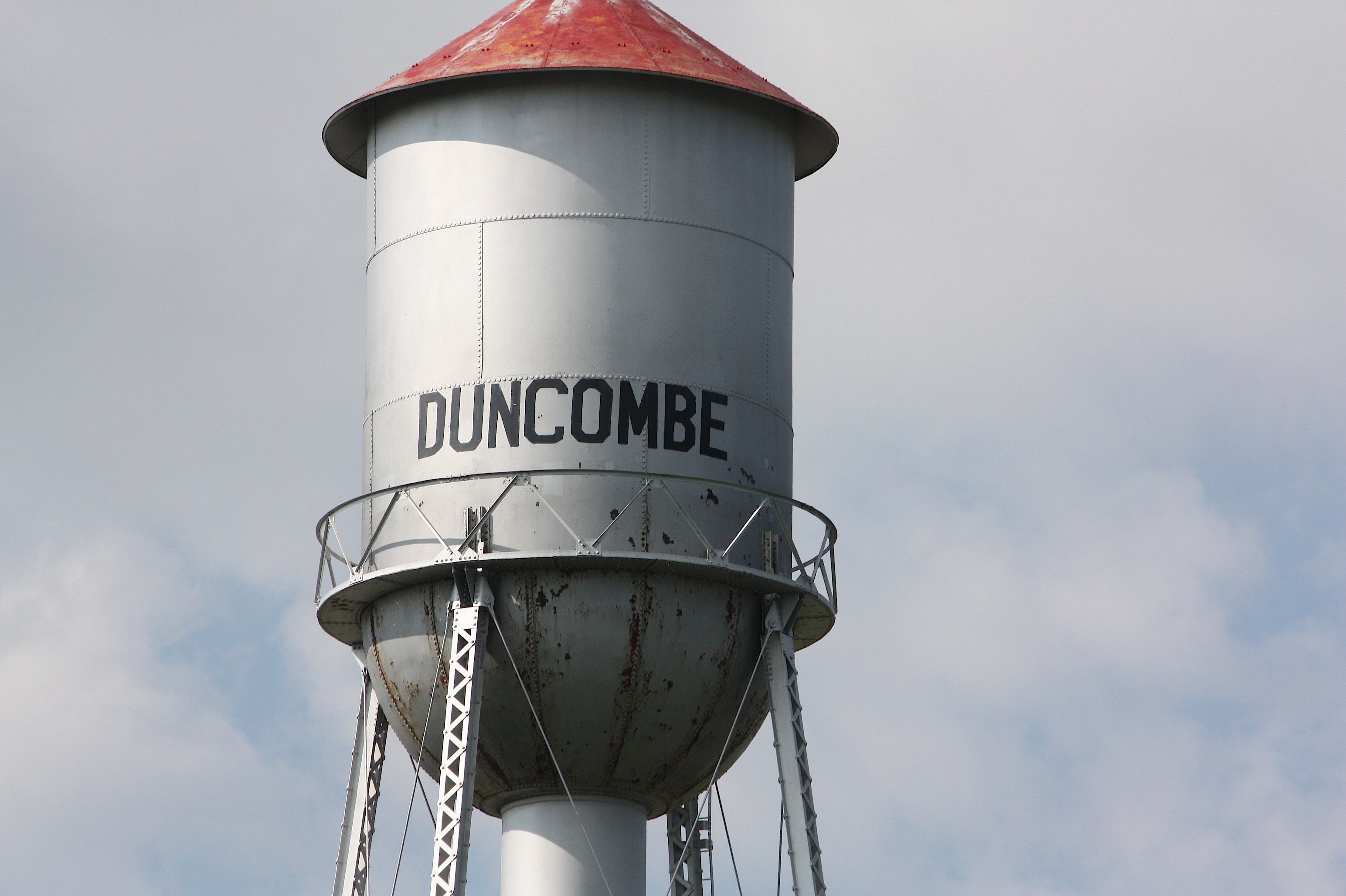

We’re on the home stretch now for Day 1. Our next stop is in Duncombe (population 410) home of Ethel’s Pub ‘n’ Grub, Duncombe Gas & Grocery, and a big-ass grain elevator. I mean, this thing is huge. It dwarfs the entire town.

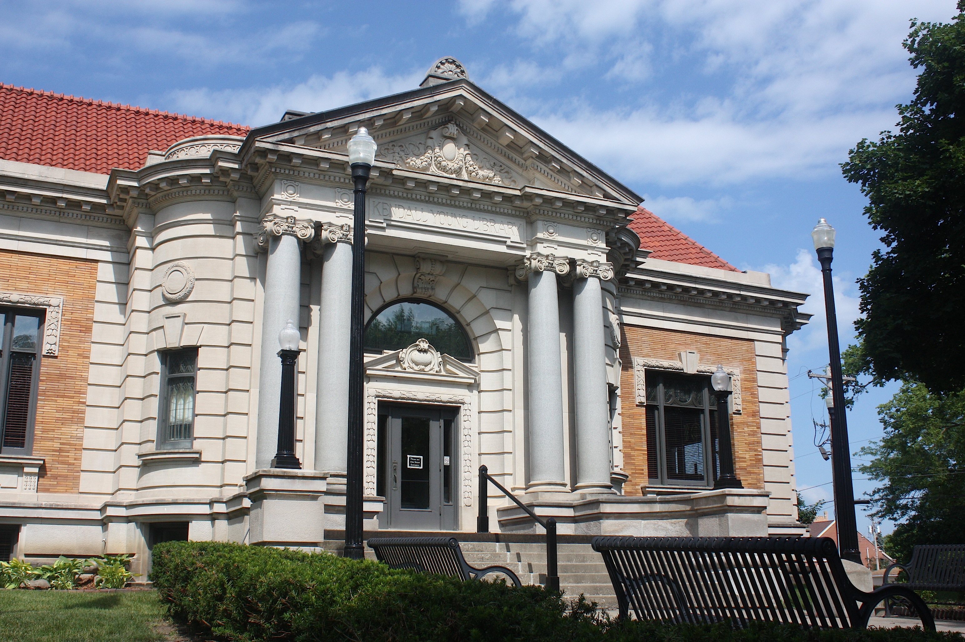
Just down the road is Webster City (population 8,070), the county seat of Hamilton County. By the time we got there, nothing was open in the downtown area, but I was impressed with the vintage shops and movie theater, and by the city’s historic homes and Kendall Young Library. Webster City is also home to Iowa Central Community College.


From there we hit Hwy. 20 and headed home. I was grateful that, unlike thousands of cyclists to come, I will have a soft, dry bed to sleep in tonight.
Spring on the North Shore
Driving to Minnesota’s North Shore in early June is like turning back time. Because although it’s full-on summer in Iowa, it’s spring up north.
That’s one of about a thousand things I love about northern Minnesota. I love the drive from Ames…once you reach Duluth, it’s like a different world.
My drive up north on June 5 was delightful, as always. I stopped at the Minnesota welcome center, stopped to buy baked goods at Whole Foods in St. Paul, slowed to smell the flowering trees in Duluth, stopped in Two Harbors to top off my gas tank. I watched as the temperature gauge on my car fell, fell, fell from 69 degrees at 7:15 a.m. in Ames to 55 degrees in Duluth to 49 degrees at 3:30 p.m. when I stopped to take a hike at Caribou Wayside, one of several dozen places to stop along Hwy. 61 to hike or view a waterfall or a lighthouse.
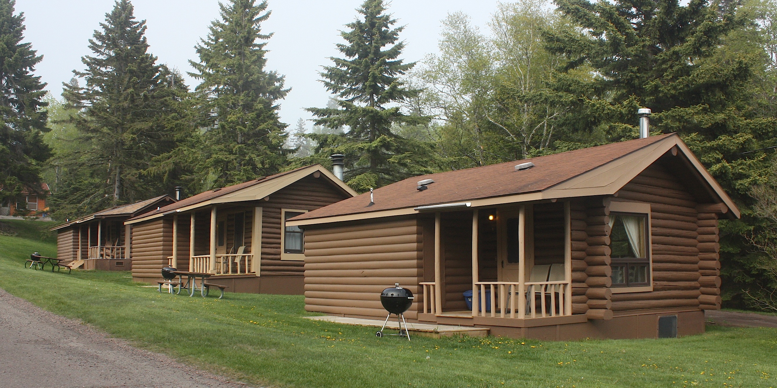
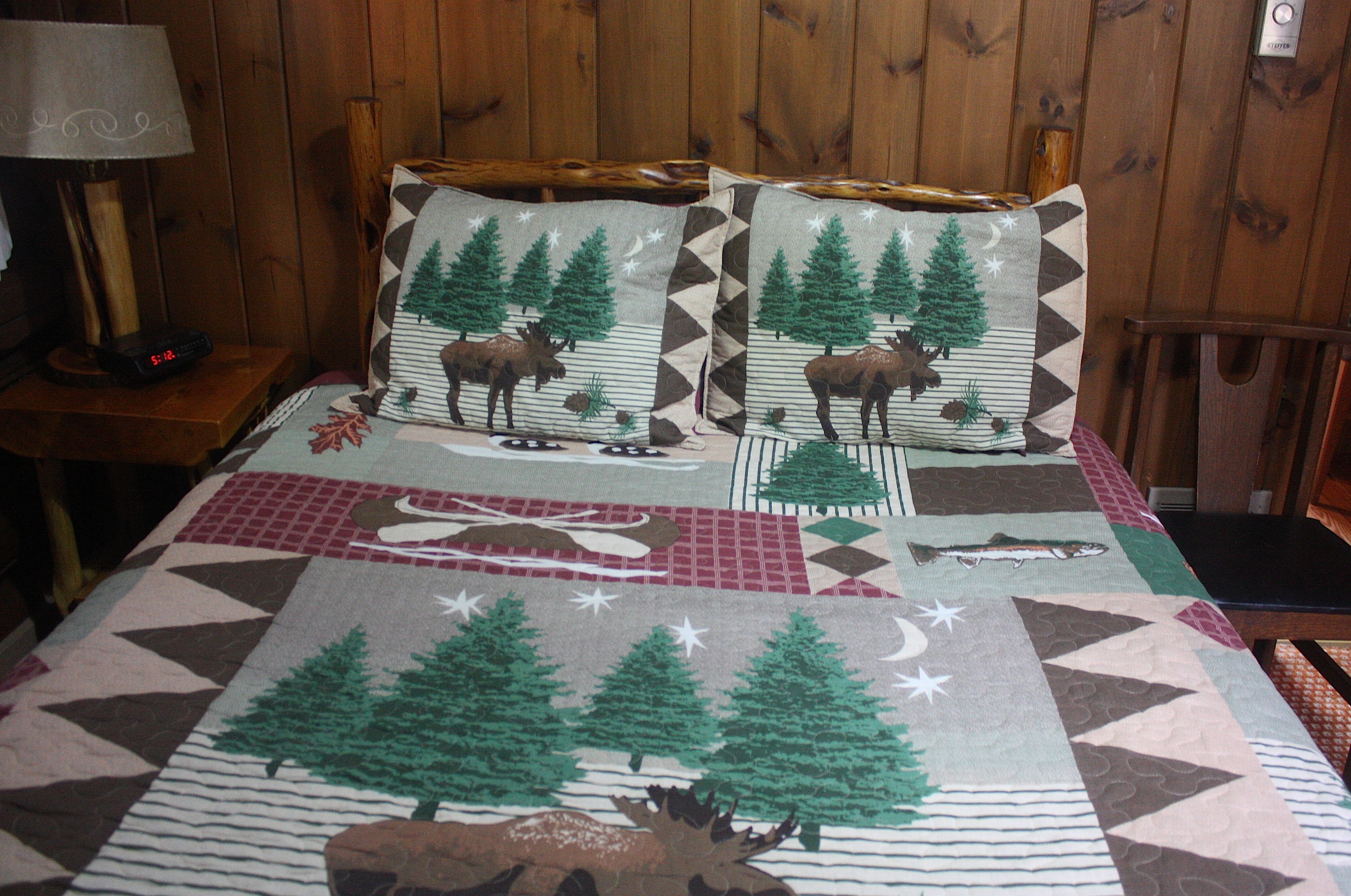
Lake Superior was covered with fog as I drove along its shoreline, but I could hear it, and I could smell it. I arrived at Cascade Lodge at 5 o’clock and settled in to Cabin 1, with its smell of wood smoke and its bedspread decorated with moose and salmon.
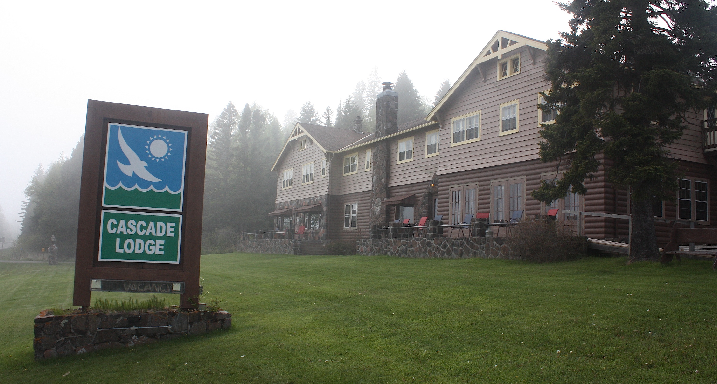

After I unloaded the car, I sat on the front porch with a glass of wine, listening to the Cascade River rush behind me, and breathing in the wonderfulness that is the North Shore. It was still light outside when I went to bed at 10 p.m. and light again when I awoke at 4-something. It’s not like being in Alaska, where it’s light pretty much all night this time of year, but there’s a lot more daylight here than in Iowa.
I managed to sleep late, even with the sunlight streaming in the cabin windows. Once I was up and dressed, I walked next door to the Cascade Restaurant, home of the best blueberry pancakes in all the world. I always order the short stack (two pancakes) and still can’t eat them all.
Around 10 a.m. I arrived at a Superior Hiking Trailhead just south of Temperance River State Park. This is a nice, easy hike with tons of wildflowers – and mud. It’s been a rainy spring up north. Parts of the trail have boardwalks, but there is boot-sucking mud nonetheless. I used to really try to avoid mud, but now I just plunge right in. It’s worth dirty boots to see the bright green ferns and marsh marigolds.


I hiked for a little more than an hour, then drove back north to Grand Marais, a harbor town and artist colony not all that far from the Canadian border. When I arrived in town there was a classic-car show going on, which meant that parking was a premium and the downtown area was busier than I like it to be, but it was OK because there was music and sunshine and blue water, so who could complain about that? Not even me.

I walked along the harbor and bought myself a sun-blocking hat at the Lake Superior Trading Post. I ate lunch at Gunflint Tavern. I’d never consider taking a trip to the North Shore without eating in this funky bar/restaurant. And then I drove a few miles north for an afternoon hike.
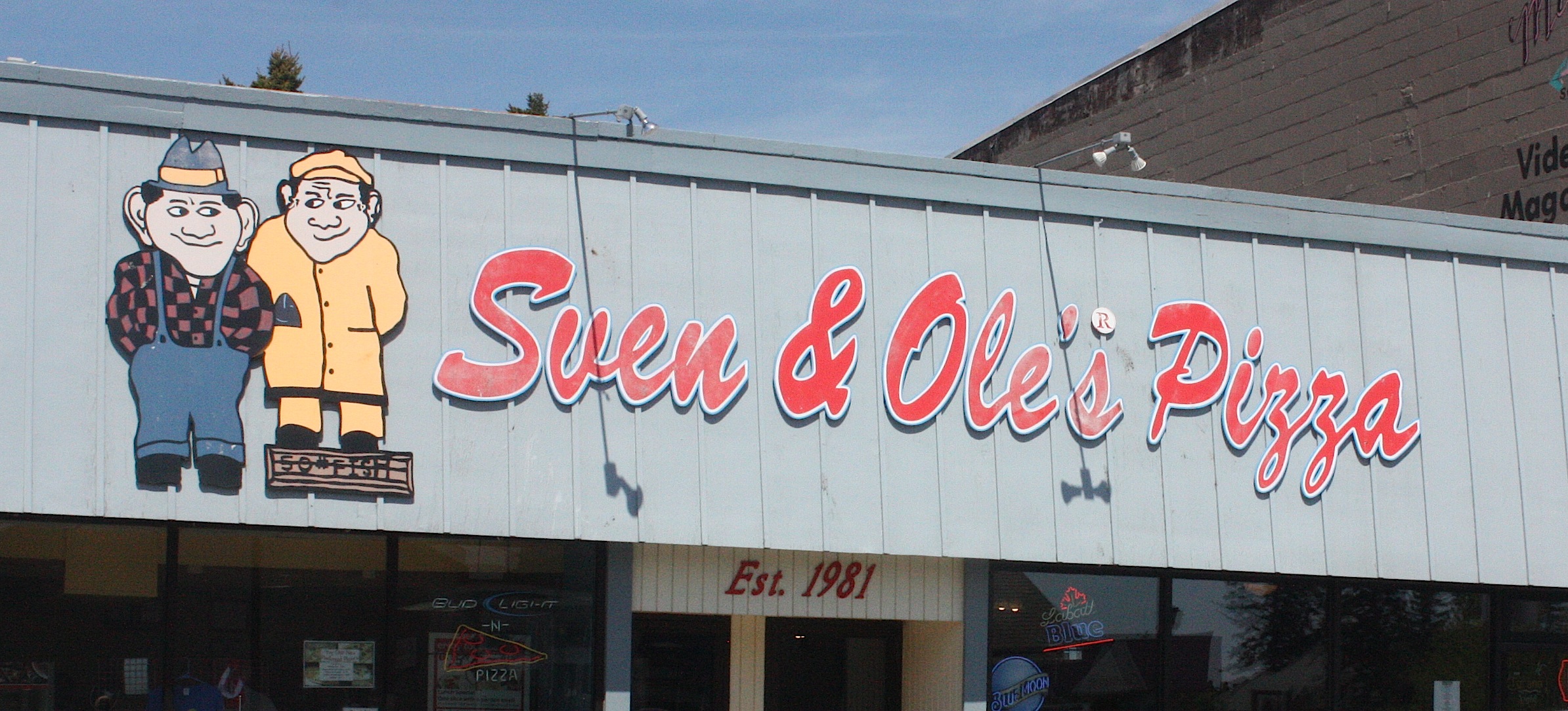
Late in the afternoon I went back to my cabin to read and take a nap. In my younger days, I’d hike all day, but now I just enjoy the relaxation and quiet. I took it easy for a few hours and then drove back to Grand Marais for a wild rice pizza and an Alaskan Amber at Sven & Ole’s, consumed happily in The Pickled Herring, the upstairs bar.

It was a good day.
On Sunday I ate breakfast again at the Cascade Restaurant, packed my car, and hit the road. I stopped twice on the North Shore, once at the Tettegouche State Park visitor center, below (it’s new, and it’s awesome – and Tettegouche is one of the BEST places to hike), and again in Two Harbors to fill my gas tank and buy a cup of coffee for the road. I stopped again in Duluth at the visitor center on the hill for one last look at the lake.

After that, it’s all downhill. The drive is much less fun on the way home. There was construction in St. Paul, and more construction between the Twin Cities and the Iowa border. I had to listen to loud music just to stay awake.
I-80 across Nebraska
So here’s the thing about crossing the belly of America on Interstate 80: It’s boring. I get really offended when people say that they drove across Iowa and it was flat and dull, but I say the same thing about crossing Nebraska. So there you go. I’m a hypocrite.
My friend Jim Heemstra and I crossed Nebraska earlier this month en route to an Iowa State speaking engagement in Denver. Jim was determined to make the crossing interesting, so he did some research and planned several stops to make along the way.
This was moderately successful.
We avoided places we’d been before, like Omaha and Lincoln.
The first place we stopped – some dinosaur museum – did not exist. Maybe it was there at one time, but not anymore. At least we didn’t travel too far off the highway to discover this.

The second stop was my favorite: Wessels Living History Farm in York, Neb. This is the cutest little farm you ever saw. There’s a lovely home – a restored 1920s farm house that belonged to the David Wessels family and moved to the location just south of I-80. There are barns and a church and a windmill and a one-room schoolhouse and – this is the best part – miniature animals.
The day we were there the miniature horned cow had just given birth (that very morning!) to a tiny, adorable white calf. She was so brand-new that she hadn’t even figured out how to nurse. Her mamma was still giving her a good licking, and she did NOT like the fact that we were there, taking pictures of her.
Friendlier animals included Nancy the miniature donkey (who reminded me of a dog) and Snowball the miniature white horse. Both of these little ladies were chubby and pregnant, and they loved attention. They followed us around the whole time we were there. A mamma goat and her baby goat were adorable but skittish. The farmer/historian in charge of our tour said even he couldn’t get the goats to eat out of his hand.
Wessels offers educational classes and facilities for weddings and special events. It costs $5 to tour the living history museum, but it’s worth that for sure.
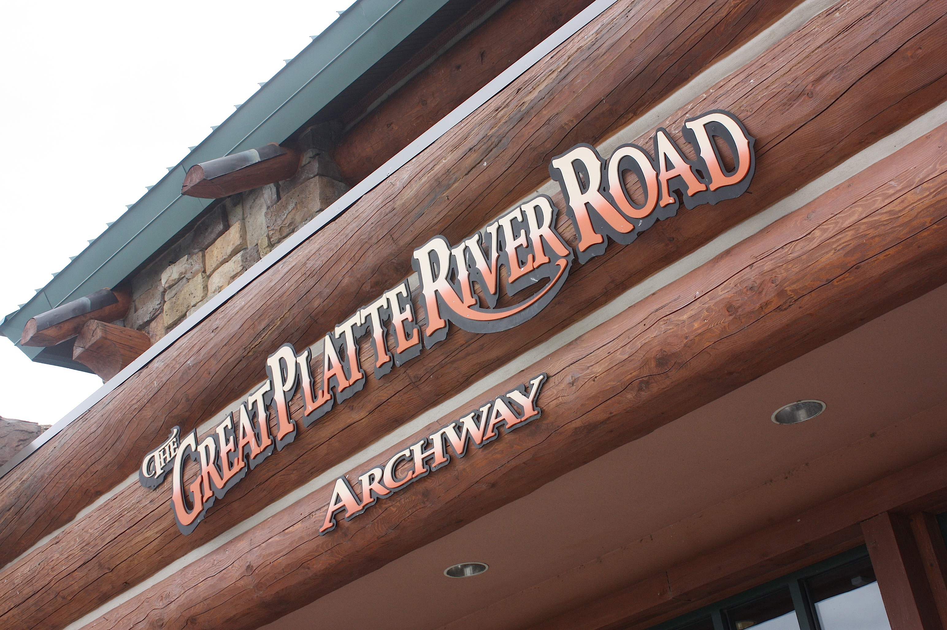
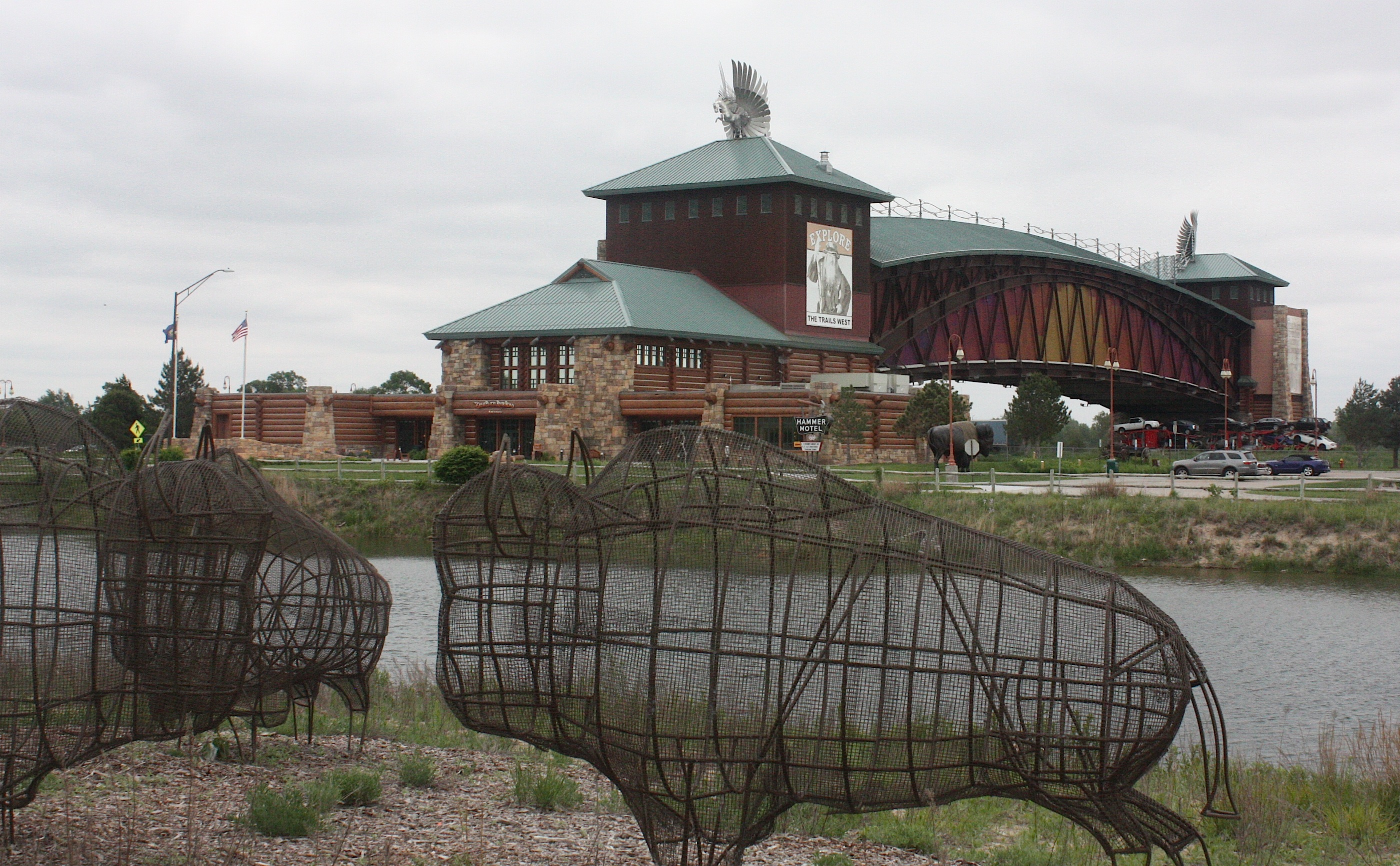
Our next stop was the Great Platte River Road Archway museum near Kearney. If you’ve ever driven across Nebraska on I-80, you’ve seen this place – and driven underneath it. The museum has a pretty cool design, with a stone-and-log bridge structure that spans 310 feet over the interstate.
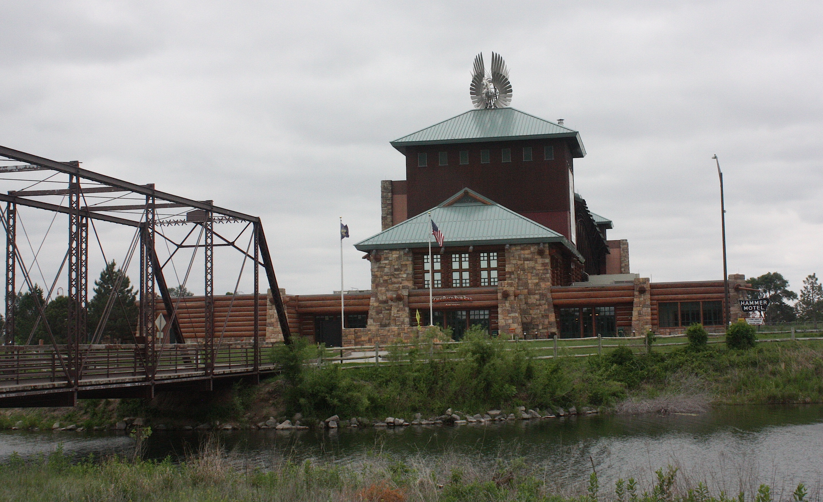
We had every intention of touring the museum. But it was getting late in the day. We wanted to get more miles behind us. And it cost $12. So we used the restrooms, walked around on the grounds, picked up a few tourist brochures, and got back on the road.
I am guessing the museum would be pretty interesting, especially for families with school-age kids or for anyone interested in the history of the Oregon, Mormon, and California Trails.

We ended up calling it a night in North Platte, Neb. This is not a town I’d really recommend, but there are not a lot of choices along this stretch of the road. Our hotel was directly next to the Fort Cody Trading Post, which is, according to its website, Nebraska’s largest souvenir and western gift store. I thought it looked like the kind of place my dad would have dragged me at age 10 in 1969. And, in fact, when I did some research I learned that the place opened in 1968, so I pretty much nailed it.

I don’t know why anyone would stop here today, but the damn thing is still in business. I also don’t know why William F. “Buffalo Bill” Cody is considered one of the good guys, especially since he is purported to have killed 4,282 American bison in a period of 18 months in 1867-68, a feat I don’t find particularly heroic. But he was a “colorful figure” in the American West and performed in Buffalo Bill’s Wild West show as well as being a rider for the Pony Express. So there you have it.
OK, so back on the road the next morning, we stopped at Ogallala for a look at Boot Hill (above), which is essentially an Old West cemetery with a statue of a cowboy in it. (Again, my father would have loved it.)
Moving on, we headed to Lake McConaughy for a “scenic drive” along Hwy. 92, which I didn’t find particular scenic. And we had to wait FOUR times for very long coal trains to pass. I’m pretty sure three of the trains were the same one.
We ended up in Ash Hollow State Historical Park, quite a bit northwest of Ogallala, near Lewellen. This place was surprisingly pretty and is historic for being on the California Trail. The area still has scars left by wagon wheels. We needed to get to Denver, so we didn’t spend much time in this area, but I think the hiking could have been very nice.
One place we didn’t stop along I-80 was Ole’s Big Game Steakhouse and Lounge in Paxton, Neb. I’ve been there a few times, and it’s worth a stop if you haven’t been there before. It’s sort of like eating/drinking in a natural history museum. The place is filled with big-game trophies, including a polar bear, elephant, giraffe, and other unexpected taxidermy animals – 200 in all — that both intrigue and disgust me. I mean, they were shot for sport, right? I don’t much care for that. Ole apparently killed animals on every continent during the 20th century. But they are beautiful animals, so it’s sort of like being in the Field Museum.
Anyway, you should stop there.
Royals vs. Yankees

Here’s the thing about baseball. It’s really fun to be at a major league park. The atmosphere is happy and friendly. It’s nice to be outside. There’s a sort of energy, beginning in the parking lot (where it seems like EVERYONE tailgates) and all around the concourse and through the pre-game stuff, all the way until… the game starts.
And then you just sit there for 9 innings (if you’re lucky and don’t go into extra innings).
My family loves baseball. Me, not so much.

I used to be a KC Royals fan back in the 1980s when the team was awesome and I lived in Missouri. I loved George Brett and Frank White and all those guys. I cheered as loud as anyone when they won the World Series in 1985.
And then they went into a slump and I had a couple of kids and a job and moved to Iowa and, well, until last year I could not tell you the name of ONE player in the Royals lineup. Not one. Not even the manager.
My husband, Dave, has been a long-suffering Royals fan all these years. He never gave up hope. Last year was super exciting for him, because the team went to the World Series again (for the first time, literally, since 1985).
He got us tickets for the first game of the Series, and that was really fun, even though we lost. I learned the players’ names and everything. For Christmas, our daughters bought him tickets to the May 16 game against the Yankees. So we went to Kansas City last weekend.
The two teams played Friday night (May 15), and the Royals whomped the Yankees 12-1. They played again on Sunday (May 17), and the Royals once again dominated 6-0.
But the game we went to? They sucked it up. I don’t know very much about pitching, but I’d have to say it was pretty awful. At one point, the bases were loaded and the Yankees hadn’t even gotten a hit. So, yeah, pretty sucky pitching. (I am talking to YOU, Danny Duffy.) The Royals ended up losing 1-5.
Oh, and did I mention that it rained? Yeah, it rained really hard.
And did I further mention that the food is overpriced and bad? I got a pretzel with cheese and spent nine bucks.
My family doesn’t like it when I point this stuff out, so when they go to another game in June, they’re leaving me home. Which is just fine with me.
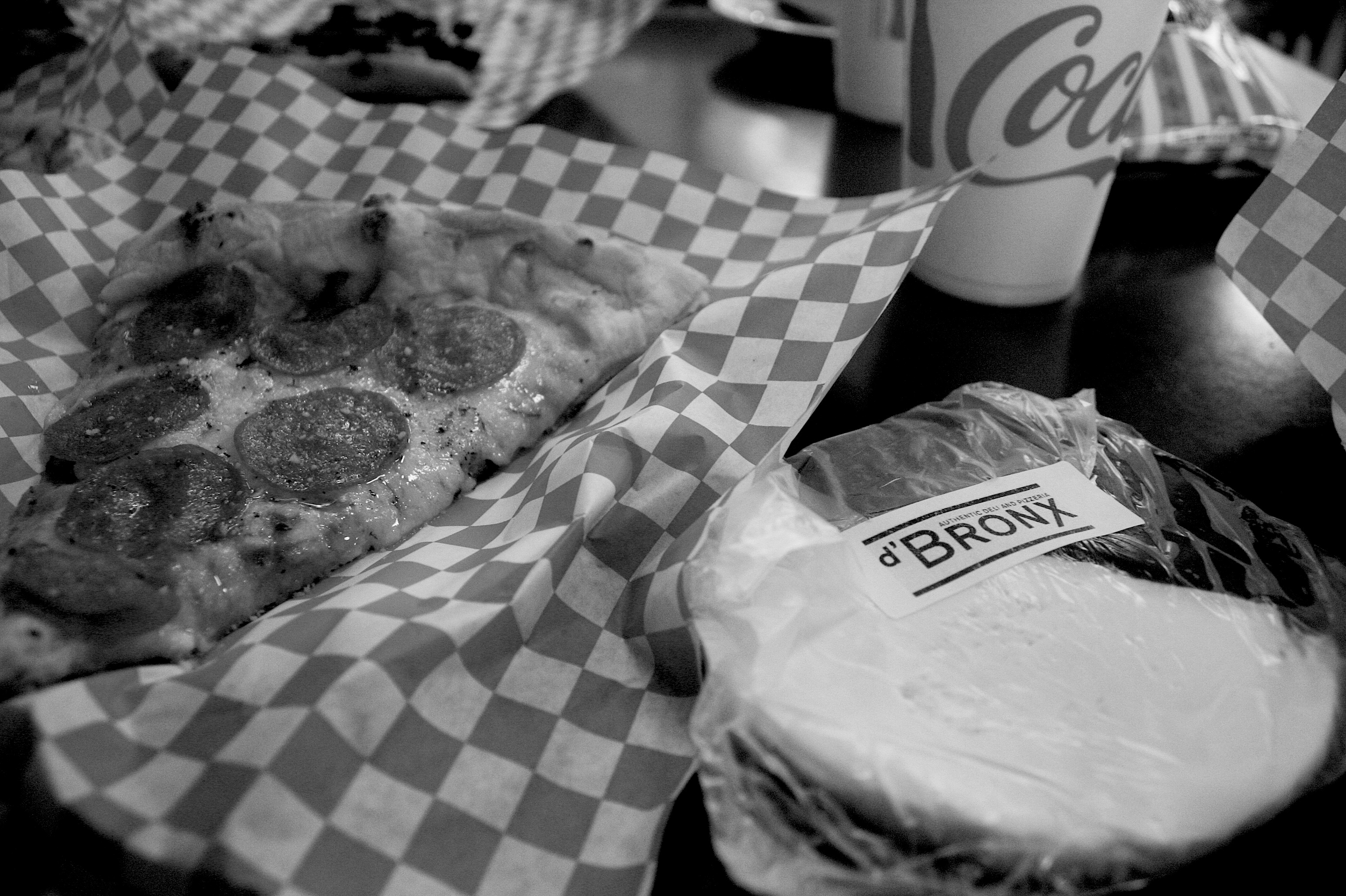
Oh, here was the bright spot of the day: Our daughter, Lauren, who used to live in Kansas City, took us to a hole-in-the-wall pizza place called d’Bronx, somewhere near Westport in a really grubby neighborhood. But the pizza was really good, and they also had black-and-white cookies, just like New York.
To market
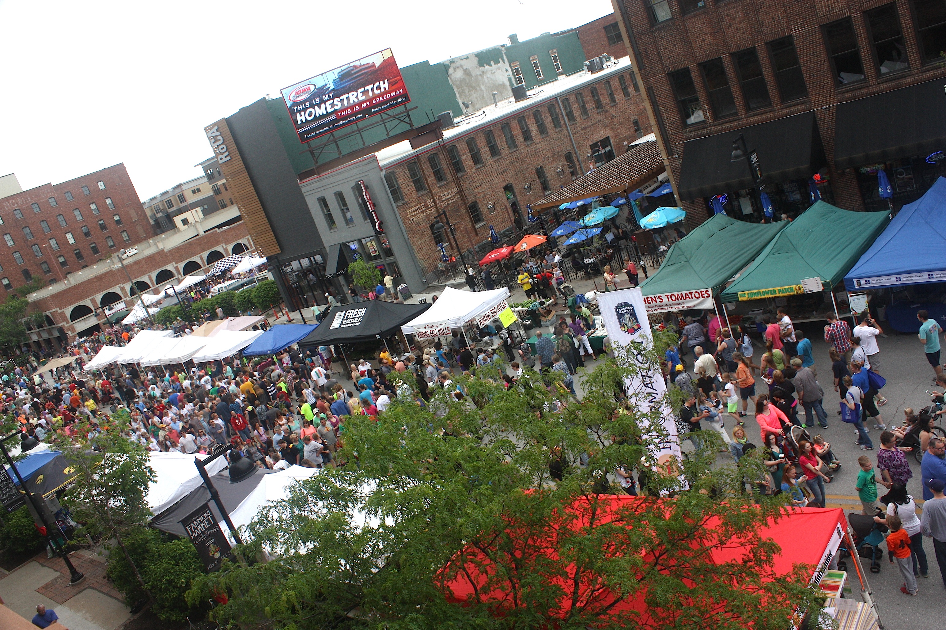
Last weekend was my first visit to the Downtown Farmers Market this season. It was crazy-crowded, of course. But it was so nice to be there and so comforting to see all my favorite vendors in their usual spots. Plus…I noticed several new vendors (grilled cheese!!) that I must try next time.


Yes, Waverly!
When I first heard the announcement that the Mumford & Sons “Gentlemen of the Road Stopover” concert this summer would have a tour stop in Waverly, Iowa, my first thought was, “What the hell? Why Waverly?”
A couple of days later, the Des Moines Register asked the same question in a March 7 story headline: “Why Waverly?” in about 400-point type, with the subhead “How a massive festival landed in small-town Iowa.”
I immediately knew I needed to pay a visit to this special little town north of Cedar Falls/Waterloo.
I drove there last Saturday, and after spending just a few hours there, I was smitten. This is a VERY nice small town – population just over 10,000 – that has just enough of everything in a great location: far enough removed from larger cities that it has a small-town feel – but, importantly, close enough that you can drive to Waterloo/Cedar Falls for more food, shopping, and entertainment choices when you need them.
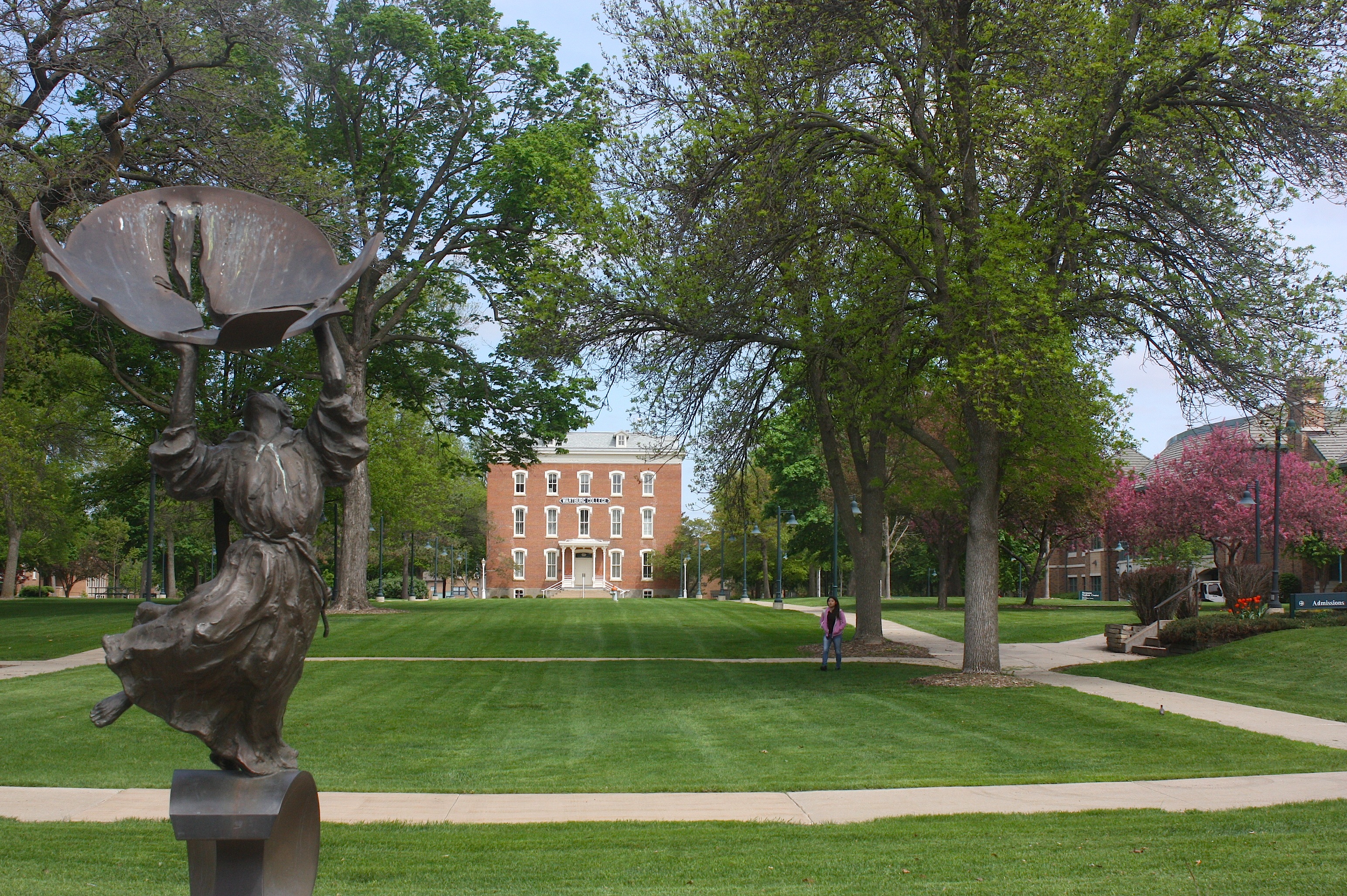
I started my self-guided tour of Waverly at the Wartburg College campus. I parked in a (friendly!) visitors’ parking spot just inside the entrance. The campus was very quiet. A groundskeeper was mowing the nearly perfect central lawn.
The campus is small, with an enrollment of 1,661 students. Although it dates back to the 1850s, the architecture is mostly new – 12 buildings have been constructed since 1990. A few of the buildings are old and lovely. The grounds are graceful. With the exception of a group of three young women discussing their laundry, the place was eerily serene.
I finished my campus walk and returned to my car. I drove around town, trying to find parks and the downtown area on my own, but I finally resorted to using the map in the Waverly Visitors Guide I’d picked up.
I drove to the Three Rivers Park, hoping to get a nice view of the Cedar River. The park was small and well maintained, with a large shelter house but not much else. The view was of Three Rivers Pond. A great place to picnic, but, alas, I had no picnic food.

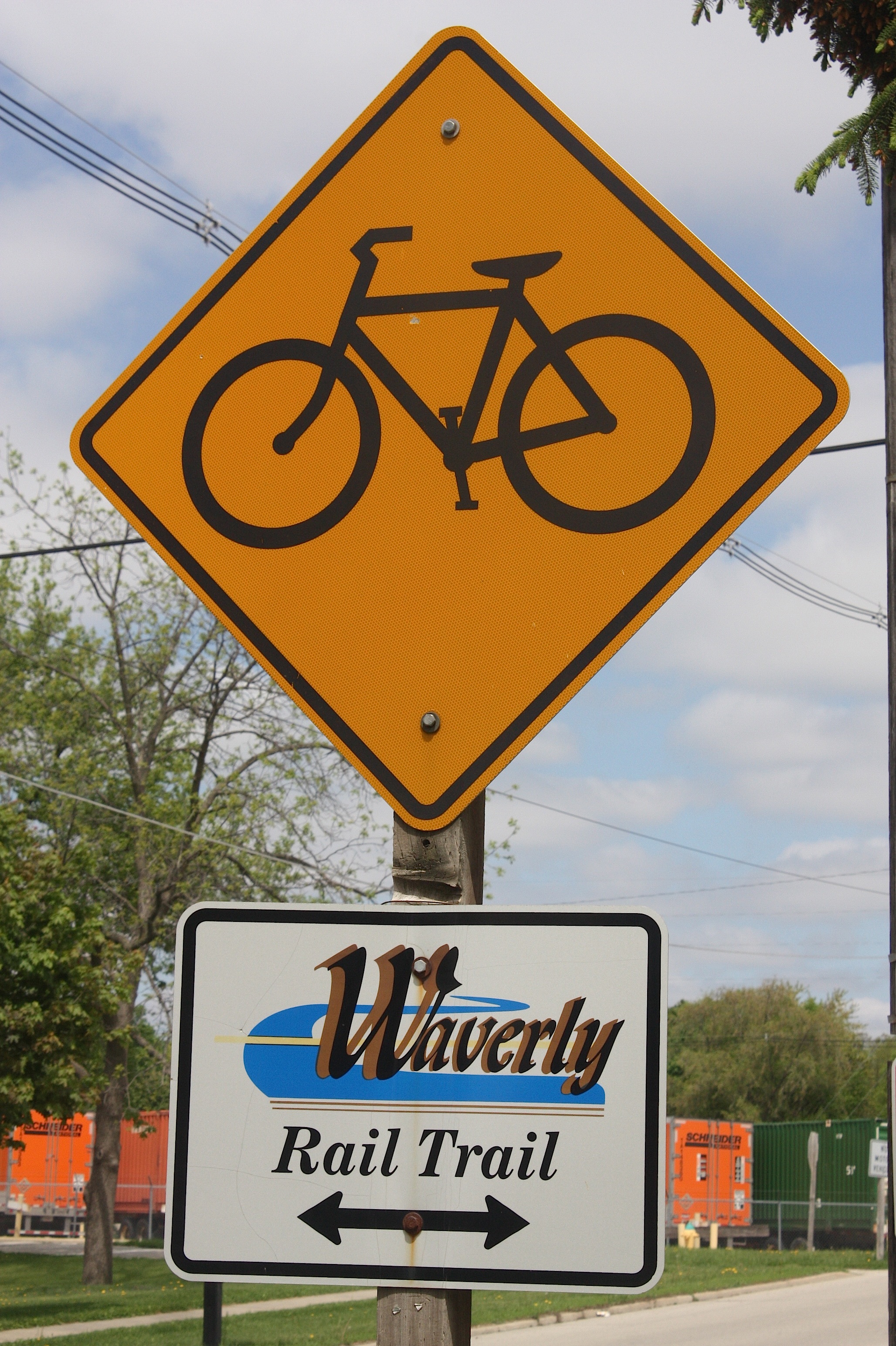 I crossed the Waverly Rail Trail, so I found a place to park my car and walked on the trail for a while. The trail includes seven bridges, three underpasses, parks, and river views. I parked near a Nestlé factory that smelled exactly like Nestlé Quik and made me crave chocolate milk.
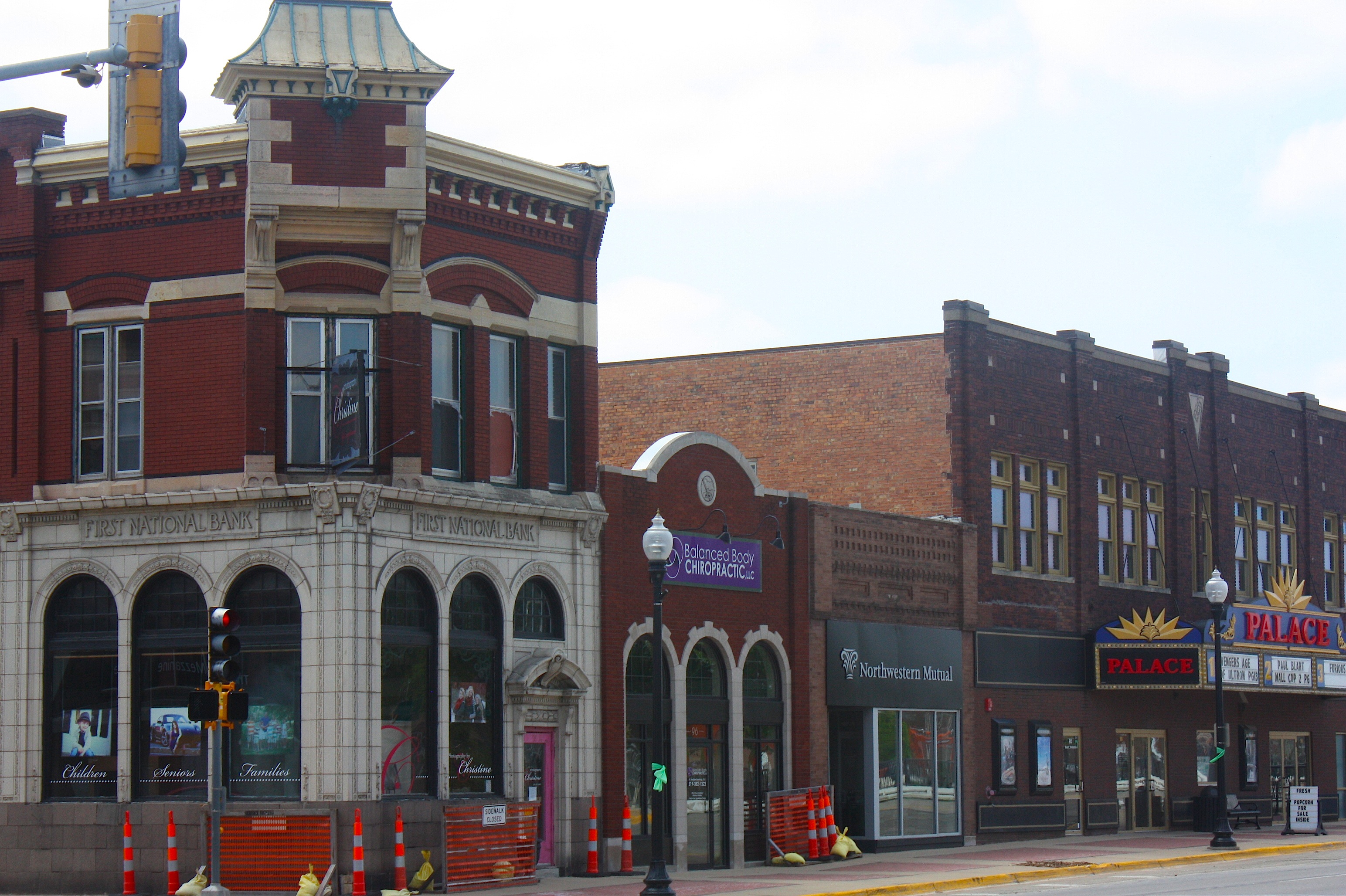
I parked downtown and took pictures of the cool old buildings and the Palace Theatre. There are plenty of downtown shops, bars, and restaurants to keep you busy all afternoon. I decided to eat at the East Bremer Diner, a decent if not memorable restaurant. The waitress called me “sweetheart” three times.
After lunch, I continued to explore. The Cedar River runs through town, with a dam located right downtown. I drove by the county fairgrounds, more parks, the very nice-looking high school, an outdoor pool with a twisty water slide, and the really gorgeous Waverly Golf and Country Club. I got a bit lost and turned around at the CUNA Mutual Group campus, which seems like a heck of a nice place to work. According to Wikipedia, CUNA is “a mutual insurance company that provides financial services to cooperatives, credit unions, their members, and other customers worldwide.”
So, back to my original reason for visiting: to try to figure out how Waverly managed to lure the Gentlemen of the Road concert (featuring lots of bands I never heard of, like My Morning Jacket, The Flaming Lips, Rubblebucket, and a few others, plus Mumford & Sons, who I really like) on June 19-20. Well, according to the Des Moines Register story, one of the musicians said this:
“The town has to understand that this is about them as much as it’s about us. We’re trying to celebrate what they’re about and have people travel there and have a really positive experience. Finding cities that are willing and cool is half the challenge.”
I think this is awesome. I would love to be able to attend this concert – maybe not camp out, which is what most people will be doing – but just see the crowd and hear the music and experience the joy. The concert itself will be, I believe, on the Wartburg athletic fields, with camping nearby. They’re expecting 35,000 people.
This will be the second time in recent memory that Waverly and Wartburg have been the center of a major event. Last year, Waverly was an overnight stop on RAGBRAI. They obviously know how to put on a party.
Call me a new fan of this charming town. And so I say: “Why NOT Waverly?”
Eat. Drink. Architecture.
How’s this for a great concept: A walking architectural tour of downtown Des Moines interspersed among stops at some of the city’s most popular bars? It’s like a super-classy pub crawl.
The Iowa Architectural Foundation’s fourth-annual “Eat.Drink.Architecture” fundraising event happened last Saturday, and despite the on-and-off showers and generally windy conditions, it was a very good time.
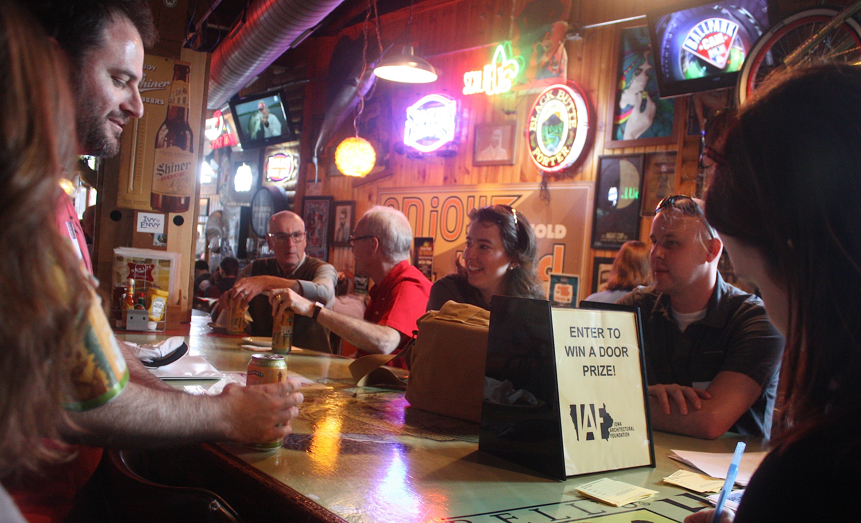
The event — described as a “progressive food, drink, and architectural tour of downtown Des Moines” — started at El Bait Shop at 200 SW 2nd St., home to the “world’s largest selection of American craft beers.” Or so they say. There we checked in and were assigned to our groups. My husband, Dave, and I were in Group 3; there were four groups total. Before we set out on our walk we were each offered a can of Summit Hopvale, a new organic beer from the Twin Cities, and an appetizer of buffalo chicken egg rolls. Since I don’t eat meat, and since I was nervous about drinking on an empty stomach, I ordered some chips and salsa and hoped the next stop would offer a vegetarian snack. The beer was OK…light, refreshing, and a bit too hoppy for my taste.
Also while we were waiting to take off, we learned more about the Iowa Architectural Foundation and participated in the door-prize drawings. My name was actually drawn FIRST – this never happens to me – so I won a cute Eat.Drink.Architecture T-shirt.
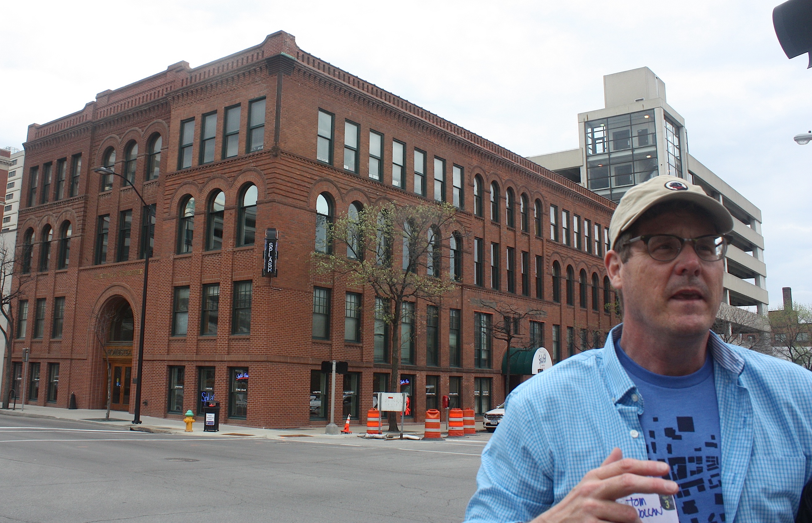
The first group took off and the rest of sort of chilled out at El Bait Shop and looked at the enormous beer list. The second group took off. And finally our group was called. We headed outside and got the low-down about how the tour would run by our group leader, Tom Wollan, a principal architect with FRK in Des Moines.

He told us that the El Bait Shop and sister bar High Life Lounge building had once been a transfer station and warehouse but had been purchased in 2004 by Full Court Press, Inc., owners of Hessen House, Mullet’s, Royal Mile, Buzzard Billy’s, Fong’s Pizza, and other popular bars and restaurants.
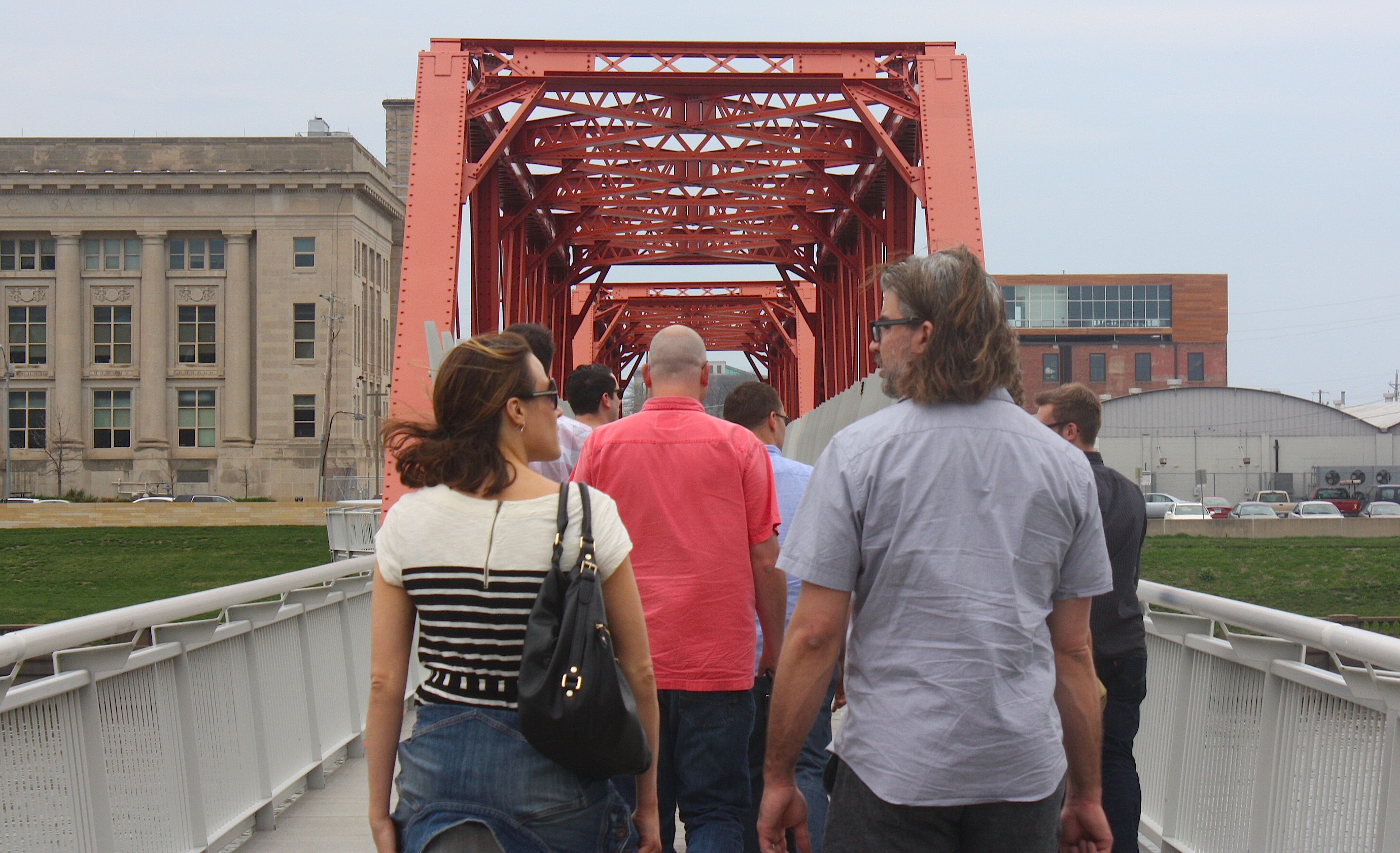
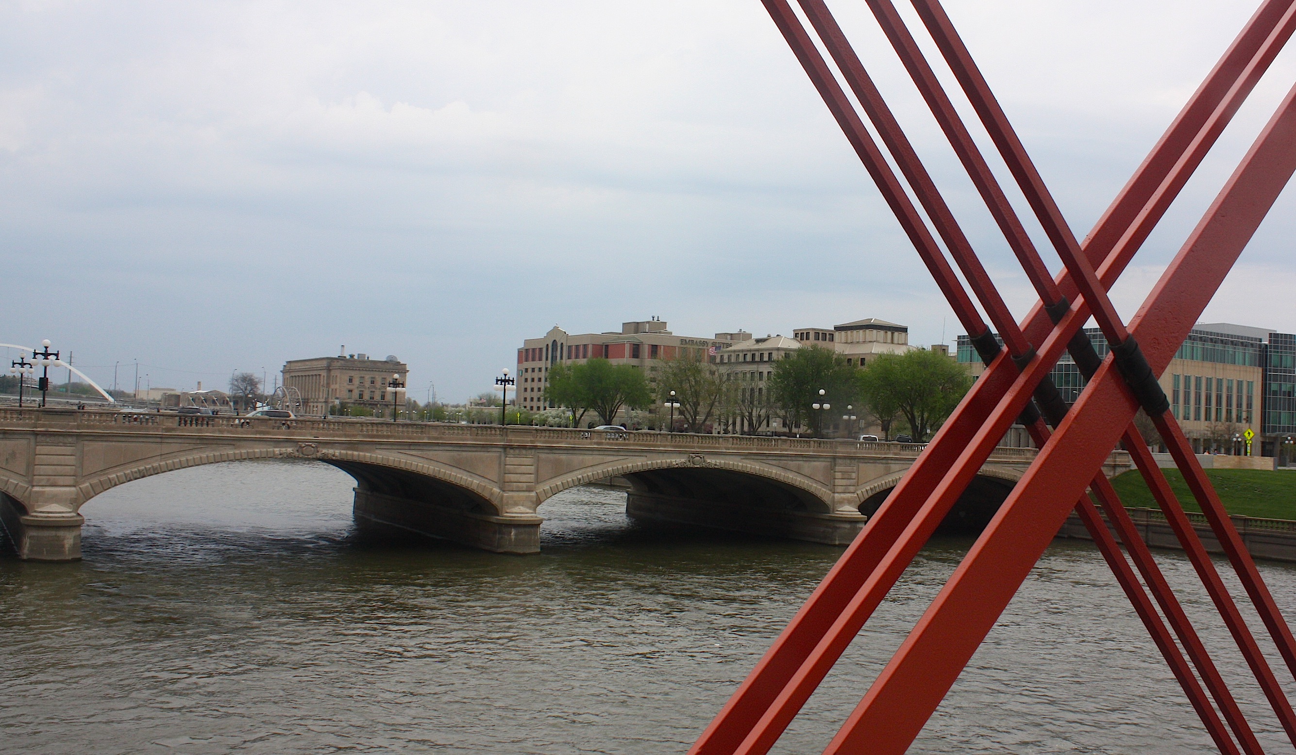
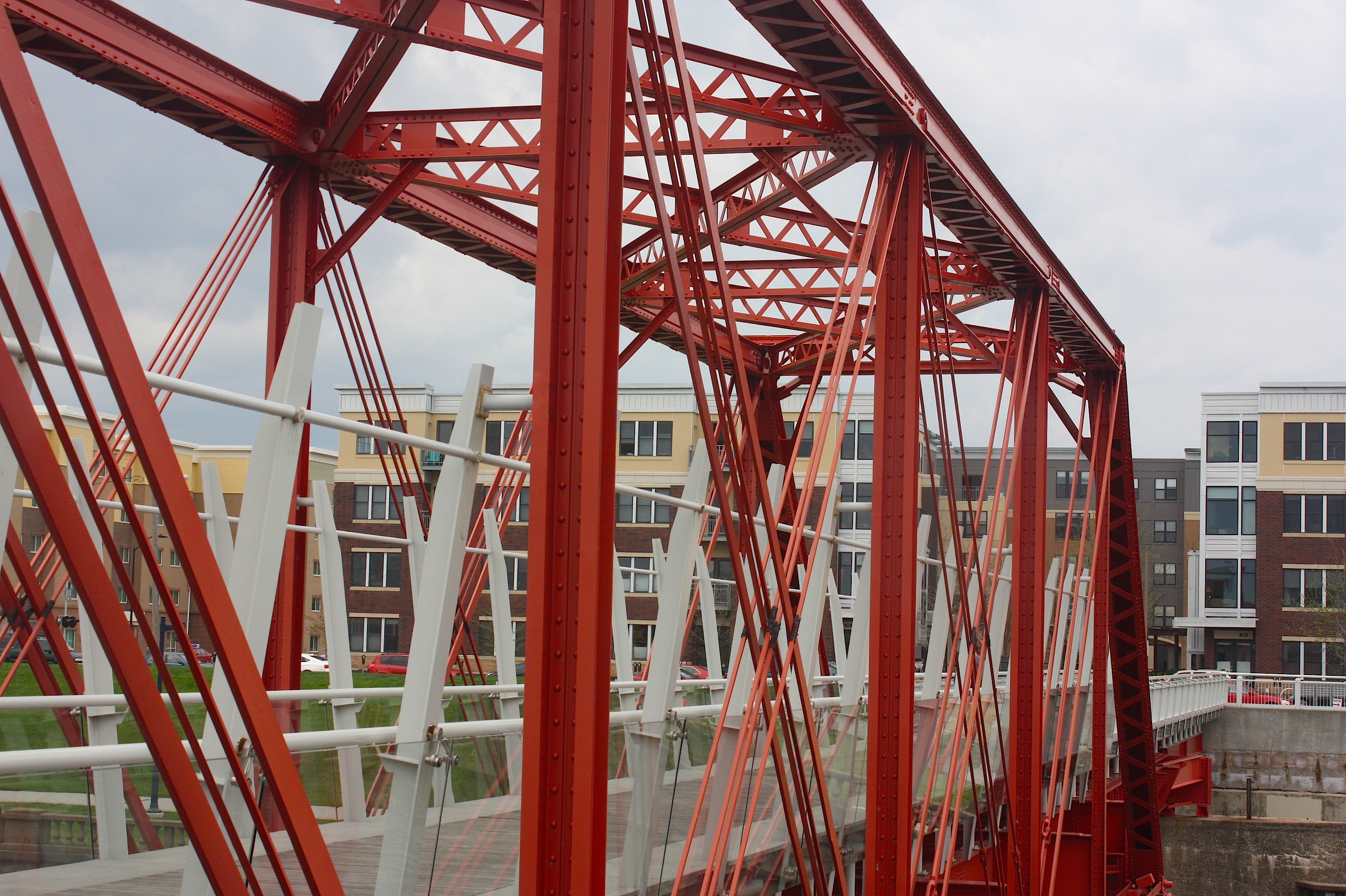
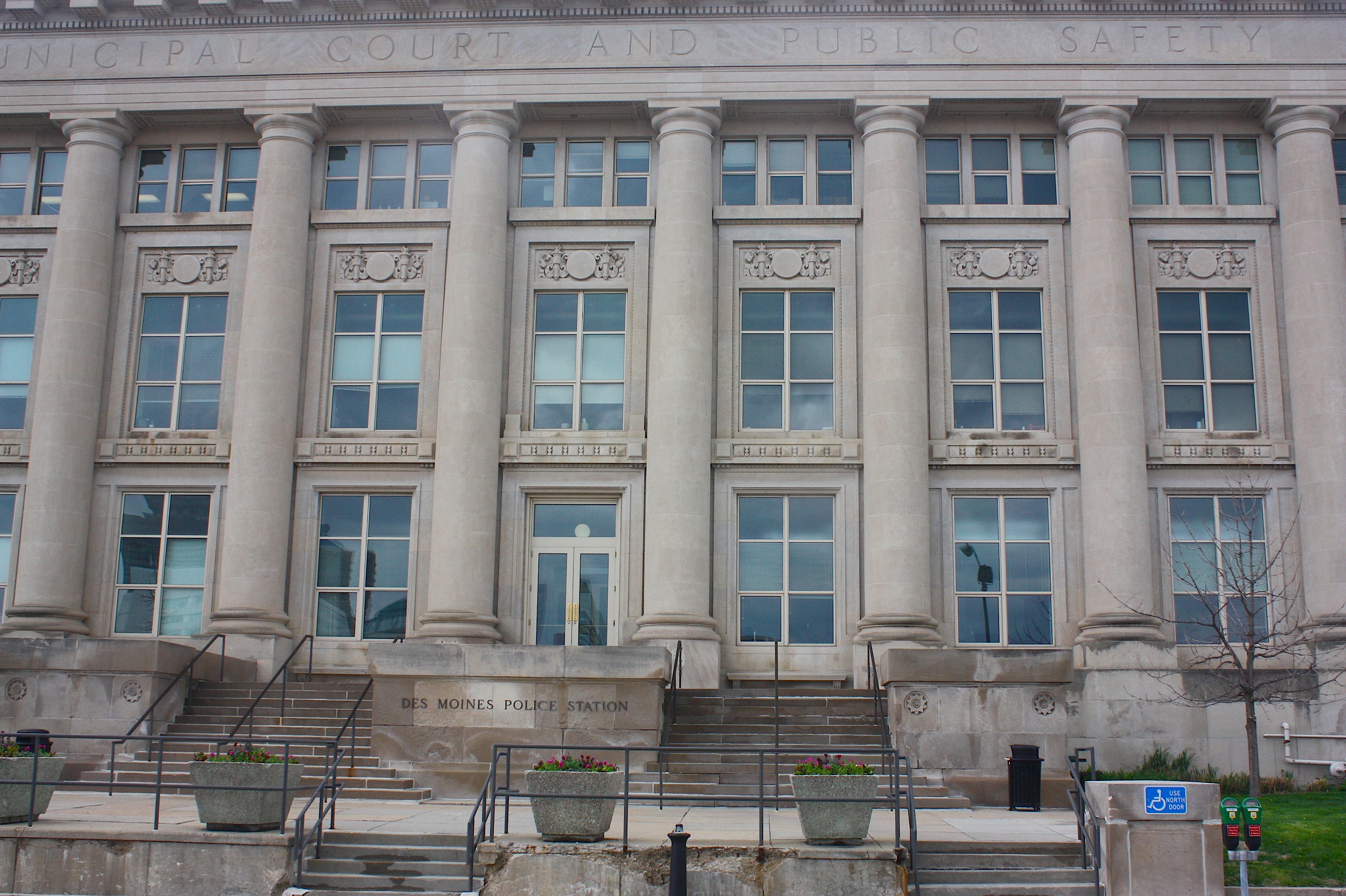
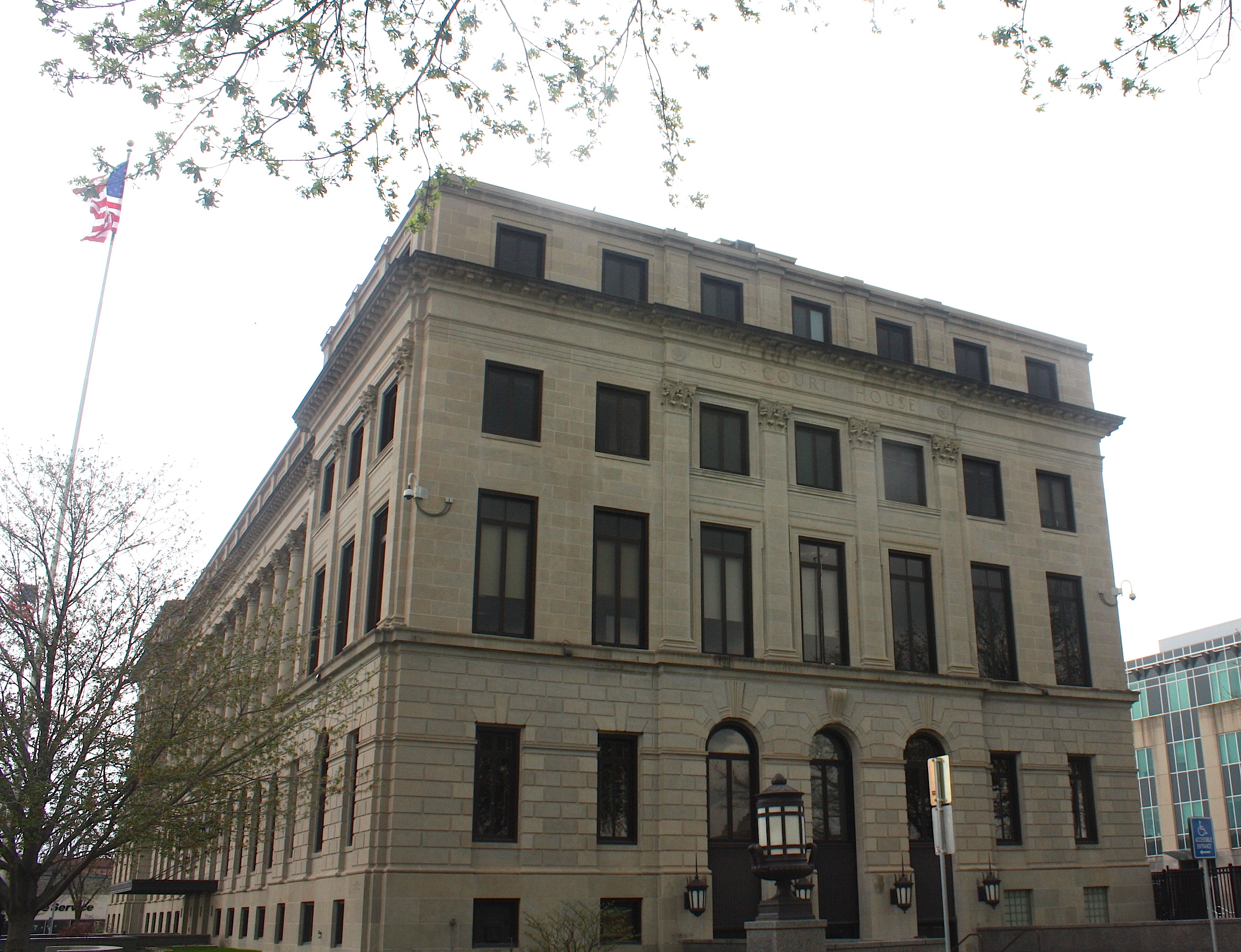
From here our group of about 20 people set off on our walk. We headed north and east and walked across the Des Moines River on the Red Bridge, a pedestrian bridge that was once a railroad bridge. We stopped on the bridge and took in the historic architectural sights on both sides of the river: The Polk County Courthouse Annex, the old Des Moines Library building that now houses the World Food Prize, City Hall, the Federal Courthouse and police station.
Wollan talked to us about the “City Beautiful” movement, a reform philosophy of North American architecture and urban planning that flourished during the 1890s and 1900s with the intent of introducing beautification and monumental grandeur in cities.
In addition to the historic buildings, from our mid-river vantage point we can also see examples of modern architecture, specifically the Embassy Suites Hotel and the Principal Riverwalk initiative. We can also see the glorious new Iowa Women of Achievement Bridge.
We crossed into the East Village, where we learned that city code decrees that no building can be built no higher than the state capitol. We also talked about the movement toward downtown living – in condos on both sides of the river.
From here we took a sort of meandering walk through parking lots and alleyways to a building under construction in the 200 block of East Third. Known as the Dilley Building, the large brick structure built in 1907 was most recently the location of City Plumbing Supply. Soon it will be the home of The Iowan, another bar/restaurant in the Full Court Press stable. (It should be noted that the good folks at Full Court Press donated all the food and drink for this Iowa Architectural Foundation fundraiser.)
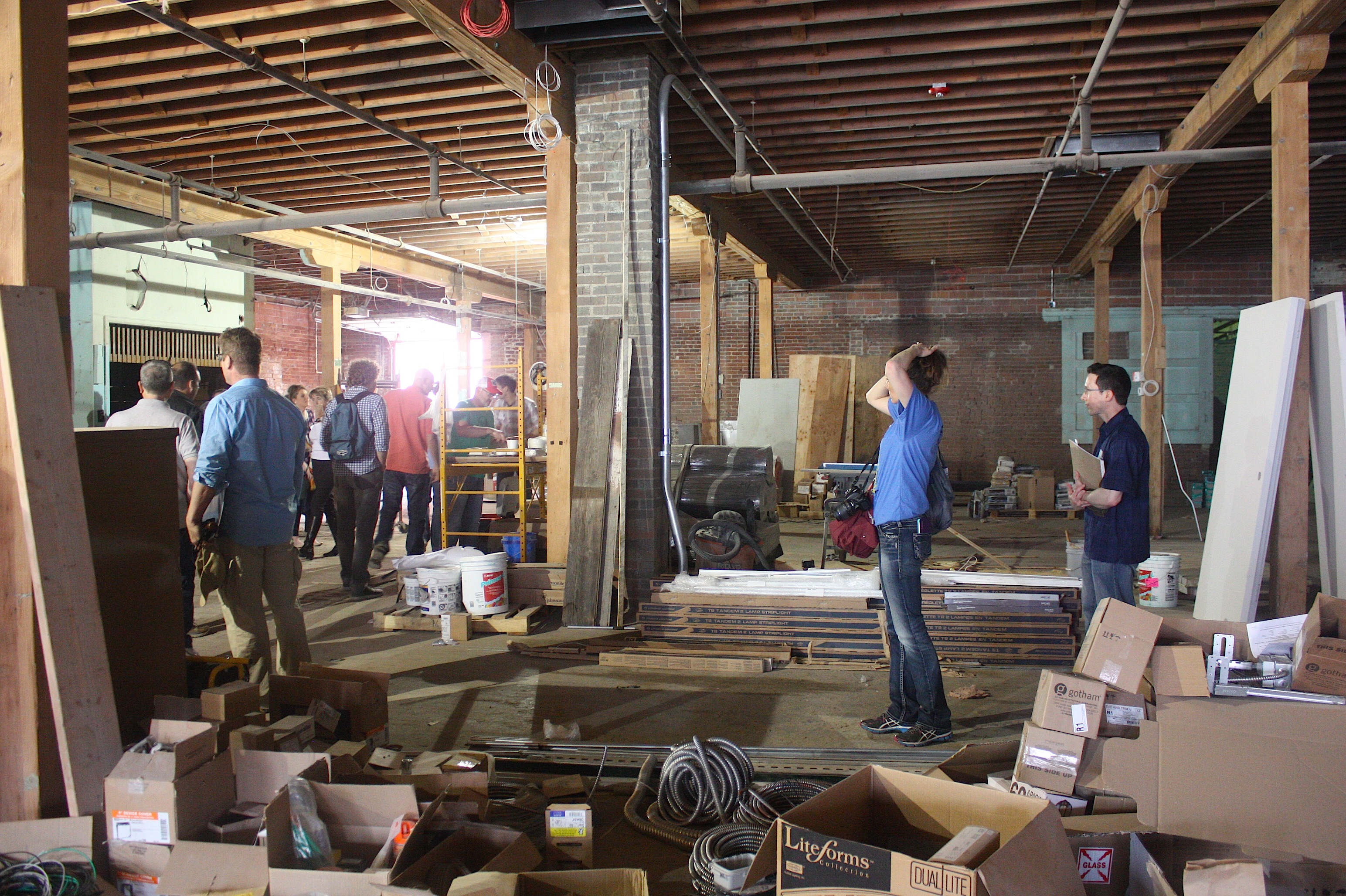
The building is definitely still a work in progress, but you can just imagine what it will look like, say, six months from now. Jeff Bruning, one of the Full Court Press owners, told us about the building and also about the new all-Iowa craft beer hall concept: The building was a lithograph company in WWII, a warehouse, and home to a tire manufacturer. In its new life, it will celebrate all things Iowa: beers, cheese, distilled spirits, wine – all made in Iowa.
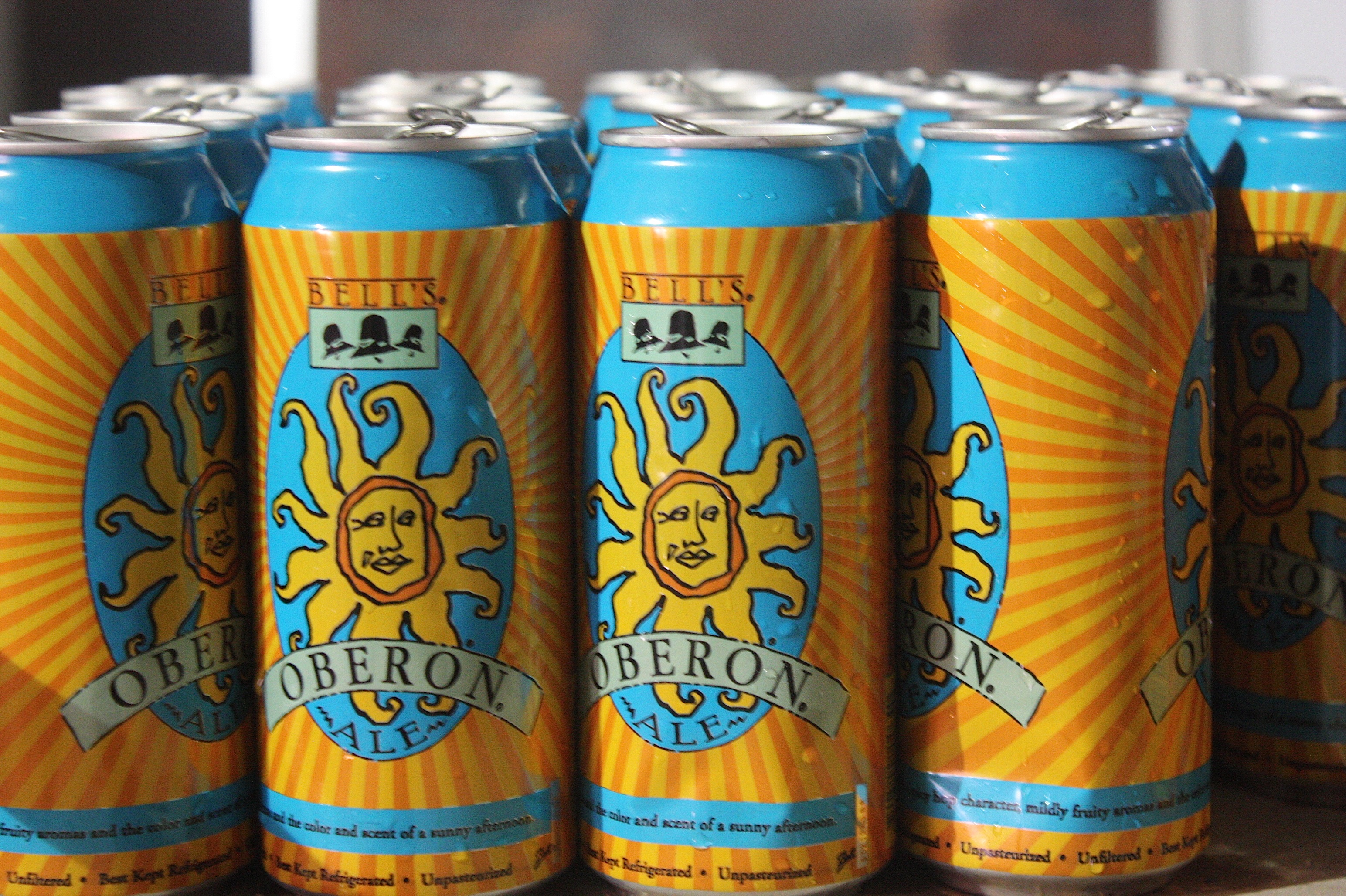
Excited about this possibility, I nearly forgot that we got to eat and drink at this stop. We were offered cans of Bell’s Oberon Ale, which was really good, and some kind of meat wrapped in more meat – maybe a little smoky in bacon? I declined.
After our food and drink and friendly chatter, we headed back out, through the streets of the East Village, and across the Locust Street Bridge, with more views of City Hall and the World Food Prize building and some discussion of the recently shuttered Downtown YMCA building. We also got an opportunity to touch the exterior walls of the Civic Center, but I’m not sure why.


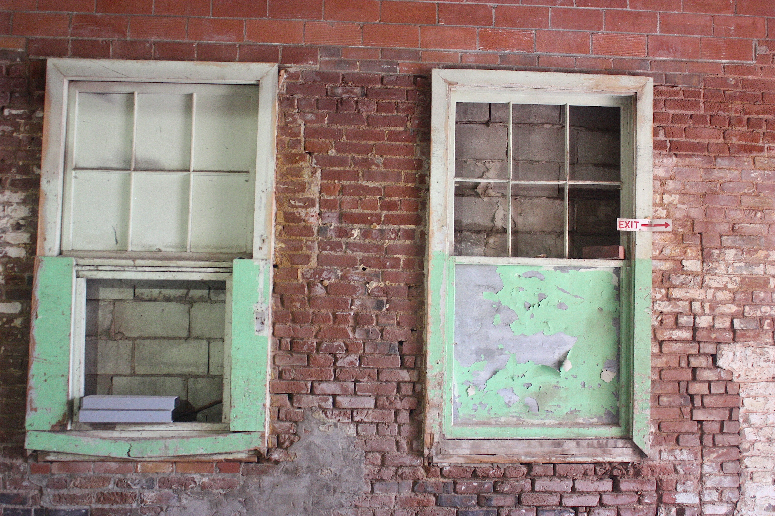
“Buildings tell a story,” Wollan told us, using as an example the Homestead Building (above), home to Splash restaurant. He pointed out how we could see that the building had been built on to by looking at the different bricks and architectural styles.
From here, we crossed by Cowles Commons, still under construction, and toward Hotel Row (Fourth Street between Walnut and Court).
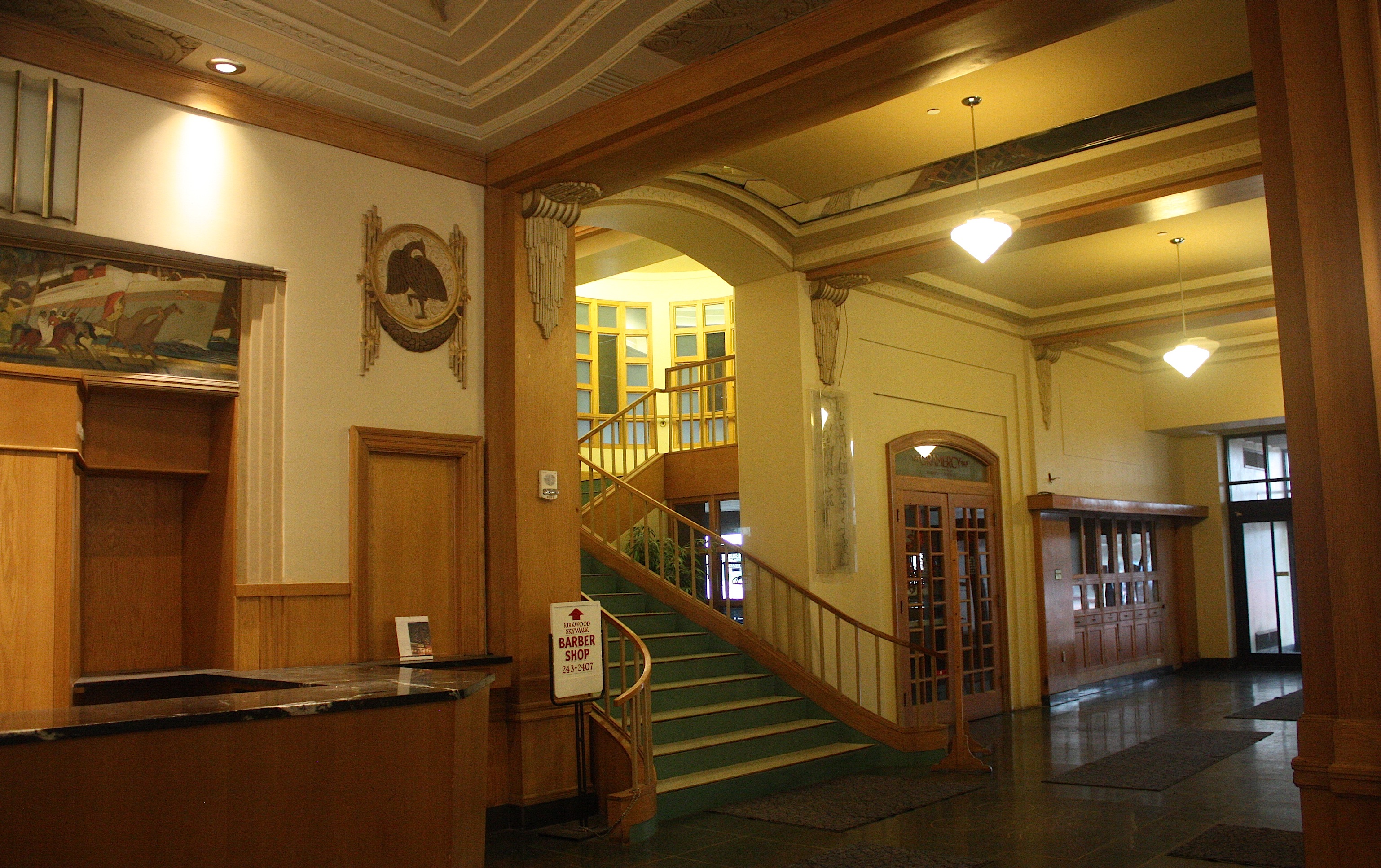
At this point it was raining, so we ducked in to the Kirkwood Hotel and had a nice discussion of the lobby’s art deco style. Our group was flush with architects and interior designers, so Wollan frequently gave up the floor to guest speakers who had specific knowledge of one thing or another.

Our next stop was the Royal Mile (410 Fourth Street), where we were served Scotch eggs (which contain sausage) and a pint of Tallgrass Pub Ale. By this point, I didn’t even care about the food. I was enjoying the beer and the conversation.

It didn’t seem like we were at the Royal Mile nearly long enough before we were moving along toward our next stop – via the skywalks. I believe the skywalk route was a last-minute decision based on the rain showers that were occurring at the time, but it was fun to stand inside and watch the rain while hearing about the Randolph Hotel, the old Elliott Hotel (now Fong’s Pizza), and the Saddlery Building (home to Court Avenue Brewing Company).
Court Avenue was once an area for light industry and commerce. The Italianate fronts of the buildings are a bit fancy, with simple brickwork on the sides and back. “Very Main Street America” according to Wollan.
Eventually we had to pop outside into the rain and walk a couple of blocks to Hessen House (101 Fourth Street), our final stop. Standing outside under the awning, Wollan pointed out the 801 Grand Building, the Science Center, the depot, and other structures within our view.

Inside, Hessen House, a German-themed bar and restaurant known for beer consumed out of enormous boot-shaped glasses, was hopping. A wedding party poured out of a party bus and went inside while we were waiting to go in, so we were lucky to have a reserved seating area.
 I do enjoy German beer, but German food is really not my favorite. So I was pleasantly surprised when the server brought out small pieces of Dutch apple pie with ice cream as our snack. Something I could actually eat! Hallelujah! Dessert came with a beer cocktail called a Hessen Grapefruit Radler Rita – vodka with Stiegel Grapefruit Radler Bier. It was yummy.
And with that, our four-hour tour was over. Four drinks, four snacks, and a fun tour of downtown Des Moines. If you like the idea of the architectural walking tour but don’t want to wait for a year for the 2016 Eat.Drink.Architecture event, you can explore downtown with the Iowa Architectural Foundation’s annual summer Architecture @ Hand walking tours. Tours are the second Friday of each month, May through September, beginning at 5:30 p.m. at the IAF office, 400 Locust Street, Suite 100. Cost is $10 and supports the IAF.
Spring, glorious spring

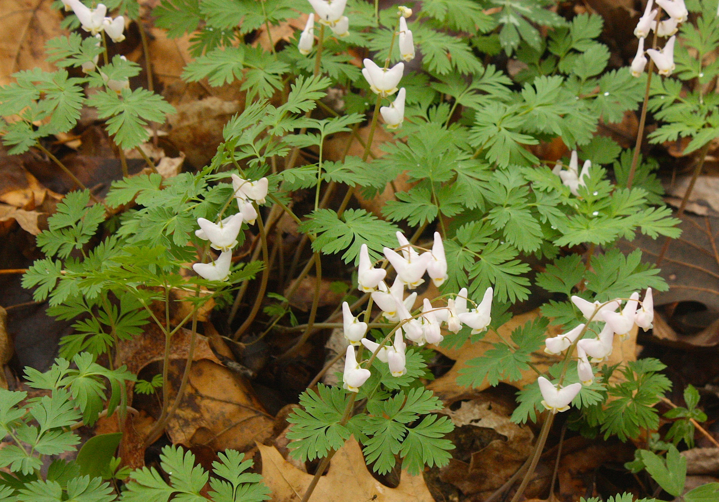
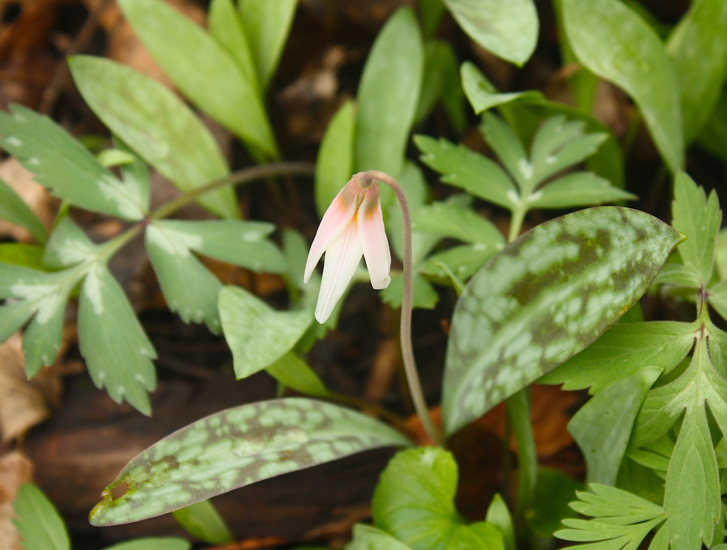
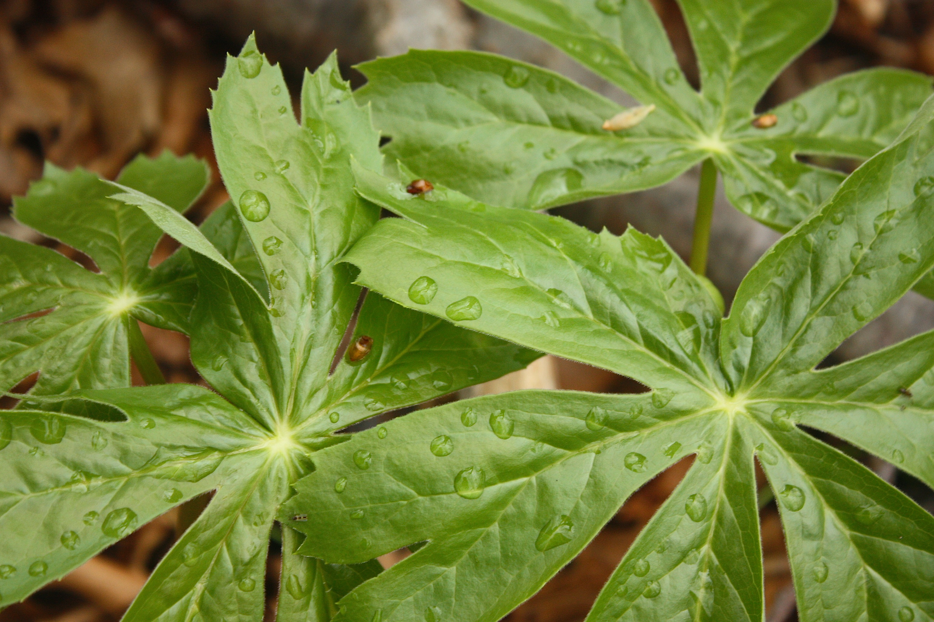
Spring wildflowers, how do I love thee? Let me count the ways: I love your bloodroots and Dutchman’s breeches, your Virginia bluebells and wild ginger, your shy violets and your May apples that look like little umbrellas. I love your trout lilies and Jack-in-the-pulpits and ferns, even though technically I guess ferns are not really flowers.
Last weekend I made my annual trek through McFarland Park, a Story County conservation area just north of Ames, to view the bounty of wild flowers blooming there. I was not disappointed.