Driving RAGBRAI XLIII: Day 1
Next to the State Fair, RAGBRAI – the Des Moines Register’s Annual Great Bicycle Ride Across Iowa – is about the most “Iowa” thing you can do during the summer. It’s the best idea ever: an enormous convoy of cyclists from all over the country converges on Iowa for one week to see the beauty and friendliness of the state while peddling along back roads and county highways. Oh, and eating pie and drinking beer and listening to bands that haven’t been popular for 30 years. So awesome!
But the thing is – and this is important – even if I did own a bicycle, which I do not, the idea of sitting on a bike seat, peddling up and down all those hills, baking in the July heat, standing in line for porta potties, and sweating with 10,000 of my closest friends in a campground? Um, no thanks.
But the roads…and the countryside…and the small towns: Those call my name.

Twice I’ve “intercepted” the crush of RAGBRAI bicycles as they rolled across Iowa: once for three days when I covered the ride from an Iowa State University viewpoint for VISIONS magazine; once when the route was so close to Ames that I couldn’t stand not visiting just a few of the pass-through towns and glomming on to some pie for myself. And two years ago I set out to drive the route the week before the actual ride, only to fail miserably after just one “ride” day – less than 100 miles – because my schedule just didn’t cooperate.
So this year I vowed I’d do the whole thing. From Sioux City to Davenport, through hills and farm fields and tiny towns and bigger cities. I’m driving the route with a friend who, like me, thinks he’s been everywhere in Iowa but, as it turns out, has not. Some of the pass-through towns on this route don’t even show up on a map. Part of the joy of driving this route is discovering these hidden gems.
This year’s RAGBRAI ride will be held July 19-25. If all goes well, the car drive will take three days. Here’s Day 1: Sioux City to Webster City.
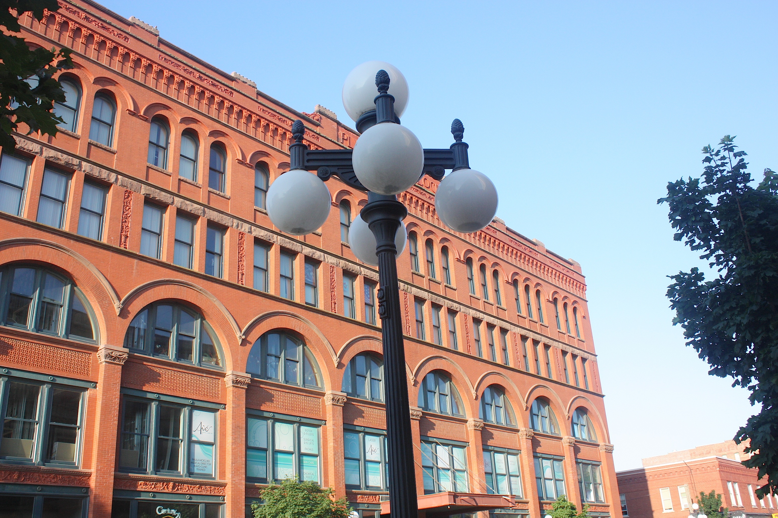
We started in Sioux City after already being in northwest Iowa for a full day, doing research and photography for a story for an upcoming issue of VISIONS. We’d been pretty much eaten alive all day by mosquitoes and ticks, so we were smelling of insect spray and sweat when we arrived in Sioux City Friday night. Desperate for food and drink, we headed to the bar-and-restaurant dense Historic 4th Street area (above). We opted for Buffalo Alice’s pizza – a pretty good choice, with a gazillion beer choices and build-your-own pizzas. Nearby, the streets of downtown Sioux City were hopping, with live music being performed outside while we ate.


The next morning, we explored the city: the Hard Rock Hotel & Casino (not my cup o’tea), Palmer’s Olde Tyme Candy Shoppe (“Making Life Sweeter Since 1878!”), the Sioux City Art Center, Lewis & Clark Interpretive Center, Sgt. Floyd river boat, and the Anderson Dance Pavilion on the Missouri River. Pretty much everything was closed at that early hour, unfortunately, so we just poked around outside.
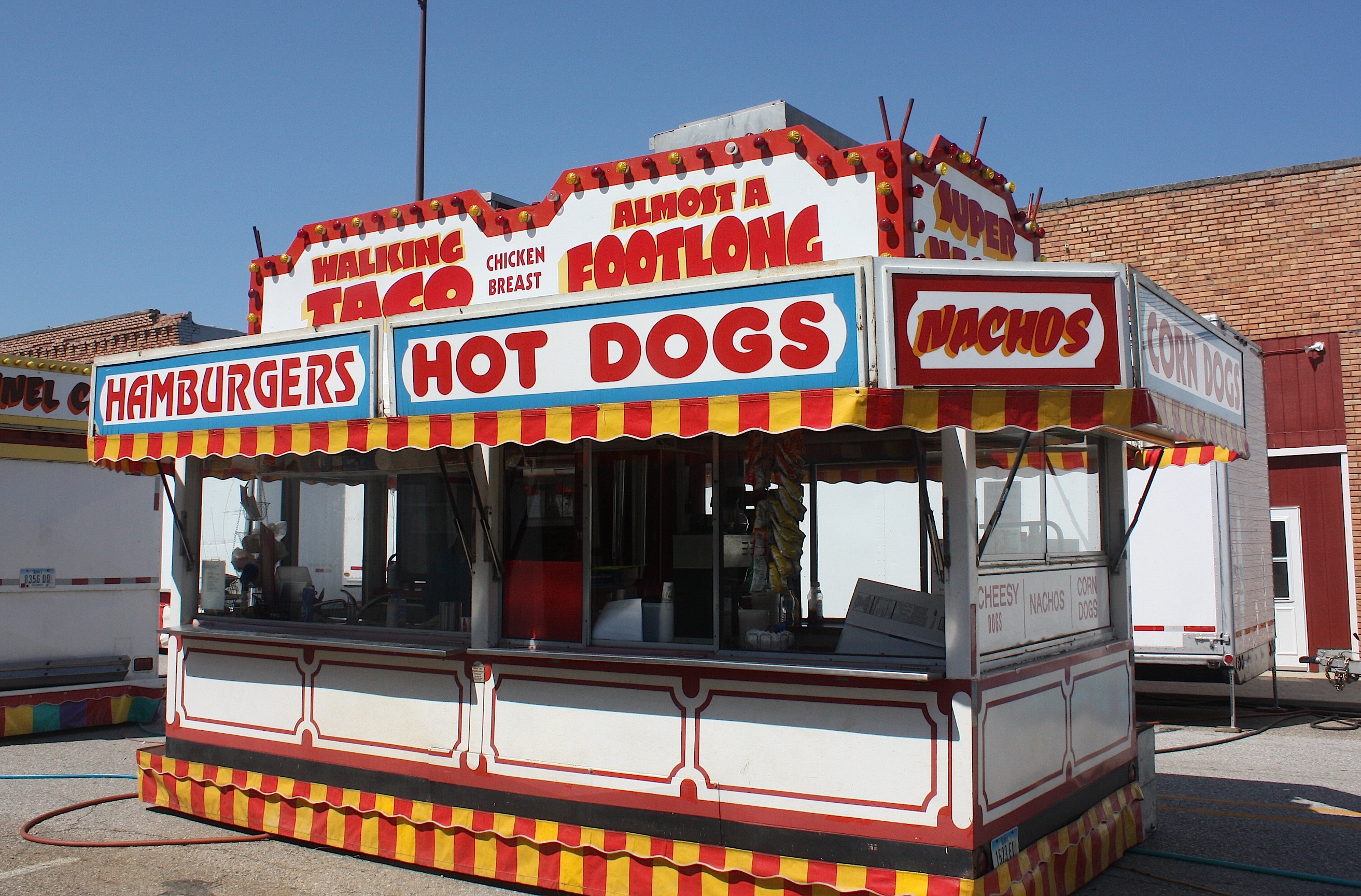
Sioux City (population 82,684) is the Woodbury County seat. During their initial overnight stay before the ride gets started, RAGBRAI-ers will be treated to the sounds of Huey Lewis & the News as the city “Parties Like it’s 1973” in the Tyson Events Center parking lot.
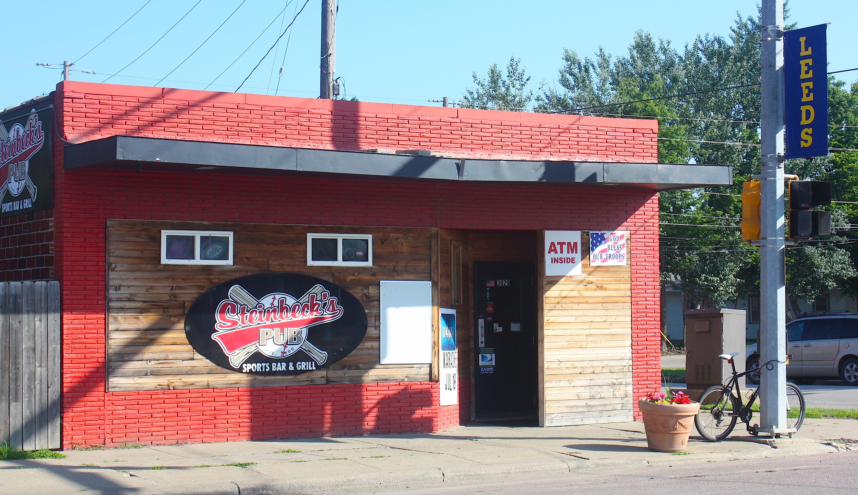
Just outside of Sioux City – really, a part of Sioux City – is Leeds, the first stop on Day 1 of the bike route. This community/neighborhood in northeast Sioux City was founded in April 1889 and annexed like five minutes later by Sioux City. Steinbeck’s Pub looks like a fun place to stop for an early-morning brew, if riders are so inclined. And many will be.

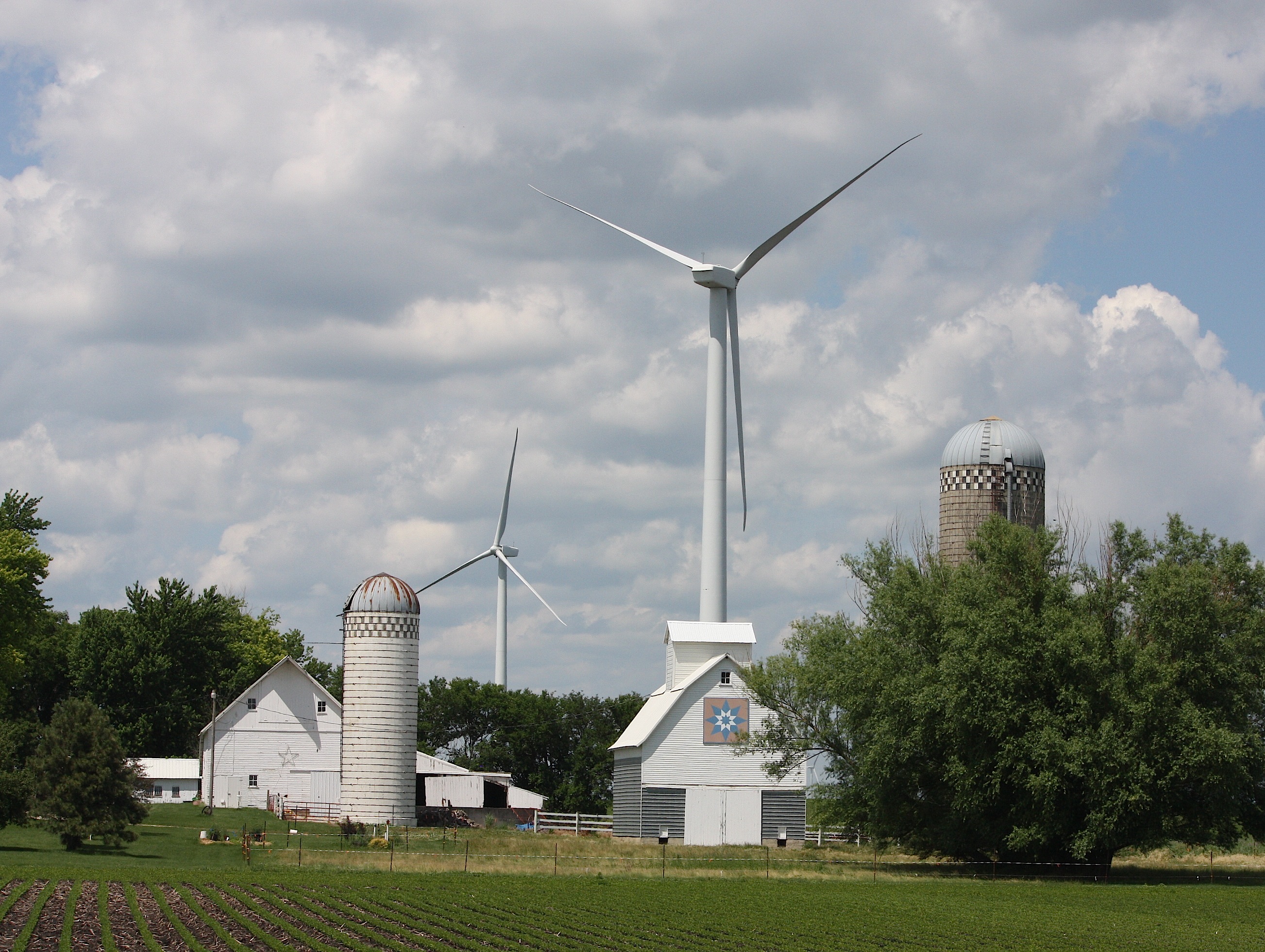
Heading out of the city and on to the open road, riders who think Iowa is flat will have an interesting time maneuvering the hills in western Iowa. In fact, today’s ride includes 4,110 feet of climb according to the Register. But what makes for a difficult bike ride makes for a gorgeous drive, and the section between Leeds and Kingsley is the prettiest on today’s route.

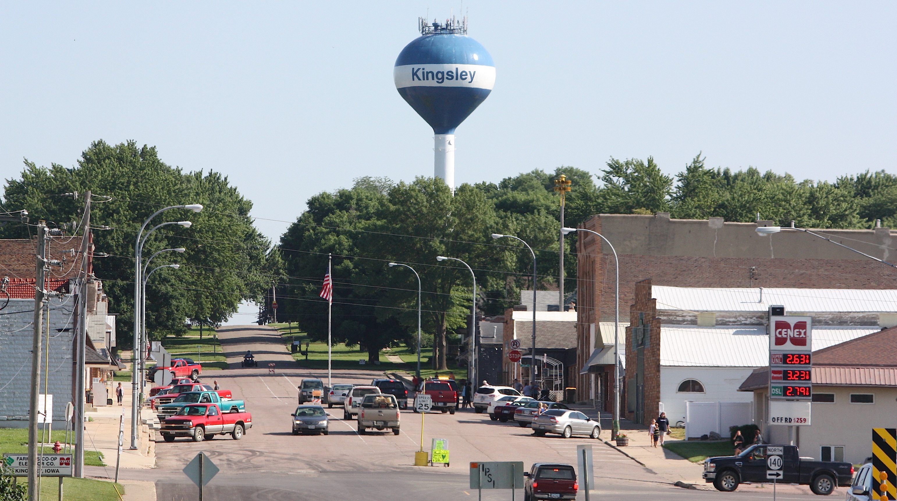
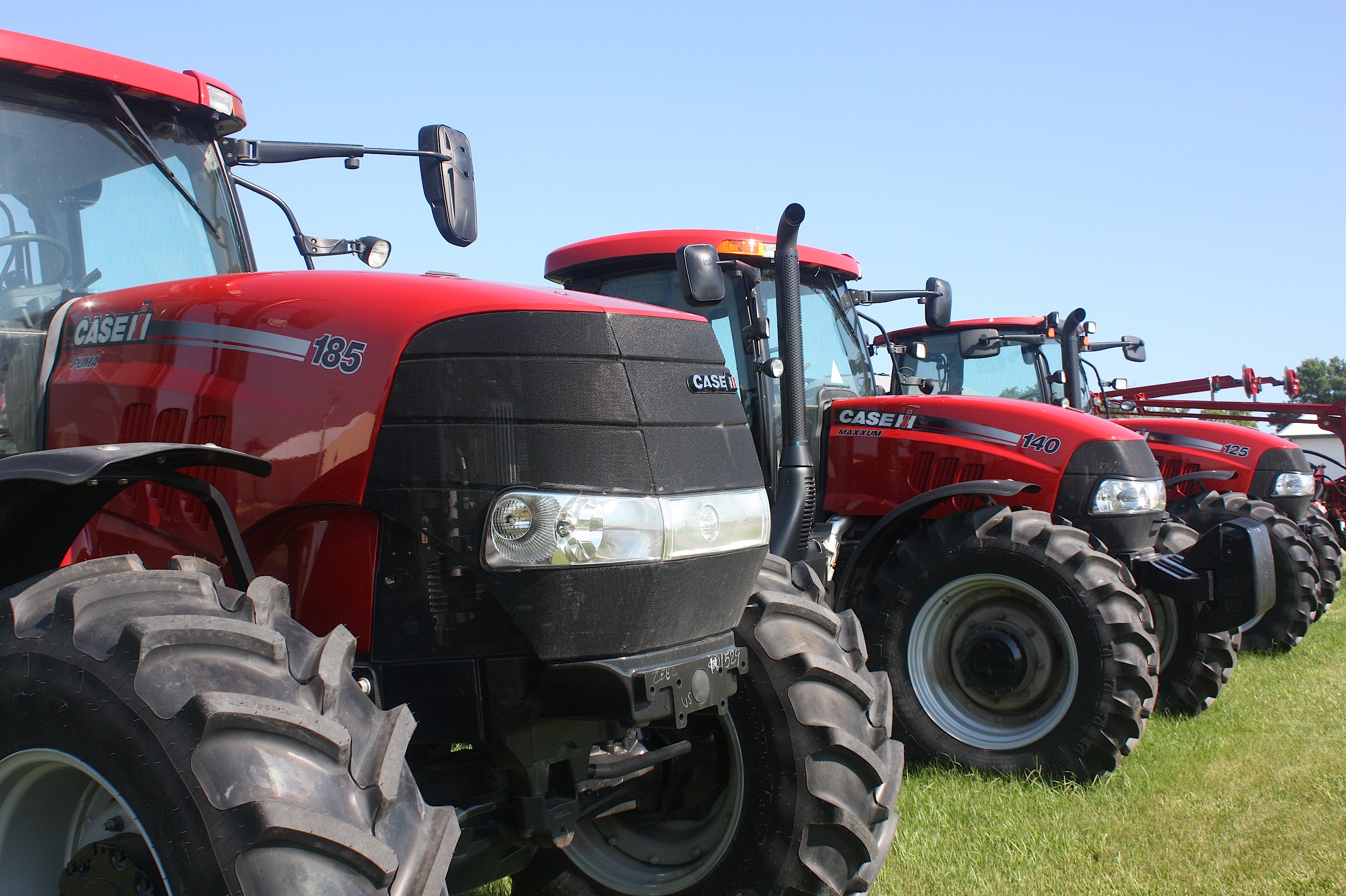
Rolling into Kingsley (population 1,411; motto “Some Bigger, None Better”) we found farm implement dealers on each end of town, which makes sense, because the town’s RAGBRAI theme is all about antique tractors.

Folks in Kingsley were getting ready for some kind of afternoon parade, with a fun run and some other stuff happening on this glorious summer Saturday. The town’s mix of older and newer homes with neat, sprawling lawns makes this Sioux City bedroom community pretty desirable for a town this size. In fact, the population grew 12% between the 2000 and 2012 census, and 166 new homes were built during that time. Kingsley has a golf course, swimming pool, city park, walking/biking trail, ball fields, tennis courts, a teen center, and five churches.
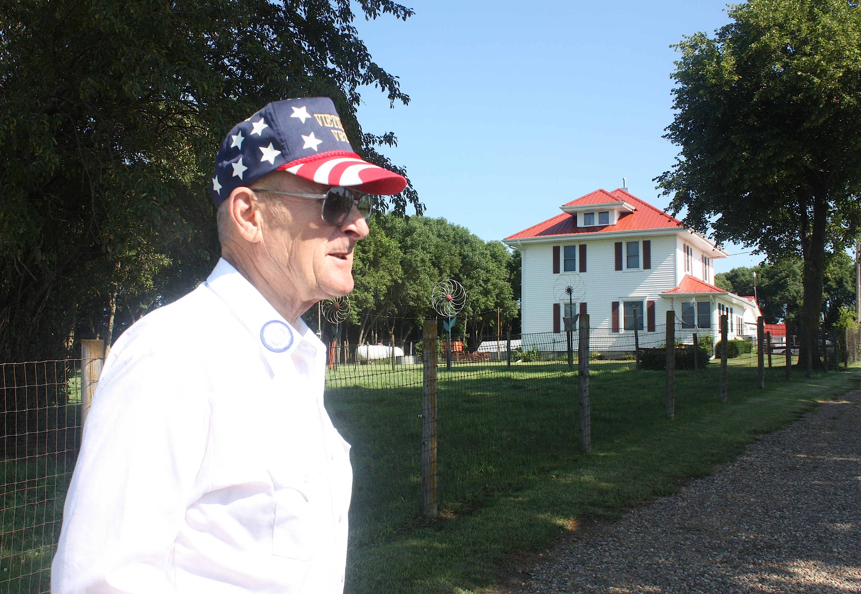
Just outside Kingsley on route C66 we ran into Don Riemenschneider, a farmer and military veteran who lives on the farmland bought by his father in 1945. He gave us a walking tour of his front yard, with a carefully curated collection of farm implements and other memorabilia. Riemenschneider was rightfully proud of his home and farm buildings — with their bright white sides and fire-engine red roofs, they stand out from others along the highway.
Just as we started to leave, a lone cyclist rode by. “Not exactly RAGBRAI,” I said to him. “But almost!” he called back.

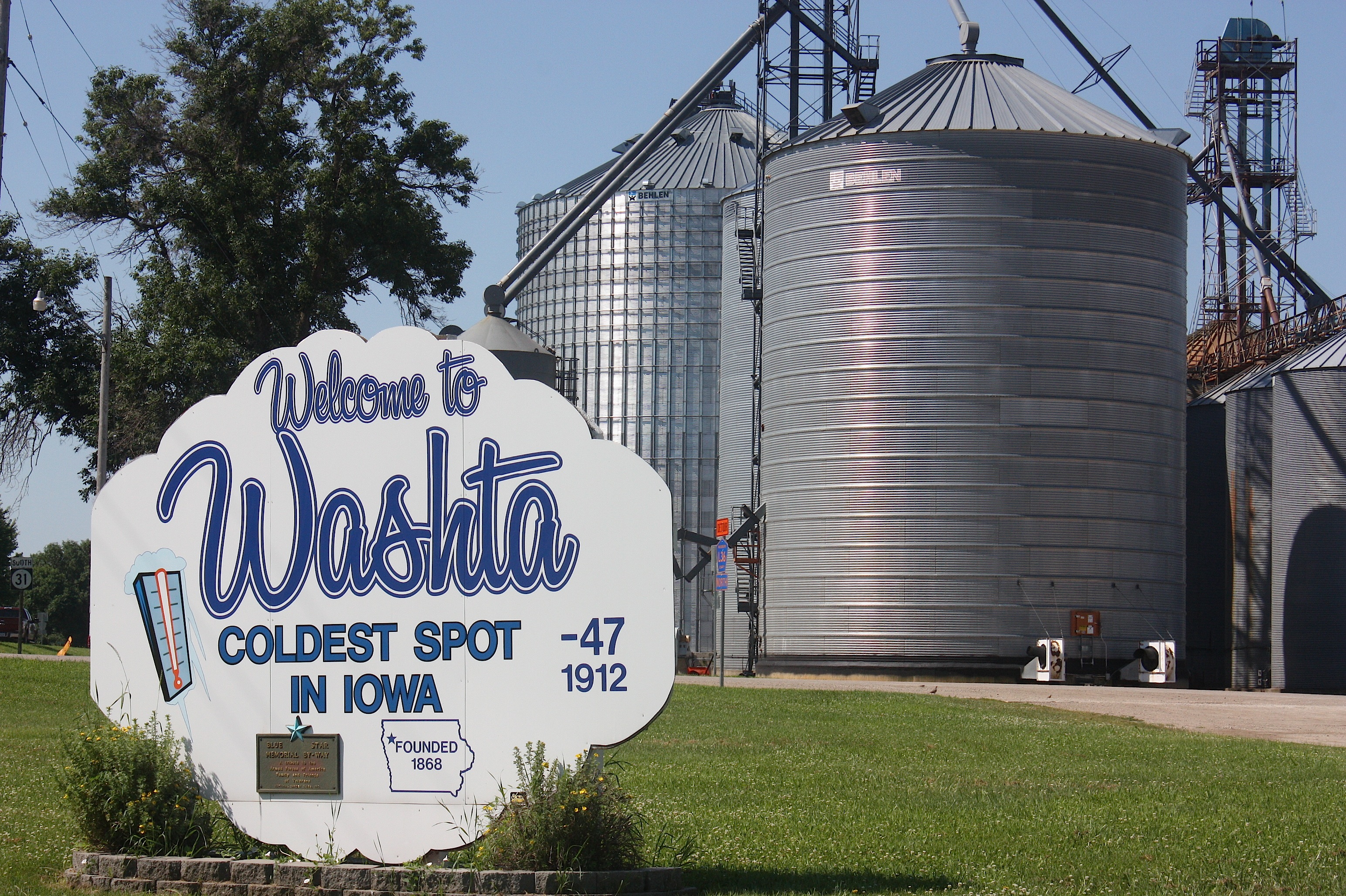
The next stop, Washta (population 248), holds the distinction of being “The Coldest Spot in Iowa,” having recorded a temperature of 47 degrees below zero without wind chill on Jan. 12, 1912. Today, there’s not much going on in Washta, although we talked to a woman at the post office and bought a big bag of Twizzlers at the convenience store on the edge of town.
This started a long discussion in the car about where older folks – or anyone without transportation, for that matter – buy food in some of these small, tucked-away Iowa towns. Many of the communities we visited today had no apparent source of food, despite being surrounded by abundant farmland. Some had Casey’s or other convenience stores, but those offer mainly packaged foods. None of the smallest towns had a visible grocery store.
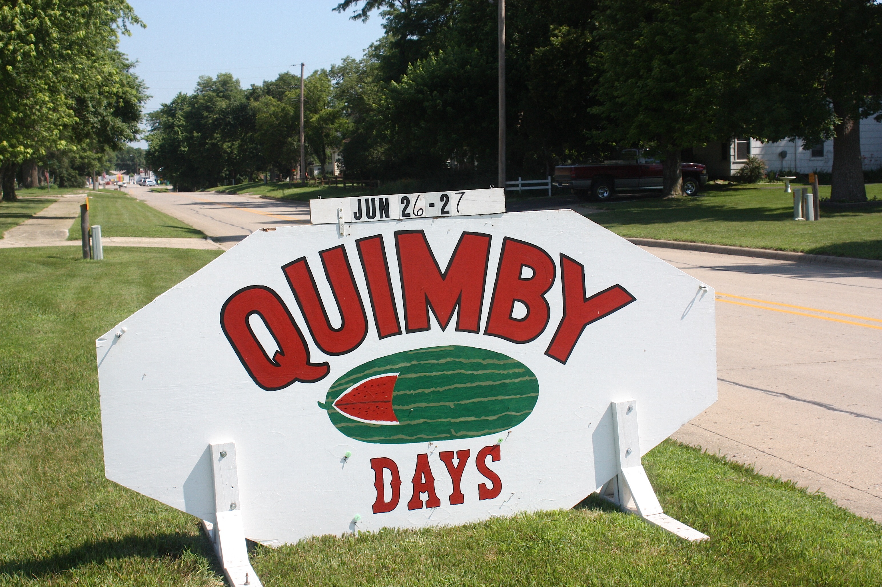
As we drove, we followed the Register’s March 8 guide to RAGBRAI towns because it includes a detailed map of the route and also because it includes highlights of each town. Nearing Quimby (population 319) we suddenly realized that the town’s Watermelon Days celebration was going on RIGHT NOW. We were stoked. I dug money out of my purse, hoping to buy a big, cold, drippy slice.

But it was not to be. Yes, Quimby Watermelon Days were indeed this weekend. But apparently things don’t get started too early around here. We were there mid-morning, and there was plenty of evidence of a festival – chainsaw artist at work, food stands and carnival rides at the ready – but nothing happening YET. And no watermelon to be seen. I’m guessing everything springs to life after dark.


Driving along C63 en route to Hanover, we spotted a friendly bicycle sculpture just in time for RAGBRAI. And then we saw a peaceful cemetery framed by wind turbines. This is the stuff you don’t see on the interstate.
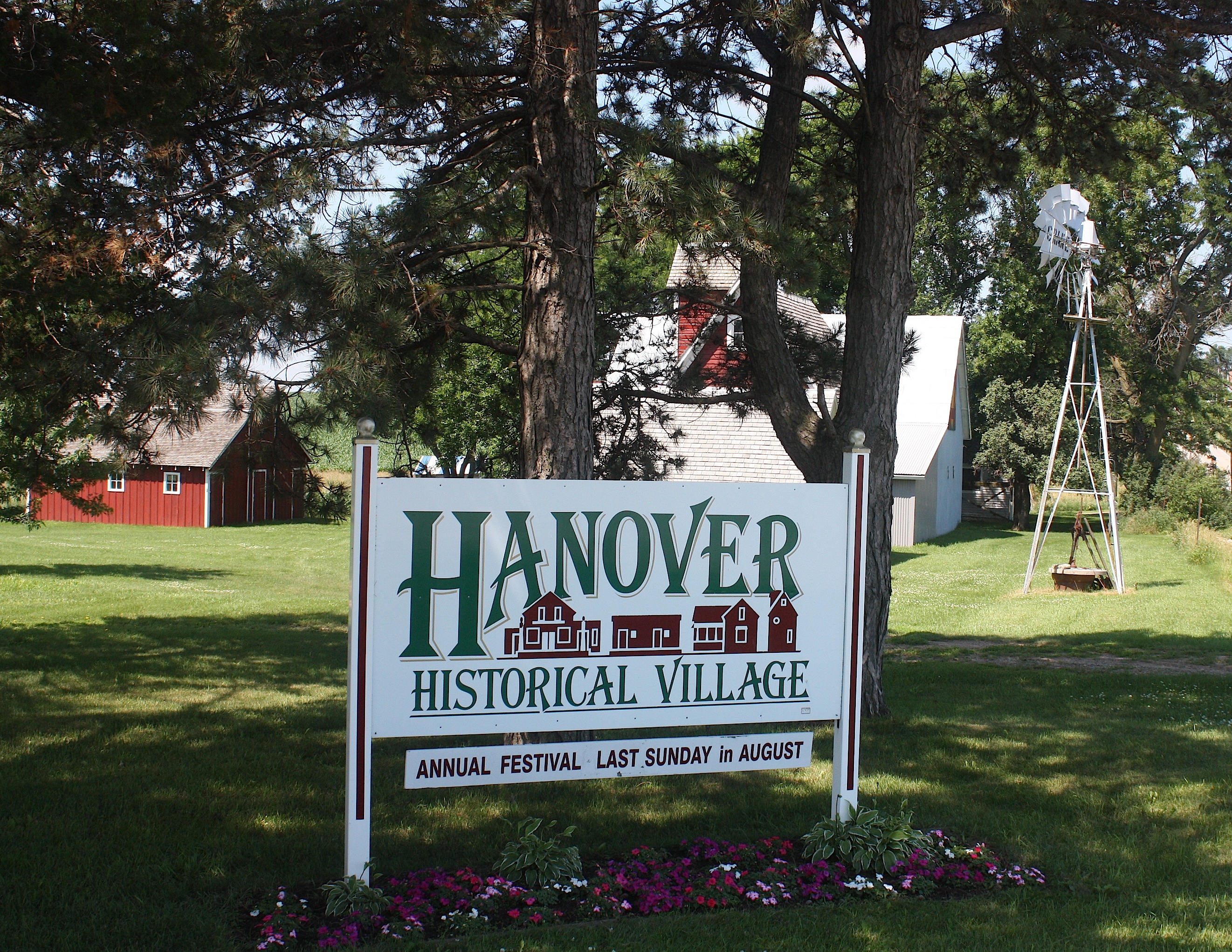
And then we came upon the Hanover Historical Village, the cutest little place you ever saw in the middle of Nowhere.
There’s a restored country general store with original furnishings, an old-time barbershop, two-story machine shed, historic home, windmill, working mill house, and a display barn. There’s even an annual Hanover Festival; this year, it’s on Sunday, Aug. 30, 2015. Here’s what the website says: “Come and help us celebrate our festival with toe-tapping polka and old-time music to listen or dance to. All buildings will be open, and numerous displays, demonstrations, games, and petting zoo will be enjoyed by all. Food is also available. Gates open at noon with music from noon-7 pm. Admission will be charged to all over 14 years of age. Free parking — bring your lawn chair.”

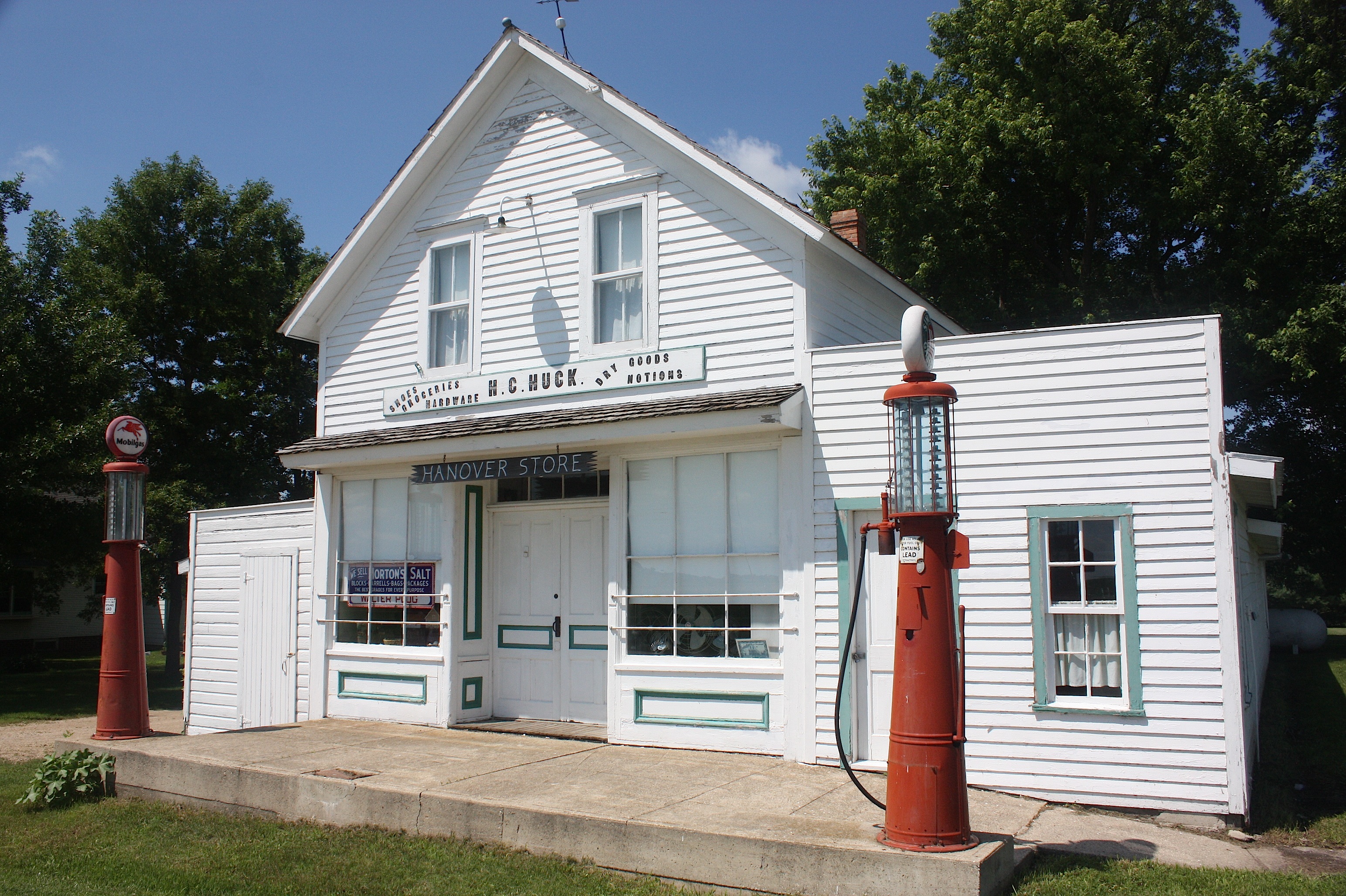
Hanover Historical Village is located 8 miles southwest of Alta, Iowa, at the corner of M27 and C65. Tours are available any time by appointment. It’s truly a hidden gem.
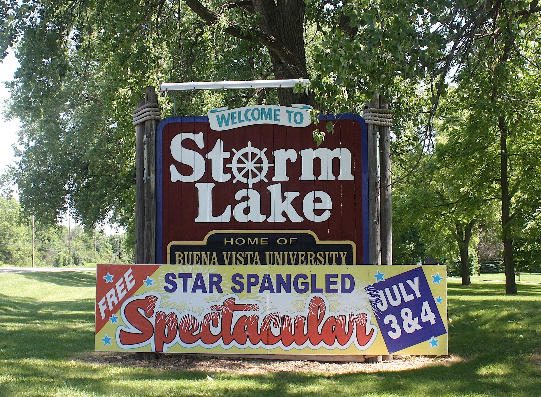
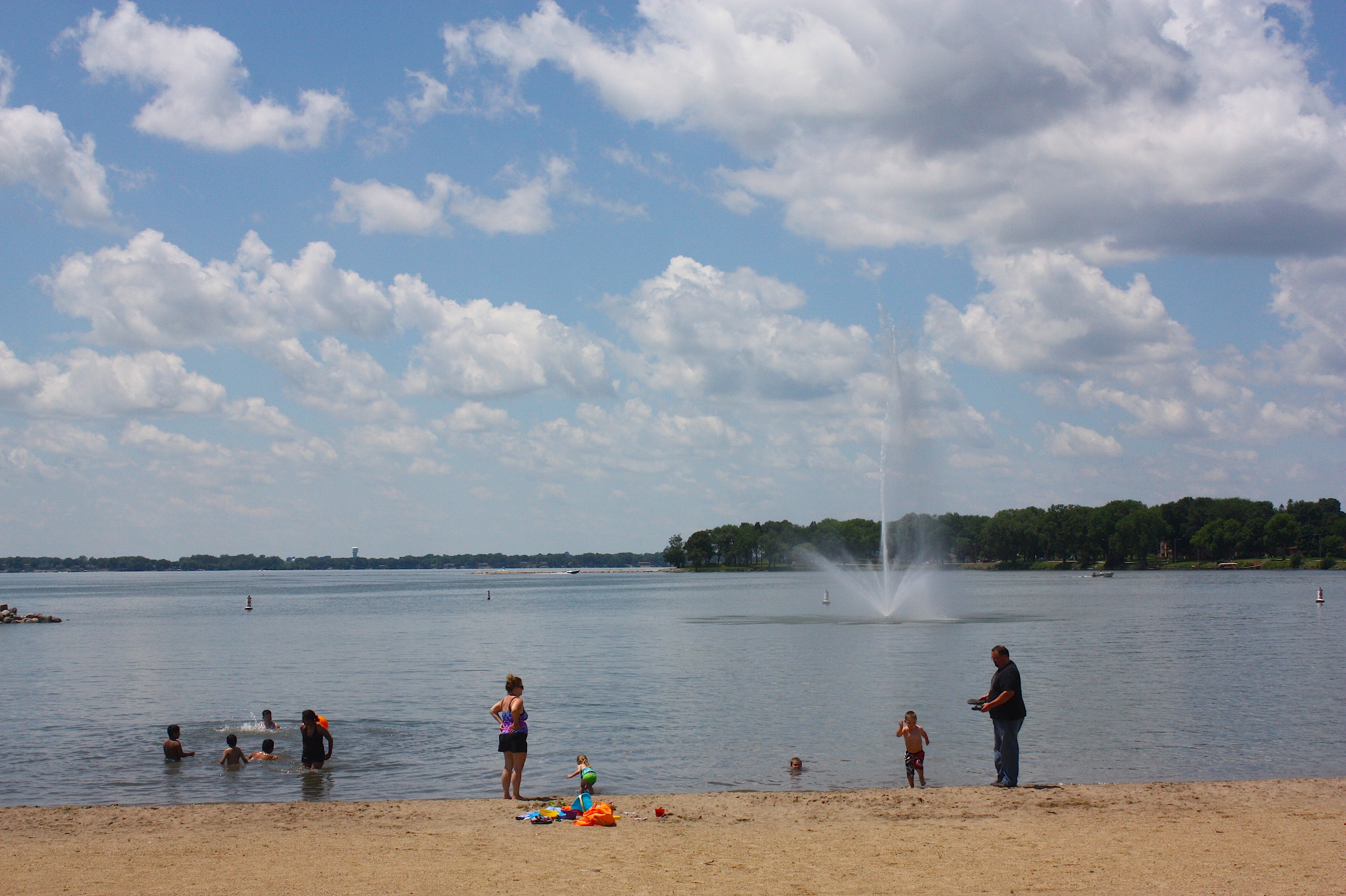
Finally, we’re at the overnight town of Storm Lake (population 10,600). After 74 miles and all those hills I can only imagine how wonderful this lake – and these shady parks and ginormous water park – are going to look to RAGBRAI riders on July 19. Because it looked pretty damn good to me, and I’d mostly been in the passenger seat of a car the whole way.
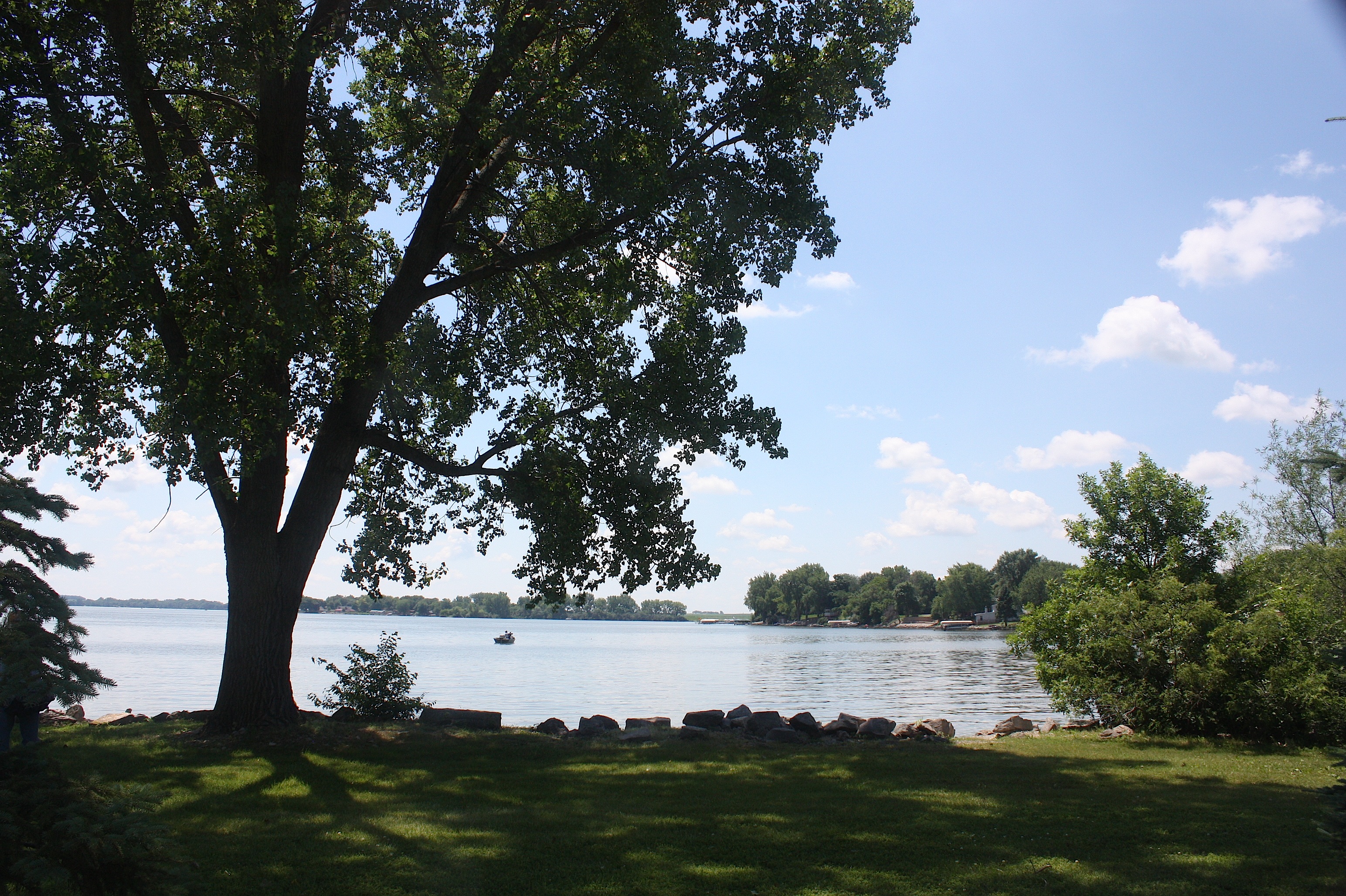

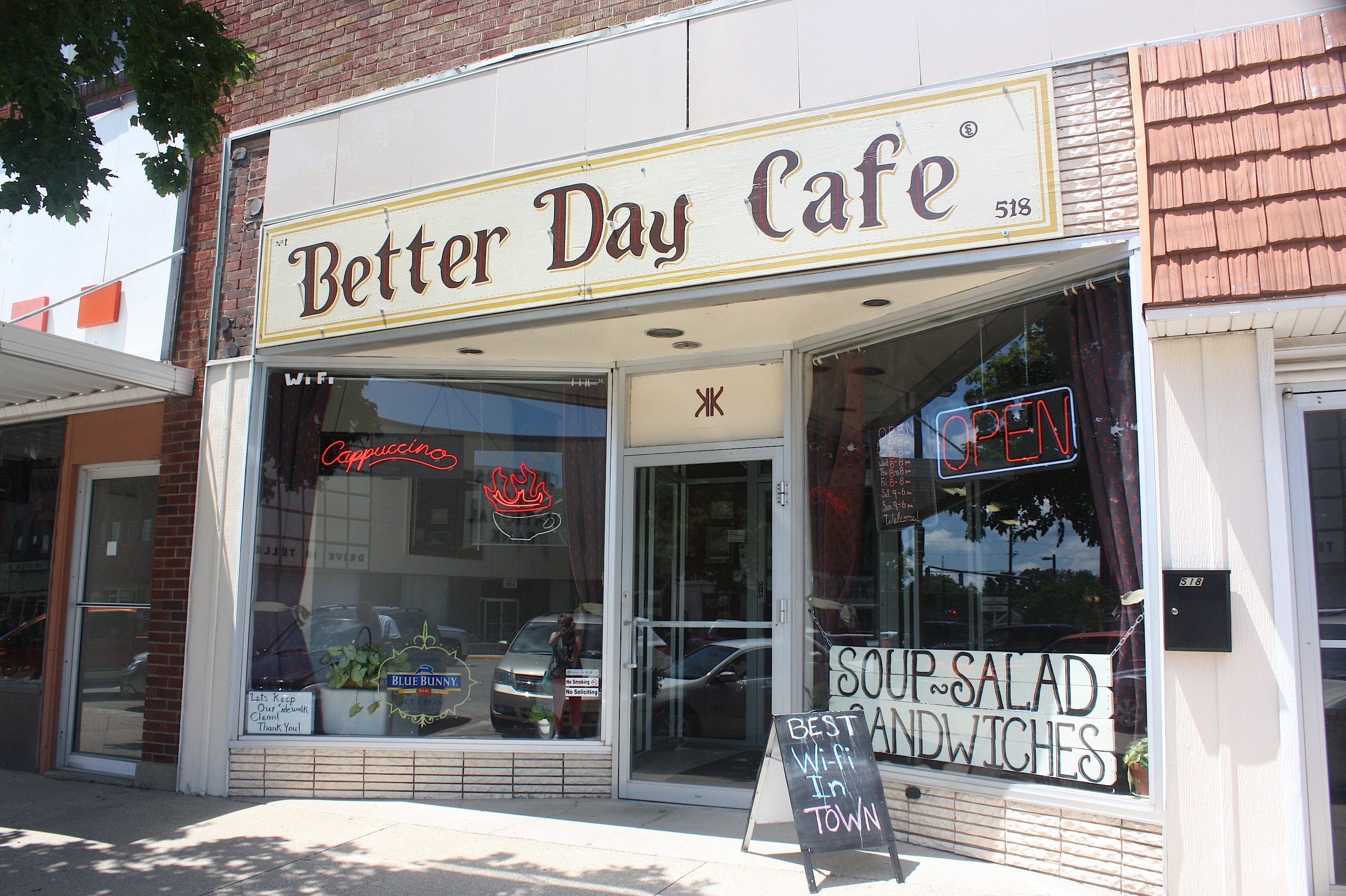
We arrived in Storm Lake around noon and took in the loveliness that is this 3,200-acre glacially created lake. We walked through Frank Starr Park, drove around town, grabbed some sandwiches at the Better Day Café, and ate them in another of the city’s lakeside parks.
Storm Lake feels like a resort town – but it’s also very much a working town. Tyson Foods operates a large hog slaughterhouse and meat packing plant here, and Sara Lee has a turkey processing plant. About 36% of the city’s population is Hispanic/Latino – making Storm Lake one of Iowa’s most diverse communities. Storm Lake is the county seat of Buena Vista County and home to Buena Vista University. And did I mention the wood carvings? Apparently any tree that dies in this town is transformed into art. There are artistic wooden statues all over town created by chainsaw artist Jeff Klatt.

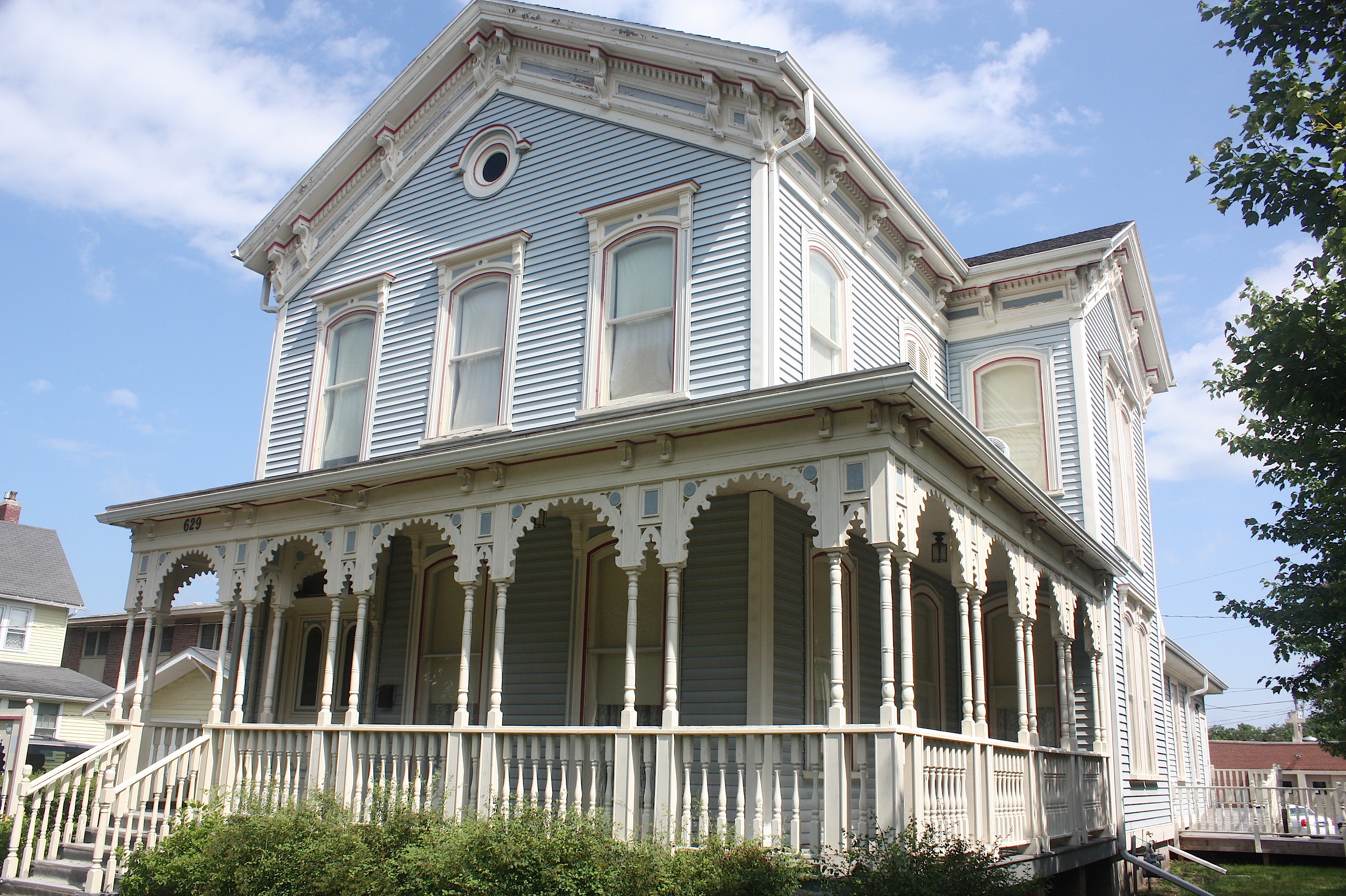
Storm Lake is also an historic town. Santa’s Castle, a former Carnegie Library, houses a collection of Christmas memorabilia, and Harker House, one of Storm Lake’s oldest homes (above), offers tours by volunteer guides all summer long.
We met one of the guides, Justin Yarosevich, and he did such a good job pitching ideas at us that we could have stayed and toured Storm Lake the rest of the day. But we needed to hit the road. So we made one last stop – at the kid-centric King’s Pointe Waterpark Resort – and headed out of town.

RAGBRAI overnighters, by the way, will be entertained by Styx, Journey, and REO. The highly appropriate overnight town theme is “Give our Shores a Spin.”
Moving on down the road:
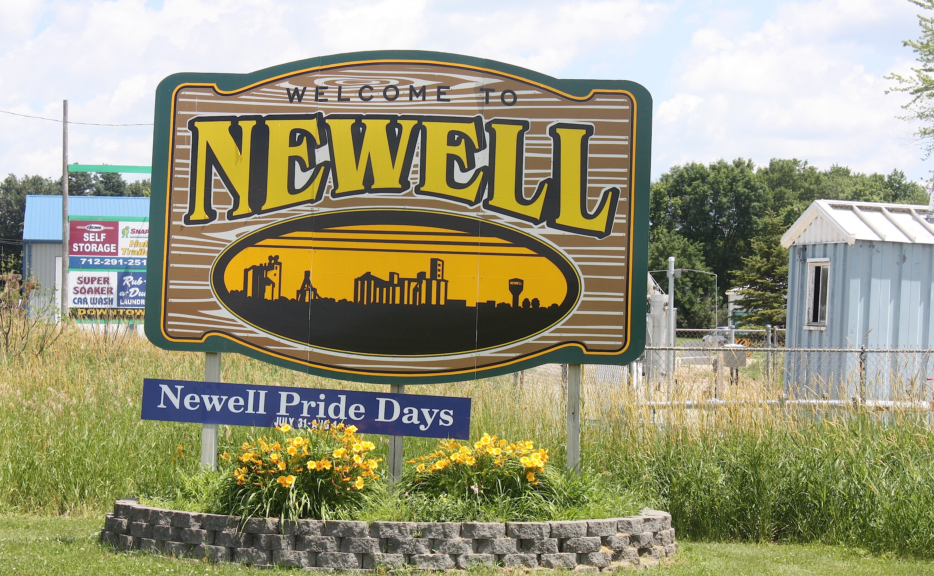
There’s not much to see in Newell (population 876); in fact, the whole town is only a total of 1.27 square miles. But just south of town is the Allee Mansion, a stunning Victorian home and farm (operated by Iowa State University) on the National Register of Historic Places. Apparently George M. Allee was a Pioneer corn breeder and philanthropist, and he willed the farm in 1958 to the state of Iowa for agricultural research.

Despite its size, I’ll give this tiny community credit: They have an up-to-date website listing “What’s New in Newell” including this RAGBRAI info:
“RAGBRAI XLIII will be in Newell on Monday, July 20th as a breakfast town. We are excited for this!! There will be several vendors on main street that morning. Food vendors will be serving Pancakes, Omelettes, Biscuits and Gravy, Breakfast Burrito at clubhouse, protein balls, homemade pies, and lots of fresh fruit! There will be DJ’s, and beer gardens. Other entertainment will be a football toss, basketball 1 on 1 throw, and golf challenge. Free water, free WiFi, free cell phone charging, & 2 ATM’s.” (This is a direct quote, with their capitalization and punctuation, just so you know.) It sounds like a fun morning to me.

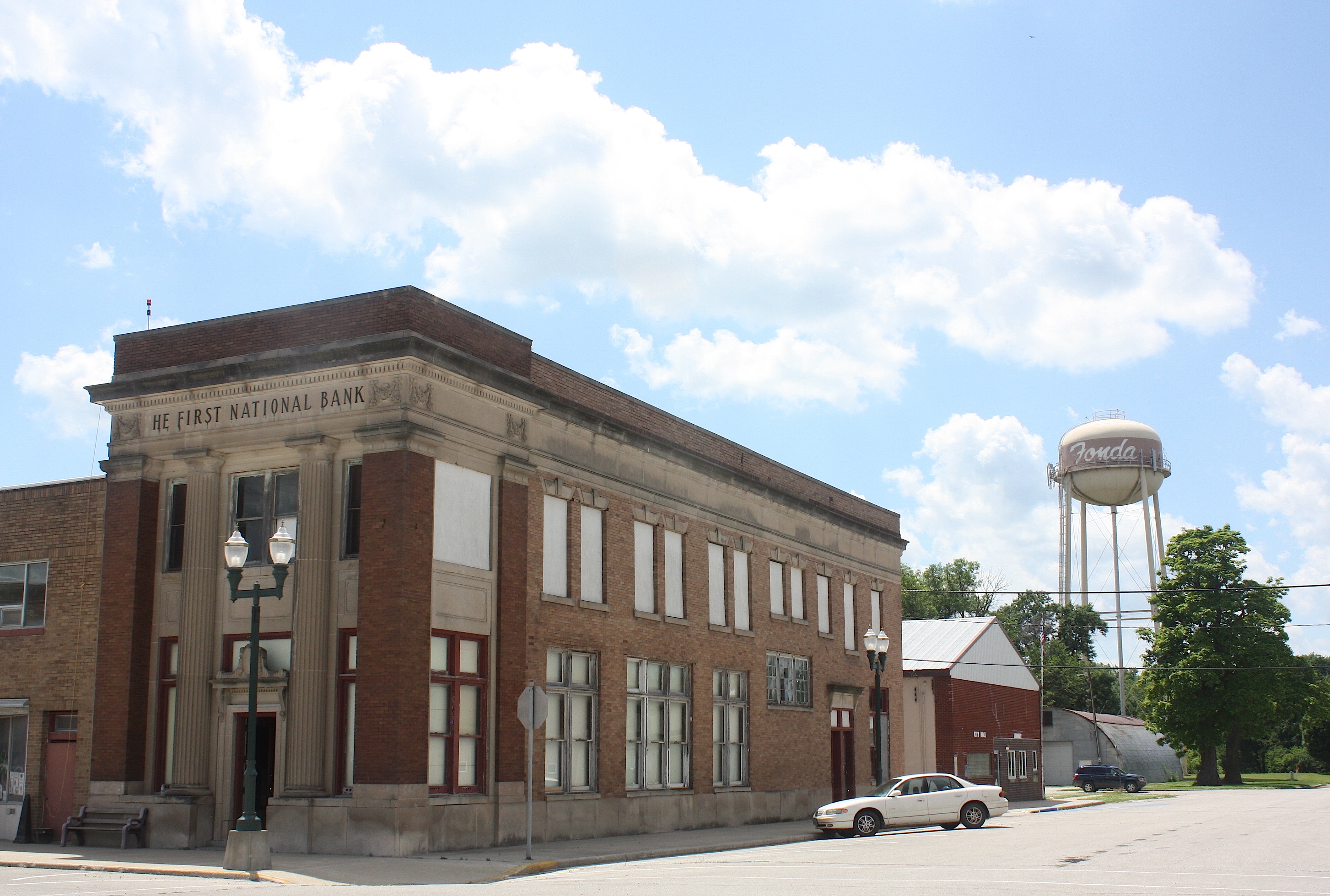
Next up is Fonda, another whopper of a town, with 631 recorded inhabitants as of the 2010 census. The community seems to be small but mighty. Fonda was founded in 1870 and is located in the southwest corner of Pocahontas County.

Fonda is home to the Fonda Museum operated privately by Jan and Gib Alpers, but unfortunately it’s open by appointment only so I didn’t get to go inside. It looks really fun; there’s a general store, ’50s room, music, barbershop, popcorn, print shop, and automotive memorabilia. You can watch a video here.
Like nearby Newell, Fonda’s Website also has RAGBRAI info.
The drive between Fonda and Pomeroy is flat – we’ve left the hills behind – but no less lovely. Cyclists will be surrounded on both sides of the road by pretty farmland and enormous wind turbines as far as the eye can see.


Pomeroy: Now here’s a town (population 662) worth going out of your way for. Byron’s bar, the town’s claim to fame, has been around “forever” according to a bartender we met who had worked there for 19 years. This place is a destination, a Grateful Dead/hippie bar with live music most weekends. I’m sure it will be hopping like crazy when RAGBRAI rolls through.

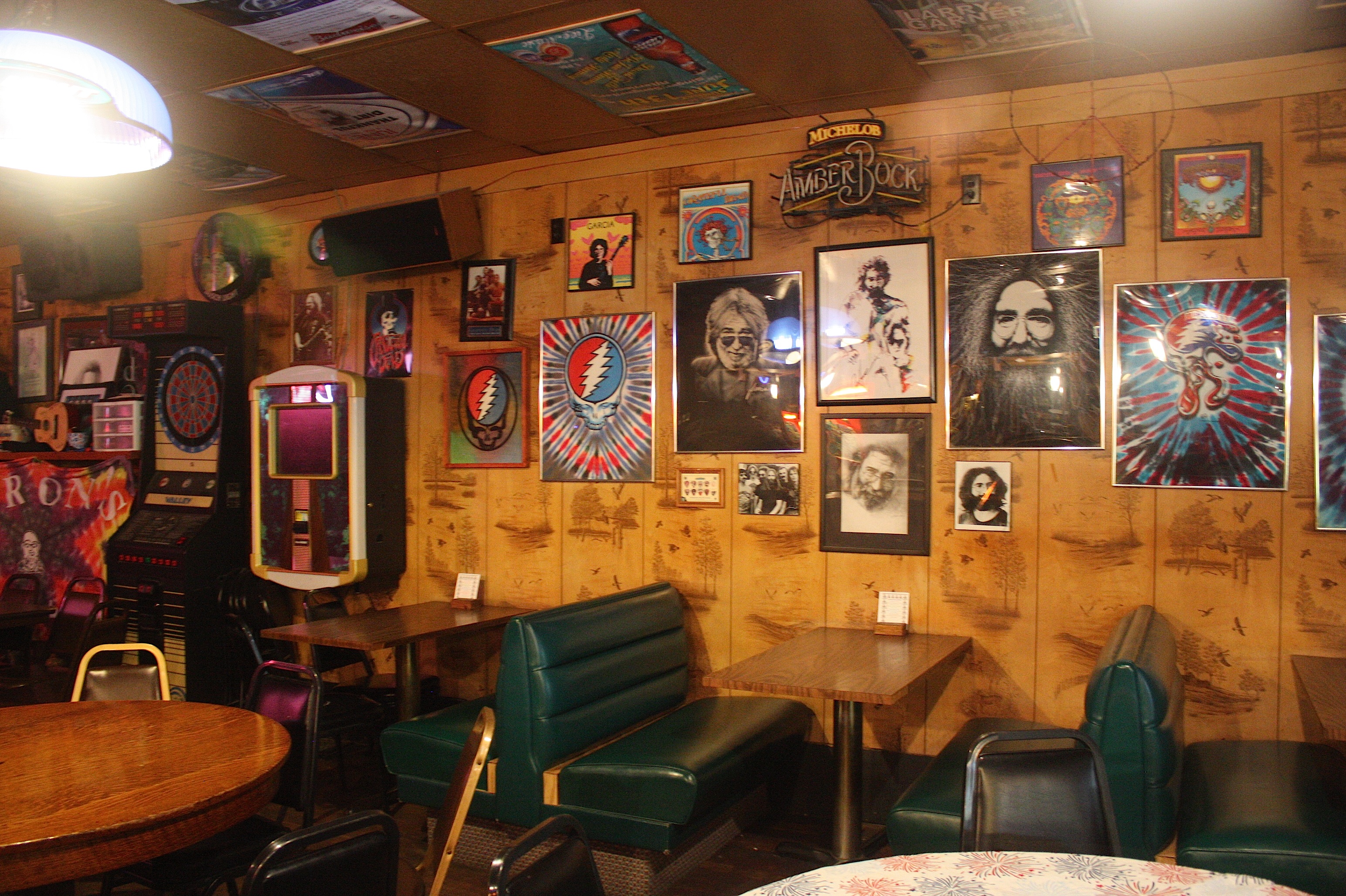
The town itself was nearly wiped off the map in 1893 by a devastating tornado. Not much remains of the downtown. But come and visit anyway, because Byron’s is a gas.

Our next pass-through town is Manson, Iowa, population 1,690. Manson (town motto: “Making an Impact!”) is famous for its ancient history. The town was built upon the site of the Manson Impact Structure, the largest known meteorite crater in the United States. The crater, measuring more than 23 miles in diameter, was created when a meteorite crashed into earth some 74 million years ago. The crater now sits approximately 200 feet below the city of Manson. Although the crater is not visible today, the impact of the meteor significantly changed the geography of the area. As a result, the city of Manson was known for years as the “soft water capital of the world.”
Besides the BEST welcome sign I’ve ever seen, there’s not much of a reason to visit Manson. It’s a pretty sleepy little town.

It’s almost the end of Day 2 for the riders when we arrive in Clare (population 146). Like most of the farming communities we’ve visited today, Clare has a grain elevator – but there’s not much else: one bar, a post office, and a couple of businesses that appear to have been closed for years.

Cyclists will be greeted in Fort Dodge (population 25,206) with the “Spazmatics Ultimate ’80s Show” and the overnight town theme “We’re Going Places!”
Historically – and I’m quoting this from the city’s website because frankly I’m too lazy to rewrite it – “Fort Dodge traces its beginnings to 1850 when soldiers from the United States Army erected a fort at the junction of the Des Moines River and Lizard Creek. It was originally named Fort Clarke but was renamed Fort Dodge because there was another fort with the same name in Texas. It was named after Henry Dodge, a governor of Wisconsin Territory (which included Iowa at the time). The fort was abandoned in 1853 and the next year William Williams, a civilian storekeeper in Fort Dodge, purchased the land and buildings of the old fort. The town of Fort Dodge was founded in 1869.”

So, blahblahblah, there’s a fort — Fort Museum & Frontier Village – a replica Civil War militia fort, with military, pioneer, and Native American artifacts and a historic town.
There’s a lot more to do in Fort Dodge, because it’s 20 times bigger than most of the towns we’ve driven through today, but I was tired and didn’t really care. I walked around the downtown area a bit and strolled through Karl King Park. Fort Dodge is the Webster County seat.
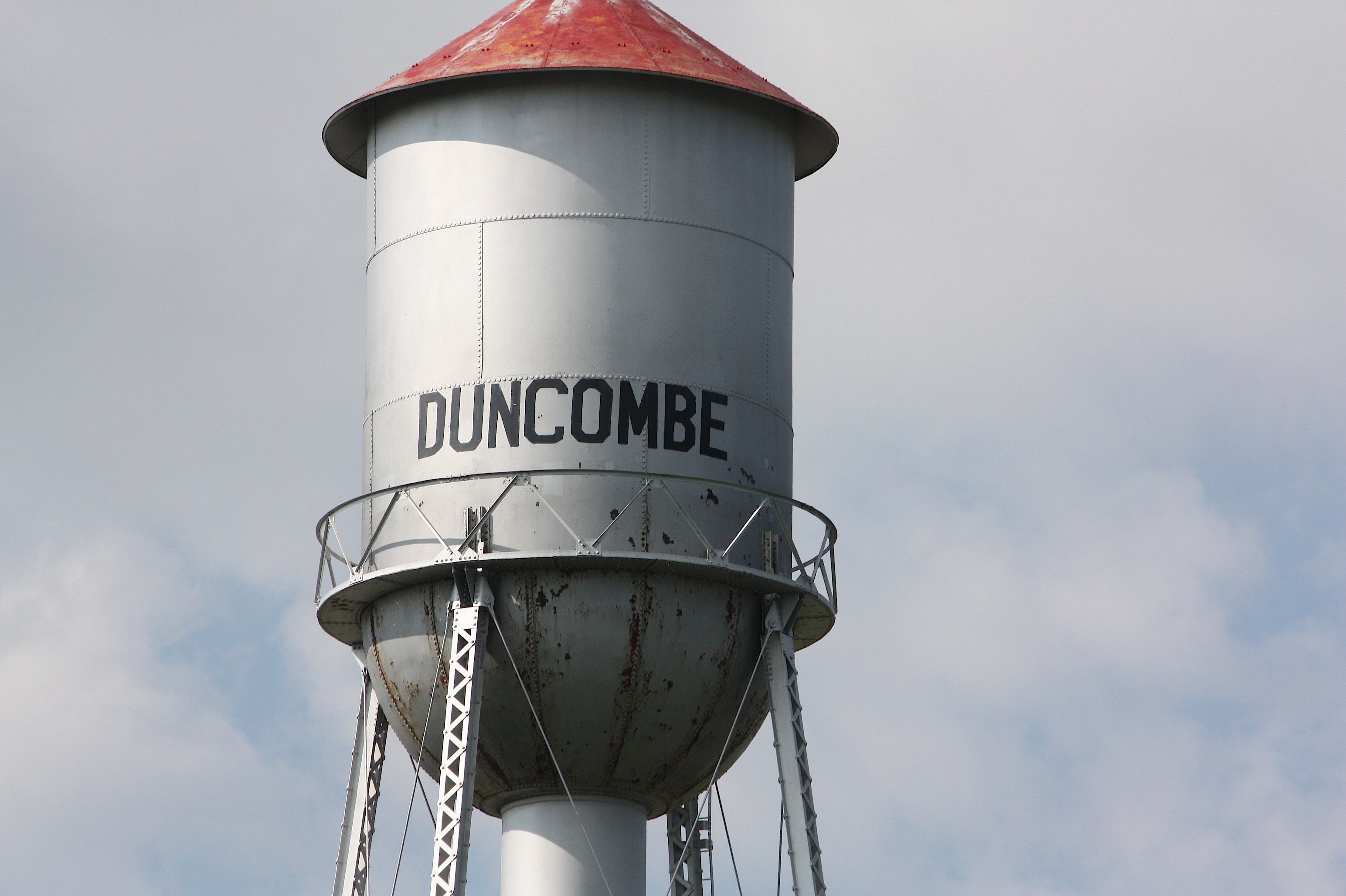

We’re on the home stretch now for Day 1. Our next stop is in Duncombe (population 410) home of Ethel’s Pub ‘n’ Grub, Duncombe Gas & Grocery, and a big-ass grain elevator. I mean, this thing is huge. It dwarfs the entire town.

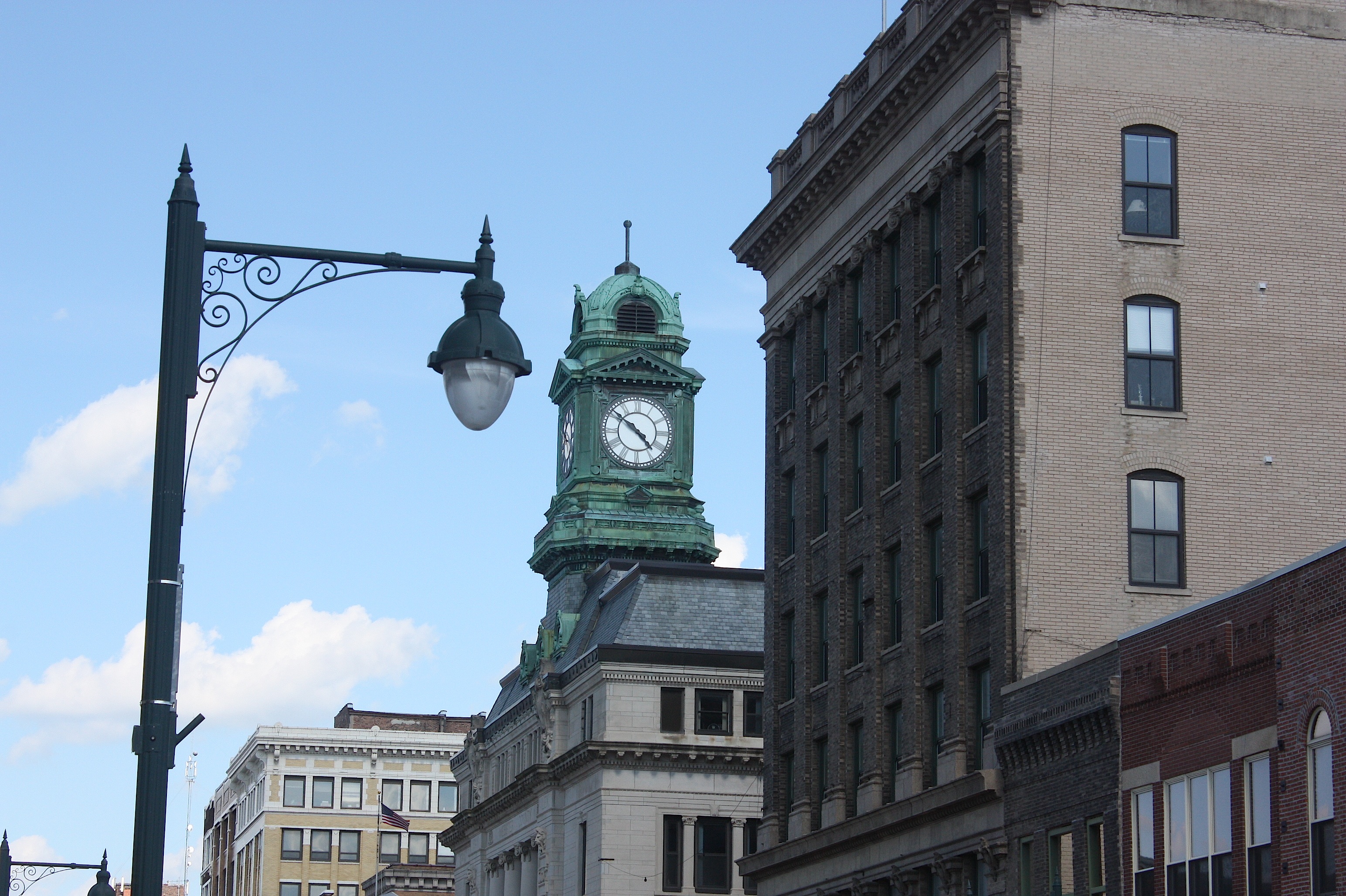
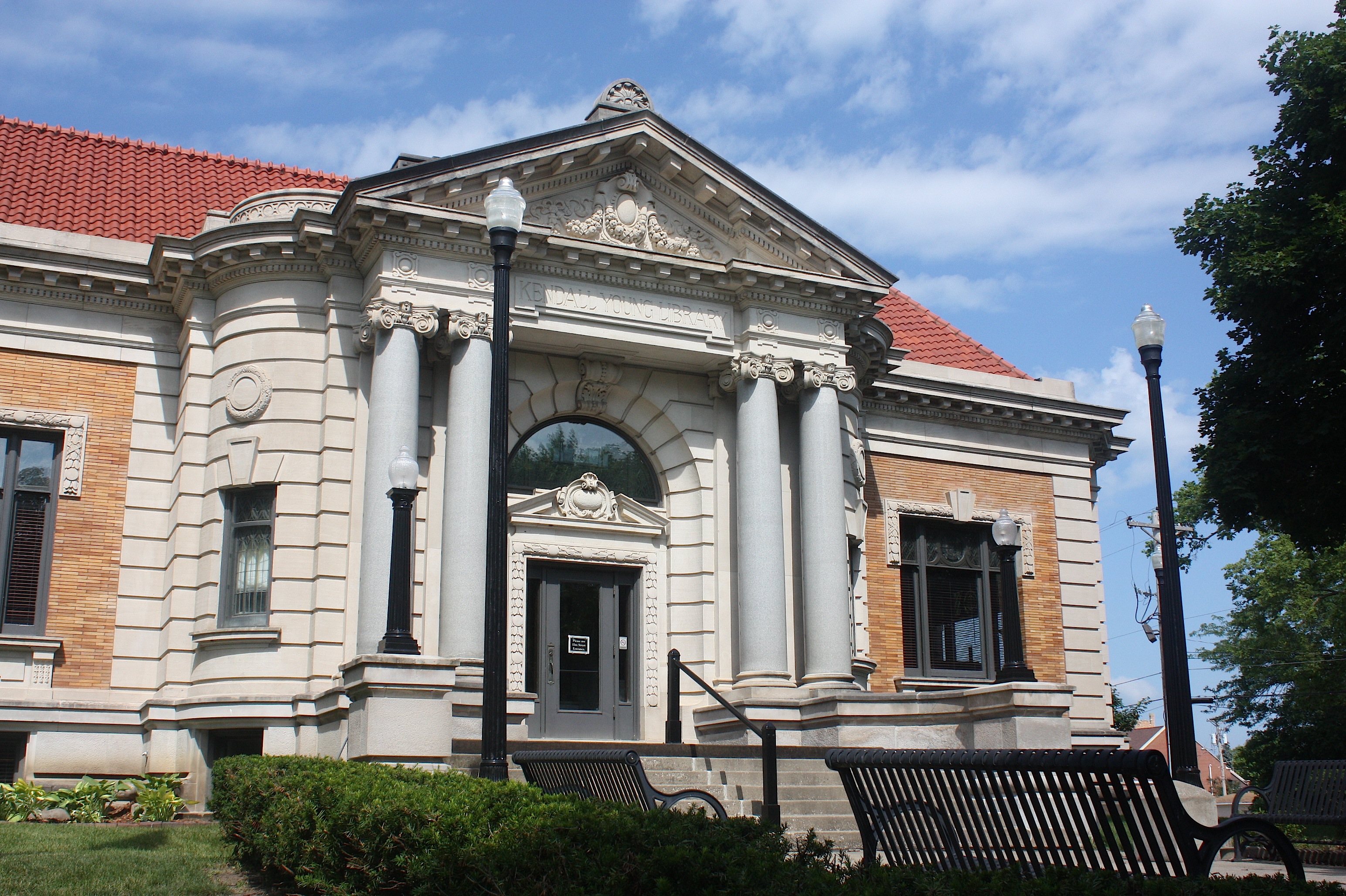
Just down the road is Webster City (population 8,070), the county seat of Hamilton County. By the time we got there, nothing was open in the downtown area, but I was impressed with the vintage shops and movie theater, and by the city’s historic homes and Kendall Young Library. Webster City is also home to Iowa Central Community College.


From there we hit Hwy. 20 and headed home. I was grateful that, unlike thousands of cyclists to come, I will have a soft, dry bed to sleep in tonight.

Love your descriptions and the pictures were awesome. I’m 70 and will not be riding RAGBRAI, but I feel “there” with you. I was raised in Storm Lake; my dad was raised in Pomeroy; his dad was raised in Manson; my children were raised in Webster City. We know all those roads and sites quite well. You did them justice. Thank you. Looking forward to reading about the next leg of your “Driving RAGBRAI” blog.
Thanks, Ann!