Driving RAGBRAI XLV: The OC to Lansing on four wheels in three days

Who’s ready to ride? Not me, that’s for sure. But last weekend I traversed the northern tier of the state in my little orange car, following the ever-inspiring RAGBRAI route. RAGBRAI – the Register’s Annual Great Bicycle Ride Across Iowa – never ceases to put together a road trip that takes you places you’ve never been (and sometimes never knew you wanted to go).
This is the second time I’ve followed the complete route (the first time was in 2015), and this time I did it in sequential days, staying in hotels along the route.
And I will say this: For people who don’t think there’s anything interesting about Iowa, I spent three days driving across the state, to many places I’d already visited, and I ran out of time and didn’t get to do many of the things I’d hoped to do.
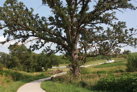
This year’s route is fairly flat – until you get to the last two days, and then all hell breaks loose. This is by far the prettiest part of the route, but it will be the most challenging on two wheels.
Even without the hoopla of the 10,000 riders, the pie, the pork chops, the beer, the music, and the wet-T-shirt contests, driving the carefully curated RAGBRAI route is a hell of a way to see this state. So, here’s a sneak peek for those of you who are biking across Iowa next week, or for folks like me who just want to experience small-town Iowa from the comfort of your car.
I present: RAGBRAI XLV.

ORANGE CITY TO SPENCER
I cheated and drove to Orange City Friday night so I could get a jump on my first full day’s drive. I wanted to get to Clear Lake (the fourth overnight town on the RAGBRAI route) by Saturday night.

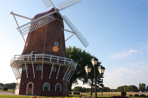
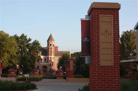
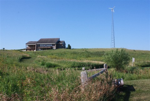
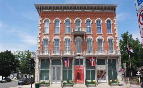
I took Hwy. 10, entering the town from the east, and immediately spotted my hotel for the night: Hampton Inn. I got checked in and then headed downtown. I encountered windmills and a park, a lovely courthouse and the postcard-pretty campus of Northwestern College. It’s not tulip time, but the town smelled like flowers, and gardens throughout the town were overflowing with colorful summer blooms.


The OC is a seriously nice little town (population 6,179), with a tidy downtown area, colorful murals, and folks out taking an evening stroll or bike ride. One thing it is not – at least on a Friday night – is open for business. I didn’t spot one restaurant or shop in the downtown area that was actually open. I opted for dinner at The Nederlander out on the highway, about 50 yards from my hotel. It was OK, but not the cozy downtown mom & pop diner I’d hoped for.
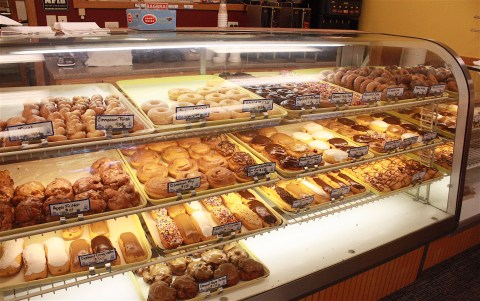
The next morning I ventured back downtown to see what was cooking at the Dutch Bakery (I peeked into the windows the night before, and it seemed tempting); alas, there was nothing remotely Dutch about this more-aptly named donut shop, so I didn’t partake.
I was super excited to be driving the entire route this year. Of course, the route itself is pre-planned, but I had a long list of things I wanted to do this first day between the OC and Clear Lake: take a historic walking tour of Alton, find the library cat in Spencer, go to the POW Museum in Algona, check out the Buddy Holly crash site outside of Clear Lake.
I didn’t do most of those things. My plans went awry: I couldn’t find the location, the attraction was closed, I ran out of time. Didn’t matter. I had a lot of fun and found other things to do.

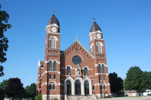
Three minutes outside the OC I encountered Alton (“Love Where You Live”), population 1,271. You can literally see Orange City from the Alton main street. It’s a pretty little town, with big houses and a golf course, and you can’t miss the huge, double-spired St. Mary’s Catholic church.
It occurred to me that Alton might have been settled by Catholics who weren’t welcome in the Dutch-Reformed-majority Orange City. But anyway, it’s a cute little town, with a park and a pub (which was not open on Saturday morning) and antiques shop. You can walk right down the middle of the street and not worry about getting hit by a car, a theme that would play out many times in the next couple of days.

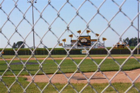
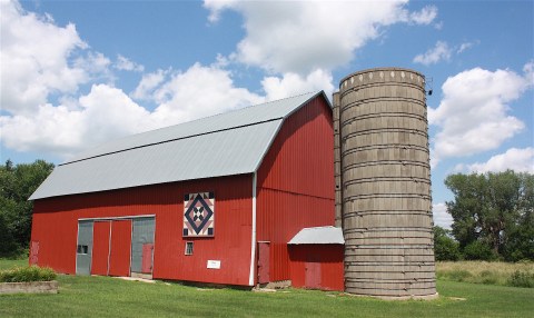
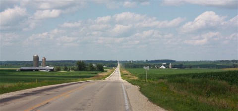
Eight miles later I arrived in Granville, home of black soil, Spartans baseball, another pretty Catholic church, and a ginormous grain elevator (this, too, would become a pattern throughout the route).
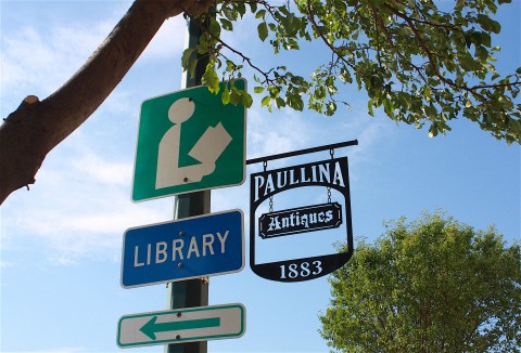
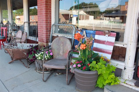
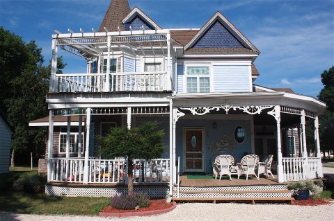
It was already 80 degrees and humid when I arrived in Paullina (“Gem of the Prairie”). The local RAGBRAI committee was hard at work, with a July 18 meeting scheduled according to a sign in town. I had to make a U-Turn – that’s another thing I did over and over during this drive – to find a suitable place to park to take a picture of this beautiful Victorian inn:
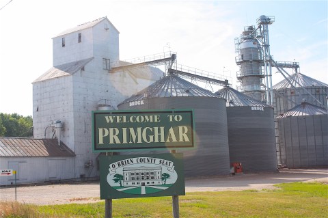
The next town is Primghar, population 909. Here there’s a nice downtown square, an average-looking courthouse, a golf course, and some good-looking houses.
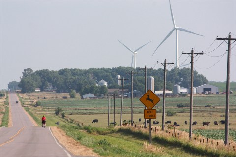
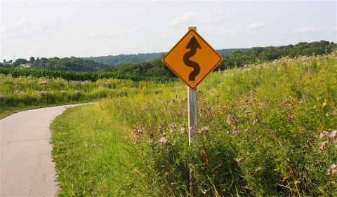
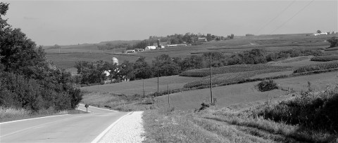
The route so far was pretty flat and easy. The surrounding land is mainly made up of farm fields dotted with wind turbines. Heading out of Primghar, I found myself leap-frogging a cyclist who seemed to be riding the RAGBRAI route. I’d pass him, then stop to take pictures and he’d get ahead of me. Then I’d pass him again. This went on for quite some time.

After Primghar I took the optional gravel loop for one reason only: It’s close to the Glacial Trail Byway and I thought the scenery might be pretty. It really wasn’t anything special, except for some nice wind turbines and corn fields; I guess the road is just a little too far removed from those glacial land forms. Too bad, because they’re really interesting. Anyway, I just ended up getting my car really filthy on that gravel road. I’ve driven a lot of gravel, and I don’t believe I’ve ever seen my back window so dirty. I had to stop to clean it off so I could see out.
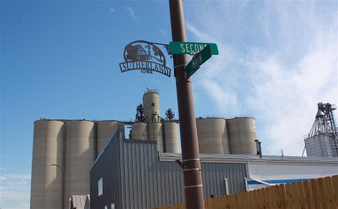
I got confused somewhere between Sutherland (population 649) and Hartley (population 1,672) and had to bring out the big guns: my brand-new Iowa Atlas & Gazetteer, with more detail than you can imagine. I’ve wanted one of these bad boys for a while now, and I knew that driving this route by myself this year I’d need one. I pre-highlighted the route before I left, and it was extremely helpful in cases where I took a wrong turn or when there was no road signage that matched up with the Register’s maps of the route. (Actually, I give high praise to the Register’s daily route maps. They’re pretty darn accurate. I didn’t have much trouble following the route the first day, even though sometimes the road names are different. I don’t know if I’m good or just lucky.)
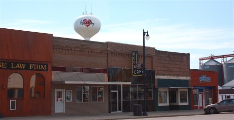
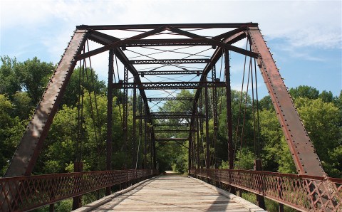
So, Hartley (“The City with a Heart”) isn’t a bad little town. I was hoping to find coffee and a bathroom, but no. I did run across a cool bridge, called the Bob Howe Thunder Bridge, below, and then I headed into Spencer.
I like Spencer (population 11,233). I’ve been in this town a number of times. Today I was happy to find Carroll’s Bakery and Coffee Shop that had good coffee, a bathroom, and friendly employees who told me about the plans for RAGBRAI’s overnight stay. Apparently all camping and services – including a big spaghetti feed – will be located in the Clay County Fairgrounds. (Loyal readers may remember I attended the Clay County Fair just last year.)


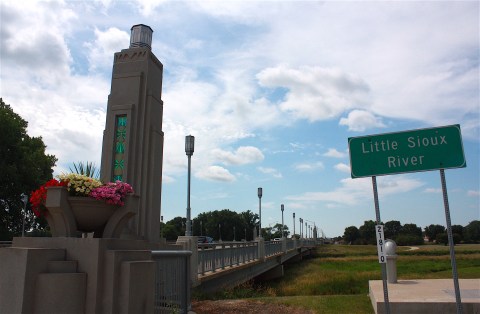
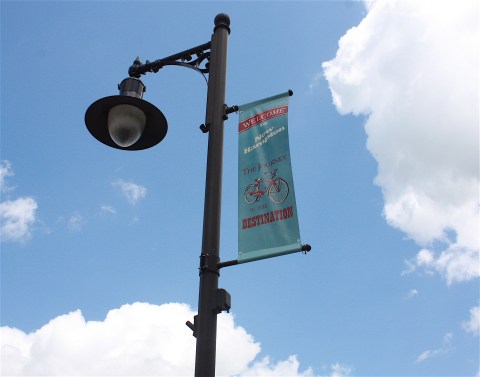
Spencer is the county seat, has a pretty courthouse, is famous for its library cat (Dewey Readmore Books), and has an awesome main boulevard with hanging flower baskets and an art deco bridge, below. Spencer was definitely getting ready for RAGBRAI; murals were already up, ready to greet cyclists in the downtown corridor.
Before I left town, I stopped at a small farmers’ market and chatted with some young women from Iowa State’s Clay County Extension serving a crunchy cabbage salad. It tasted great; I even picked up the recipe.

SPENCER TO ALGONA
Since Spencer is an overnight town, I was officially finished with the first day’s route around noon. Heading out of town, I looked for the towns of Dickens (population 185) and Gillett Grove (population 49) – both on the RAGBRAI map – but saw absolutely no sign of either one. I swear I was on the right road, too.

I encountered my first hill on B53 before coming to Ayrshire (population 143), Curlew (population 58), and Mallard (population 274). Honestly, I can’t think of anything to say about any of these towns. Just outside Mallard, riders will have an opportunity to take the optional Karras Loop, but I opted to NOT do that.

Instead, I headed straight to West Bend (population 785) and its world-famous (and famously weird) Grotto of the Redemption. I visited the Grotto once before, and I found it creepy, even though I am well aware that other people think it’s the coolest thing ever.

The Grotto takes up a whole city block and is series of grotto-ish things constructed of minerals and gems by a Catholic priest, Father Paul Dobberstein. He worked on it from 1912 to 1942, and I totally believe it took that long because this thing is massive.

Apparently each of the grotto clusters depict a scene in the life of Jesus of Nazareth but was “built to be for people of all religions to enjoy.” So check it out for yourself. (Creepy or cool? You decide.)

Whittemore (“Proud of our past…excited for our future”), just down the road from West Bend (population 504) has a community center with a veteran’s display… and then you’re in Algona, the next overnight town. Wow, this section (Monday, if you’re doing RAGBRAI) went really fast. Algona’s RAGBRAI theme is “Discover Our Oasis.”
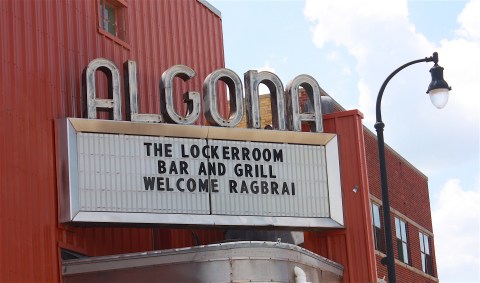
I want to like Algona (population 5,560). I’ve often thought it would be interesting to visit the POW Museum. I didn’t find it, but even if I had, it probably would have been closed.

Everything always seems to be closed in these small Iowa towns when I try to visit. I actually started taking pictures of the “closed” signs on doors. I understand that businesses aren’t open 24/7, but, seriously, Saturday afternoon? This is Prime Time. I stopped at a coffee shop in downtown Algona, hoping to grab a sandwich or something. The helpful barista there told me they stopped serving lunch at 2 p.m. I checked my watch. It was 2:01. (Seriously. You can’t make this stuff up.)
Oh, well. At least they had coffee, which is more than I can say about many small towns.

Algona has a pretty Methodist Episcopal church, a cute downtown with a display of a children’s RAGBRAI artwork competition, and a decent park in which I ate a sad peanut butter sandwich since the coffee shop would not accommodate my lunch-time needs.
ALGONA TO CLEAR LAKE
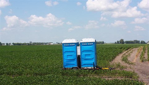
Leaving Algona and heading to Clear Lake will be Day 3 (Tuesday) for riders, and it would be the last section for me to drive on Saturday. I headed out of town at 2:30 p.m. and almost immediately encountered a series of blue porta-potties in a farm field – I assume this in preparation for RAGBRAI?

The town of Wesley (population 390) has a pretty white church and not much else. I drove through Hutchins (an unincorporated town of 28) without stopping.
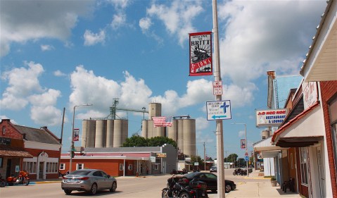
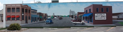
And then I came to Britt, population 2,069. Britt, with its very cool mural. Britt, with its awesome banners and motorcycles parked on the main drag. Britt, with its National Hobo Museum.
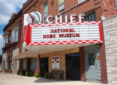
Wait – what? A national hobo museum? Why did I not know about this? I got very excited. And then…of course…the damn thing was closed. I peeked in the windows and saw a sign for the 117th annual National Hobo Convention, which includes a Hobo Memorial Service at a local cemetery and a parade and a king and queen and everything. It’s in August…maybe I’ll just go back up there. It sounds awesome.

Garner, Iowa, feels like it should be bigger than its population (3,129) would indicate. Probably because it’s at the crossroads of U.S. Highways 18 and 69. So, there’s a Casey’s and a bunch of other stuff where the two roads meet. In town, there’s a nice farmers co-op and railroad tracks and a central park.
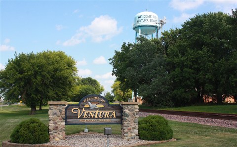
Leaving Garner, the next town to the east is Ventura, population 717 (“Sportsman’s Paradise”), and Ventura feels pretty much like part of Clear Lake. It’s technically in Ventura where you hop on North Shore Drive, and it hugs the shoreline of the lake all the way in.

If I was at all bored with the farm fields and sleepy little towns I was driving through (I swear I was not!), Clear Lake was a huge change of scenery. This town (population 7,777) was by far the most happening place on the route up to this point. By my rough estimate, there were about 100,000 people there, with their cars and their boats and their kids and their dogs, all living it up at the lake on a sweltering July afternoon. I had a hard time imagining how another 10,000 MORE people were going to fit on this town’s roadways – not to mention all the support vehicles and hangers-on – but the riders will be coming into town on a Tuesday, and I was there on a Saturday, so maybe it will be less crazy.


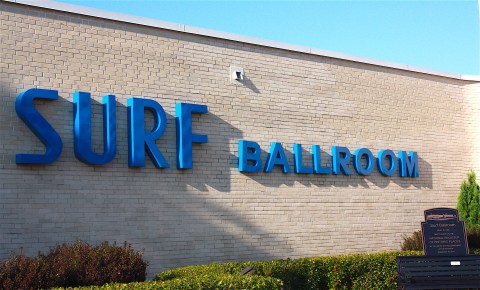
At any rate. Clear Lake has a lot to offer its two-wheeled visitors: There’s the lake, of course, for boating and swimming and skiing and a boat cruise on the Lady of the Lake. And a vibrant downtown area, a pretty central garden, the famous Surf Ballroom (which had a show the night I was there), and several restaurants from which to choose. Just north of town is the Buddy Holly crash site.
Clear Lake is the fourth overnight town, if you count Orange City, but it was my second. I tried my best to secure a place to stay on the lake, but everywhere I called was either booked or required a multiple-night stay or was way out of my price range. I stayed at the sad-looking Super 8 motel out on the highway. My room was actually so close to the on-ramp for I-35 that the entrance sign was right outside my window.
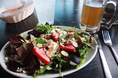
After I checked in to the Ritz, I drove back down to the downtown area, parked, and began walking. I explored the main street, went to the public lakefront area, took a lot of pictures, and remembered that this was the place I nearly died one time from choking on a garbanzo bean. I decided to get some dinner, so I went to GE-Jo’s Italian restaurant and sat outside. It was a terribly hot day, but the patio had nice shade. I was thinking pasta when I chose this restaurant, but I was so hot that I decided to go for a refreshing salad with strawberries, feta cheese, and almonds with a very light dressing – and it really hit the spot. So did the beer and the multiple glasses of water I downed while sitting there.

After dinner I set off walking again. I found a pretty white church, the central garden (above), nice-looking older homes, and the aforementioned Surf Ballroom. The Surf is a concert venue built in 1948 and placed on the National Register of Historic Places in 2011. It’s best known for being the last place that Buddy Holly, Ritchie Valens, and the Big Bopper played a concert. The night I was there, Dennis DeYoung of Styx was performing. (The only time I ever saw a concert at the Surf Ballroom was many years ago when Dave and I went to see George Thorogood and the Destroyers, and I thought I was going to get killed by a guy with a tattoo on his scalp. Also, Thorogood is one ugly dude, but I love his music.)


Speaking of music, walking back to my car (sweating in a most unladylike manner, clear through my T-shirt) I stumbled upon a municipal band playing a concert in the band shell of the city park. Heck, yes! I love a good municipal band. This one played some marching tunes, some Gershwin, and so forth, and I stayed there listening until I got tired of swatting the bugs. And then I went back to my room on the interstate ramp.
CLEAR LAKE TO CHARLES CITY
This was the start of my second full day of driving. I thought about going back into Clear Lake’s downtown area for coffee, but instead I just grabbed a cup at the motel and called it good. I was on the road by 7:30 a.m.

Twenty minutes later I was in Thornton (population 422). Thornton has a gas station, a park, a grain elevator, and a small downtown. Do I need to mention that nothing was open? I’m not too clear how many of these businesses are open EVER, and it was early Sunday morning.
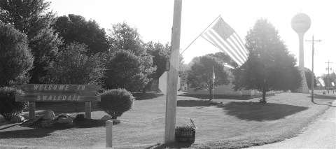
Swaledale (population 165) had a lot of American flags but not much else.

I continued on to Rockwell, which I found surprisingly agreeable for a town of 1,039 people. There’s the very nice Linn Grove Park, with its restored prairie, a bridge over Beaver Creek, and an area where folks were camping in RVs. In fact, when I was there, families were outside cooking their Sunday breakfast, and it was very pleasant. The town also has a golf course and an aquatic center.


Leaving Rockwell behind, I headed east on B60 but inadvertently turned north on S56 instead of S66 (I know, call me crazy) so I missed Cartersville. Ugh. I backtracked, but there really was no reason to. Cartersville is unincorporated and only has a few homes/farms and a grain elevator. You don’t even have to reduce your speed to drive through it. So, moving on.

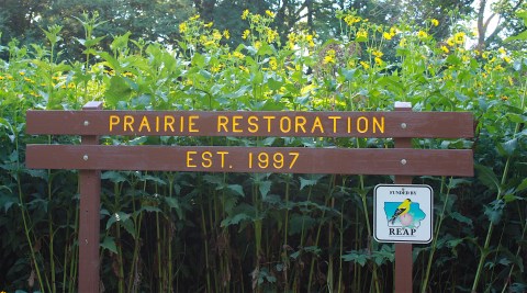
When I got up Sunday morning, I was already looking forward to this next town: Rockford. Not to be confused with Rockwell. I knew Rockford would have one place that could NOT be closed: The Floyd County Fossil and Prairie Park, which is right on the RAGBRAI route. I spent some time here last year when I was doing a story on Iowa’s geologic history. The education center itself was closed, of course, since it was still pretty early on Sunday morning (it’s open from 1-4 p.m. daily), and mine was the only car in the parking lot when I got there. But the prairie and rock quarry are just THERE, so they can’t really be closed. Yay!
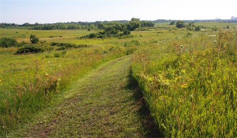
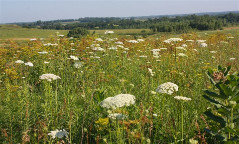
I took off through the prairie on carefully mown paths and just walked and walked until I thought, hey, why didn’t I bring my bottle of water? I’m gonna die out here! I walked for about 25 minutes in the heat and very much enjoyed the colorful blooming prairie plants, ponds, birds, bees, and other insects.
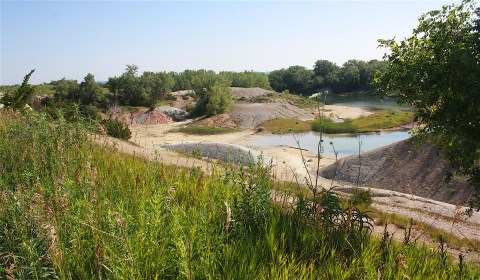
By the time I got back to the parking lot there were a couple of trucks there, and some guys from the local Lions Club setting up a blue-and-white-striped tent for what appeared to be an event later in the day. Or maybe it was being set up early for RAGBRAI? Who knows – I didn’t ask. I grabbed my water and headed off walking to the gorge where you can find fossil marine species from the Devonian period.

Apparently the abundance of brachiopods is unique to this area, because the ocean-bottom sediment that was deposited here 400 million years ago (when Iowa was covered with a shallow sea) never turned to hard stone as it did almost everywhere else in the region. Fossils are plentiful, and visitors are allowed to collect them. I didn’t do any actual fossil hunting, but I walked around the edge of the old quarry, which was originally a clay pit for the now-closed Rockford Brick and Tile Company. I met a chatty man who talked at some length about what was blooming in the prairie and what was not.
Fossil and Prairie Park is one of the coolest thing about Rockford (population 860), and it’s just outside the city limits. Driving into town, I saw some cyclists and a bridge spanning an attractive river, and couple of spotted baby deer on the side of the road. There’s a downtown area with historic buildings and a park.

At this point I started heading toward Charles City, dutifully following my map, and just outside the town, Hwy. 14 abruptly ended. This was the first of many times during the remainder of the route that road work was being performed, I assume, for the upcoming onslaught of bikers. Most of the construction work was merely a nuisance for me on my four-wheeled drive, but a couple of times it prevented me from enjoying an area, which I will tell you about later. At this point, I found a different way into Charles City (population 7,652), the next overnight town.

I was so looking forward to Charles City! In my pre-planning notes, I’d listed a whitewater rafting course, the Charles Theatre, an art collection in the public library, historic homes, and an art center. I assumed the downtown area would be terrific. And I was hoping to have enough time to try to find the girlhood home of Carrie Chapman Catt.


Well, Charles City totally confounded me at every turn. I easily found my way downtown and was immediately wowed. I walked the length of the area, from the courthouse to the central park. Although it looked great – especially the bridge and dam area on the Cedar River – I found no coffee shop, no diner, nothing in the way of food.
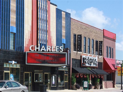
There were nice-looking store fronts, but nothing was open. I found the Charles Theatre, a classic car show in the park, and the Charles City Art Center, whose sign said it was open even though it was closed.

I left the downtown area thinking what a missed opportunity I’d just had. I drove around town, noting a couple of chain restaurants (open) and the public library, which is supposed to have a great art collection (closed).
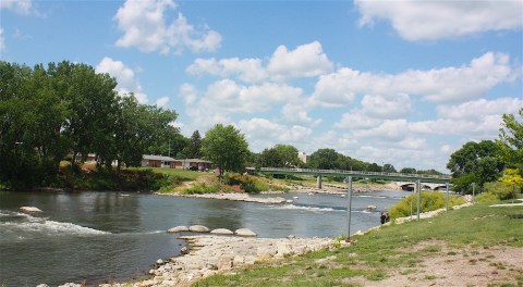
I found what I assumed to be the area used for recreational white-water rafting (above). At 11:45, desperate for a bathroom break and not finding anything to eat for lunch (for the second day in a row), I stopped at Hy-Vee. After I used the facilities, I was nosing around in the deli section, thinking I might be able to find something for a picnic, when I did something I’ve never done before: I ate lunch in the Hy-Vee restaurant. I am not proud to admit this. I try to avoid chain restaurants; I was so looking forward to eating at a little independent diner or coffee shop. But I have to say, the food was darn good. They were still serving breakfast because it was Sunday, so I ordered a cheese omelet, hash browns, and toast for $8.50 – and it was enough for two people. It was delicious, and the coffee was even good.
At this point, with a full belly and an optimistic outlook, I set out to either A) get back on the RAGBRAI route or B) find the road that would lead to the Catt home – whichever I found first. But I was all turned around and ended up heading out of town going east on Hwy. 18. Wrong on both counts. I stopped and consulted the Big Map. Went back into town. Found T64 and followed the brochure directions and helpful signage to the Carrie Lane Chapman Catt Girlhood Home. (Warning: It’s down a couple of travel roads.)
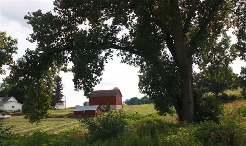
I was so glad I found this place. The historic brick house and red barn are in impeccable shape, and the modern visitor center is quite thorough. The home is a museum; it’s filled with displays rather than the period furniture you find in most “childhood home” sites.
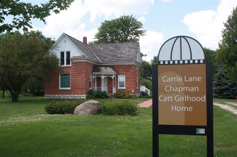
Catt is familiar to most people who have a connection to Iowa State University, as she’s one of the school’s most famous grads. But in case the name doesn’t ring a bell, here’s her story in a nutshell: She grew up on the farm south of Charles City, attended Iowa State, and became a prominent leader of the woman suffrage movement. Her efforts led to the passage of the 19th amendment that allowed women the vote, and she was the founder of the League of Women Voters. Iowa State has a building on its campus named in her honor.
Here’s a 1924 Catt quote I liked from the museum: “The struggle for the vote was an effort to bring men to feel less superior and women to feel less inferior.” Amen, sister.
CHARLES CITY TO CRESCO
I spent only about 20 minutes at the historic site and very much enjoyed it, but I needed to get back on the road. I headed back to Charles City. Took a road that I thought might be the right one to get back on the RAGBRAI route. It was not. Doubled back. Cut my losses. Went out on east Hwy. 18 – the very road I’d been on more than an hour before! I took that highway until I came to a cut-through road that would take me to the road I was supposed to be on. I was finally back on the RAGBRAI route. Whew!

So, I finally made it to Ionia, “The little town with the big welcome,” population 291.
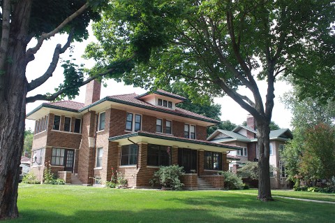
Next up: New Hampton. This town (population 3,751) had a decent downtown area, some beautiful older homes, a park with a band shell, and a community pool. Residents have done a good job of decorating with bicycles throughout the town, and I really liked their banners.
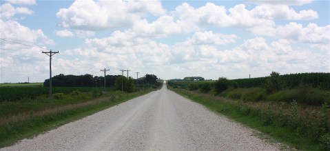
In the next town, Lawler (population 439), there wasn’t much to photograph; it’s mostly residential. Heading out of town I encountered some picturesque — but still flat — farmland.
The next town was Protivin – the last town before Thursday’s overnight stop – and for a little town with just 278 people, I spent a fair amount of time there.
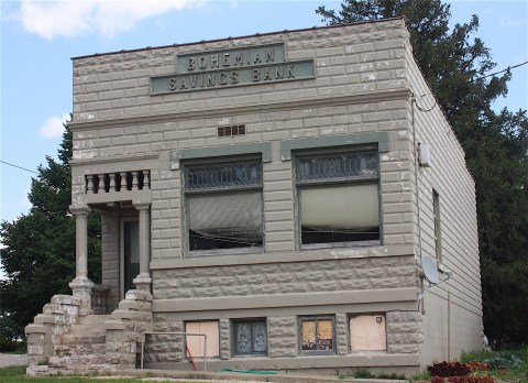
I was fascinated by the Czech names in the cemetery, names like Kostohryz, Vsetecka, Slifka, and Kovarik. Protivin celebrates its Czech heritage each August with Czech Days. The Bohemian Savings Bank, Holy Trinity Church, and the adjacent cemetery all felt really sweet and special for some reason. I liked this place a lot.


I headed to Cresco, population 3,868. Cresco’s chamber of commerce website calls the town “Iowa’s Year-Round Playground.” The welcome sign as you drive into town proclaims it “Home of Iowa Wrestling Hall of Fame.” And it’s known for being the boyhood home of Norman Borlaug – a Nobel Peace Prize, Medal of Freedom, and Congressional Gold Medal recipient for his scientific and humanitarian contributions to solving world hunger.


Cresco’s RAGBRAI theme is “Pedal to the Paranormal,” which I don’t understand at all. But I enjoyed walking around the downtown area, with its historic buildings, court house, theatre/opera house, funky vintage gas station display, and public art.

This town also has truly fabulous old homes. I walked for blocks, just drooling over them. Cresco is also home to the wrestling hall of fame and Prairie’s Edge Nature Center, and it hosts an annual Norman Borlaug Harvest Fest the third weekend in September.
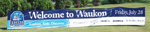
CRESCO TO WAUKON
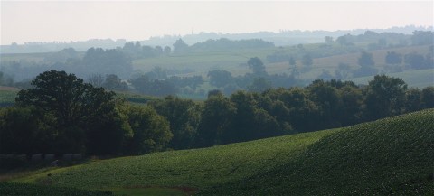
OK, so Cresco may be the overnight town for RAGBRAI, but I had one more town to go before my own overnight stop. I headed for Decorah. And here is where I say…Welcome to the Driftless Area, RAGBRAI-ers! Because this part of the route is spectacular, but also will be spectacularly challenging for anyone on two wheels. I just kept saying, Oh my god, there are hills and hills and hills and curves and hills and curves! And then bluffs! This is an amazing section of road that I’m not sure I’ve ever been on before (A34). I’ve probably only come into Decorah on Hwy. 52 and Hwy. 9 before. This way is better. My only regret is that there is literally no place to pull over to take a picture – the hills and curves and lack of shoulder would make it too dangerous to stop. (The picture above was taken the next morning, heading out of town on a different road.) My, oh, my, what a ride. The section between Cresco and Decorah was definitely my favorite section of the entire route. Whee!
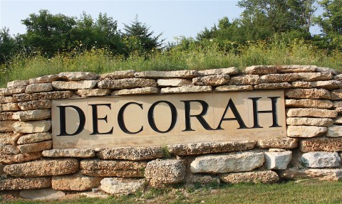
I had a whole list of things to do in Decorah, but there were not enough hours in the day to do everything. My plan was to check into my hotel (the Country Inn & Suites on Hwy. 9) and jump onto the Trout Run Trail for an 11-mile walk. I’ve done it before, and I know I can do it (you can read details here). I had it in my head that I would walk on the trail until I got near the downtown area, then I’d get off the trail, have some dinner and a beer, and walk the rest of the way back to the hotel.

I headed off, quite prepared to do this. I brought a change of shirt and shoes, extra water bottles (it was still very hot), and money. I started walking… and then I started doing the math: At the pace I would be walking on this very hilly trail in high heat and humidity (certainly no more than 3 miles an hour), it would probably be dark before I finished the 11 miles, and most of the trail appeared to be without lights. I definitely would not be able to stop for dinner and make it back before dark.
So, I walked about three miles, turned around, walked back to the hotel, changed clothes, and drove into town for dinner. This was a good decision, and the 6 miles I walked in the heat were plenty. It’s such a beautiful trail!

I love Decorah. It’s chock full of culture and nature and shopping and dining options. But…you know where this is going, right?…it was Sunday, and my first choice of restaurants was closed. As was my second choice. Happy Joe’s was open, as was another uninspiring pizza place, but that was not what I wanted. It would have been too depressing. I ended up eating at Restauration, the restaurant at the Hotel Winneshiek. I ate my dinner (a hummus appetizer with pita and veggies) and drank a beer at a table on the sidewalk, even though it was still hotter than bloody hell outside.


Back at the Country Inn, I took advantage of the pool area before falling into a very comfy bed.
The next day – after a quickie free breakfast – I headed out on my last section of the route. It was Monday, and I needed to get home.
How is it possible to drive 85.4 miles from Decorah to Lansing? Google Maps says it takes 47 minutes (36.6 miles), even along the delicious curviness of Hwy. 9. The RAGBRAI version? It took me hours and hours. But that’s why this is so much fun.
My drive on this day encompassed much of Friday and all of Saturday’s RAGBRAI route. They definitely saved the best for last. (I won’t even bore you with how much trouble I had finding the prescribed route out of Decorah, but shades of Charles City all over again.) The land forms in this area are absolutely beautiful, and unique in all of Iowa.
Why? Well, let’s talk geology for a moment. This area of the state hasn’t been glaciated for a very long time, maybe 400,000 years ago (if ever – scientists do not agree on this point), as opposed to central and north-central Iowa, where the last glacier (the Des Moines Lobe) receded only about 14,000 years ago. This Driftless Area – or Paleozoic Plateau – features deeply carved river valleys and spectacular bluffs. For today’s humans, that means fun, up-and-down roads and the most gorgeous farmland you’ve ever laid eyes on. Like, so beautiful you might have a bike wreck just staring at it. Be careful out there.
Anyway, that ends our geology lesson for the day.

Heading out of Decorah I encountered the town of Ossian (population 845), which made me laugh right away because the permanent welcome sign announced that they have a public restroom. Ossian also had many signs of RAGBRAI, including cleverly decorated bikes on the main street.
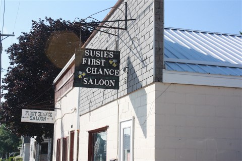
Next up was Castalia (population 173), which had a fire department/city hall combo, Susie’s First Chance Saloon, and old bank building, church, and city park.
I arrived in the next town – Postville – a little after 9 a.m. I was a little bit disappointed in Postville on this visit. I’ve been here before and thought it was a very unique small town, with its mix of diverse ethnicities based on the large meat-packing plant in town. It’s a pretty famous place; the history is that a group of Hasidic Jews started a Kosher slaughterhouse called Agriprocessors here in 1987. Later the company faced complaints about its mistreatment of cattle and violations of child labor laws, and the facility was raided by the federal government in 2008, arresting hundreds of undocumented workers. Books have been written about this place.

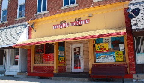
Downtown Postville still shows signs of its diverse populations, with Hispanic supermarkets and restaurants and Jewish synagogues. But overall it felt tired and worn out. The population has decreased a bit lately – to 2,116 people according to a website. The meatpacking plant was apparently sold and is back in business, but I didn’t look for it because the whole concept of meatpacking grosses me out.
Leaving Postville and heading toward the overnight town of Waukon, I apparently missed a turn and ended up in Frankville, which is not on the RAGBRAI route. Oops. I improvised and made my own route – Hwy. 51 to Hwy. 9 – to Waukon. By this point, I was getting eager to get to the end.

I like Waukon. It has an energetic vibe that’s part funky, part farm-y, and part business-y. Coming in to town, I photographed a giant statue of a cowboy with a bull in a farm supply store parking lot. And I was happy to see the town had a Casey’s, because I was overdue for a bathroom-and-gasoline break.
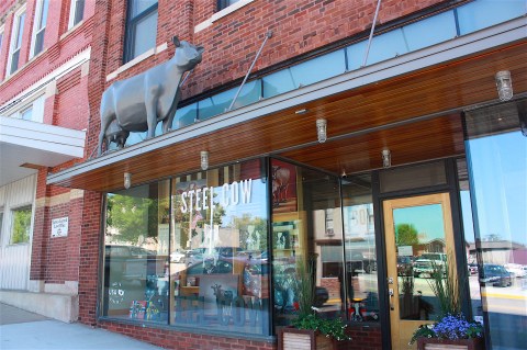
Downtown, I window-shopped the eclectic stores – especially Steel Cow, which may be the coolest art gallery in Iowa – and bought a cup of coffee for a dollar at the S&D Café. Hey, a coffee shop that’s open!


I was lured into a T-shirt shop by the adorable RAGBRAI shirts in the window. Waukon’s theme is “A week behind handlebars,” with a play on the word “handlebar,” as in mustache, as in the Monopoly man. It’s super cute – the glasses are even a bicycle! – and my favorite theme of the week.

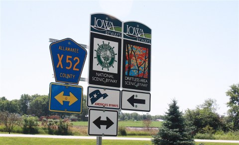
Also in Waukon I found a nice park, an interesting, historic city hall, an old movie theatre, taverns called Waukon City Club and GoodFellas Party Bar, bicycle decorations, and the soaring St. Patrick’s church that you can see for blocks away. Waukon (population 3897) is the county seat of Allamakee County.
WAUKON TO LANSING
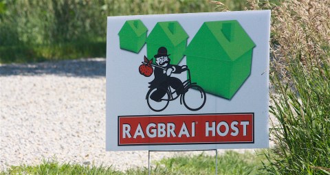
Leaving Waukon: More lovely farm landscape. The route (county road A52) is actually part of the Driftless Area Scenic Byway. I drove by a large, modern home with a spectacular view that will soon be serving as a RAGBRAI host. (Cool sign, you guys!)
On X32 I got stopped for road construction by a flagger man with long gray hair and no teeth, smoking a cigarette. Classy guy. Oh, and he was spitting. Even better.
I had to wait to follow the pilot car because the road had only one lane. Again, I am assuming this was road work in preparation for RAGBRAI, which is a good thing, and it didn’t slow me down more than a few minutes.

I arrived in Waterville (population 144), the hilliest little town I’d seen so far on the route. The whole town seemed to be built on a hill. It had a pretty white-steepled church and a staging area for road construction (the section I just passed? Or something else? All I know is that road construction would be the theme of the day.)
Speaking of road construction: After driving up a very LONG hill out of Waterville, I was really looking forward to driving through Yellow River Forest. But when I got there, they were working on the road, so once again I had to stop and then follow the pilot car. It was really disappointing, because you can’t exactly pull over and take a picture or launch yourself down a hiking trail when you’re following a pilot car down a one-lane road. Drat!
I can say this about Yellow River Forest: It’s very lush and shady. I think the riders will love it, because it will be a really nice break from the sun. I imagine the hiking trails are nice, but I didn’t get to experience them. Nor the scenic overlooks. So let me know how much fun it is, okay?
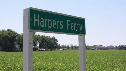
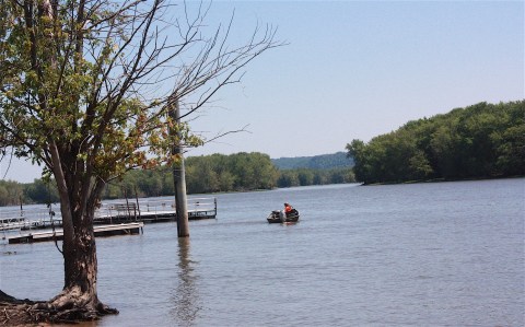
Harpers Ferry (population 328) is the next town on the route. It’s right on the Mississippi River, so there’s a lot of boating activity. The river laps right up onto your feet if you aren’t careful. I’m sure this will be a fun town to ride through.
The road from here on out is on both the Driftless Area Scenic Byway and the Great River Road National Scenic Byway.
Side note about Harpers Ferry: It’s very close to Effigy Mounds. I didn’t take the time to visit because I’ve been there before, but if you’re in the area and you have time, do yourself a favor and check out this National Monument run by the National Park Service. The preserved mounds are considered sacred to Native Americans, and they’re located in a really beautiful area just south of Harpers Ferry.

Heading north, between Harpers Ferry and Lansing, I came upon the Immaculate Conception Wexford Church, which sits high up on a hill. It’s a really striking building in a pretty amazing setting, so I stopped and took some pictures of the church and the adjacent cemetery.
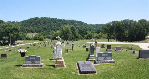
Apparently the church has been there since 1851 and was established by an Irish priest. (Fun fact: If you go to their website, you can find recipes for Irish stew and salted codfish and the like.)

OK, we’re now seriously near the end of the route. Let’s stay focused! And……we’re in Lansing!!! There’s the cool/awesome/scary Mississippi River bridge! And vibrant main street! And lots of bicycle motifs all ready for RAGBRAI’s final stop of 2017. This is the end of the road, folks.
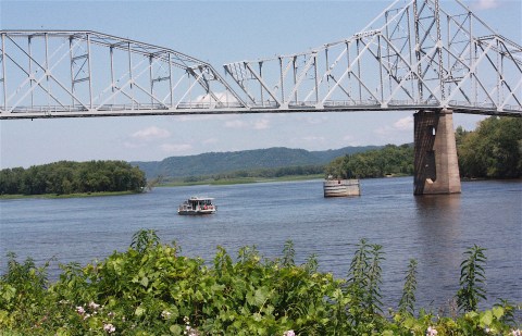
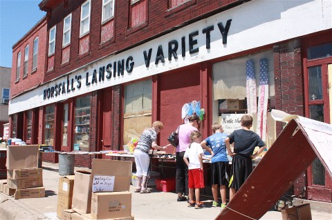
Before you leave Lansing (population 999), check out Horsfall’s variety store, which is filled with pretty much everything you can imagine. And ride to the top of Mt. Hosmer for the coolest view of the river and the scary bridge. I was headed up there myself when I was slapped with the last of the road-construction indignities: The road was being completely resurfaced when I got there. So sad!
But, as if to make up for my disappointment, within 30 seconds a deer walked in front of me. And then I passed the Oscar Mayer Wienermobile. How’s that for an awesome end to an awesome drive?
And it WAS an awesome drive. I took 1,153 pictures. Kudos to the folks who come up with this route, because I had a blast. Even though I may have sounded whiny and complained about stuff being closed and not being able to find a good cup of coffee, I loved this drive and this part of the state, and I loved all the little towns, even the ones I didn’t bother to stop in. Together they make up all the things I love about being an Iowan.
POSTSCRIPT

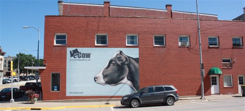
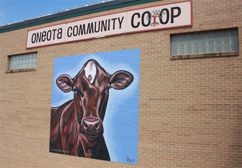
OK, so after I was officially finished with the RAGBRAI route and was heading back to Ames on Hwy. 9 (the most direct route available), I stopped back in Decorah, where I ate a giant ice cream cone at the Sugar Bowl. (I thought it was closing. I’m so glad it didn’t.) And I took a few more pictures: The Vesterheim Norwegian-American Museum and the cow painted on the side of the co-op building. And, of course, filled up my travel mug at Java John’s Coffee House.
And the last thing I did was drive to the north side of town to find Dunning’s Spring Park. I’ve read about this place and seen pictures of the waterfall, but I never knew where it was. My trusty map got me there! It’s a cool place in both uses of the word – it’s awesome and it’s also about 15 degrees cooler than the rest of the town. I walked up the 120 steps to view the falls from above, but in my opinion the best views are below. You can even play in the water if you want to. And you know you’ll want to.


Carole, you absolutely “live” your blog’s title, and this story, as well as the trip north to Lake Superior, are an absolute delight to read. Thanks for sharing, and for putting in the time, the miles and especially the attention! Wonderful tidbits and insights. Decorah is Anne’s hometown, and Dunning Springs is one of our favorite spots. It really is that “cool” even in July. So glad Java John’s was open for ya! Keep on truckin’!
Hello Carole, I am contacting you on behalf of Silos & Smokestacks National Heritage Area. Carrie Lane Chapman Catt Girlhood Home is one of our partner sites. We love the photo you took with signage in front. May we use it in our National Park Service social media? We would be sure to credit you for the photo.
Of course! Let me know what you need from me.