Exploring west-central Colorado
I traveled to Colorado last month with my National Parks-obsessed husband, Dave. He’s trying to visit all of the 417 NPS sites, and occasionally I am interested enough to tag along.
We drove to Denver the first night, then got up early the next morning and headed south on Interstate 25, then west on Hwy. 50. I had to stop and take Dramamine because of the curves and also sinus medicine because we were gaining altitude so quickly I thought my head would explode. I’m sure I was a lot of fun in the car.
As we were driving, we could see fires burning in the distance, and we drove past a staging area for firefighters – there was a camp there and a lot of helicopter activity. Luckily, none of the areas we planned to visit were directly affected by the fires.
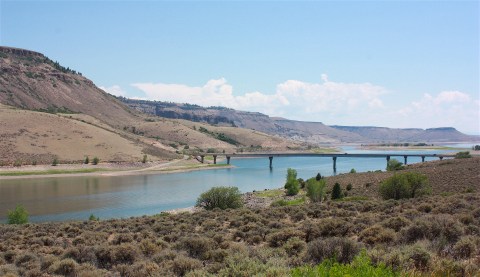
After about 4 hours we arrived at Curecanti National Recreation Area. Our first views were of Blue Mesa, Colorado’s largest lake (above). We stopped at the Elk Creek visitor center for advice on what to see and where to hike, then we drove along the scenic reservoir until we arrived at the trailhead for Pine Creek Trail.
I must admit that I wasn’t all that keen on hiking this trail based on the description in the park service brochure: “This hike descends 232 stairs along Pine Creek to the old railroad bed and Morrow Point Reservoir. This is the access trail for the boat tour.”
Okay, how about, “This is a pretty hike, with scenic vistas and happy wildlife”? I wasn’t sure I wanted to hike down (and then, of course, back up) 232 stairs to see an old railroad bed. I may have grumbled a bit.

But down the stairs we went in the 95-degree heat and bright sun, down, down, down to the bottom of the canyon to the river, where boat tours begin and hikers go to die.
As it turns out, it wasn’t all that bad. There was a tiny bit of shade here and there, and the steep canyon walls were pretty cool. Reading the signs, I learned that the Denver & Rio Grande Railroad, built in 1881-82, went through the canyon for 67 years, hauling coal, ore, livestock, and passengers.
We came upon the boat-launch area and saw one of the Park Service pontoon boats leaving for its tour of the Black Canyon of the Gunnison, where we’d go later by car.

After finishing that hike with no casualties, we drove further to Mesa Creek Trail. This one was easy, and it included crossing a pretty foot bridge over the Gunnison and a view of a dam.

From there, we headed to our next destination: Black Canyon of the Gunnison National Park near Montrose, Colo.
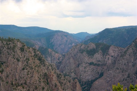
This park got its name because the canyon walls are made of dark volcanic rock and because, while the gorge is an average of 2,000 feet deep, it’s only about 1,500 feet across, thus not allowing sunlight to illuminate the canyon walls.

I’ll say this: It’s a pretty dramatic place. We stayed mostly on the south rim road, stopping often to hike to overlooks offering incredible views of the canyon and the Gunnison River far below.
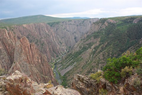
One sign at the Chasm View overlook said the walls of Black Canyon range in depth from 2,700 feet to 1,750 feet, and the Gunnison River has a very steep gradient – an average fall of 95 feet per mile. Every overlook offered a different, dramatic view.


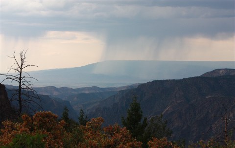
The afternoon light was nice, but we could see storm clouds gathering in the distance.
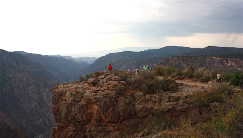
We stayed overnight in Montrose, a pretty cool town, and planned to visit the park all day the next day. So, we drove there the next morning and started at the far end of the park at Warner Point Trail, a 1.5-mile nature hike. It started with sweeping views of the valley…

…and then views of the canyon, which unfortunately were looking directly into the sun.


Note to self: Viewing the south canyon is definitely better in the afternoon than the morning.
We met a young hiker who was visiting a number of national parks for the first time. But, mostly, we had the trail to ourselves.
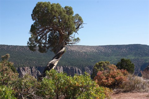
I really liked the craggy juniper trees, which create twisted sculptures whether they’re alive or dead.

We stopped and hiked at each of the overlooks we hadn’t done the afternoon before – and revisited a few we’d already seen. We thought it would take all day to see this park, but by noon we’d done everything we wanted to do on the south rim.
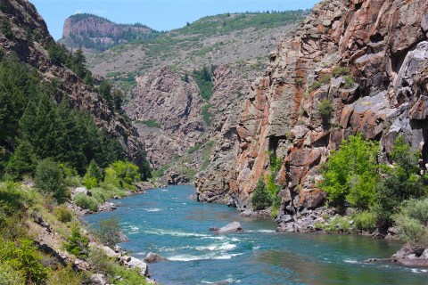
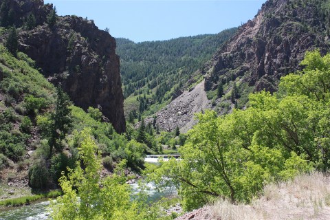
We headed back toward the park entrance and took the East Portal Road down to the bottom of the canyon. This road is extremely steep, with 16-percent grades and hairpin curves. By the time we got to the bottom, our brakes were smoking. But what a cool drive, and what a beautiful sight at the bottom! It was suddenly so green!

We had a picnic lunch along the river, and had the whole area to ourselves.

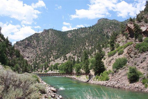
Afterwards, we attempted to take a little hike, but the trail was pathetic so we turned back. We did see some fishermen in the water. If fishing is your thing, this would be a very scenic place to do it.

We had lots of time to kill in the afternoon and evening, but in a way that was nice because it forced us to relax and enjoy being on vacation. We’d been on the go for several days, and it was SO HOT that we were really exhausted.
We decided to go to the downtown area of Montrose, which is really quirky and fun. We found the Horsefly Brewing Company (motto: “No crap on tap”) and tried several of their beers. I liked the Jazzy Razzy, which was pink and fruity and not at all what I generally drink. I also tried the Bug-Eyed Blonde, an easy beer to drink on a hot day. We also stopped for ice cream at the Daily Bread bakery and soda fountain.
That evening we ate dinner at Trattoria Di Sofia, a small Italian restaurant with red-checkered tablecloths and fresh pasta dishes. We definitely enjoyed our time in Montrose.
The next morning, we got up at 5 a.m. and left town an hour later, stopping only for coffee at a local coffee shop. Our destination today: Colorado National Monument.
We arrived at the National Park site, located near Grand Junction, at 7:30 a.m. As it turns out, morning was a terrible time to visit. All along Rim Rock Drive, we were facing into the direct early-morning sun, making it difficult to see and almost impossible to take decent photos. But we didn’t have much choice as we needed to be back in Denver by late afternoon (a 4-hour drive).
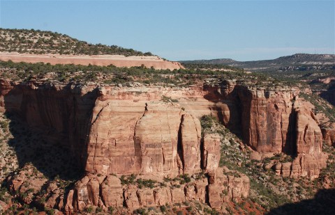
This area is described as having “big, bold, and brilliantly colored mesas, with towering and fascinating rock sculptures.” Like the Black Canyon, the main way to see the Monument is to drive along the rim road and stop at overlooks. Most of these overlooks don’t require much of a hike, although there are hiking trails in the park ranging from one to 14 miles long.
All along the 23-mile drive, visitors are treated to views of the Colorado River Valley, high cliffs, and the Grand Mesa. It’s pretty spectacular.
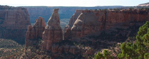
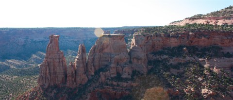
I especially liked these Coke Ovens…

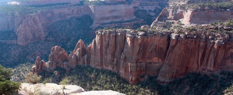
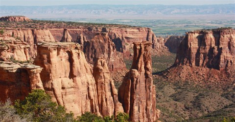
… and Monument Canyon…
…and the Grand View. Just think how spectacular it would have looked if the sun would have been in a better spot?
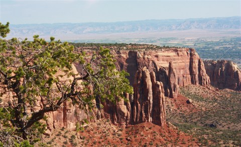
We did take one short hike along the Canyon Rim Trail, and I got to see more of those awesome, twisty juniper trees.

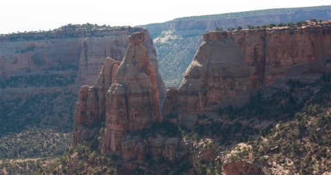
The Park Service says this drive is one of the grandest scenic drives in the American West. And it’s right off of Interstate 70, so it’s really easy to access. Here are a few parting shots:


Our drive back to Denver was through towering Rocky Mountains, along white-water streams, and near a number of swanky ski resorts. Overall, this section of I-70 may be the one of the most scenic drives anywhere on a U.S. interstate highway.

Lovely pics.