National Parks of North Dakota
When we enter North Dakota on Interstate 29, the first thing that happens is a really bad noise that sounds like some huge, angry vehicle following us. But, no, it’s us making the really bad noise. We have a flat tire.
Well, crap. This is no way to start a vacation.
We pull to the side of the interstate and take a look. Rear passenger tire flatter than flat. I guess it could be worse: It could be raining. Or dark. Or we could be in a really remote location.
So, OK. We will deal with this. My husband Dave makes a valiant attempt to change the tire while I call AAA and try not to freak out that one of the many semis blowing past us will crash into my tiny, injured Prius.


AAA to the rescue! The dispatcher finds our location and sends help. A guy from a nearby tow service arrives in record time, changes our tire, and we’re back on the road to Fargo. Twenty years of paying our AAA dues has finally paid off. (Meanwhile, we experience a true-life example of North Dakota Nice when a woman and her son heading southbound on I-29 spot me and my car and, thinking I’m alone, turn around and come to my aid. My faith in basic human kindness is still intact.)

LEWIS & CLARK AND INDIAN VILLAGES
We decided to visit North Dakota for the primary reason of checking more National Park Service locations off of Dave’s NP list. But our first stops were actually the Lewis & Clark Interpretive Center and Fort Mandan near Washburn, about four hours west of Fargo (not in the National Park Service purview). These historic locations tell the story of the Lewis & Clark Corps of Discovery with a special focus on the group’s winter stay with the Mandan and Hidatsa nations.


The interpretive center is especially nice. It had great displays with more than 100 artifacts and nice-quality art galleries. We even saw the artwork of ISU alumnus Charles Fritz, who specializes in Lewis & Clark illustrations.

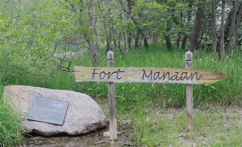

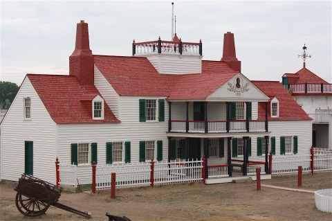
Fort Mandan (above) is where Lewis & Clark stayed during the winter of 1804-05. The replica fort, built in 1972, was OK, but forts are not really my thing. The interpreter on site was a hippy-dippy stoner dude; I’m pretty sure he had been smoking something, or maybe he was just naturally strange.

After touring the fort (yawn), we walked along the riverbank and then came upon a giant statue of Seaman, the Newfoundland dog who accompanied Lewis & Clark on his trek, and that was basically the highlight of that particular stop.

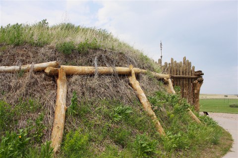
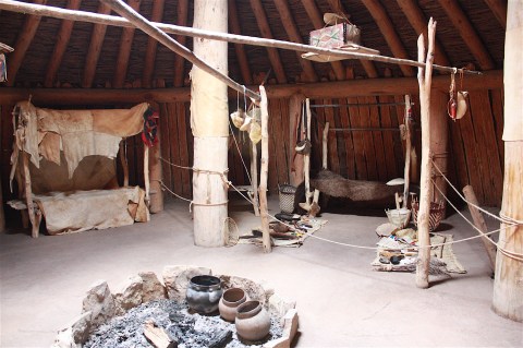
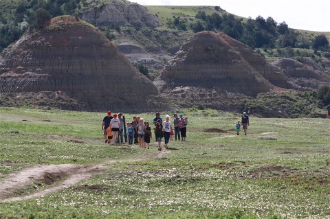
Our next stop was the Knife River Indian Villages near Stanton, about 60 miles north of Bismark. This is a National Historic Site run by the Park Service. I liked this place a lot. There was a reconstructed earth lodge that I could actually imagine living in, furnished with replica artifacts.
We took a nice hike along the River Villages Loop Trail that went through a grassland and along a river and through the site of the Awatixa Village, one of the Northern Plains tribes.
Most of the village sites in this area have been destroyed by erosion and river channel shifting and modern farming. The village site we hiked through was once home to as many as 400 people from the late 1790s to 1834.
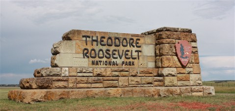
THEODORE ROOSEVELT NATIONAL PARK
From Stanton, we headed to Medora for a quick drive through the south unit of Theodore Roosevelt National Park. I was super excited to re-visit this park; we wanted to explore the south unit more thoroughly and to experience the north unit, which we hadn’t seen before.
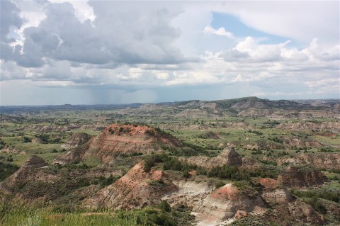
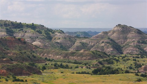
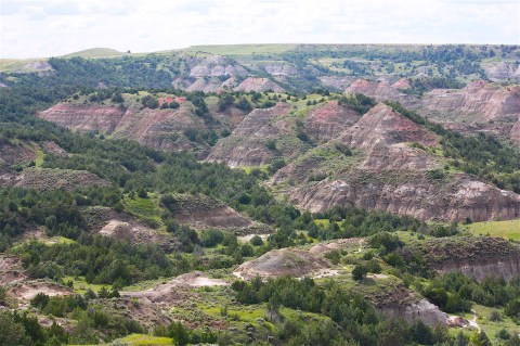
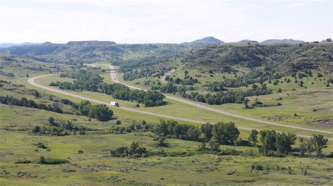
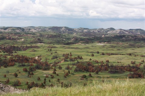
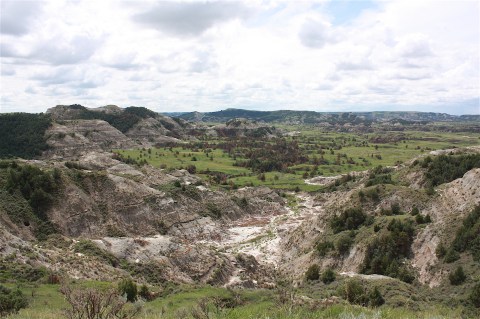
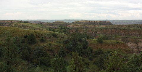
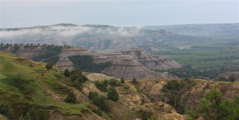
As you drive along Interstate 94, you can actually see the park to your north, and at one point the highway cuts through the lower edge of the park. The first place to stop, even before you have to pay to get into the park itself is the Painted Canyon Visitor Center. There’s a spectacular, breathtaking view of the park’s Badlands right off the interstate. It’s really amazing:

After Painted Canyon, you drive into Medora, a little tourist town famous for its Medora Musical (“the rootin’-tootinist, boot-scootinist show in all the west”), Pitchfork Steak Fondue, Medora Gospel Brunch, and all the fudge and taffy you can eat – all within about five blocks. We drove through town without stopping and headed for the park entrance gate (which is right there in Medora. Really, you can walk there from the fudge shop.)
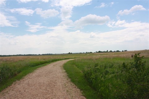
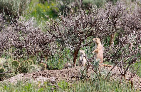
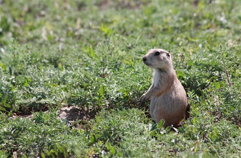
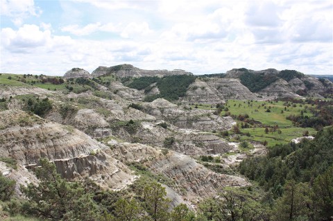
It was already late afternoon when we started the 36-mile scenic drive that takes a really long time because you have to stop for bison on the road and to stop and watch the adorable prairie dogs and to stop and take pictures of wild horses and scenic overlooks. This is truly a spectacular park, just filled with wildlife and virtually no cars. I mean, there were some people there, yeah, but it’s nothing like Yellowstone or some of the other national parks where it’s just bumper-to-bumper. This park feels really wild, and it’s just wonderful to experience it in relative silence.
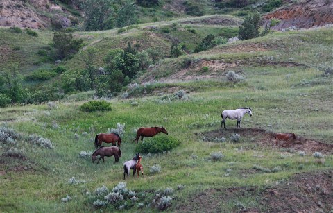
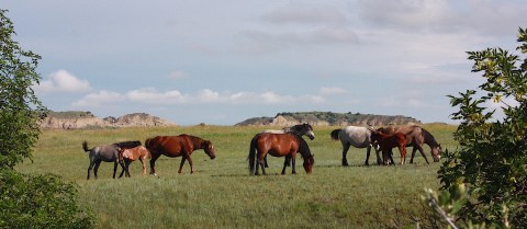
We saw this herd of wild horses (below) when we first entered the park. Feral horses, descendants of ranch stock, roam all over the south unit, just like they did when Teddy Roosevelt first came to this place.
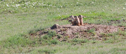
So, like I said, we followed the road through prairie dog towns and scenic overlooks, stopping at every one of them because they’re so awesome.


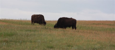
Our first bison sighting was a pair, one on each side of the road. One was happily scratching its shaggy head on a trailhead post. We were joined by just a couple of cars while we watched in awe as the huge animals walked within just a few feet of us.

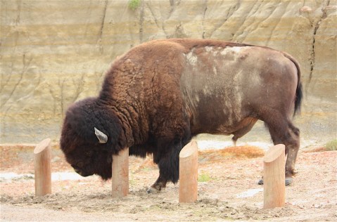
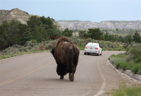
We saw more bison that afternoon, but no big herds. Just this guy, below. We finished the loop before dark and headed off to our overnight lodging and dinner at the Brick House Grill in Dickinson.
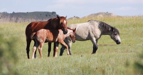
The next morning we arrived early to retrace our drive in the South Unit and to hopefully do some hiking (though the forecast was calling for rain). We were again greeted by a herd of wild horses (maybe the same ones as we’d seen the day before), this time within just a few yards of the road. They were so beautiful! There were even a couple of babies; I couldn’t get enough of watching them. It was a great way to start the day.
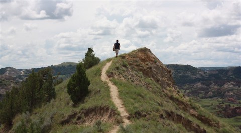
Our first “hike” was at the Skyline Vista overlook. It’s not really a hike, just a quick walk to the overlook, but it’s pretty and worth the stop:
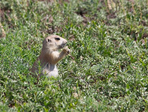
The prairie dogs were out enjoying the sunny morning, so we stopped and photographed them again:


And we spotted this next big guy walking away from us as we drove along the loop road:

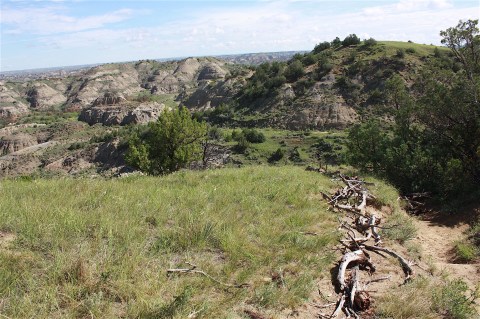
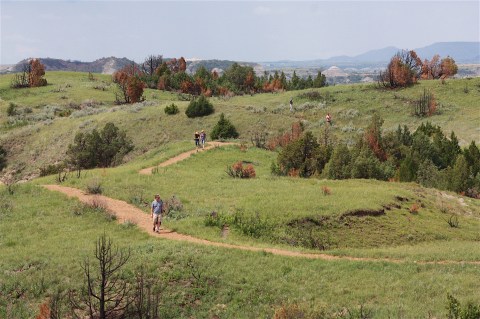
Our next stop was a real hike along Ridgeline Trail. It wasn’t super long, but it was a workout, with a ton of steep stairs and views along a high, grassy ridge.


Back in the car and we spot another guy in a picturesque setting, so we can’t pass up the photo op:


Our next hike is to the Old East Entrance, a .8-mile flat walk through a prairie dog town with Badlands in the distance. It was hot and sunny by this point, and I was glad I wore a hat. We saw one group led by a park ranger, but no other people. The prairie dogs kept us company with their high-pitched chatter.


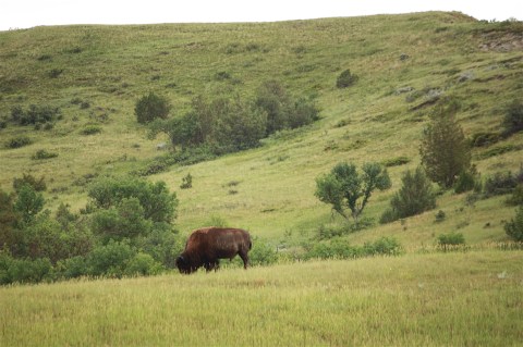
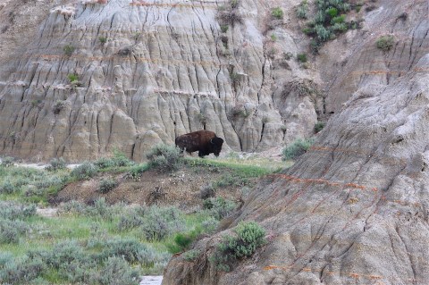
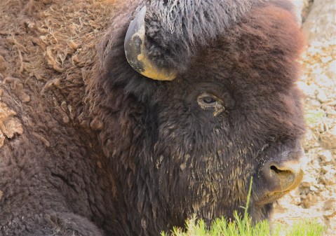
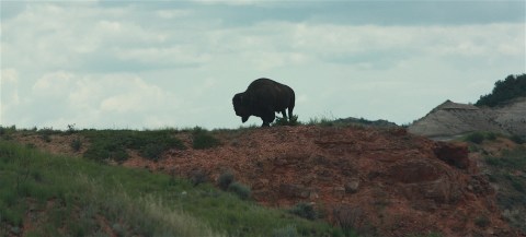
Back in the car, and around another bend, we came across this craggy, old bison, all alone:
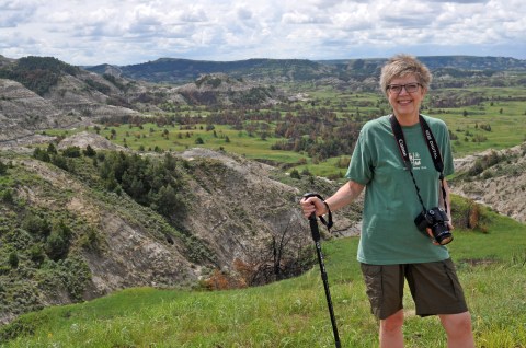
We passed by the Coal Vein Trail because the road to get to it seemed too muddy. By now we were about a third of the way around the loop, and we stopped at Buck Hill to climb to the top for a 360-degree view of the southeast portion of the park. Here I am at the top:


Our next bison sighting was different: Several of them were climbing along a ridgetop. We snapped a few pictures before they disappeared around the side:

One of our favorite views the day before was the Boicourt Overlook, but it was raining when we were there and the light wasn’t so great. So we were happy to get some good photos today and hike along the Boicourt Trail. The main trail is a quickie, just about .3 miles, but we found that the trail continued, so we took it and experienced some of the best views we’d seen by climbing along the narrow ridge. This was my favorite part of the South Unit.


The last hike we took was the Wind Canyon Trail, and it was different from anything else we’d seen, with views of the oxbow of the Little Missouri River. It was also the toughest, with steep up-and-down scrambles, and while we were there the storm clouds came rolling in. We narrowly finished our hike and were back in the car before it began to rain.

On our way out of the park, we had one final view before taking shelter in the visitor center until the rain let up:
The rain followed us as we drove the 50 miles north to the park’s North Unit. This was new territory for us, and how I wish the weather would have cooperated because I was so looking forward to taking a longer hike there. But it was not to be; it rained the whole time we were there.
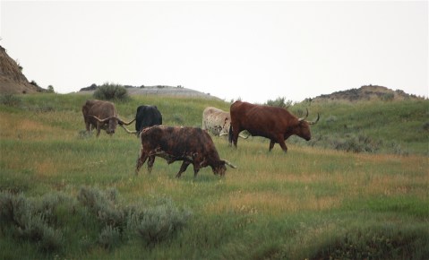
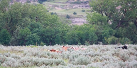
We were mostly undeterred. We drove the 14 mile scenic drive to the far end, turned around, and drove back (it’s not a loop). We stopped to photograph a herd of longhorn steers, a historic demonstration herd that harkens back to the Badlands cattle industry. The North Unit also has bighorn sheep, but we didn’t see any.
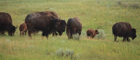
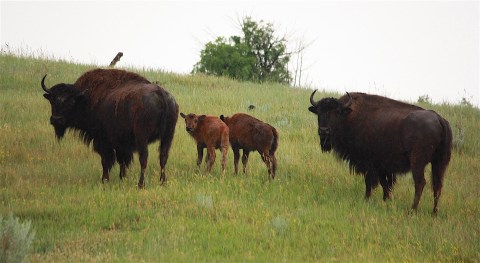
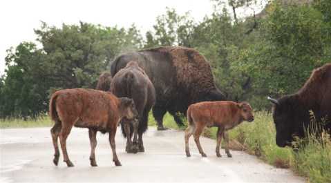
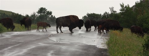
Our next wildlife viewing was a good one: a large herd of bison, with many offspring, on both sides of the road. And on the road itself. In the pouring rain. I got really wet but couldn’t stand not to take pictures, they were so awesome. We noticed that a couple of them had tracking collars, something we hadn’t seen in the South Unit. We watched them for a very long time until we decided we’d better move on.


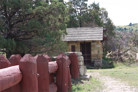
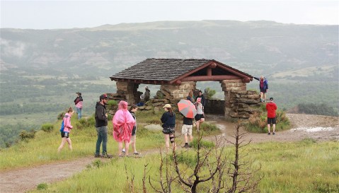
The other highlight of our visit to the North Unit was the River Bend Overlook. Here we encountered a large number of young visitors traveling by tour bus. It was raining and muddy and the trail was slippery, but the view was spectacular and I actually think the rain made the colors more vibrant. This is the area in which I was hoping to do a 4-mile hike along the Caprock Coulee Trail…but I wasn’t counting on the rain, so it was not to be. We had to be satisfied with the iconic overlook and the small shelter built by the CCC.

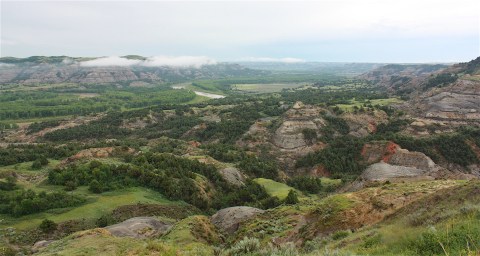
At the very end of the trail is the Oxbow Overlook, another view of the Little Missouri River Badlands. The rain had let up by this point, but the clouds were really low and just added to the beauty of the place. According to signage, the river here makes a hard turn to the east even though it used to continue north to Hudson Bay. During the most recent ice age, continental glaciers blocked its path; hence the turn.

As in the South Unit, our drive back was peppered with scenic overlooks and picturesque bison sightings…and a view of some longhorn steers relaxing (or hiding?) in the tall grass.
I hated to leave this place. It’s really remarkable, and I can’t say enough about its rugged beauty. If you ever get a chance and don’t mind the long drive across North Dakota, I highly recommend a visit. And don’t just go to the South Unit like so many people do…the North Unit is definitely worth the extra drive.

FORT UNION TRADING POST
We stayed in Williston overnight. Williston is at the epicenter of the recent oil boom. The small city has been featured in the New York Times, Forbes, The Guardian, ABC News, and other media outlets, and not with the kindest coverage. Here are a few headlines from stories I’ve read: “An Oil Town Where Men are Many, and Women are Hounded,” “In North Dakota, Boom, Bust and Oil,” “Built Up by Oil Boom, North Dakota Now Has an Emptier Feeling.” This last one, from the NY Times, is worth a link so you can read the whole story, but let me just share the lead: “WILLISTON, N.D. — The ‘man camps’ sprang up from the prairie, rows of trailers and modular steel boxes that housed thousands of workers chasing their fortunes in North Dakota’s oil fields. But these days, the man camps are missing something: men.”
Yeah, so we stayed in an interesting town. We saw the “man camps” and the industry that’s popped up alongside the drilling rigs and the businesses that are already closed down. But, hey, we stayed at a perfectly nice Hampton Inn. And ate dinner at a mostly empty and overpriced Italian restaurant.
The next morning we had to search for decent coffee before hitting the road. Our final destination: Fort Union Trading Post, another National Historic Site managed by the National Park Service. It’s southwest of Williston, and it’s right on the Montana border. In fact, when you enter the site you momentarily enter Montana, but then you’re right back in South Dakota. Anyway, this is a reconstruction of a non-military fur-trading post from the 1800s, and I was not too excited about going. But it’s actually pretty cool. There are some teepees set up, with a pretty backdrop, and the trading post itself is a full-scale reconstruction built on the exact location of the original structures.

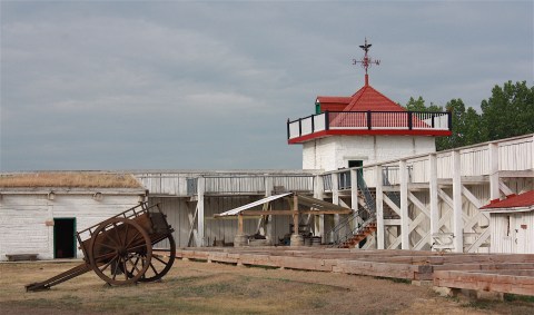
Fort Union was the most important fur trading post on the upper Missouri River from 1828 to 1867, longer than any other post on the frontier. Congress in 1966 designated the site to commemorate its significant role in the development in the American West.
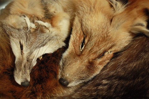
The displays are nice (with actual pelts, if you enjoy that kind of thing), and the setting is pretty. But watch out for mosquitoes. I had to run away and barricade myself in the car.
And then we drove 13 hours (give or take) back to Ames. But at least we didn’t have a flat tire.

Leave a comment