The Superior Hiking Trail

I’ve been visiting the north shore of Lake Superior in Minnesota since 2000. With this last trip (Oct. 2-4, 2016), I’ve visited a total of 20 times. The fall is the best time to visit; there’s absolutely no such thing as going to the north shore too many times.
The reason I started visiting the north shore was to hike the Superior Hiking Trail – a foot path that was then about 205 miles long and has now been expanded to a total of around 260 miles (not including spur trails), starting in northern Duluth and ending at the Canadian border, roughly following the ridgeline along Lake Superior. It’s sort of like a much shorter, more accessible Appalachian Trail.
There’s primitive camping along the trail, and I’ve often encountered campers and thru-hikers – serious backpackers who hike the whole trail in one big 2- to 4-week chunk. Lucky for the rest of us there are access points all along the trail where we can park our cars and just hike one section at a time.
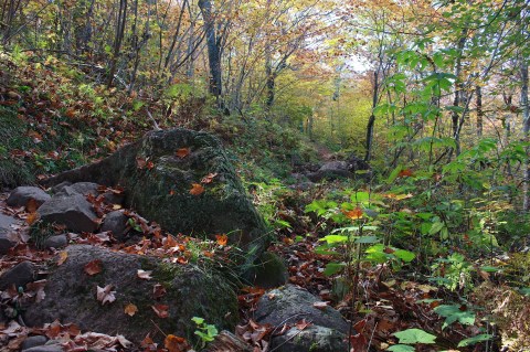
If you love to hike, you really need to experience this trail. It’s truly beautiful, lined with maples and aspen and birches and firs, with views of Lake Superior and inland lakes. The trail is mostly narrow and intimate, with boulders to clamber over and rocks and tree roots to maneuver. Sometimes the trail is very steep, and some sections have been stepped, either with wooden steps or large rocks. Wooden walkways and bridges have been installed to help hikers avoid the worst of the muddy, marshy areas. The mountaintops are mostly bald granite – tricky for me to climb – and provide the most spectacular views. But mostly I just love the narrow, secluded trails. I could walk there for hours and hours.
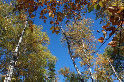
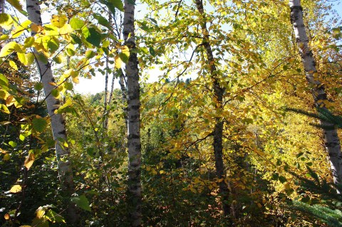
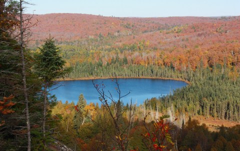
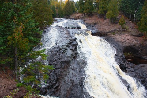
This past weekend I took four short hikes. The first one (pictured above and below) was just an hour-long leg stretcher as I drove northeast along Hwy. 61, the highway that hugs the shoreline of Lake Superior. The Caribou River Wayside (mile post 70.5) is my go-to stop as I head to Cascade Lodge, my lodging of choice about 10 miles south of Grand Marais.
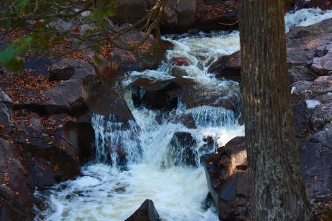
This hike is easily accessible, with a trailhead right next to the highway, and it doesn’t take long before you encounter a fast-moving river with a viewing platform, then a steep wooden staircase to a lovely waterfall, and a bridge that crosses the river. You get a lot of bang for your one-hour hike here, and the fall color is usually good.

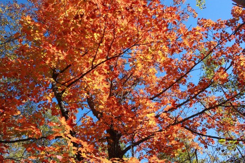
Speaking of fall color, the first weekend in October is usually the peak on the north shore. You catch the end of the red maples and the peak of the golden aspen and birch. Unfortunately, the color was not too spectacular this year – subtle as opposed to brilliant. Word on the trail was this year just wouldn’t be too great; it’s not that I was either late or early. The maples, especially, just didn’t really turn.

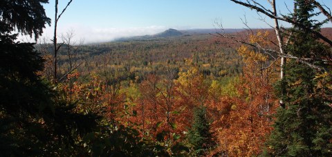
I started the next day (after a night in my cozy cabin, above, and a hearty breakfast at Cascade Restaurant) hiking up Oberg Mountain, one of the most accessible and beautiful spur hikes along the Superior Hiking Trail. There’s a large parking lot (accessible from Onion River Road, mile post 87.5) and you don’t have to do much hiking to get to the top.

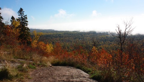
Along the way, the fall color was lovely. The many views from the top were pretty, even with the less-than-perfect color. As you walk around the hiking trail at the top of Oberg Mountain, you can see Lake Superior, Moose Mountain, Leveaux Mountain, and an inland lake. The whole hike is only about two miles, but give yourself a couple of hours to stop and take pictures and enjoy the views.
From the same parking lot, you can hike north toward Moose Mountain (I’ve done this hike before and remember it being fairly difficult) or you can go south to Leveaux Mountain, which is what I did this time. Leveaux is a fairly easy hike through an enchanting forest and a not-too-difficult climb to get to the top along a loop trail. The views of fall color, again, were less than spectacular, but the trail was awesome (3.7 miles total).


After a quick lunch stop at the Coho Café in Tofte (an overpriced but delicious salad and a latte, consumed on the outdoor patio), I hiked south on a section between the Temperance and Cross Rivers (below).


This is not one of the more popular trails, so it was a quiet, remote, and intimate hike without running into a lot of other people. There were a few scrambling-up-and-down sections and a few nice views, ending at Cross River (3.8 miles total). Here’s a view of the Cross River, not from the hiking trail but from the highway bridge:
My trail total was 9.8 for the day – not bad for an old gal – and I was hungry, so I cleaned myself up at the cabin (Cabin 2, my favorite) and headed into Grand Marais (see below for an evening view of the harbor) for beer and pizza at Sven and Ole’s. Unfortunately, the Pickled Herring, the bar upstairs, was closed, so I was forced to eat my wild rice pizza in the restaurant. (The pizza here is to die for, but not so much the dining atmosphere.)

There are about 35 trail sections on the Superior Hiking Trail, and I’ve hiked most of the ones north of Two Harbors. (The sections between Duluth and Two Harbors are relatively new, and I haven’t hiked any of them. I am guessing they are crowded, given their proximity to Duluth. There are also some sections from the Minnesota-Wisconsin border to Duluth that are now apparently part of the Superior Hiking Trail system, but I don’t know anything about those.) Here are some of my favorites hikes:
- Temperance River to Britton Peak: One of the most popular sections, and for good reason; it’s awesome. (4.8 miles)
- Britton Peak to Oberg Mountain: This section includes the Leveaux Mountain loop I took this year. (5.7 miles)
- Lutsen to Caribou Trail: This is one of my very favorite sections, although my old legs have a hard time doing it anymore. Highlights include Lake Agnes, a crazy log ladder, moss-covered boulders, and spectacular fall color. (6.4 miles)
- Cascade River Loop: I’m proud to say I’ve done this very difficult hike twice, but that was back when I was younger. I couldn’t do it today, but I recommend it to hearty hikers who want to see spectacular falls.
- Caribou River Wayside to Cook County Road 1: This is the section I like to hike on my way up to the cabin, but I don’t do very much of it these days. If you do the whole thing (9 miles), the highlight is Alfred’s Pond, one of my favorite places along the whole trail. It’s closer to the northern end (about 3.2 miles from the trailhead). I hiked to the pond and back one time and never saw another human.
- Cook County Road 1 to Temperance River State Park: Highlights are the Tower Overlook and the Cross and Temperance Rivers. (I did a section of this hike this year.) (8 miles total)
- Silver Bay to Tettegouche State Park/Hwy. 1: The south end of this section includes Bean and Bear Lakes – very challenging but an awesome hike with incredible views. The north end features Round Mountain and Mt. Trudee. I’ve done both ends separately, because I can’t hike the whole thing (11.1 miles) and then back to my car, because that would be WAY too much hiking for one day, even in my younger years. I’ve done the Mt. Trudee section several times, and it’s incredible – but treacherous. I especially like that section for spring flowers.
- Gooseberry Falls State Park to Split Rock River: This hike doesn’t start out too exciting, and it’s über popular due to its location. But the Split Rock end of the trail is pretty awesome, even though I distinctly remember how hard it rained on the day I hiked and how I slid down one of the trails in the mud (6 miles).

- Split Rock River Loop: Also really, really popular; moderately difficult but pretty (5 miles). The photo of the Split Rock Lighthouse above was shot from the wayside on Hwy. 61.
- All the really northern trails (Grand Marais to Cook County Road 58, with its Devil Track River; Kadunce River Wayside to Judge Magney State Park, and others) are probably the most remote and least traveled sections, which make them really special to me. These are the sections on which you can literally hike all day and not see another person.
If you’re going to hike the Superior Hiking Trail, even just a section or two, I’d recommend buying this book: Guide to the Superior Hiking Trail, now in its seventh edition. This and other books, maps, clothing, and other stuff can be purchased through the Superior Hiking Trail Association web store. The SHTA keeps the trail in hiking shape, and it’s all run by volunteers, so it’s a great organization to support.

Very nice photos. I love the SHT and have hiked/backpacked all of it N of Two Harbors, much of it many times and my favorite season is fall as well. Check my blog, lots of pics along SHT and elsewhere. Maybe see you on the trail sometime… never know! 😉