Adventures in western Iowa, part 3: Hiking the Loess Hills
I spent a weekend in northwest Iowa recently with two main goals: Drive the Glacial Trail Scenic Byway and hike in the Loess Hills. But I had some other adventures along the way. Here is part 3 of a 4-part series:

Leaving behind the Glacial Trail Scenic Byway late Saturday morning, I drove west toward the Loess Hills National Scenic Byway. I had explored the entire length of the byway back in summer 2014 and blogged about it here.
One of my regrets from that trip was being in such a hurry to see it all that I had little time to truly explore any one area of these beautiful landscape formations. This time, I really wanted to hike in two specific locations along the byway: the Broken Kettle Grasslands / Five Ridge Prairie area and the Preparation Canyon State Park / Loess Hills State Forest area.
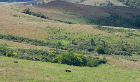
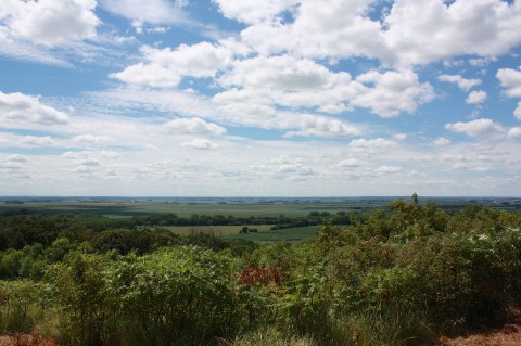
At the northern end of the byway, I took the Ridge Road Loop. This is, in my opinion, one of the most stunning parts of the whole drive. Cruising slowly along the gravelly hills, I tried to find a trail to hike in the Broken Kettle Grasslands Preserve. This 4,500-acre preserve is home to Iowa’s largest remaining prairie as well as a large herd of bison (I saw just two animals, below), and it’s preserved by The Nature Conservancy. It’s a truly beautiful place.

I had found a map online that showed the area with roads and suggested viewing areas – and a small section highlighted as “recommended hiking.” I know I drove through that section. But even with the map, I didn’t find any place to park, much less hike – no trails, no trailheads, no signs, nothing. Most of the prairie is fenced off, with signs that specifically prohibit entrance. I took a lot of pictures from the road. Hiking or no hiking, this place is just spectacular.
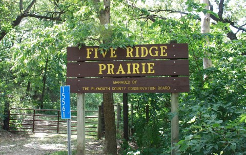
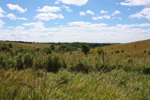
Also on the Ridge Road Loop is Five Ridge Prairie, a Plymouth County park that promises hiking trails through loess bluffs with a mixture of oak-timbered valleys, native prairie ridge tops, and west-facing slopes. It’s not the easiest place to find – there’s a west and an east entrance – but I finally found the west entrance off Hwy. 12. The hiking in that part of the park didn’t turn out to be so great – very open and scrubby and with no signage – and I didn’t want to get lost.

So I hiked a bit, but after the trail split three times I figured it was time to go back to the car. It was a hot day, and the trail provided no shade. I was glad I had plenty of water in my car.

I then attempted to find the east entrance, thinking it might be more hiker-friendly, and when I found the road to turn on – the crazy, roller-coaster road (above) – I realized that I had briefly hiked this place before. When I was there two years ago (this very weekend) I drove to the entrance, walked a short distance, and then got back in the car – because I had no idea what to expect from the park and didn’t have time to explore. I was in such a rush to drive the whole Loess Hills Byway. On this visit, I had plenty of time, so I did hike there for an hour or so. It was pretty, but the hiking itself was just OK. Hot and scrubby, with little shade and no spectacular views. Overall disappointing.

If you want to visit Five Ridge Prairie, it’s officially located 7 miles west of Westfield on Hwy. 12 (west entrance) or 15561 260th St. (east entrance). Blink and you’ll miss either one. Good luck.
I spent Saturday night in Le Mars, but I’ll write more about that in Part 4.
Sunday morning, leaving Le Mars bright and early, I had to drive about an hour to get to my next destination. I took Hwy. 75 to Sioux City, hopped on I-29 south, then got off at Onawa to get back on the Loess Hills Byway.

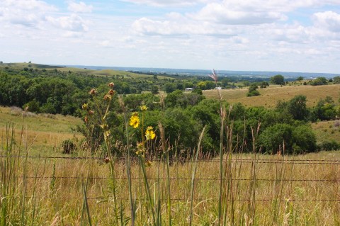
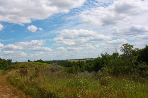
Once I got off the interstate, the drive was beautiful. I found the Byway quite easily, but trying to follow the map I once again had a hard time finding what I was looking for. I ended up getting turned around (AKA lost) and taking a different route than I’d planned, but I was loving the show I was listening to on NPR, and the scenery (below) was gorgeous so I didn’t mind at all.


I finally got on the Preparation Loop road (above) and found Preparation Canyon State Park…but could NOT find a single hiking trail, despite the map’s promise of many, many backpacking trails. (What am I doing wrong? All I found was campgrounds and dead ends.)
The state park is 344 acres with forests, savannas, and prairies. It’s located in Monona County at the north end of Loess Hills State Forest.

My friend Jim told me that the state forest has a spectacular overlook and some hiking trails. Luckily there was a SIGN that helped guide me to the wooden, easily accessible overlook (above) – finally, the quintessential Loess Hills view! – and I took a short hike on the overlook loop.
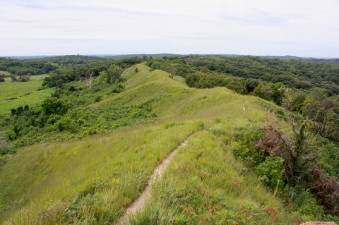
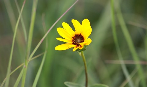


I would have taken a much longer hike, but the trail was so overgrown with tall grasses (do you see that adorable baby hiding in the grass above?) that it wasn’t even fun after awhile, so I turned around and walked back. I walked for less than half an hour. I was hoping to hike all day. Fail!
This is a beautiful part of Iowa, and I highly recommend a visit. But if you go, I hope you have better navigational skills than I do.

Those rolling hills are so majestic