Michigan’s Upper Peninsula
We entered the Upper Peninsula of Michigan late in the day at the northernmost road connecting with Wisconsin. Our journey was about to begin.
I’d pondered the wilds of the UP for nine months since a conversation with two of my colleagues at a holiday party. Both had grown up in Michigan and knew the lakeshores, backwoods, cliffs, small towns, waterfalls, hiking trails, shipwrecks, and lighthouses that make up the Upper Peninsula. I was immediately smitten with the idea of making this one of my next vacations.
So I bought a book – Michigan’s Upper Peninsula by Paul Vachon – and unearthed a clipping I’d saved from the New York Times called “My Upper Peninsula” by Jim Harrison, author of Legends of the Fall.
Still winter, with resources in hand, I plotted our itinerary. We’d go to the Keweenaw Peninsula, the upper fin on the fish-shaped landform. We’d go through Marquette, the only city of any size in all the UP. We’d visit Pictured Rocks National Lakeshore and Tahquamenon Falls State Park. We’d venture into Canada via Sault Ste. Marie, take a ferry to Mackinac Island, and drive across the Mackinac Bridge to the Lower Peninsula.

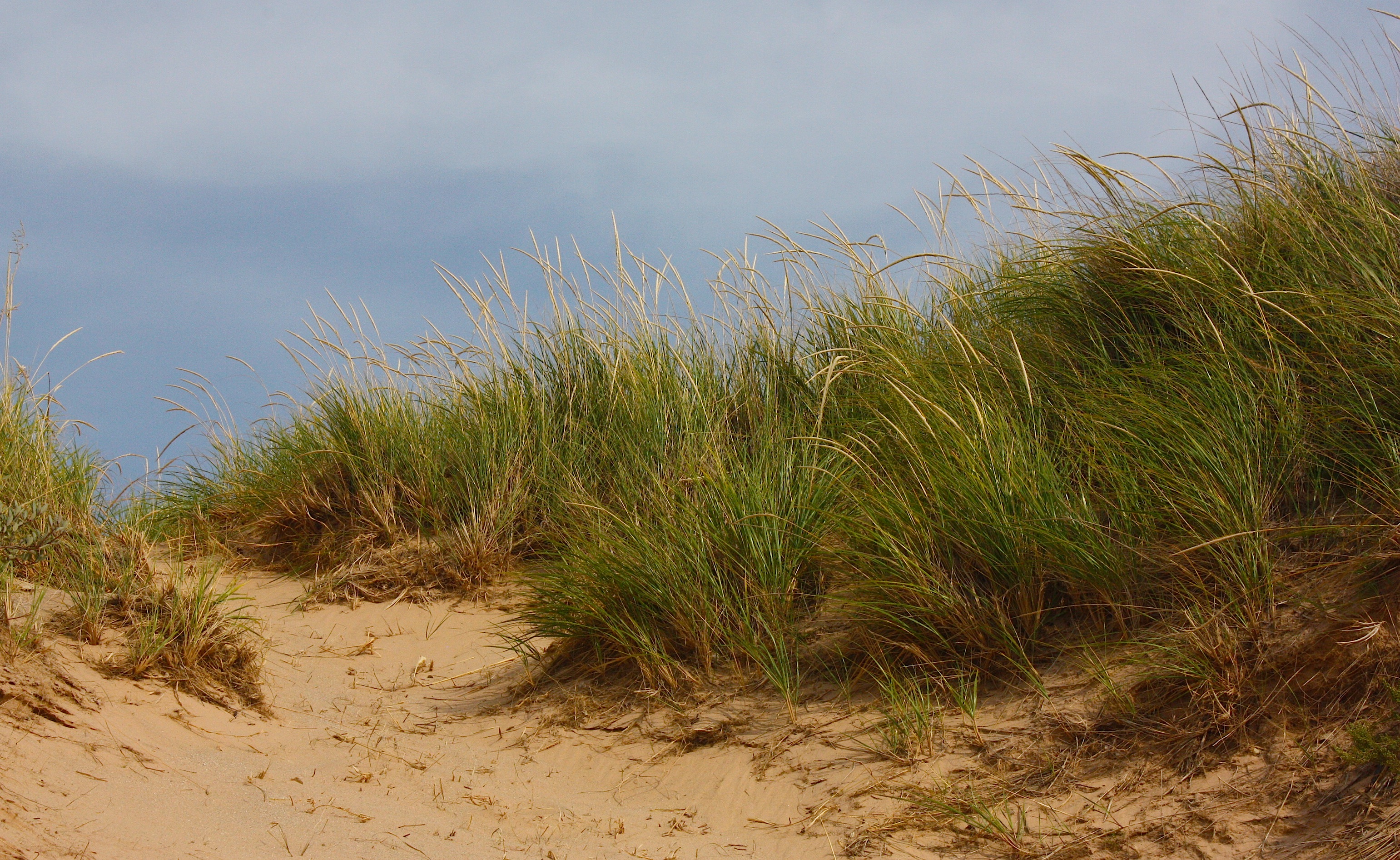
I learned that the UP is about 30 percent of Michigan’s total land mass but contains only 3 percent of its population. The area gets up to 300 inches of snow each winter. It’s surrounded by the Great Lakes: Superior to the north, Huron to the east, and Michigan to the south. Although it’s firmly connected to Wisconsin, the UP never touches the rest of Michigan – you can only reach the UP from the Lower Peninsula by bridge or ferry. The natives are called “Yoopers,” and the tourists who travel to Mackinac Island are called “Fudgies.”
Dave and I determined that we would go to the UP in the early fall, hoping for few tourists and cool weather. We never really considered fall color, though if we would have thought about it, we might have pushed our travel schedule back a couple of weeks. Instead, we booked hotels starting the weekend of Sept. 13, the first non-home Cyclone football weekend (Dave does NOT miss an opportunity to tailgate). We didn’t want to go too late…we’d heard about the area’s early winter storms.
In the end, we spent a day driving to the UP, four full days traveling the area, one day on Mackinac Island, and one day along the Lake Michigan shoreline in the northwest Lower Peninsula before driving home. Here are the highlights:
KEWEENAW PENINSULA
The Keweenaw (pronounced “Kee-wuh-naw”) Peninsula is the northernmost part of the UP. To get there from Ames, we drove north to the Twin Cities and across northern Wisconsin to the towns of Hurley (on the Wisconsin side) and Ironwood (on the Michigan side). After spending the first night in Hurley, we drove northeast on a two-lane highway (our mode of transportation for the next four days) toward Copper Harbor, which is pretty much the end of the road.

Highlights of the drive included the more-or-less-conjoined towns of Houghton (pronounced “HOE-ton”) and Hancock. Houghton is home to Michigan Tech University, and Hancock has Finlandia University. The towns are small, but they’re sort of a population hub in this neck of the woods, and with the colleges they offer a fair number of restaurants, shops, bars, and other services. (We ate lunch at The Library in Houghton. The atmosphere was cool, but the food was just so-so. I did get a good cup of coffee at a coffee shop called Cyberia.)
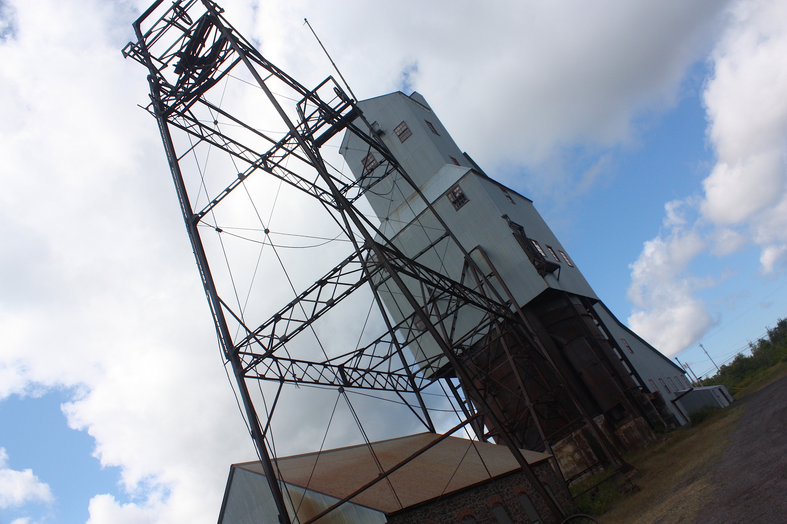
This whole area of the UP is known for its history of copper mining. In Hancock, you can visit the Quincy Mine (below), part of the Keweenaw National Historical Park administered by the National Park Service. (A two-hour tour takes you 2,000 feet into the mine, which is, well, underground, so it was obviously not an option for me, the world’s most claustrophobic woman.)

Another cool thing about Houghton and Hancock is the lift bridge between the two towns (above). The bridge crosses the Keweenaw Waterway, which splits the peninsula in half. The 21-mile portage waterway also allows boaters to cut across the peninsula, saving them a 100-mile trip round the tip. Visitors heading to Isle Royale National Park can board the ferry here, too.
Northeast of Hancock is Calumet (below), a historic mining town with terrific old architecture and several interesting museums, including one run by the National Park Service.


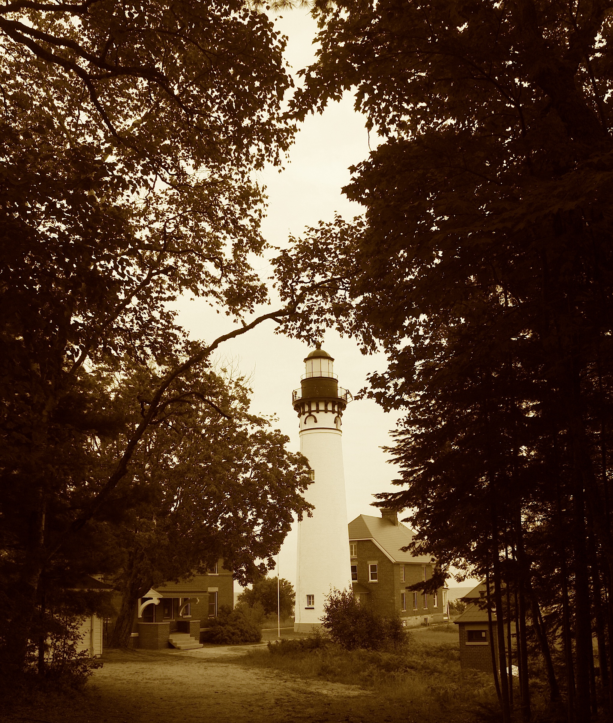
Not long after driving through Calumet, we got off the main road and scooted over to the lakeshore at Eagle River. We were immediately greeted by a waterfall and a lighthouse. Yes! This is what we came to see. I was hoping to stop at The Jampot, a bakery and jam shop in the middle of nowhere run by Byzantine monks. The monastery’s website says the monks “embrace evangelical poverty, chastity, obedience, and stability of life” – and, apparently, the making of dozens of kind of fruity jams and booze-soaked fruitcake-style breads. When do you get the chance to see such a place? Never, that’s when.
So I was completely bummed (but not altogether surprised) that the shop was closed. After all, it was a Sunday afternoon. But we went back the next morning and I bought a loaf of ginger-walnut cake soaked in brandy, plus four jars of exotic-sounding jams. And I got to see a couple of the monks; they totally made me think of Monty Python and the Holy Grail. I wanted to take pictures, but it seemed sort of disrespectful, so I only photographed the outside of the building…and the jam.

We stopped at the Eagle Harbor lighthouse before jumping on the Brockway Mountain Drive, said to be the highest drive between the Rockies and the Alleghenies and also the most beautiful road in Michigan. I’m not sure if I agree with that, but there is one kick-ass overlook (above) that makes the drive well worth it.

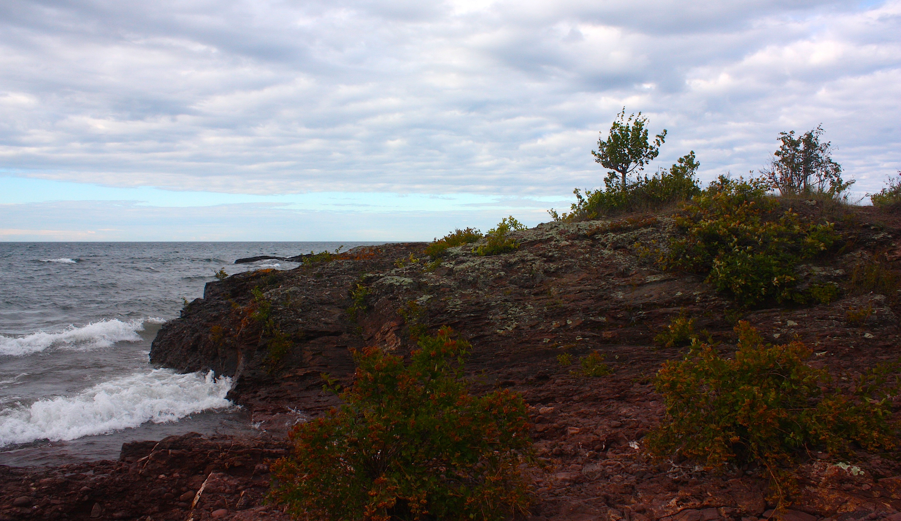
The mountain drive ends in Copper Harbor (above), our home for the night. But we were not ready to settle in just yet. Instead, we drove back west for about 10 miles along the lakeshore drive. We thought it was more scenic than Brockway, with its rocky outcroppings and crashing waves.

We checked into Brockway Inn, a mom-and-pop affair that promoted itself as also having the best coffee shop in Copper Harbor. The coffee shop was closed, and the motel was just OK – about what we expected. Based on our friendly innkeeper’s recommendation, we went to the Harbor Haus for dinner, a German/seafood hybrid with good food and a great view of the lake. Afterwards, we watched the Isle Royale Queen at the dock (another ferry to Isle Royale National Park), then drove around chasing the sunset.
PICTURED ROCKS NATIONAL LAKESHORE

After a full day driving back through the Keweenaw Peninsula, to Marquette, and hiking up Sugar Loaf Mountain (with views of Lake Superior and the Huron Mountains), we ended up in Munising, our jumping-off point for Pictured Rocks National Lakeshore.
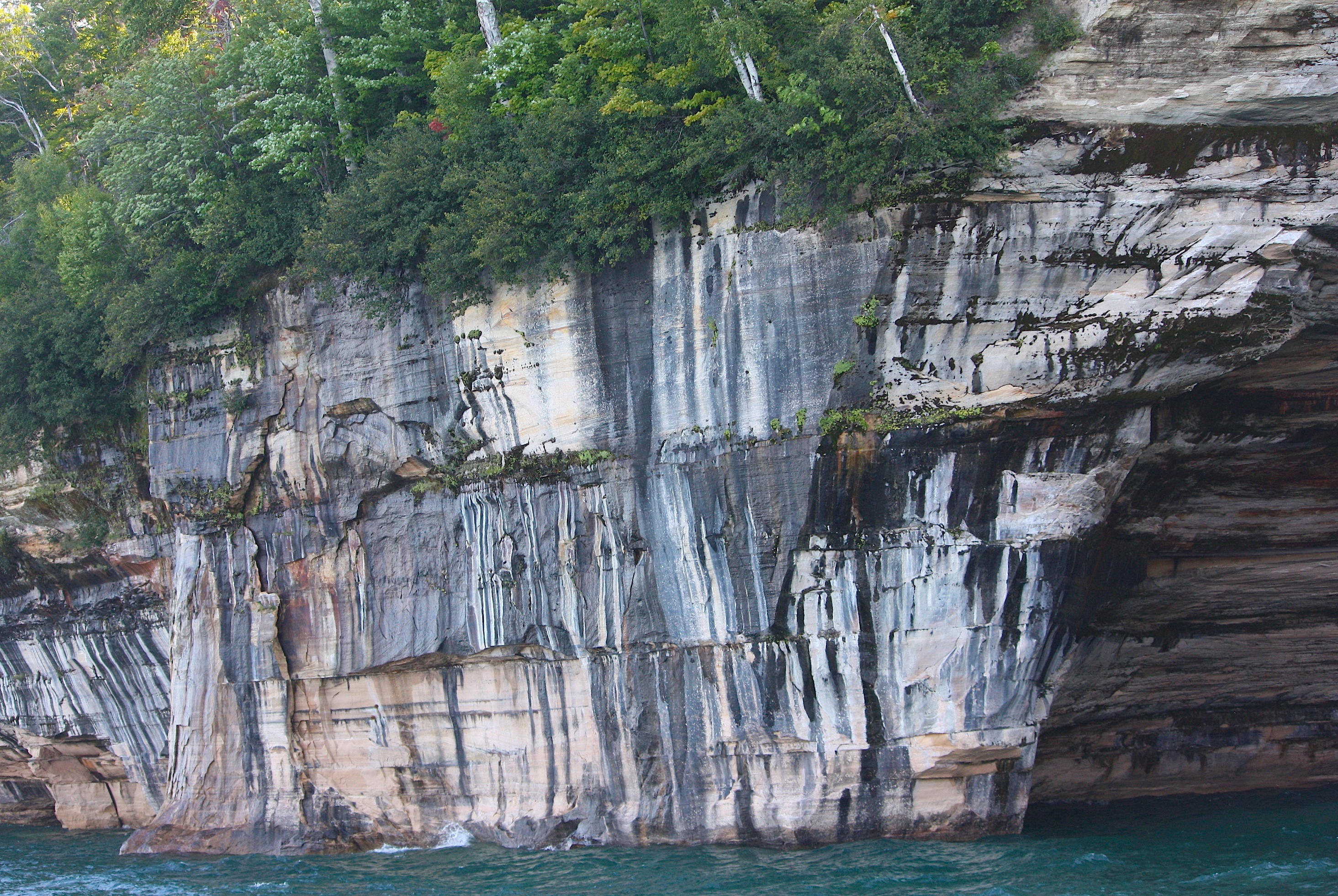
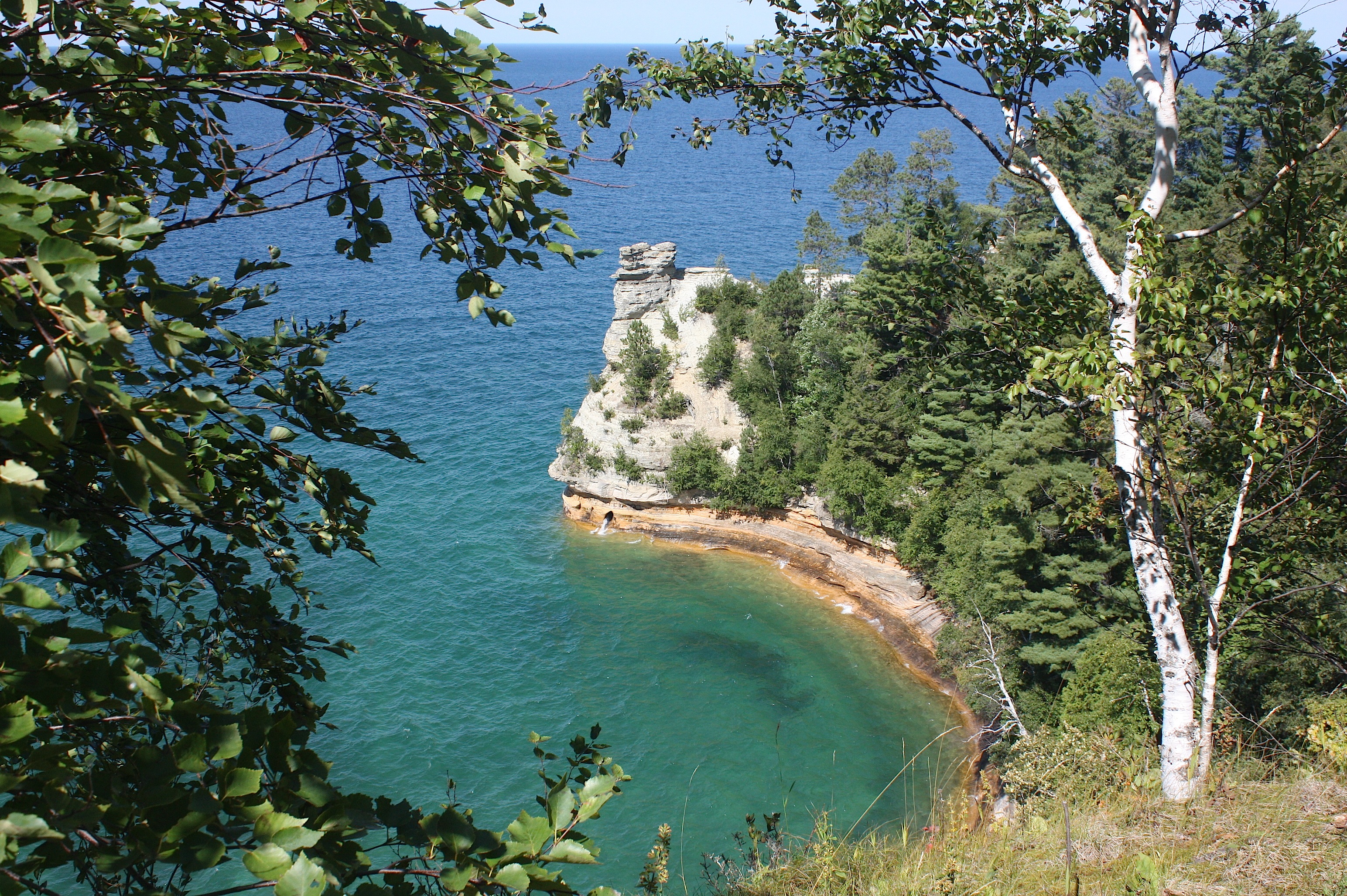
Pictured Rocks was our favorite place on the trip. It’s so much more than its famous sandstone cliffs – it also has waterfalls, forests, hiking trails, and lighthouses.
We started our tour with the first Pictured Rocks cruise of the day. The tour company (authorized by the National Park Service) runs a number of boat tours of varying lengths each day. Ours left the dock at 10 a.m. and took 2 hours and 40 minutes. We were at the front of the line so we could grab a good seat on the right side of the boat’s upper deck.
I highly, highly recommend doing this or a similar boat tour. Ours cost $36 per person. It’s the best way to see the colored cliffs, sea caves, rock formations, lighthouses, and arches. I thought it was absolutely unique and beautiful.

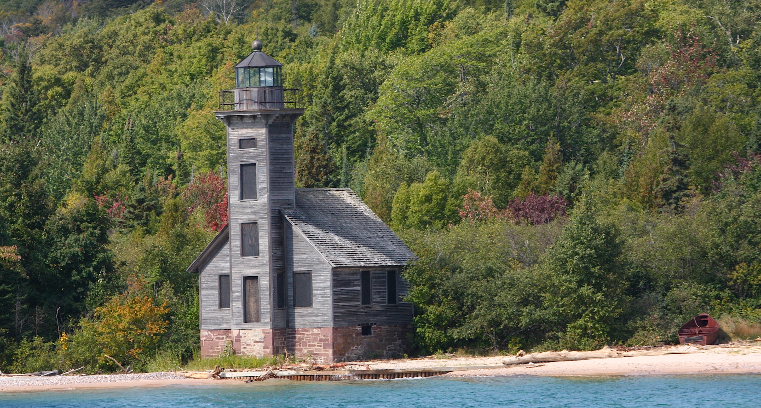
I sat through pretty much the whole thing but still managed to work up an appetite. We ate lunch at the Navigator restaurant in Munising, right across from the cruise headquarters. And then we spent the rest of the day hitting the highlights of the national lakeshore: Munising Falls (a quick boardwalk stroll from the parking lot), Miners Castle (an awesome overlook), Au Sable Light Station (a 1.5 mile walk to the prettiest lighthouse we saw on the whole trip), Log Slide overlook (a scenic view with interesting logging history), and Sable Falls (lots of steps with a waterfall and lake walk payoff). Here’s a whole photo gallery:


It was a lovely place. In my younger days I could have spent three days here, hiking the trails and exploring the entire park. But today I was satisfied with the amount of walking I did and all the great scenery. The national lakeshore ends at the town of Grand Marais; from there, we drove south and then east to Newberry, the only town of any size in this part of the UP and our home for the night.
TAHQUAMEMON FALLS STATE PARK
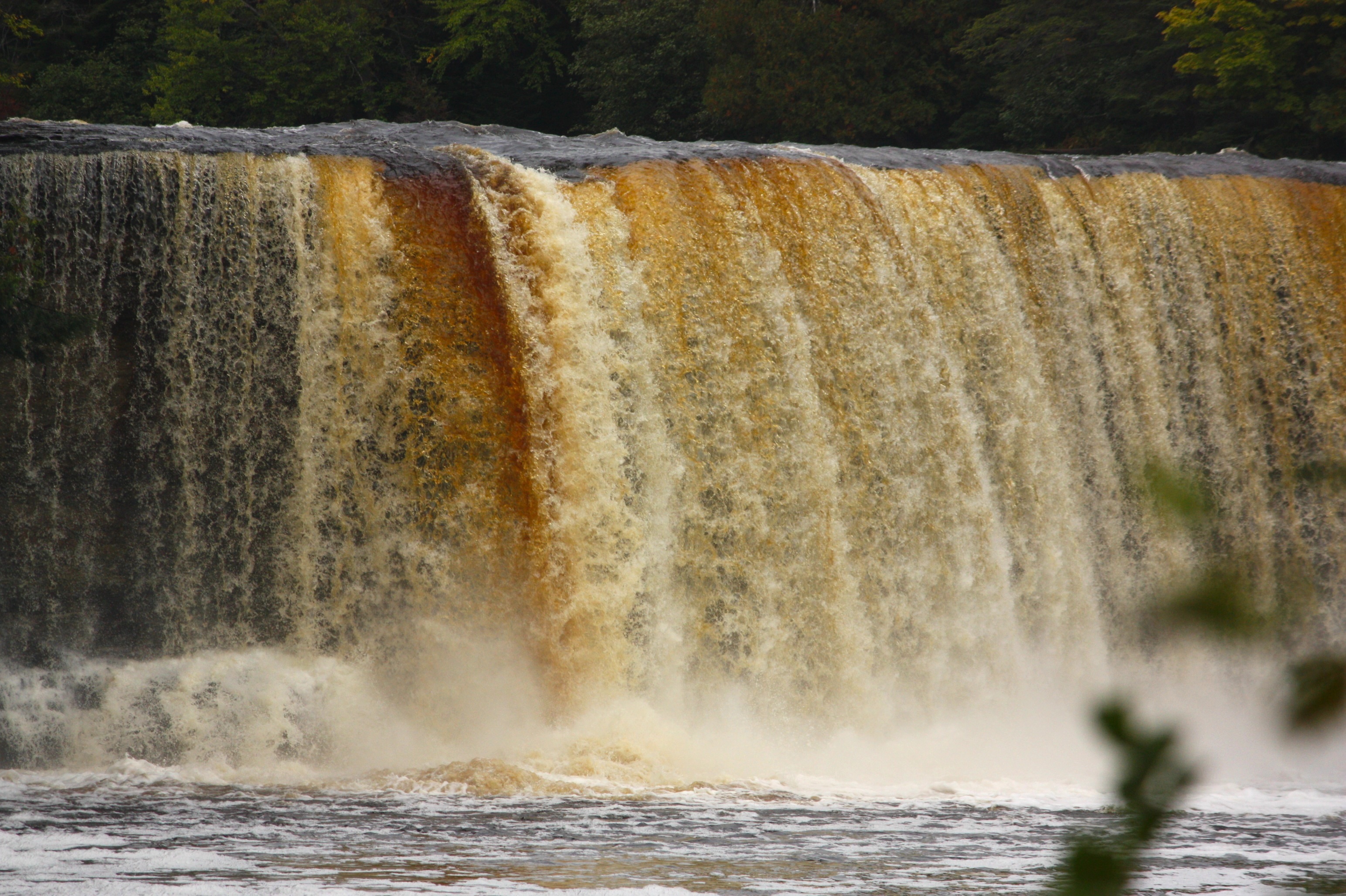
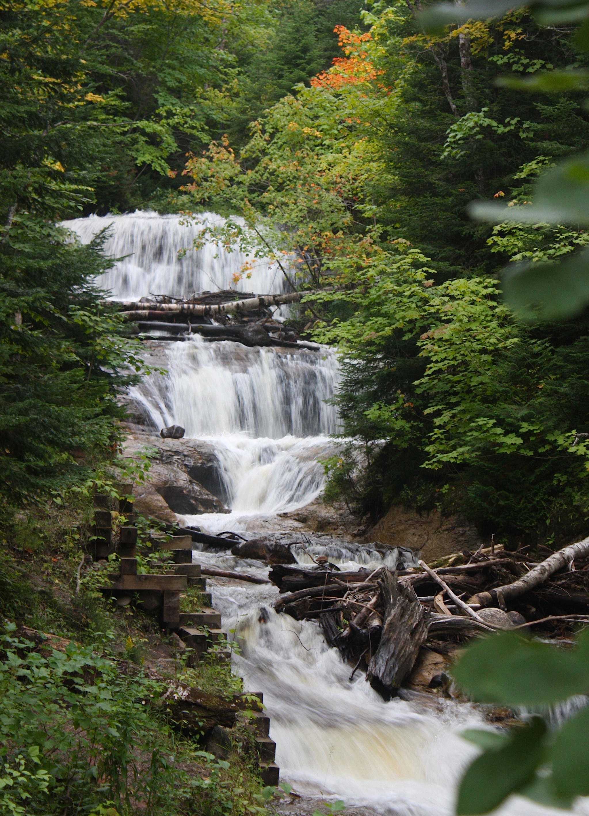
This morning, after a breakfast of blueberry pancakes at Pickleman’s restaurant in Newberry, we drove the 26 miles northeast to Tahquamenon Falls State Park. I’ve seen lots of pictures of UP waterfalls, and this might be the most spectacular falls in all of the Upper Peninsula. The upper falls are 200 feet wide and 50 feet tall. You can view them from the top or bottom, both accessible by a hundred or more man-made steps – well worth the climb.
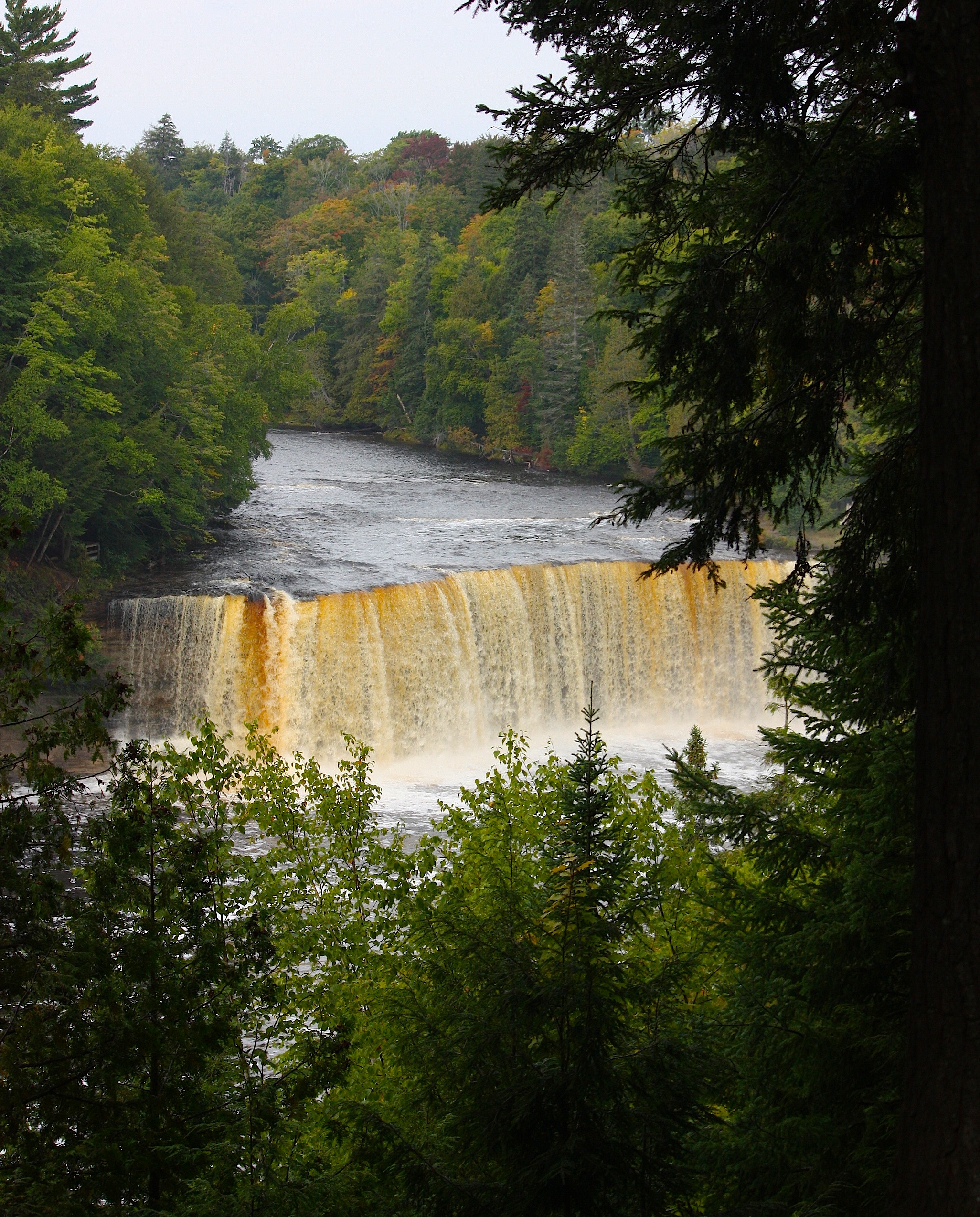

The lower falls of the Tahquamenon River are less spectacular in terms of sheer size, but I think they’re more beautiful because of their setting (above). They are easily viewed by walking along paved and boarded walkways. When we were there, the trees were turning and the whole thing was just glorious. The entire park is 50,000 acres, with tons of hiking trails, camping, fishing, boating, and cross-country skiing.
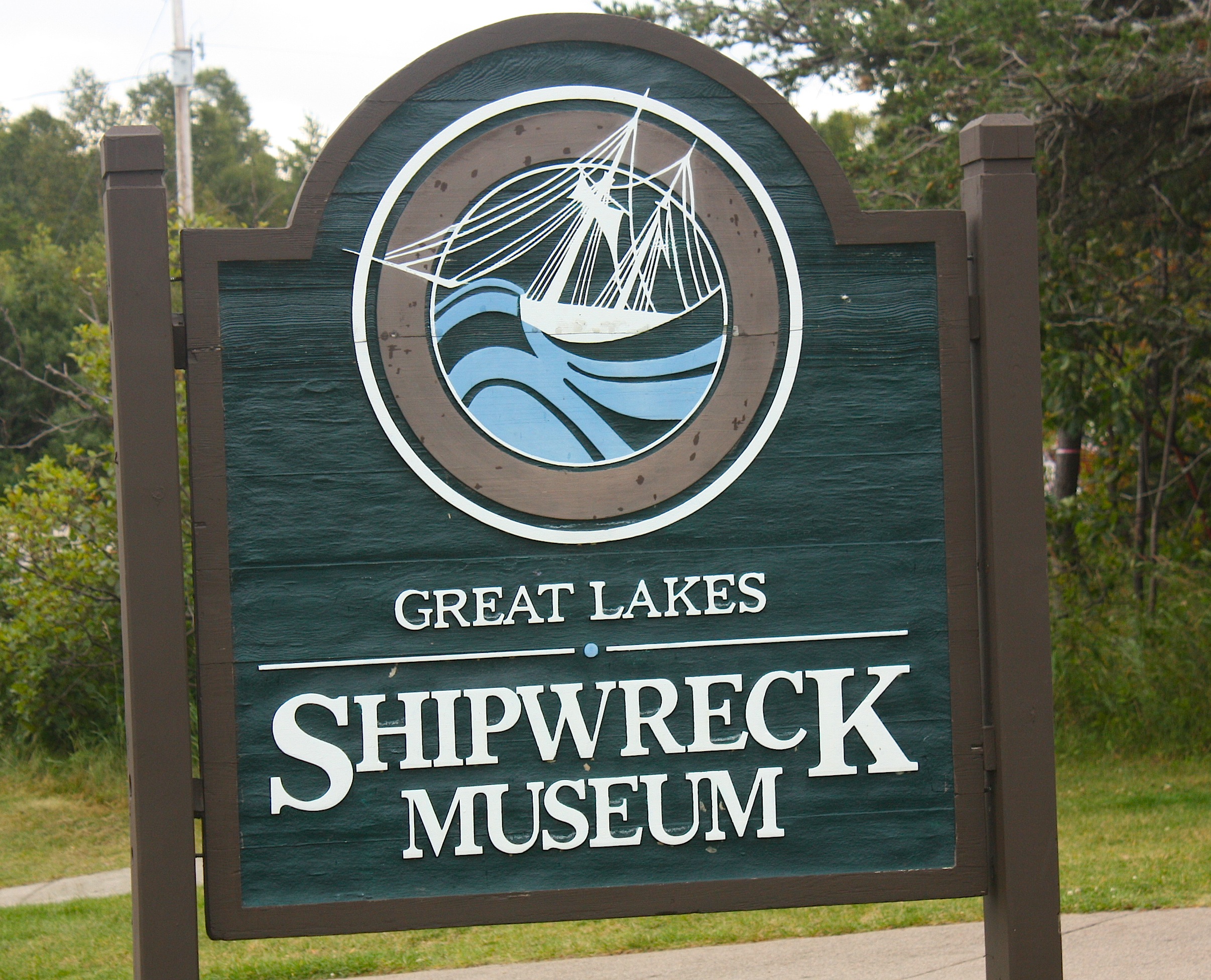 Like most things in the UP, Tahquamenon Falls State Park is pretty much in the middle of nowhere. But if you continue a bit east to the town of Paradise (it’s definitely not), turn north, and drive until the road literally ends on a tiny spit of land sticking out into Lake Superior, you’ll find the Great Lakes Shipwreck Museum.

Thanks to the Gordon Lightfoot song, pretty much everyone knows about the wreck of the Edmond Fitzgerald, which happened just 17 miles off Whitefish Point, the location of the museum. For a $13 entrance fee you can learn more about the Fitzgerald and other Lake Superior shipwrecks. There are lots of them, it turns out. Besides the main museum, you can also tour the Whitefish Point Light Station (above) and the Shipwreck Coast Lifeboat Station. Normally there’s a movie as part of the entrance fee, but the theater was undergoing restoration so we got a DVD to watch at home.
MACKINAC ISLAND
From Whitefish Point, we drove south on Hwy. 123 (a remote two-lane with lots of fall color) to the town of St. Ignace, our home for the next two nights. (We changed our itinerary midway through our trip, eliminating our drive to Sault Ste. Marie to cross into Canada – it just seemed excessive. Instead, we decided to go directly to St. Ignace (pronounced “Igniss”) so we could get an early ferry to Mackinac Island the next morning.
We stayed at the Holiday Inn Express and got upgraded to a deluxe queen room with a terrific view of Lake Huron. We would have heard gulls screaming all night if we had left the balcony door open, but we didn’t because it was too cold.
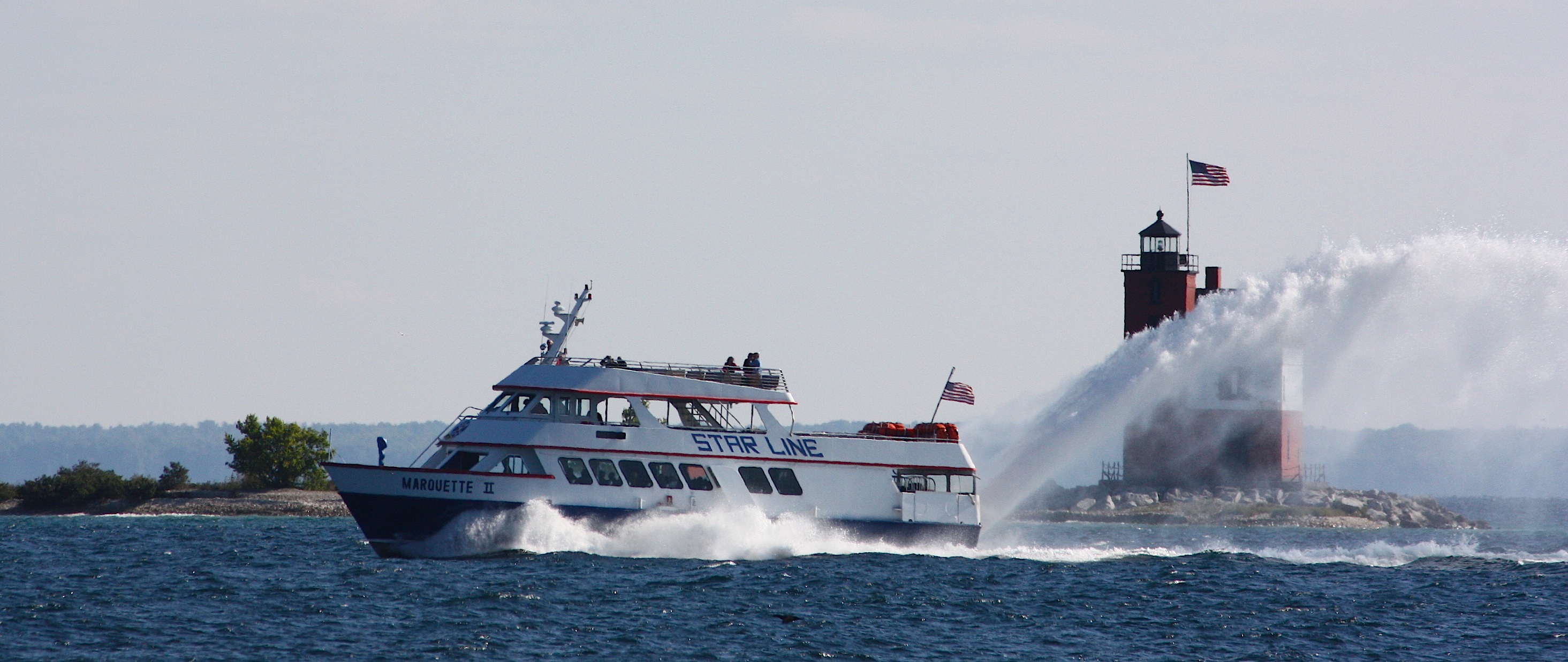
To get to the island, you have to board a ferry either at the north end of the Mackinac Bridge (in St. Ignace) or the south end of the bridge (in Mackinac City). There are several ferry providers; we took a Star Line hydro-jet ferry from St. Ignace. It was quick and efficient. About half of the passengers on our 9 a.m. boat appeared to be locals using the ferry as commuter transportation. Nearly everyone, including us, rode inside the ferry and not on the observation deck. I’m guessing it was pretty wet up there, not to mention cold, because the morning temperature was in the low 40s. As the ferry rounded the south end of the island toward the dock, we got a great view of the Grand Hotel and the elegant west bluff cottages.
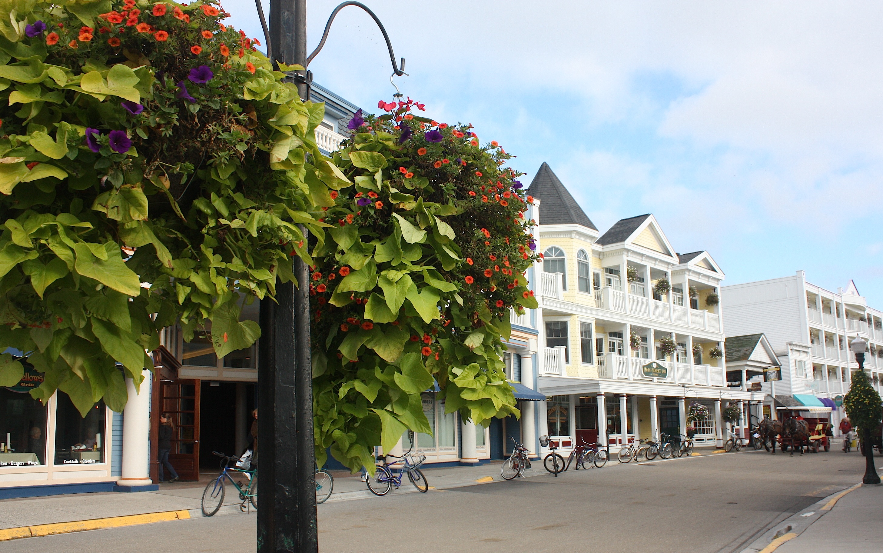
Once off the ferry, I was told to expect to be hit with two odors: fudge and horse poop. Sort of a chocolate-poop smell. I can’t say that I found either odor overpowering, although at different points in the day I did smell horse manure. I’m guessing it’s worse in the summer, both because of the heat and the increased number of tourists.

Dave and I walked to the right, down the main street and around the southeast end of the island to Arch Rock. It’s a pretty walk along Lake Shore Blvd., and the natural arch is moderately interesting (though after Pictured Rocks, stuff like this sort of pales in comparison). After that walk I was cold, my feet hurt, and I was very eager to find a good cup of coffee. I didn’t. I ended up ordering a latte at one of the many, many fudge shops, and it was lacking in every way.
We were hungry by this point, anyway. So we walked around a bit and then found lunch at the Village Inn. From there, we walked to the Grand Hotel. Of course, you can’t walk INSIDE the Grand Hotel – or even on the sidewalk in FRONT of the Grand Hotel – without paying a $10-per-person fee. I will say that although I totally get the reason for this, it still sort of pisses me off. We walked as far as we could until we were turned away by the young, female hotel bouncer, then briefly toured the hotel’s gardens (she said that was OK) and ended up with plenty of good-enough views of the place.


The Grand Hotel opened in 1887; it’s ridiculously famous and is said to have the world’s longest front porch (660 feet long). If you stay there, expect a lot of amenities, but expect to pay a hefty price for them: the smallest rooms start at $275 per person for a double (that’s $550 for the two of you) during the week; the price goes up on the weekend and for larger rooms, topping out at $410 per person ($820 for a double room). To be fair, the room does come with meals, but who needs THAT much food?
We did not stay the night on the island, but if we were going to, we’d stay at one of the many, many other inns and B&Bs that look very nice for far less cash.
Here’s a bit of history of the island: It’s been a favorite destination since it became Mackinac National Park in 1875 – the United States’ second national park after Yellowstone; it’s since been transferred to state control. The park covers about 80% of the island.
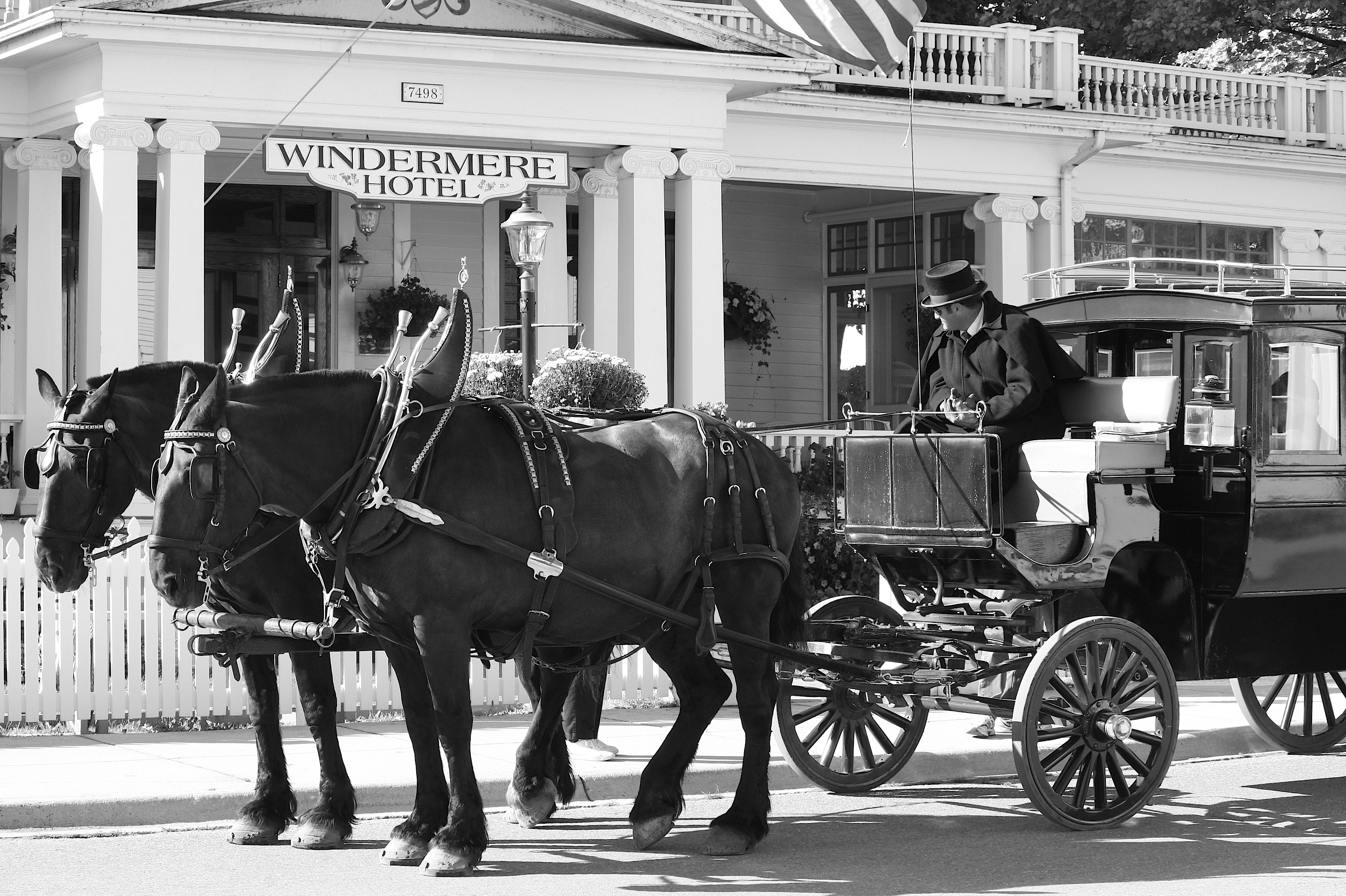
I’m sure you already know that there are no cars allowed on the island, only horse-drawn vehicles, horseback rides, and bicycles. You can pay for a horse-drawn carriage tour or taxi, and bicycles are available for rent.


We visited historic Fort Mackinac (above), a walled fort that sits high above the downtown area. It’s a $12 entrance fee, and even though I don’t get into the history all that much (British & American troops fought over Fort Mackinac during the War of 1812, yawn), I’d pay the fee again just for the view – it’s amazing (below). Dave enjoyed the fort, with its historic displays and costumed interpreters.


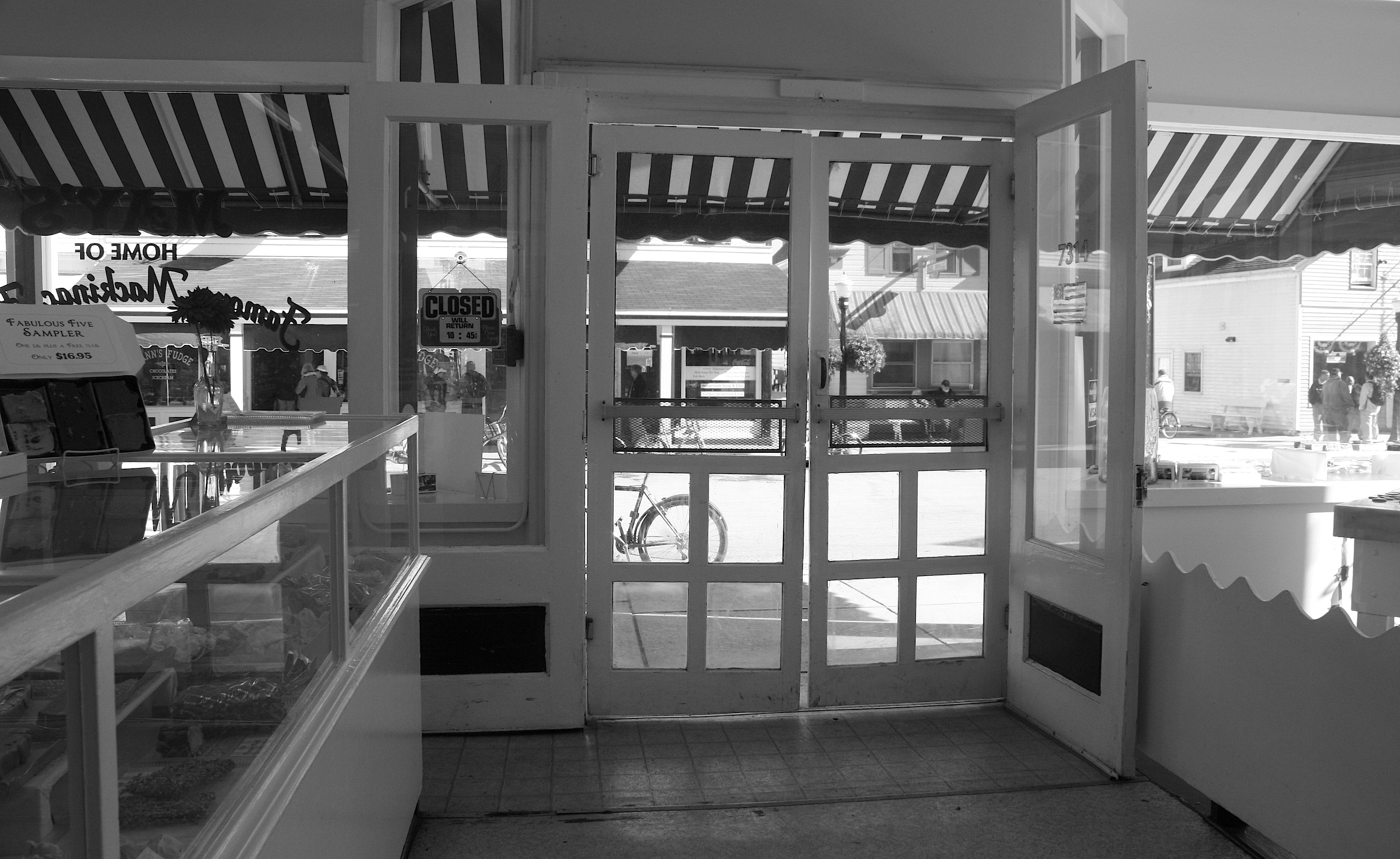
What else is there to do on the island? You can bike around the perimeter, explore the state park, play golf, or do what most visitors do – just hang out in the downtown area, enjoying the Victorian homes (above), the many fudge shops (the earliest of which was established in 1887), and other places to eat and drink. We had a pleasant beer at the Pink Pony bar and grill, bought some candy, and took the 5 o’clock ferry back to the mainland. Afterwards, I sort of felt like I’d spent the day at the Magic Kingdom.
SLEEPING BEAR DUNES NATIONAL LAKESHORE
The next day we crossed the Mackinac Bridge. Constructed in 1957, this 5-mile-long suspension bridge is the only connection between Michigan’s upper and lower peninsulas. Pay $4 per car to cross the bridge; points to observe the bridge are located on both sides. The view from the south looked much better the morning we crossed (below).

Though our original plan was to stay on the Upper Peninsula the whole time (plus Mackinac), we were convinced by my Michigan colleagues to add the northwest Lower Peninsula lakeshore region of Petosky, Traverse City, the Old Mission Peninsula – and, especially, Sleeping Bear Dunes.
Another National Park property, Sleeping Bear Dunes was established in 1970. Its 35 miles of lakeshore are divided into two districts. We spent our time in the Leelanau District.

The first thing we did upon entrance to the park ($10 per car) was to take the Pierce Stocking Scenic Drive. The drive is lovely, with several overlooks and a covered bridge. I will admit I giggled a bit at the name “Pierce Stocking” – I feel sorry for any little kid with this name.

After the drive, we went to the Dune Climb (as observers, not participants) and then to Sleeping Bear Point. There’s much more to see, but we had limited time and we were told these were some of the highlights.
OLD MISSION PENINSULA

By now it was getting late and I was quite eager to get to our next stop: The Old Mission Peninsula. (It seems we were on a peninsula vacation.) I must say that this is my kind of place, and I could have spent a full day here, not just a couple of hours. The peninsula is just a skinny little spit of land poking out from Traverse City into a bay connected to Lake Michigan. Unlike the pokey parts sticking into the crashing waves of Lake Superior, this one is verdant and seems protected inside Grand Traverse Bay. It’s dotted with wineries (as is all of the area around Traverse City), vineyards, B&Bs, antiques shops, farm stands, and orchards. It’s very agrarian, with historic barns around every turn. And there’s an adorable lighthouse at the very end.

In my limited time on the peninsula, I visited the Mission Point Lighthouse (above) and drove past the Old Mission itself and the general store. I bought some mini-pumpkins and took pictures of a few vineyards. And I went to one winery: Chateau Chantal. With no time to spare (wine tastings ended at 7 p.m., and it was 6:45), we did a quick tasting ($3 for 6 tastes). The reds were acceptable, but I can buy better pinot noir for $10 a bottle at the grocery store. I really did like the whites, though, so I bought two bottles (a pinot grigio and a chardonnay, both proprietor’s reserve wines). And then Dave and I each got a full glass of white wine, plus a cheese plate, and headed out to the patio overlooking the end of the peninsula.

And then the sun went down. It was really quite lovely and a perfect way to end our Michigan vacation.

Wonderful summary of the Up and Northern Michigan. It was wonderful to see you both on your late summer adventure to God’s country!
Wonderful Post on UP.
Always had a long distance fascination with Mackinac Island since reading the novel “Afloat” by Jennifer McCartney.
The lake district of Michigan has also been a source of travel desire since being given a map by my American relatives, who lived in Boone, Iowa back in the late 1950s. Never been, never likely to now so I thoroughly enjoy the postings.
This was a great read in the middle of a long day at work. Thanks for sharing.